Related Research Articles

The Capital City Trail is a shared use path in Melbourne, Victoria, Australia, which circles the city centre and some inner eastern and northern suburbs. It is 29km in length, and mostly consists of sections of other trails, such as the Merri Creek Trail, Main Yarra Trail, Moonee Ponds Creek Trail and Inner Circle Rail Trail.
Lovely Banks is a northern suburb of Geelong, Victoria, Australia. Once an agricultural and rural area, the suburb is quickly developing into a residential area adjoining the Geelong suburbs of Bell Park, Corio and Norlane. At the 2016 census Lovely Banks had a population of 2,301.

North Shore is an industrial and residential suburb of Geelong, Victoria, Australia. The suburb overlooks Corio Bay. A small residential area is east of the North Shore railway station with a few neighbourhood shops.

Norlane is a northern suburb of Geelong, in Victoria, Australia. Norlane is bordered in the south by Cowies Creek, in the north by Cox Road, in the west by Thompson Road and in the east by Station Street. It is about 7 km from the Geelong central business district and approximately 70 km from the state capital, Melbourne. It is about one kilometre from the shore of Corio Bay. At the 2016 census, Norlane had a population of 8,306.
Manifold Heights is a residential suburb of Geelong. At the 2016 census, Manifold Heights had a population of 2,649.

North Geelong is a suburb of Geelong in the Australian state of Victoria. The suburb was bypassed by traffic from Melbourne coming from the Princes Freeway by the creation of the Geelong Ring Road, which was complete in 2009. At the 2016 census, North Geelong had a population of 2,966.
Newtown is an inner western suburb of Geelong, Victoria, Australia. At the 2021 census, Newtown had a population of 10,445. It is a primarily residential area occupying one of the highest points of urban Geelong. It has always been a desirable place of residence and is the location of many of Geelong's oldest and most valuable properties.

Bell Post Hill is a residential suburb of Geelong, Victoria, Australia. At the 2016 census, Bell Post had a population of 4,919.

North Shore railway station is located on the Warrnambool line in Victoria, Australia. It serves the northern Geelong suburbs of North Shore and Norlane, and it opened on 15 April 1895. It was renamed Corio on 27 September 1909, and was renamed North Shore on 1 December 1913.

The Geelong and Melbourne Railway Company was a railway company in Victoria, Australia. Alexander Thomson, a member of the Victorian Legislative Council, introduced and mentored a bill to incorporate the Geelong and Melbourne Railway Company. On 8 February 1853, the operation of Melbourne and Geelong Railway Company and Mount Alexander and Murray River Railway Company was approved by the Victoria Government. Thomson was one of the directors and presided at the first shareholder meeting. Work began at the Geelong end in 1854 but progress was slow due to a labour shortage caused by the Victorian gold rush, so the Victorian government hired out 100 prisoners to the company at a daily rate of five shillings each. They were housed in prison hulks moored in Corio Bay. English engineer and surveyor, Edward Snell, undertook the survey and design of the line, including a station and extensive workshops at Geelong, and a number of bluestone and timber bridges.

Queenscliff railway station was the terminus of the Queenscliff branch line in Victoria, Australia, which left the main Warrnambool line near South Geelong station. The Queenscliff station was opened on 21 May 1879. The current station building was constructed in 1881 and is listed on the Victorian Heritage Register.
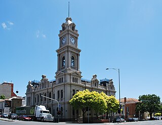
The current Geelong Post Office opened in 1994 and is located on the corner of Gheringhap and Little Myers Streets. The original post office was located on the corner of Ryrie and Gheringhap Streets. The Geelong Telegraph Station was located next door.
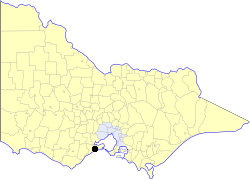
The City of South Barwon was a local government area in Victoria, Australia, which contained a number of Geelong suburbs south of the Barwon River, and extending to Torquay in the south and Barwon Heads to the east. The city covered an area of 165.4 square kilometres (63.9 sq mi), and existed from 1863 until 1994.
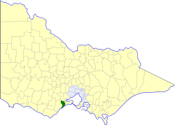
The Shire of Barrabool was a local government area about 100 kilometres (62 mi) southwest of Melbourne, the state capital of Victoria, Australia. The shire covered an area of 575.18 square kilometres (222.1 sq mi), and existed from 1853 until 1994.

Moorabool is a closed railway station on the Geelong–Ballarat railway line, in the locality of Moorabool, Victoria, Australia. Until 1864 it was called Steiglitz Road. The station building was constructed for the Victorian Railways in 1861, by a private contractor, and comprises a single-storey, gable-roofed, bluestone station building, with an attached two-storey residence.
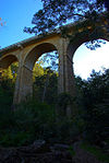
Cowies Creek is a creek flowing through the northern suburbs of Geelong, Victoria, Australia. It rises in wetlands in Moorabool and debouches at Corio Quay, Corio Bay. After 1909, the Geelong Harbour Trust excavated the mouth of Cowies Creek to create Corio Quay.
Moorabool is a bounded rural locality of the City of Greater Geelong local government area in Victoria, Australia.
Geelong West was an electoral district of the Legislative Assembly in the Australian state of Victoria from 1859 to 1985. It was located west of the city of Geelong, defined in the Victorian Electoral Act, 1858 as:
Bounded on the north and north-west by a line drawn at a distance of 2 miles from the north-western angle of the town reserve of Geelong, as a centre from the western shore of Corio Bay, near Cowie's Creek, to a road leading to the River Barwon; on the west by that road; on the south-west and south by the River Barwon; and on the east by the western boundary of the town reserve of Geelong and the shores of Corio Bay, including the reserve at the junction of the Barwon and Moorabool
The Electoral district of Geelong was one of the original sixteen electoral districts of the old unicameral Victorian Legislative Council of 1851 to 1856. Victoria being a colony in Australia at the time.
The Geelong Maritime Museum is a volunteer-run Community group or not-for-profit historical museum located at 'The Stables', Osborne House, Swinburn Street, North Geelong Victoria, Australia since 1993. The Museum was founded in about 1989, with ex Royal Navy Ldg. Tel, Robert Henry (Bob) Appleton OAM as the foundation Honorary Curator. The Museum collects and displays historic artefacts and documents related to the Maritime History of geelong and Victoria, and the history of the Victorian and Australian Navy's.
References
- ↑ "Victorian Heritage Database Report: Cowies Creek Rail Bridge No 1". Heritage Council Victoria. Retrieved 7 February 2016.
38°05′16″S144°19′33″E / 38.08773°S 144.32588°E
| | This article about a bridge in Australia is a stub. You can help Wikipedia by expanding it. |