The Boston Public Library is a municipal public library system in Boston, Massachusetts, founded in 1848. The Boston Public Library is also the Library for the Commonwealth of the Commonwealth of Massachusetts; all adult residents of the commonwealth are entitled to borrowing and research privileges, and the library receives state funding. The Boston Public Library contains approximately 24 million items, making it the third-largest public library in the United States behind the federal Library of Congress and New York Public Library, which is also privately endowed. In 2014, the library held more than 10,000 programs, all free to the public, and lent 3.7 million materials.

Roxbury is a neighborhood within the City of Boston, Massachusetts, United States.

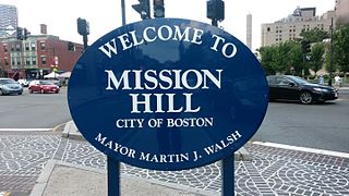
Mission Hill is a 3⁄4 square mile, primarily residential neighborhood of Boston, bordered by Roxbury, Jamaica Plain and Fenway-Kenmore and the town of Brookline. It is home to several hospitals and universities, including Brigham and Women's Hospital and New England Baptist Hospital. Mission Hill is known for its brick row houses and triple decker homes of the late 19th century. The population was estimated at 15,883 in 2011.

Charles Street African Methodist Episcopal Church is an historic African Methodist Episcopal Church at 551 Warren Street in Boston, Massachusetts. The current church building was built in 1888 by J. Williams Beal and added to the National Register of Historic Places in 1983.

The Lower Roxbury Historic District is a historic district encompassing an isolated pocket of 1890s mixed residential-commercial property in the lower Roxbury neighborhood of Boston, Massachusetts. Bounded by Tremont, Columbus, and Burke Streets and St. Cyprian's Place, the area contains a well-kept collection of architect designed buildings that survived late 20th-century urban redevelopment. The district was added to the National Register of Historic Places in 1994.

The Moreland Street Historic District is a historic district roughly bounded by Kearsarge, Blue Hill Avenues, and Warren, Waverly, and Winthrop Streets in the Roxbury neighborhood of Boston, Massachusetts. It encompasses 63 acres (25 ha) of predominantly residential urban streetscape, which was developed between about 1840 and 1920. Housing types represent a cross-section of architectural styles from the period, including Second Empire, Italianate, and Queen Anne style. It is a fairly well-preserved grouping in an area where many sections have been negatively affected by urban blight and redevelopment. One notable house is at 130 Warren Street: it is the only house in the district built out of Roxbury puddingstone. That building is currently under study as a pending landmark for the Boston Landmarks Commission.

Mount Pleasant Historic District is a historic district encompassing a cluster of well-preserved 19th-century residential buildings on Forest Street and Mount Pleasant Avenue in the Roxbury neighborhood of Boston, Massachusetts. First developed in 1833, it was one Roxbury's first speculative residential subdivision developments. The district features Greek Revival, Italianate, and Romanesque architecture, and was added to the National Register of Historic Places in 1989.

The Sumner Hill Historic District encompasses a predominantly residential area of high-quality late 19th-century residences in the Jamaica Plain neighborhood of Boston, Massachusetts. It is roughly bounded by Seaverns Avenue, Everett Street, Carolina Avenue, and Newbern Street just east of the neighborhoods commercial Centre Street area. The district features Second Empire, Italianate, and Queen Anne style architecture, and was listed on the National Register of Historic Places in 1987.

The University–Cultural Center MRA is a pair of multiple property submissions to the National Register of Historic Places which were approved on April 29 and May 1, 1986. The structures included are all located in Midtown, near Woodward Avenue and Wayne State University in Detroit, Michigan. The two submissions are designated the University–Cultural Center MRA Phase I, containing five properties, and the University–Cultural Center MRA Phase II, containing three properties.

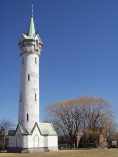
Fort Hill is a 0.4 square mile neighborhood and historic district of Roxbury, in Boston, Massachusetts. The approximate boundaries of Fort Hill are Malcolm X Boulevard on the north, Washington Street on the southeast, and Columbus Avenue on the southwest.

The Francis Street–Fenwood Road Historic District encompasses a small but cohesive early 20th-century residential area and streetcar suburb in the Longwood area of Boston, Massachusetts. Bounded by Huntington Avenue, Francis Street, Vining Avenue, Fenwood Road, and St. Albans Road, it includes a collection of two and three-family houses, as well as two apartment houses, a school, and one commercial building, all of which predate the large medical complexes that dominate the Longwood area. The district was listed on the National Register of Historic Places in 2016.

The Columbia Road–Bellevue Street Historic District encompasses a collection of brick residential apartment houses on Columbia Road and Bellevue Street in the Dorchester neighborhood of Boston, Massachusetts. Arrayed mainly on Columbia Road between Wheelock Avenue and Bodwell Street, south of the Uphams Corner commercial area, area collection of primarily late 19th and early 20th-century multiunit residential buildings, built when the area was developed as a streetcar suburb. Most of these are Colonial Revival masonry or frame buildings three and four stories in height, although some exhibit Queen Anne features. There are a few older Greek Revival buildings in the district, and a number of apartment blocks built in the 1920s during a second phase of development.

Crawford Manor, also the George W. Crawford House or George Crawford Towers, is a historic high-rise apartment building at 84-96 Park Street in New Haven, Connecticut. Completed in 1966, the fifteen-story building is a significant mature work of architect Paul Rudolph, and a good local example of Brutalist architecture. The building was listed on the National Register of Historic Places in 2015, and as a non-contributing element to the Dwight Street Historic District in 1983. It is owned by the city of New Haven, which uses it for public housing.

The Intervale Street-Columbia Road Historic District is a historic district encompassing a small residential area in the Dorchester neighborhood of Boston, Massachusetts. Centered on a stretch of Intervale Street, the area was developed in the early 20th century during a major Jewish migration, and includes a fine sample of Colonial Revival architecture. The district was listed on the National Register of Historic Places in 2019.

The Intervale Street-Blue Hill Avenue Historic District is a historic district encompassing a densely built residential area in the Dorchester neighborhood of Boston, Massachusetts. Centered on a stretch of Intervale Street near Blue Hill Avenue, the area was developed in the late 19th and early 20th centuries during a major Jewish migration, and includes a fine sample of Colonial Revival architecture. The district was listed on the National Register of Historic Places in 2020.

The Elm Hill Park Historic District is a historic district encompassing a small residential area in the Roxbury neighborhood of Boston, Massachusetts. It encompasses a residential development created in the early 20th century, including fine examples of Colonial Revival and Queen Anne wood-frame construction, as well as a series of brick Romanesque apartment houses. The district was listed on the National Register of Historic Places in 2021.

The Greenville Street Historic District is a historic district encompassing a primarily residential property in the Roxbury neighborhood of Boston, Massachusetts. Extending along Greenville Street, the district includes a diversity of architecture, and is prominent for significant urban renewal efforts conducted in the city in the 1960s and 1970s. The district was added to the National Register of Historic Places in 2021.
The Humboldt Avenue Historic District is a historic district encompassing a cluster of multifamily brick buildings in the Dorchester neighborhood of Boston, Massachusetts. Centered on the junction of Humboldt Avenue and Hutchings Street, the area was developed in 1915-16 during a major Jewish migration, and includes a fine sample of Colonial Revival architecture. The district was listed on the National Register of Historic Places in 2021.
The Walnut Park Historic District is a historic district encompassing a cluster of multifamily brick buildings in the Roxbury neighborhood of Boston, Massachusetts. Roughly centered on the junction of Walnut Park and Waldren Road, the area was developed in the early 20th century during a major Jewish migration, and includes a fine sample of Colonial Revival architecture. The district was listed on the National Register of Historic Places in 2022.
The Camden Street Development Historic District is a historic district encompassing a cluster of municipally owned residential apartment blocks in the Roxbury neighborhood of Boston, Massachusetts. It consists of three nearly identical buildings centered on Shawmut Avenue between Camden Street and Brannon Harris Way. The blocks were built in 1949 by the city to provide housing to low-income African-American veterans, and have had only minimal alteration since then. The district was listed on the National Register of Historic Places in 2022.


