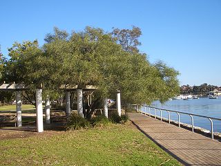
Lilyfield is a suburb in the Inner West of Sydney, in the state of New South Wales, Australia. Lilyfield is located 6 kilometres west of the Sydney central business district, in the local government area of the Inner West Council.

Binda is a village in the Southern Tablelands region of New South Wales, Australia in Upper Lachlan Shire.

Baulkham Hills is a suburb in the Hills District of Greater Sydney, in the state of New South Wales, Australia. It is located within 30 kilometres north-west of the Sydney central business district mostly within the local government area of The Hills Shire, of which Baulkham Hills was formerly the administrative seat and namesake of The Hills Shire. A small section of the suburb which is located south of the Hills Motorway-Windsor Road intersection is part of the City of Parramatta.
South Windsor is a suburb of the town of Windsor in north west Sydney in the state of New South Wales, Australia. It is generally bounded in the west by Rickabys Creek and in the east by South Creek, both tributaries of the Hawkesbury River. It is also home of Bede Polding College, a Catholic secondary school.

Bankstown Aerodrome is a suburb south-west of Sydney, in the state of New South Wales. The suburb was gazetted in May 1994 and is the location of the Bankstown Airport. The suburb is bounded by the Georges River in the west and Condell Park in the east. In the 2021 census, Bankstown Aerodrome had a population of 5 people.

Denistone West is a suburb in Northern Sydney, in the state of New South Wales, Australia. Denistone West is located 16 kilometres north-west of the Sydney central business district in the local government area of the City of Ryde. Denistone and Denistone East are separate suburbs; Denistone West was gazetted as a suburb in its own right on 5 February 1999.

Mooney Mooney Creek is a suburb of the Central Coast region of New South Wales, Australia, located 60 kilometres (37 mi) north of Sydney along both sides of the river after which it is named. It is part of the Central Coast Council local government area.
Kilaben Bay is a suburb of the city of Lake Macquarie in the Hunter Region of New South Wales, Australia.
Tantonan is a rural locality in the central south part of the Riverina, New South Wales, Australia. It is situated by road, about 8 kilometres north west from Caldwell and 13 kilometres south east from Bunnaloo.
Brookdale is a rural locality in the central east part of the Riverina. It is about 8 kilometres, by road, north-west of Bullenbung and 34 kilometres south-east of Galore.

Corobimilla is a village locality in the central east part of the Riverina. It is situated by road, about 12 kilometres northeast of Morundah and 20 kilometres south west of Narrandera.
Niemur is a historic village community in the central west part of the Riverina and the site of a railway station. It is situated about 24 kilometres south east of Moulamein and 27 kilometres north west of Burraboi.
Nyora is a rural locality in the central south part of the Riverina and the previous site of a public school. It is situated by road, about 21 kilometres west of Oaklands and 27 kilometres north east of Berrigan.
Fishermans Bay is a small suburb of the Port Stephens local government area in the Hunter Region of New South Wales, Australia. It is located on the coast of the Tasman Sea adjacent to Anna Bay. A large part of the eastern portion of the suburb is occupied by Tomaree National Park and only a very small portion of the south western corner of the suburb is populated. The suburb is named after the adjacent bay.
Osterley is a small rural suburb of the Port Stephens local government area in the Hunter Region of New South Wales, Australia. Most of the small population lives in the elevated part of the suburb along Hinton Road, east of Barties Creek which is a tributary of the Hunter River. The area to the west of Barties creek is low-lying and subject to periodic flooding. .In 2016 117 people live there with a median age of 46.
Huntley is a suburb of the City of Wollongong to the west of Dapto. At the 2021 census, it had a population of 66.
Mount Saint Thomas is a suburb of Wollongong in New South Wales, lying east of Figtree and South west of Wollongong. At the 2021 census, it had a population of 1,449.

Queanbeyan West is a suburb of Queanbeyan, New South Wales, Australia. Queanbeyan West is located west of the central business district (CBD) and also borders the Australian Capital Territory, it is located south of Crestwood and Canberra Avenue and west of Tharwa Road. At the 2021 census, it had a population of 3,146.

Campvale is a sparsely populated rural suburb of the Port Stephens local government area in the Hunter Region of New South Wales, Australia.

Norwest is a suburb of the Hills District within Greater Western Sydney, in the state of New South Wales, Australia, located 35 kilometres north-west of the Sydney central business district. The Norwest Business Park is located within Norwest and the adjacent suburb of Bella Vista and Baulkham Hills. The council chambers for The Hills Shire Council are also located within this suburb.

