The Wiradjuri people are a group of Aboriginal Australian people from central New South Wales, united by common descent through kinship and shared traditions. They survived as skilled hunter-fisher-gatherers, in family groups or clans, and many still use knowledge of hunting and gathering techniques as part of their customary life.
Tidbinbilla Nature Reserve is a 54.5 square kilometres (21.0 sq mi) protected area, on the fringe of Namadgi National Park. Tidbinbilla is a short drive from the capital city of Australia, Canberra, in the Australian Capital Territory.

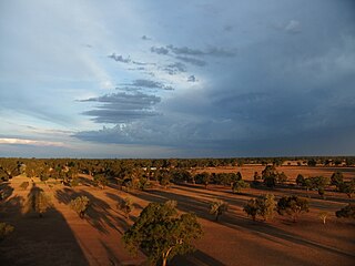
Dubbo is a city in the Orana Region of New South Wales, Australia. It is the largest population centre in the Orana region, with a population of 43,516 at June 2021.

The Molonglo River is a perennial river that is part of the Murrumbidgee catchment within the Murray–Darling basin. It is located in the Monaro and Capital Country regions of New South Wales and the Australian Capital Territory, in Australia.

Queanbeyan is a city in the south-eastern region of New South Wales, Australia, located adjacent to the Australian Capital Territory in the Southern Tablelands region. Located on the Queanbeyan River, the city is the council seat of the Queanbeyan-Palerang Regional Council. At the 2021 census, the Queanbeyan part of the Canberra–Queanbeyan built-up area had a population of 37,511.

Wellington is a town in the Central Western Slopes region of New South Wales, Australia, located at the junction of the Wambuul Macquarie and Bell Rivers. It is within the local government area of Dubbo Regional Council. The town is 362 kilometres (225 mi) northwest of Sydney on the Mitchell Highway and Main Western Railway, and 50 km southeast of Dubbo, the main centre of the Central Western Slopes region.

The Queanbeyan River, a perennial stream that is part of the Molonglo catchment within the Murray–Darling basin, is located in the Monaro and Capital Country regions of New South Wales and the Australian Capital Territory, in Australia. The river is 104 kilometres (65 mi) in length with a catchment area of 96,000 hectares. The Queanbeyan River and the Cotter River meet the potable water supply needs of the Canberra and Queanbeyan region and whose water quality is specifically protected under Federal legislation.

Ngunnawal is a suburb in the district of Gungahlin in Canberra, Australia. The suburb is named in tribute to the Ngunnawal people, the original inhabitants of the area. The suburb was gazetted on 24 April 1992. Ngunnawal is adjacent to the suburbs of Nicholls, Casey, Moncrieff, Amaroo and Gungahlin. It is bounded by Gungahlin Drive, Horse Park Drive, Gundaroo Drive and Mirrabei Drive. Ginninderra Creek is situated near Ngunnawal's eastern boundary. The suburb is located approximately 4 km from the Gungahlin Town Centre and about 13 km from the centre of Canberra.

Hall is a town in the district of Hall, in the Australian Capital Territory in Australia. Is situated on the north side of the Australian Capital Territory. At the 2021 census, the village had a population of 298 people. It is surrounded by open country and has a rural appearance. Hall has retained a village character. The town features historic buildings that existed before the establishment of Canberra.
The Ngunnawal people, also spelt Ngunawal, are an Aboriginal people of southern New South Wales and the Australian Capital Territory in Australia.

Sutton is a small village in the Southern Tablelands of New South Wales, Australia in Yass Valley Shire. It is situated on the west bank of the Yass River, about 17 kilometres south of Gundaroo, near the Federal Highway, not far from Canberra. It has a primary school, an Anglican church, a general store, an estate agent, an artists gallery, and a baker. Sutton has its own volunteer Bush Fire Brigade located in the village.
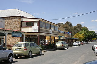
Bungendore is a town in the Queanbeyan Region of New South Wales, Australia, in Queanbeyan-Palerang Regional Council. It is on the Kings Highway near Lake George, the Molonglo River Valley and the Australian Capital Territory border. It has become a major tourist centre in recent years, popular with visitors from Canberra and some of it has heritage protection. It has expanded rapidly in recent years as a dormitory town of Canberra.

Ginninderra Creek, a partly perennial stream of the Murrumbidgee catchment within the Murray–Darling basin, is located in the Capital Country region spanning both the Australian Capital Territory and New South Wales, Australia.

The Ngambri, also known as Kamberri, are an Aboriginal clan or group who claim traditional ownership of the Australian Capital Territory area, but their connection to the land is contested. One reason for this is that Canberra, where Ngambri claims are made, lay close to the tribal boundaries that separated the Ngarigo from the Ngunnawal people. Other reasons are the dislocation of Aboriginal populations and intertribal marriage and interracial relationships following European settlement, leading to a high proportion of people identifying themselves as Indigenous Australians, but not knowing their traditional origins. As of April 2023 the ACT Government does not recognise Ngambri people as traditional owners of the ACT, listing only the Ngunnawal people as traditional custodians of the land, but has promised a review of their Indigenous protocol following a Supreme Court challenge by Ngambri families in July 2022.
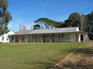
Gold Creek Homestead is a 140-year-old stone and brick building located off Gungahlin Drive in Ngunnawal a north-western suburb of Canberra, Australia. It is adjacent to the Grove Ngunnawal retirement village currently being developed by Lend Lease.
Matilda Williams House was born in 1945 on the Erambie Aboriginal Reserve at Cowra, New South Wales (NSW), and raised in her grandfather’s house at Hollywood Aboriginal Reserve in Yass, NSW. When she was 12, House spent a year in Parramatta Girls' Home. House was one of ten children.

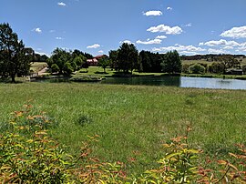
Carwoola is a locality in the state of New South Wales, Australia. It is immediately to the south of the Kowen district, which is located in the Australian Capital Territory. The Molonglo River passes through the Carwoola area before opening out into the Molonglo Plains. The Kings Highway and Captains Flat Road are the two major through routes. Carwoola is part of the Queanbeyan-Palerang Regional Council and the Southern Tablelands geographic area. The area also roughly aligns with the original Carwoola Parish.

Carual, New South Wales also known as Carval is a civil parish and rural locality of New South Wales located at 31°37'54.0"S 147°44'04.0"E.
Egelabra, New South Wales is a civil parish and rural locality of New South Wales located at 31°47′54″S 147°50′04″E.
Strathnairn is a suburb in the Belconnen district of Canberra, located within the Australian Capital Territory, Australia. The suburb was gazetted in 2016 as part of the West Belconnen / Parkwood cross-border development near the Australian Capital Territory and New South Wales border.