Creswell, North Carolina

Last updated

Creswell, North Carolina
Creswell, North Carolina.jpg
Downtown Creswell
NCMap-doton-Creswell.PNG
Location of Creswell, North Carolina
Coordinates: 35°52′13″N76°23′38″W / 35.87028°N 76.39389°W / 35.87028; -76.39389
Country United States
State North Carolina
County Washington
Area
[1]
  Total0.57 sq mi (1.47 km2)
  Land0.57 sq mi (1.47 km2)
  Water0.00 sq mi (0.00 km2)
Elevation
[2]
7 ft (2 m)
Population
 (2020)
  Total207
  Density365.72/sq mi (141.22/km2)
Time zone UTC-5 (Eastern (EST))
  Summer (DST) UTC-4 (EDT)
ZIP code
27928
Area code 252
FIPS code 37-15420 [3]
GNIS feature ID2406336 [2]

Creswell is a town in Washington County, North Carolina, United States. The population was 207 at the 2020 census.

Contents

Geography

The town is located in the North Carolina Inner Banks on the north-central portion of the Albemarle-Pamlico Peninsula, and along the western edge of the southern portions of the Scuppernong River.

According to the United States Census Bureau, the town has a total area of 0.4 square miles (1.0 km2), all land.

Demographics

Historical population
CensusPop.Note
1880 145
1890 20239.3%
1900 22410.9%
1910 32946.9%
1920 39319.5%
1930 350−10.9%
1940 45931.1%
1950 425−7.4%
1960 402−5.4%
1970 63357.5%
1980 426−32.7%
1990 361−15.3%
2000 278−23.0%
2010 276−0.7%
2020 207−25.0%
U.S. Decennial Census [4]
A scenic view of Lake Phelps at nearby Pettigrew State Park LakePhelps2.jpg
A scenic view of Lake Phelps at nearby Pettigrew State Park

As of the census [3] of 2000, there were 278 people, 118 households, and 86 families residing in the town. The population density was 666.0 inhabitants per square mile (257.1/km2). There were 141 housing units at an average density of 337.8 per square mile (130.4/km2). The racial makeup of the town was 50.00% White, 39.93% African American, 0.36% Native American, 0.36% Asian, 1.80% Pacific Islander, 4.68% from other races, and 2.88% from two or more races. Hispanic or Latino of any race were 6.83% of the population.

There were 118 households, out of which 28.0% had children under the age of 18 living with them, 40.7% were married couples living together, 27.1% had a female householder with no husband present, and 27.1% were non-families. 24.6% of all households were made up of individuals, and 13.6% had someone living alone who was 65 years of age or older. The average household size was 2.36 and the average family size was 2.77.

In the town, the population was spread out, with 22.3% under the age of 18, 10.4% from 18 to 24, 19.1% from 25 to 44, 24.1% from 45 to 64, and 24.1% who were 65 years of age or older. The median age was 43 years. For every 100 females, there were 78.2 males. For every 100 females age 18 and over, there were 77.0 males.

The median income for a household in the town was $20,833, and the median income for a family was $23,750. Males had a median income of $25,000 versus $16,500 for females. The per capita income for the town was $11,769. About 18.3% of families and 26.1% of the population were below the poverty line, including 41.1% of those under the age of eighteen and 20.3% of those 65 or over.

History

Creswell was incorporated in 1874, and named for John Angel James Creswell, [5] the United States Postmaster General at that time. The structures in downtown Creswell are some of North Carolina's best remaining examples of downtown architecture from the late 19th century.

The Belgrade and St. David's Church, Creswell Historic District, Davenport House, and Somerset Place State Historic Site are listed on the National Register of Historic Places. [6]

Transportation

Highways and roads

The town can be accessed from the east or west by U.S. Highway 64, and from the north or south by North Carolina Highway 94.

Creswell is within 300 miles (480 km) of these destinations:

Airports

Air travel is best served through the Norfolk International Airport (ORF) in Norfolk, Virginia or the Pitt-Greenville Airport (PGV) in Greenville, North Carolina

Town Hall - Creswell, North Carolina CreswellTownHall.jpg
Town Hall - Creswell, North Carolina

Politics

Town government

The Mayor of Creswell is Edwin Ray Blount.

Elected members to the Town Council:

State government

Creswell is served in the North Carolina General Assembly by State Senator Stan White (Democrat) and State Representative Tim Spear (Democrat).

Federal government

The town is also served in the United States Congress by U.S. Senator Richard Burr (Republican), U.S. Senator Kay Hagan (Democrat) and U.S. Representative G. K. Butterfield (Democrat).

Recent issues

The Town of Creswell is aligned with a group called North Carolinians Opposed to the Outlying Landing Field. This group opposes a United States Navy proposal to construct an outlying landing field near the Pocosin Lakes National Wildlife Refuge in Washington County.

Somerset Place - Creswell, North Carolina SomersetPlace.jpg
Somerset Place - Creswell, North Carolina

Attractions

The town symbol, an artesian well hand-pump, can be found on Main Street in heart of downtown.

Notable people

Education

Media

Newspaper

Creswell is served by the weekly Roanoke Beacon newspaper from Plymouth, North Carolina, and the daily Washington Daily News from Washington, North Carolina.

Television

Creswell is part of the GreenvilleWashingtonNew BernMorehead City market, which is the 107th largest in 2006, according to Nielsen Media Research. Broadcast television stations serving the market include:

Related Research Articles

<span class="mw-page-title-main">Washington County, North Carolina</span> County in North Carolina, United States

Washington County is a county located in the U.S. state of North Carolina. As of the 2020 census, the population was 11,003. Its county seat is Plymouth. The county was formed in 1799 from the western third of Tyrrell County. It was named for George Washington.

<span class="mw-page-title-main">Pamlico County, North Carolina</span> County in North Carolina, United States

PamlicoCounty is a county located in the U.S. state of North Carolina. As of the 2020 census, the population was 12,276. Its county seat is Bayboro.

<span class="mw-page-title-main">Greene County, North Carolina</span> County in North Carolina, United States

Greene County is a county located in the U.S. state of North Carolina. As of the 2020 census, the population was 20,451. Its county seat is Snow Hill.

<span class="mw-page-title-main">Beaufort County, North Carolina</span> County in North Carolina, United States

Beaufort County is a county located in the U.S. state of North Carolina. As of the 2020 census, the population was 44,652. Its county seat is Washington. The county was founded in 1705 as Pamptecough Precinct. Originally included in Bath County, it was renamed Beaufort Precinct in 1712 and became Beaufort County in 1739.

<span class="mw-page-title-main">Bond County, Illinois</span> County in Illinois, United States

Bond County is a county located in the U.S. state of Illinois. As of the 2020 census, the population was 16,725. Its county seat is Greenville.

<span class="mw-page-title-main">Chocowinity, North Carolina</span> Town in North Carolina, United States

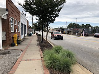
Chocowinity is a town in Beaufort County, North Carolina, United States. The population was 820 at the 2010 Census. The town is a part of the Washington Area located in North Carolina's Coastal Plains region.

<span class="mw-page-title-main">Morehead City, North Carolina</span> Town in North Carolina, United States

Morehead City is a port town in Carteret County, North Carolina, United States. The population was 8,661 at the 2010 census. Morehead City celebrated the 150th anniversary of its founding on May 5, 2007. It forms part of the Crystal Coast.

<span class="mw-page-title-main">Pinetops, North Carolina</span> Town in North Carolina, United States

Pinetops is a town in Edgecombe County, North Carolina, United States. It is part of the Rocky Mount, North Carolina Metropolitan Statistical Area. The population was 1,374 at the 2010 census.

<span class="mw-page-title-main">Snow Hill, North Carolina</span> Town in North Carolina, United States

Snow Hill is a town in Greene County, North Carolina, United States. The population was 1,595 at the 2010 census. It is the county seat of Greene County and is part of the Greenville Metropolitan Area. Snow Hill hosts numerous tennis tournaments during the year. Snow Hill is home to the Green Ridge Racquet Club. Many junior players and adults travel to Snow Hill in order to play in the USTA Sanctioned tournaments.

<span class="mw-page-title-main">Walstonburg, North Carolina</span> Town in North Carolina, United States

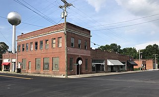
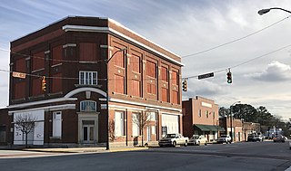
Walstonburg is a town in Greene County, North Carolina, United States. The population was 219 at the 2010 census. It is located north of Snow Hill on North Carolina Highway 91. The town is part of the Greenville Metropolitan Area.

<span class="mw-page-title-main">Trenton, North Carolina</span> Town in North Carolina, United States

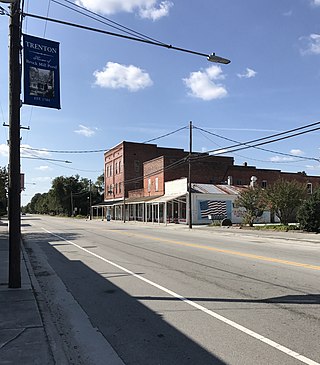
Trenton is a town in Jones County, North Carolina, United States. The population was 238 in 2020 census. It is the county seat of Jones County.

<span class="mw-page-title-main">Ayden, North Carolina</span> Town in North Carolina, United States

Ayden is a town in Pitt County, North Carolina, United States. The population was 4,977 at the 2020 census. The town is a part of the Greenville Metropolitan Area of North Carolina's Inner Banks region.

<span class="mw-page-title-main">Bethel, North Carolina</span> Town in North Carolina, United States

Bethel is a town in Pitt County, North Carolina, United States. The population was 1,577 at the 2010 census. The town is a part of the Greenville Metropolitan Area located in North Carolina's Inner Banks region. Confusingly, there are three other towns in the state named "Bethel." One is between Edenton and Hertford in the "Finger Counties" region in the northeastern corner of the state, another is in the north-central part, in Caswell County and the third is located in the Mountain Region of North Carolina, in Haywood County. There is also a community named Bethel located in Watauga County.

<span class="mw-page-title-main">Falkland, North Carolina</span> Town in North Carolina, United States

Falkland is a town in Pitt County, North Carolina, United States. The population was 96 at the 2010 census, making it the least populous town in Pitt County. The town is a part of the Greenville Metropolitan Area located in North Carolina's Inner Banks region.

<span class="mw-page-title-main">Fountain, North Carolina</span> Town in North Carolina, United States

Fountain is a town in Pitt County, North Carolina, United States. The population was 427 at the 2010 census. The town is a part of the Greenville Metropolitan Area located in North Carolina's Inner Banks region.

<span class="mw-page-title-main">Grimesland, North Carolina</span> Town in North Carolina, United States

Grimesland is a town in Pitt County, North Carolina, United States. The population was 441 at the 2010 census. The town is a part of the Greenville Metropolitan Area located in North Carolina's Inner Banks.

<span class="mw-page-title-main">Winterville, North Carolina</span> Town in North Carolina, United States

Winterville is a town in Pitt County, North Carolina, United States. The population was 10,591 as of the 2020 census. The town is a part of the Greenville Metropolitan Area.

<span class="mw-page-title-main">Plymouth, North Carolina</span> Town in North Carolina, United States

Plymouth is the most populous town in Washington County, North Carolina, United States. The population was 3,320 at the 2020 census. It is the county seat of Washington County. Plymouth is located on the Roanoke River about seven miles (11 km) upriver from its mouth into the Albemarle Sound in North Carolina's Inner Banks region.

<span class="mw-page-title-main">Travelers Rest, South Carolina</span> City in South Carolina, United States

Travelers Rest is a city in Greenville County, South Carolina. The population was 7,788 at the 2020 census. It is part of the Greenville-Mauldin-Easley Metropolitan Statistical Area. Travelers Rest, the northernmost city in Greenville County, is located 10 miles north of Greenville and around 20 miles south of the North Carolina border. Furman University, a private liberal-arts university, was annexed into the city limits of Travelers Rest in April 2018 and North Greenville University, a private Christian institution, is located in nearby Tigerville.

<span class="mw-page-title-main">Pickens, South Carolina</span> City in South Carolina, United States

Pickens, formerly called Pickens Courthouse, is a city in and the county seat of Pickens County, South Carolina, United States. The population was 3,126 at the 2010 census. Pickens changed its classification from a town to a city in 1998, but it was not reported to the Census Bureau until 2001. It was named after Andrew Pickens (1739–1817), an American revolutionary soldier and US Congressman for South Carolina.

References

  1. "ArcGIS REST Services Directory". United States Census Bureau. Retrieved September 20, 2022.
  2. 1 2 U.S. Geological Survey Geographic Names Information System: Creswell, North Carolina
  3. 1 2 "U.S. Census website". United States Census Bureau . Retrieved January 31, 2008.
  4. "Census of Population and Housing". Census.gov. Retrieved June 4, 2015.
  5. Gannett, Henry (1905). The Origin of Certain Place Names in the United States. Govt. Print. Off. pp.  96.
  6. "National Register Information System". National Register of Historic Places . National Park Service. July 9, 2010.
  7. "Elmo Langley dead at 68". us.motorsport.com. May 8, 1996. Retrieved April 6, 2024.