
The Drakensberg is the eastern portion of the Great Escarpment, which encloses the central Southern African plateau. The Great Escarpment reaches its greatest elevation – 2,000 to 3,482 metres within the border region of South Africa and Lesotho.

Mpumalanga is one of the nine provinces of South Africa. The name means "East", or literally "The Place Where the Sun Rises" in the Nguni languages. Mpumalanga lies in eastern South Africa, bordering Eswatini and Mozambique. It shares borders with the South African provinces of Limpopo to the north, Gauteng to the west, the Free State to the southwest, and KwaZulu-Natal to the south. The capital is Mbombela.

Mbombela, formerly Nelspruit, is a city in northeastern South Africa. It is the capital of the Mpumalanga province. Located on the Crocodile River, the city lies about 110 km (68 mi) by road west of the Mozambique border, 330 km (210 mi) east of Johannesburg and 82 km (51 mi) north of the Eswatini border. Mbombela was one of the host cities of the 2010 FIFA World Cup.
Dullstroom, also known as Emnothweni, is a small town in Mpumalanga province, South Africa. The town lies 35 kilometres north of Belfast and some 53 kilometres south-west of Lydenburg on the R540 road.

Machadodorp, also known by its official name eNtokozweni, is a small town situated on the N4 national highway, near the edge of the escarpment in the Mpumalanga province of South Africa. The Elands River runs through the town. There is a natural radioactive spring here that is reputed to have powerful healing qualities.

Komatipoort is a town situated at the confluence of the Crocodile and Komati Rivers in Mpumalanga province, South Africa. The town is 8 km from the Crocodile Bridge Gate into the Kruger National Park, just 5 km from the Mozambique border and 65 km from the Eswatini border.
White River is a small holiday and farming town situated just north of Mbombela in Mpumalanga, South Africa. The farms in the region produce tropical fruits, macadamia nuts, vegetables, flowers and timber. As of 2011, White River had a population of 16,639.

The Highveld is the portion of the South African inland plateau which has an altitude above roughly 1,500 m (4,900 ft), but below 2,100 m (6,900 ft), thus excluding the Lesotho mountain regions to the south-east of the Highveld. It is home to some of the country's most important commercial farming areas, as well as its largest concentration of metropolitan centres, especially the Gauteng conurbation, which accommodates one-third of South Africa's population.

The Olifants River,Lepelle, iBhalule or Obalule is a river in South Africa and Mozambique, a tributary of the Limpopo River. It falls into the Drainage Area B of the Drainage basins of South Africa. The historical area of the Pedi people, Sekhukhuneland, is located between the Olifants River and one of its largest tributaries, the Steelpoort River.

The Breede River, also known as Breë River, is a river in the Western Cape Province of South Africa. Travelling inland north from the city of Cape Town, the river runs in a west to east direction. The surrounding western mountains formed the first continental divide experienced by European settlers in the 18th century. The Titus River and Dwars River become the Breë River.

The Komati River, also known as the Inkomati River or Incomati River, is a river in South Africa, Eswatini and Mozambique. Originating in north-western Eswatini, it is joined by the Crocodile River in the Lebombo Mountains, enters far south-western Mozambique below the border town of Komatipoort, and enters the Indian Ocean around 24 km (15 mi) north-east of Maputo.
Mont-aux-Sources is a mountain in Southern Africa, forming one of the highest portions of the Drakensberg Range. It is mostly within Lesotho, with parts in the KwaZulu-Natal and Free State provinces of South Africa.

Skukuza, a town in Mpumalanga located 57 km east of Hazyview at the confluence of the N'waswitshaka and Sabie Rivers, is the administrative headquarters of the Kruger National Park.

The Sabie River is a river in South Africa that forms part of the Komati River System. The catchment area of the Sabie-Sand system is 6,320 km2 in extent. The Sabie is one of the most biologically diverse rivers in South Africa, with generally good water quality.

Elands River is a river of the Komati River basin in Mpumalanga province, South Africa.
Inkomati WMA, or Inkomati Water Management Area , in South Africa is situated in the north-eastern part of South Africa in the Mpumalanga Province, with a small area in the Limpopo Province. It borders on Mozambique in the east and on Swaziland in the south-east. The water management area extends over several parallel river catchments which all drain in a general easterly direction, and flow together at the border with Mozambique or within Mozambique, to form the Incomati River which discharges into the Indian Ocean immediately north of Maputo. A special situation is presented by the Komati River, the most southern tributary of the Incomati River, which rises in South Africa and flows into Swaziland, then re-enters South Africa where it is joined by the Crocodile River at the border with Mozambique, before flowing into Mozambique as the Incomati River. The Sabie River is the other main river in the water management area and flows into Corumuna Dam in Mozambique just downstream of the border with South Africa, and upstream of its confluence with the Inkomati River.

The Motlatse River, Blyde River, or Umdhlazi River is a river in the Mpumalanga and Limpopo provinces of South Africa. It has a northwards course in steep-sided valleys and ravines of the Mpumalanga Drakensberg, before it enters the lowveld region of the Limpopo province. It has its ultimate origins at around 2,000 m altitude in the Hartebeesvlakte conservation area, to the north of Long Tom Pass. It runs through the Blyde River Canyon.

The Levubu River or Levuvhu is located in the northern Limpopo province of South Africa. Some of its tributaries, such as the Mutshindudi River and Mutale River rise in the Soutpansberg Mountains.
Elands River may refer to any of the following rivers in South Africa:

Crocodile Bridge is the name of both a camp along the southern border of Kruger National Park and a gate to the park in Mpumalanga Province of South Africa. The gate is at a low water bridge crossing the Crocodile River and leads directly to the Crocodile Bridge rest camp. The park entry, including payment, is adjacent to the camp itself.
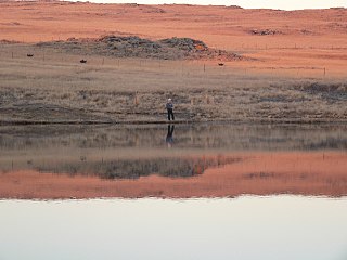
 View of the river from Marloth Park
 View of the river from Ngwenya Lodge during the wet season
 Nile crocodile resting on the river bank, near Malalane
 Irrigation on the right bank, and the Kruger Park on its left bank, as observed by Sentinel-2


