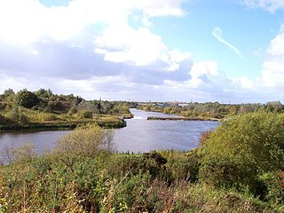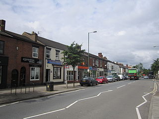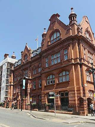
Woolston is a settlement and civil parish in the Borough of Warrington in the county of Cheshire, England. Formerly a township called 'Woolston with Martinscroft' within the parish of Warrington, there are two main settlements: Woolston to the west and Martinscroft to the east. Formerly within the historic county of Lancashire, the parish is on the north bank of the River Mersey and takes in Paddington to the south-west. It is bounded by the River Mersey to the south, Bruche and Padgate to the west, Longbarn and Birchwood to the north and Rixton to the east.

Great Sankey is a civil parish in the Borough of Warrington, Cheshire, England. It is 2 miles (3.2 km) west of Warrington town centre and had a population of 24,211 in 2001 Census.

Winwick is a village and civil parish in the Borough of Warrington, Cheshire, England. Located within the historic boundaries of Lancashire, it is situated about three miles north of Warrington town centre, nearby is junction 22 of the M6 and Junction 9 of the M62. Winwick also borders Newton-le-Willows and Burtonwood.

Newton-le-Willows is a market town in the Metropolitan Borough of St Helens, Merseyside, England. The population at the 2011 census was 22,114. Newton-le-Willows is on the eastern edge of St Helens, south of Wigan and north of Warrington.

Birchwood is a town and civil parish in the Borough of Warrington, Cheshire, England. The parish had a population of 10,614 at the 2021 census. Located originally in Lancashire, it was built as a new town in the 1970s. Birchwood is made up of three districts: Gorse Covert, Locking Stumps and Oakwood.

The Metropolitan Borough of Wigan is a metropolitan borough of Greater Manchester, England. It is named after its largest town, Wigan but covers a far larger area which includes the towns of Atherton, Ashton-in-Makerfield, Golborne, Hindley, Ince-in-Makerfield, Leigh and Tyldesley. The borough also covers the villages and suburbs of Abram, Aspull, Astley, Bryn, Hindley Green, Lowton, Mosley Common, Orrell, Pemberton, Shevington, Standish, Winstanley and Worsley Mesnes. The borough is also the second-most populous district in Greater Manchester.

Orford is a suburb of Warrington, in the Warrington district, in the ceremonial county of Cheshire, England.

Burtonwood is a village in the civil parish of Burtonwood and Westbrook, in the Borough of Warrington, Cheshire, England. Within the boundaries of the historic county of Lancashire, the name Burtonwood is known worldwide as the location of the former RAF Station Burtonwood military camp. Burtonwood village itself is a few miles away from the site of the former station. The civil parish also includes Westbrook, which is a council ward and suburb of Warrington. According to the 2001 census, the population of the entire civil parish was 11,265.

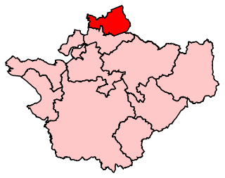
Warrington North is a parliamentary constituency represented in the House of Commons of the Parliament of the United Kingdom since 2019 by Charlotte Nichols of the Labour Party. It elects one Member of Parliament (MP) by the first past the post system of election.

Culcheth is a village in the civil parish of Culcheth and Glazebury, Cheshire, England, six miles (10 km) north-east of Warrington.
Priestley Sixth Form and Community College is a sixth form college in Warrington, Cheshire, England. It also offers adult courses and professional training on another site, and is an associate college of the University of Salford. The college offers a range of courses, including AS/A2 Levels, BTECs, Advanced Diplomas, functional skills, and pre-university foundation courses.

Golborne is a town in the Metropolitan Borough of Wigan, in Greater Manchester, England. It lies 5 miles (8.0 km) south-southeast of Wigan, 6 miles (9.7 km) northeast of Warrington and 14 miles (22.5 km) to the west of the city of Manchester. Along with the neighbouring village of Lowton, it recorded a population of 24,041.
There are various modes of transport available in Warrington.
Hollins Green is a village on the eastern edge of Warrington, in the Warrington district, in the ceremonial county of Cheshire and formerly in the historic county of Lancashire, England. The village is in the civil parish of Rixton-with-Glazebrook; the ecclesiastical parish is Hollinfare.

Culcheth and Glazebury is a civil parish in Borough of Warrington, Cheshire, England. At the 2001 census, it had a population of 8,534.

Kenyon is a village and former civil parish, now in the parish of Croft, in the Warrington district, in the ceremonial county of Cheshire, England. In 1931 the parish had a population of 259.

The Borough of Warrington is a unitary authority area with borough status in the ceremonial county of Cheshire, England. The borough is centred around the town of Warrington, and extends out into outlying villages of Lymm and Great Sankey and the town of Birchwood.
Croft is a village and civil parish in the Borough of Warrington in Cheshire, England, north of the town of Warrington. It contains 13 buildings that are recorded in the National Heritage List for England as designated listed buildings. All of these are listed at Grade II, the lowest of the three gradings given to listed buildings, applied to "buildings of national importance and special interest". The parish is mainly rural, and other than a milestone its listed buildings are related to churches, houses or farms.

Warrington is an industrial town in the borough of the same name in Cheshire, England. The town sits on the banks of the River Mersey and until 1974, was part of Lancashire. It is 19 miles (31 km) east of Liverpool, and 18 miles (29 km) west of Manchester.


