| |
 | |
| Location | Carrabelle Florida United States |
|---|---|
| Coordinates | 29°49′39″N84°42′04″W / 29.82750°N 84.70111°W |
| Tower | |
| Constructed | 1895 |
| Foundation | concrete base |
| Construction | wrought iron skeletal tower |
| Automated | 1965 |
| Height | 100 feet (30 m) |
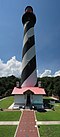
| Shape | square pyramidal skeletal tower with central cylinder, balcony and lantern |
| Markings | white lower half tower, red upper half tower, black lantern |
| Operator | Carrabelle Lighthouse Association [1] [2] |
| Heritage | National Register of Historic Places listed place |
| Light | |
| Deactivated | 1995-2007 |
| Focal height | 115 feet (35 m) |
| Lens | fourth order Fresnel lens |
| Range | 17 nautical miles (31 km; 20 mi) |
| Characteristic | Fl (2) W 15s. |
Crooked River Lighthouse | |
| Nearest city | Carrabelle, Florida |
| Area | less than one acre |
| Built | 1895 |
| NRHP reference No. | 78000941 [3] |
| Added to NRHP | December 1, 1978 |
The Crooked River Light, also known as the Carrabelle Light, was built in 1895 to replace the Dog Island Light on Dog Island, which had been destroyed in 1875 by a hurricane. The location on the mainland allowed the light to serve as the rear range light for the channel to the west of Dog Island, used by ships in the lumber trade.