Croton Township, Michigan

Last updated

Croton Township, Michigan
Croton Dam Muskegon River Dscn1080 cropped.jpg
The Croton Dam along the Muskegon River
USA Michigan location map.svg
Red pog.svg
Croton Township
Location within the state of Michigan
Usa edcp location map.svg
Red pog.svg
Croton Township
Location within the United States
Coordinates: 43°25′03″N85°37′25″W / 43.41750°N 85.62361°W / 43.41750; -85.62361
CountryUnited States
State Michigan
County Newaygo
Established1840
Government
[1]
  SupervisorMorgan Heinzman
   Clerk Debbra Wright
Area
  Total36.38 sq mi (94.22 km2)
  Land33.70 sq mi (87.28 km2)
  Water2.68 sq mi (6.94 km2)
Elevation
906 ft (276 m)
Population
 (2020)
  Total3,368
  Density99.9/sq mi (38.6/km2)
Time zone UTC-5 (Eastern (EST))
  Summer (DST) UTC-4 (EDT)
ZIP code(s)
49239 (Howard City)
49337 (Newaygo)
Area code 231
FIPS code 26-18980 [2]
GNIS feature ID1626143 [3]
Website Official website

Croton Township is a civil township of Newaygo County in the U.S. state of Michigan. The population was 3,368 at the 2020 census.

Contents

Communities

Geography

According to the U.S. Census Bureau, the township has a total area of 36.38 square miles (94.22 km2), of which 33.70 square miles (87.28 km2) is land and 2.68 square miles (6.94 km2) (7.37%) is water. [9]

The Croton Dam on the Muskegon River is located in the township.

Major highways

Demographics

As of the census [2] of 2000, there were 3,042 people, 1,222 households, and 874 families residing in the township. The population density was 89.4 inhabitants per square mile (34.5/km2). There were 1,696 housing units at an average density of 49.8 per square mile (19.2/km2). The racial makeup of the township was 96.84% White, 0.39% African American, 0.79% Native American, 0.13% Asian, 0.85% from other races, and 0.99% from two or more races. Hispanic or Latino of any race were 1.64% of the population.

There were 1,222 households, out of which 29.7% had children under the age of 18 living with them, 60.6% were married couples living together, 7.0% had a female householder with no husband present, and 28.4% were non-families. 24.2% of all households were made up of individuals, and 8.8% had someone living alone who was 65 years of age or older. The average household size was 2.49 and the average family size was 2.94.

In the township the population was spread out, with 25.2% under the age of 18, 6.4% from 18 to 24, 28.3% from 25 to 44, 25.6% from 45 to 64, and 14.5% who were 65 years of age or older. The median age was 39 years. For every 100 females, there were 104.6 males. For every 100 females age 18 and over, there were 103.0 males.

The median income for a household in the township was $41,596, and the median income for a family was $48,229. Males had a median income of $40,219 versus $22,717 for females. The per capita income for the township was $21,036. About 5.2% of families and 7.4% of the population were below the poverty line, including 7.9% of those under age 18 and 5.0% of those age 65 or over.

Related Research Articles

<span class="mw-page-title-main">Newaygo County, Michigan</span> County in Michigan, United States

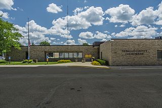
Newaygo County is a county in the U.S. state of Michigan. As of the 2020 United States Census, the population was 49,978. The county seat is White Cloud. The county was created in 1840, and was organized in 1851. It was either named for an Ojibwe leader who signed the Treaty of Saginaw in 1819 or for an Algonquian word meaning "much water".

<span class="mw-page-title-main">Redding Township, Michigan</span> Civil township in Michigan, United States

Redding Township is a civil township of Clare County in the U.S. state of Michigan. The population was 459 at the 2020 census.

<span class="mw-page-title-main">Summerfield Township, Clare County, Michigan</span> Civil township in Michigan, United States

Summerfield Township is a civil township of Clare County in the U.S. state of Michigan. The population was 459 at the 2020 census.

Otisco Township is a civil township of Ionia County in the U.S. state of Michigan. As of the 2000 census, the township population was 2,243. Township offices are located in the community of Smyrna.

<span class="mw-page-title-main">Canadian Lakes, Michigan</span> Census-designated place in Michigan, United States

Canadian Lakes is an unincorporated community and census-designated place (CDP) in Mecosta County in the U.S. state of Michigan. The area is mostly within the southwest portion of Morton Township, southwest of Mecosta and east of Stanwood. As of the 2020 census, the CDP population was 3,202, up from 2,756 in 2010. The area defined by the CDP includes small portions in eastern Austin Township.

Colfax Township is a civil township of Mecosta County in the U.S. state of Michigan. The population was 1,962 at the 2020 census.

Green Charter Township is a charter township of Mecosta County in the U.S. state of Michigan. As of the 2020 census, the township population was 3,219. The township was organized in 1858, before Mecosta County was detached from Newaygo County.

Hinton Township is a civil township of Mecosta County in the U.S. state of Michigan. As of the 2020 census, the township population was 1,054.

<span class="mw-page-title-main">Butterfield Township, Michigan</span> Civil township in Michigan, United States

Butterfield Township is a civil township of Missaukee County in the U.S. state of Michigan. As of the 2020 census, the township population was 473.

Casnovia Township is a civil township of Muskegon County in the U.S. state of Michigan. The population was 2,652 at the 2000 census.

Dalton Township is a civil township of Muskegon County in the U.S. state of Michigan. As of the 2000 census, the township population was 8,047.

Holton Township is a civil township of Muskegon County in the U.S. state of Michigan. As of the 2000 census, the township population was 2,532.

<span class="mw-page-title-main">Wolf Lake, Michigan</span> Census-designated place & unincorporated community in Michigan, United States

Wolf Lake is an unincorporated community and census-designated place (CDP) in Muskegon County in the U.S. state of Michigan. At the 2020 census, the population of Wolf Lake was 5,034. As an unincorporated community, Wolf Lake is governed by Egelston Township. The community lies 4 miles (6.4 km) east of the city of Muskegon.

Garfield Township is a civil township of Newaygo County in the U.S. state of Michigan. The population was 2,464 at the 2000 census.

Merrill Township is a civil township of Newaygo County in the U.S. state of Michigan. The population was 590 at the 2000 census.

<span class="mw-page-title-main">Newaygo, Michigan</span> City in Michigan, United States

Newaygo is a rural city in Newaygo County in the U.S. state of Michigan. The population was 2,471 at the 2020 census.

Chester Township is a civil township of Ottawa County in the U.S. state of Michigan. As of the 2000 United States Census, the township population was 2,315.

Wright Township is a civil township of Ottawa County in the U.S. state of Michigan. The population was 3,147 at the 2010 census.

<span class="mw-page-title-main">Aetna Township, Missaukee County, Michigan</span> Civil township in Michigan, United States

Aetna Township is a civil township of Missaukee County in the U.S. state of Michigan. As of the 2020 census, the township population was 429.

Dayton Township is a civil township of west central Newaygo County in the U.S. state of Michigan. The population was 2,002 at the 2000 census.

References

  1. Michigan Townships Association (2023). "Croton Township, Newaygo County, Michigan" . Retrieved November 10, 2023.
  2. 1 2 "U.S. Census website". United States Census Bureau . Retrieved January 31, 2008.
  3. U.S. Geological Survey Geographic Names Information System: Croton Township, Michigan
  4. U.S. Geological Survey Geographic Names Information System: Croton, Michigan
  5. Romig, Walter (October 1, 1986) [1973]. Michigan Place Names: The History of the Founding and the Naming of More Than Five Thousand Past and Present Michigan Communities (Paperback). Detroit, Michigan: Wayne State University Press. p. 141. ISBN   978-0-8143-1838-6.
  6. U.S. Geological Survey Geographic Names Information System: Croton Heights, Michigan
  7. U.S. Geological Survey Geographic Names Information System: Riverview, Michigan
  8. U.S. Geological Survey Geographic Names Information System: Tift Corner, Michigan
  9. "Michigan: 2010 Population and Housing Unit Counts 2010 Census of Population and Housing" (PDF). 2010 United States census . United States Census Bureau. September 2012. p. 36 Michigan. Archived (PDF) from the original on October 19, 2012. Retrieved January 13, 2023.