Hesperia, Michigan

Last updated

Hesperia, Michigan
Newaygo County Michigan Incorporated and Unincorporated areas Hesperia Highlighted.svg
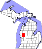
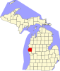
Location of Hesperia, Michigan
Coordinates: 43°34′08″N86°02′22″W / 43.56889°N 86.03944°W / 43.56889; -86.03944 [1]
Country United States
State Michigan
Counties Oceana, Newaygo
Area
[2]
  Total0.86 sq mi (2.22 km2)
  Land0.82 sq mi (2.12 km2)
  Water0.04 sq mi (0.10 km2)
Elevation
[1]
745 ft (227 m)
Population
 (2020)
  Total1,034
  Density1,264.06/sq mi (487.99/km2)
Time zone UTC-5 (Eastern (EST))
  Summer (DST) UTC-4 (EDT)
ZIP code
49421
Area code 231
FIPS code 26-37860 [3]
GNIS feature ID1620176 [1]
Website Hesperia

Hesperia is a village in Newaygo and Oceana Counties in the U.S. state of Michigan; it is also the only village in Newaygo County. About half of the village lies in Newfield Township in Oceana County and half in Denver Township in Newaygo County. The population was determined to be 954 in both the 2000 and the 2010 Census.

Contents

Geography

According to the United States Census Bureau, the village has a total area of 0.86 square miles (2.23 km2), of which 0.79 square miles (2.05 km2) is land and 0.07 square miles (0.18 km2) is water. [4]

Major highways

Climate

This climatic region is typified by large seasonal temperature differences, with warm to hot (and often humid) summers and cold (sometimes severely cold) winters. According to the Köppen Climate Classification system, Hesperia has a humid continental climate, abbreviated "Dfb" on climate maps. [5]

Demographics

Historical population
CensusPop.Note
1880 147
1890 506244.2%
1900 474−6.3%
1910 462−2.5%
1920 439−5.0%
1930 4676.4%
1940 53514.6%
1950 76042.1%
1960 8228.2%
1970 8776.7%
1980 876−0.1%
1990 846−3.4%
2000 95412.8%
2010 9540.0%
2020 1,0348.4%
U.S. Decennial Census [6]

The 2010 American Community Survey 5-year estimate [7] indicates the median income for a household in the village was $30,104 and the median income for a family was $32,500. Males had a median income of $21,809 versus $12,083 for females. The per capita income for the village was $14,471. About 12.9% of families and 19.4% of the population were below the poverty line, including 21.1% of those under the age 18 and 7.3% of those age 65 or over.

2010 census

The 2010 United States Census [7] indicates Hesperia had a 2010 population of 954. There was no change in the population from the 2000 United States Census. In 2010 there were 382 households and 231 families in the village. The population density was 1,211.5 per square mile (467.8 square kilometers). There were 431 housing units at an average density of 547.3 per square mile (211.3 square kilometers). The racial and ethnic makeup of the village was 88.5% White, 0.0% Black or African American, 1.0% Native American, 0.1% Asian, 8.1% Hispanic or Latino, 0.0% from other races, and 2.3% from two or more races.

There were 382 households, of which 34.0% had children under the age of 18 living with them, 39.8% were husband and wife families, 13.4% had a female householder with no husband present, 39.5% were non-families, and 34.8% were made up of individuals. The average household size was 2.45 and the average family size was 3.14.

In the village, the population was spread out, with 27.0% under age of 18, 10.7% from 18 to 24, 21.3% from 25 to 44, 24.8% from 45 to 64, and 16.1% who were 65 years of age or older. The median age was 36 years. For every 100 females, there were 78.7 males. For every 100 females age 18 and over, there were 78 males.

Government

The Village of Hesperia political body consists of a Village President, six Council members, a Clerk, and a Treasurer. [8]

Elected and Appointed Officials:

Trustees:

Related Research Articles

<span class="mw-page-title-main">Oceana County, Michigan</span> County in Michigan, United States

Oceana County is a county located in the U.S. state of Michigan. As of the 2020 Census, the population was 26,659. The county seat is Hart. Long known as part of the large Ojibwe territory, the county was founded by European Americans in 1840 and organized in 1855.

<span class="mw-page-title-main">Newaygo County, Michigan</span> County in Michigan, United States

Newaygo County is a county in the U.S. state of Michigan. As of the 2020 United States Census, the population was 49,978. The county seat is White Cloud. The county was created in 1840, and was organized in 1851. It was either named for an Ojibwe leader who signed the Treaty of Saginaw in 1819 or for an Algonquian word meaning "much water".

<span class="mw-page-title-main">Delta, Louisiana</span> Village in Louisiana, United States

Delta is a village in Madison Parish, Louisiana, United States. The population was 232 at the 2020 census. It is part of the Tallulah Micropolitan Statistical Area.

<span class="mw-page-title-main">Powhatan, Louisiana</span> Village in Louisiana, United States

Powhatan is a village in Natchitoches Parish, Louisiana, United States. The population was 141 at the 2000 census. It is part of the Natchitoches Micropolitan Statistical Area.

<span class="mw-page-title-main">Central Lake, Michigan</span> Village in Michigan, United States

Central Lake is a village in Antrim County in the U.S. state of Michigan. The population was 952 at the 2010 census. The village is located within Central Lake Township.

<span class="mw-page-title-main">Ionia, Michigan</span> Largest city and the county seat of Ionia County, Michigan, United States

Ionia is the largest city in, and the county seat of, Ionia County, Michigan, United States. The population was 13,378 at the 2020 census. Every July it hosts what is said to be the world's largest free-admission fair. The city is mostly within Ionia Township, with small portion extending into Easton Township and Berlin Township, but is politically autonomous of the townships. The city is named after Ionia, a historic region in Greece.

<span class="mw-page-title-main">McBain, Michigan</span> City in Michigan, United States

McBain is a city in Missaukee County in the U.S. state of Michigan. The population was 656 at the 2010 census, making McBain the eighth-smallest city in the state of Michigan by population.

<span class="mw-page-title-main">Fruitport, Michigan</span> Village in Michigan, United States

Fruitport is a village in Muskegon County in the U.S. state of Michigan. The population was 1,093 at the 2010 census. The community is located within Fruitport Charter Township.

Holton Township is a civil township of Muskegon County in the U.S. state of Michigan. As of the 2000 census, the township population was 2,532.

<span class="mw-page-title-main">Norton Shores, Michigan</span> City in Michigan, United States

Norton Shores is a city in Muskegon County in the U.S. state of Michigan. The population was 23,994 at the 2010 census.

<span class="mw-page-title-main">Newaygo, Michigan</span> City in Michigan, United States

Newaygo is a rural city in Newaygo County in the U.S. state of Michigan. The population was 2,471 at the 2020 census.

<span class="mw-page-title-main">Hart, Michigan</span> City in Michigan, United States

Hart is a city and county seat of Oceana County, Michigan. The population was 2,126 at the time of the 2010 census. The city is located within Hart Township, but is politically independent.

Newfield Township is a civil township of Oceana County in the U.S. state of Michigan. As of the 2000 census, the township had a population of 2,483.

<span class="mw-page-title-main">Pentwater, Michigan</span> Village in Michigan, United States

Pentwater is a village in Oceana County in the U.S. state of Michigan. The population was 890 at the 2020 census. The village is located within Pentwater Township. Pentwater is home to Mears State Park. The name Pentwater comes from Pent or Penned up waters. The entrance to the channel is notoriously shallow and for many years dictated the size of vessels that the village was able to accommodate.

<span class="mw-page-title-main">Sandusky, Michigan</span> City in Michigan, United States

Sandusky is a city in the U.S. state of Michigan. The population was 2,679 at the 2010 census. It is the county seat of Sanilac County.

<span class="mw-page-title-main">Mayville, Michigan</span> Village in Michigan, United States

Mayville is a village in Tuscola County, in the U.S. state of Michigan. The population was 950 at the 2010 census. The village is within Fremont Township along the boundary with Dayton Township.

<span class="mw-page-title-main">Touchet, Washington</span> CDP in Washington, United States

Touchet is a census-designated place (CDP) in Walla Walla County, Washington, United States. The population was 421 at the 2010 census.

<span class="mw-page-title-main">Beech Bottom, West Virginia</span> Village in West Virginia, United States

Beech Bottom is a village in Brooke County, West Virginia, United States, situated along the Ohio River. The population was 523 at the 2010 census. It is part of the Weirton–Steubenville metropolitan area.

<span class="mw-page-title-main">Oceana, West Virginia</span> Town in West Virginia, United States

Oceana is a town in Wyoming County, West Virginia. The population was 1,462 at the time of the 2020 census. Oceana is the oldest city in Wyoming County and was the county seat until 1907. Oceana was the eponym of the film Oxyana. The town has a town hall and a local police department. It is home to the only McDonald's in Wyoming County.

Denver Township is a civil township of Newaygo County in the U.S. state of Michigan. The population was 1,971 at the 2000 census.

References

  1. 1 2 3 U.S. Geological Survey Geographic Names Information System: Hesperia, Michigan
  2. "2020 U.S. Gazetteer Files". United States Census Bureau. Retrieved May 21, 2022.
  3. "U.S. Census website". United States Census Bureau . Retrieved January 31, 2008.
  4. "US Gazetteer files 2010". United States Census Bureau. Archived from the original on January 25, 2012. Retrieved November 25, 2012.
  5. "Hesperia, Michigan Köppen Climate Classification (Weatherbase)". Weatherbase. Retrieved October 10, 2018.
  6. "Census of Population and Housing". Census.gov. Retrieved June 4, 2015.
  7. 1 2 "U.S. Census website". United States Census Bureau . Retrieved March 11, 2012.
  8. "Council – Village of Hesperia, Michigan".

43°34′08″N86°02′22″W / 43.56889°N 86.03944°W / 43.56889; -86.03944