Related Research Articles

Marshall County is a county located on the south central border of Oklahoma. As of the 2020 census, the population was 15,312. Its county seat is Madill. The county was created at statehood in 1907 from the former Pickens County of the Chickasaw Nation. It was named to honor the maiden name of the mother of George Henshaw, a member of the 1906 Oklahoma Constitutional Convention. The county and its cities are part of the Texoma region.

Johnston County is a county located in the U.S. state of Oklahoma. As of the 2020 census, the population was 10,272. Its county seat is Tishomingo. It was established at statehood on November 16, 1907, and named for Douglas H. Johnston, a governor of the Chickasaw Nation.

Bryan County is a county in the U.S. state of Oklahoma. As of the 2020 census, the population was 46,067. Its county seat is Durant. It is the only county in the United States named for Democratic politician William Jennings Bryan.

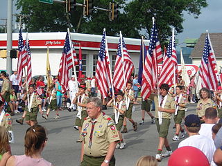
Scouting in Oklahoma has a long history, from the 1910s to the present day, serving thousands of youth in programs that suit the environment in which they live.

Durant is a city in Bryan County, Oklahoma, United States. The population was 18,589 in the 2020 census. It serves as the capital of the Choctaw Nation, and is the largest settlement on the reservation, ranking ahead of McAlester and Poteau. Durant is the principal city of the Durant Micropolitan Statistical Area, which had a population of 46,067 in 2020. Durant is also part of the Dallas–Fort Worth Combined Statistical Area, anchoring the northern edge.
New Woodville is an unincorporated community in Marshall County, Oklahoma, United States. The population was 132 at the 2010 census. Proposals to annex the unincorporated areas of New Woodville and McBride on the shores of Lake Texoma were considered in the past. Listed erroneously by the Census Bureau as "Woodville" from 2000 to 1980, the town's name was corrected in Census Bureau listings in 2005.

The Washita River is a river in the states of Texas and Oklahoma in the United States. The river is 295 miles (475 km) long and terminates at its confluence with the Red River, which is now part of Lake Texoma on the Texas–Oklahoma border.
Boggy Depot is a ghost town and Oklahoma State Park that was formerly a significant city in the Indian Territory. It grew as a vibrant and thriving town in present-day Atoka County, Oklahoma, United States, and became a major trading center on the Texas Road and the Butterfield Overland Mail route between Missouri and San Francisco. After the Civil War, when the MKT Railroad came through the area, it bypassed Boggy Depot and the town began a steady decline. It was soon replaced by Atoka as the chief city in the area. By the early 20th century, all that remained of the community was a sort of ghost town.
Chockie is an unincorporated community 11 miles northeast of Stringtown, in Atoka County, Oklahoma, United States.

South Central Oklahoma is an amorphous region in the state of Oklahoma, perhaps encompassing 10 counties. It is centered on the Arbuckle Mountains, an ancient, eroded range traversing some 70 miles (110 km) across the region, and surrounded by rivers and lakes, notably Lake Texoma, Lake Murray and Lake of the Arbuckles. For tourism purposes, the Oklahoma Department of Tourism has more narrowly defined South Central Oklahoma, which they refer to as Chickasaw Country, as being a seven-county region including Pontotoc, Johnston, Marshall, Garvin, Murray, Carter, and Love counties. A ten-county definition might also include Coal, Atoka, and Bryan counties, although the Department of Tourism includes those in Choctaw Country. The Choctaw Nation of Oklahoma covers the eastern third of the region. Its headquarters is in Durant, and its capitol building, now a museum, is in Tuskahoma. The Chickasaw Nation lies within the region, with the tribal capitol building located at Tishomingo and its headquarters in Ada. The Chickasaw Nation, which runs "Chickasawcountry.com"., promotes the idea of Chickasaw Country as the 13 south-central Oklahoma counties that comprise the Chickasaw Nation, being the Tourism Department’s seven counties plus Coal, Bryan, Jefferson, Stephens, Grady, and McClain counties.
Cloudy is an unincorporated community located in Pushmataha County, Oklahoma, United States. It is 12 miles northeast of Rattan. Cloudy is located at 34°18′07″N95°16′52″W.
Preston, also known as Preston Bend, is an unincorporated community and census-designated place located on the Red River in Grayson County, Texas, United States. It grew in the 19th century at the intersection of several military and trade roads and was an important crossing on the Shawnee cattle trail. Preston lost prominence after the MK&T railroad bypassed the town to the east, leading to a decline in traveler and cattle drive traffic. Much of its former town site is submerged beneath the waters of Lake Texoma. Its population was 2,096 as of the 2010 census.
Belzoni is a community in Pushmataha County, Oklahoma, United States. Located several miles southwest of Rattan, it was formerly home to a thriving community and continues as a place name.
Fewell is a community in eastern Pushmataha County, Oklahoma, United States. Fewell is located at 34°31′05″N95°03′14″W.
Lenox is an unincorporated community in Le Flore County, Oklahoma, United States.
Octavia is an unincorporated community on the Choctaw Reservation, in Le Flore County, Oklahoma, United States.
Reichert is the name of two separate locations approximately one-half mile apart for the unincorporated community in Le Flore County, Oklahoma, United States.
Aylesworth was an unincorporated community in Marshall County, Oklahoma, United States. It is located 6 miles (9.7 km) east of Kingston. A post office operated in Aylesworth from June 6, 1903 to October 15, 1943. The community was named after a Dawes Commission official named Allison Aylesworth. all of the Aylesworth community is now underneath Lake Texoma.
Denby is an unincorporated community in Oglala Lakota County, in the U.S. state of South Dakota.
Gatewood is an unincorporated community in Fayette County, in the U.S. state of West Virginia.
References
- ↑ U.S. Geological Survey Geographic Names Information System: Cumberland, Oklahoma
- ↑ George H. Shirk. Oklahoma Place Names (Norman: University of Oklahoma Press, 1965), p. 58.
- ↑ Charles Goins, Historical Atlas of Oklahoma (Norman: University of Oklahoma Press, 2006), plate 105.
34°03′39″N96°35′32″W / 34.06083°N 96.59222°W
