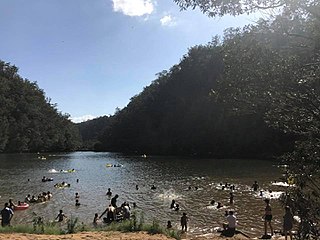
Bents Basin is a protected nature reserve and state park near Wallacia, New South Wales, Australia in the Sydney metropolitan area. The lake basin, which formed at the efflux of the Nepean River from the Hawkesbury Sandstone gorge, is a popular swimming hole with a camping area and an education centre used by local school groups. Also featuring a large woodland area and native wildlife, the reserve is the only picnic area along the Nepean River and it is one of the most popular water-based picnic parks in Greater Western Sydney.

Eucalyptus saligna, commonly known as the Sydney blue gum or blue gum, is a species of medium-sized to tall tree that is endemic to eastern Australia. It has rough, flaky bark near the base of the trunk, smooth bark above, lance-shaped to curved adult leaves, flower buds in groups of seven, nine or eleven, white flowers and cylindrical to conical or cup-shaped fruit.

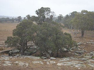
The Cumberland Plain, also known as Cumberland Basin, is a relatively flat region lying to the west of Sydney CBD in New South Wales, Australia. An IBRA biogeographic region, Cumberland Basin is the preferred physiographic and geological term for the low-lying plain of the Permian-Triassic Sydney Basin found between Sydney and the Blue Mountains, and it is a structural sub-basin of the Sydney Basin.

Syncarpia glomulifera, commonly known as the turpentine tree, or yanderra, is a tree of the family Myrtaceae native to New South Wales and Queensland in Australia, which can reach 60 metres in height. It generally grows on heavier soils. The cream flowers appear in spring and are fused into compound flowerheads.

Eucalyptus grandis, commonly known as the flooded gum or rose gum, is a tall tree with smooth bark, rough at the base fibrous or flaky, grey to grey-brown. At maturity, it reaches 50 metres tall, though the largest specimens can exceed 80 metres tall. It is found on coastal areas and sub-coastal ranges from Newcastle in New South Wales northwards to west of Daintree in Queensland, mainly on flat land and lower slopes, where it is the dominant tree of wet forests and on the margins of rainforests.

Eucalyptus botryoides, commonly known as the bangalay, bastard jarrah, woollybutt or southern mahogany, is a small to tall tree native to southeastern Australia. Reaching up to 40 metres high, it has rough bark on its trunk and branches. It is found on sandstone- or shale-based soils in open woodland, or on more sandy soils behind sand dunes. The white flowers appear in summer and autumn. It reproduces by resprouting from its woody lignotuber or epicormic buds after bushfire. E. botryoides hybridises with the Sydney blue gum in the Sydney region. The hard, durable wood has been used for panelling and flooring.

The Sydney Turpentine-Ironbark Forest (STIF) is a wet sclerophyll forest community of Sydney, New South Wales, Australia, that is typically found in the Inner West and Northern region of Sydney. It is also among the three of these plant communities which have been classified as Endangered, under the New South Wales government's Threatened Species Conservation Act 1995, with only around 0.5% of its original pre-settlement range remaining.

Angophora floribunda, commonly known as the rough-barked apple, is a common woodland and forest tree of the family Myrtaceae native to Eastern Australia. Reaching 30 m (100 ft) high, it is a large tree with fibrous bark and cream-white flowers that appear over the Austral summer. It grows on alluvial soils on floodplains and along watercourses. Much of the land it grew on has been cleared for agriculture.

Eucalyptus deanei, commonly known as mountain blue gum, round-leaved gum, or Deane's gum, is a species of large tree endemic to New South Wales. It has smooth bark, lance-shaped leaves that are paler on the lower surface, flower buds in groups of seven to eleven, white flowers and cup-shaped to bell-shaped fruit.

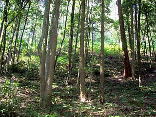
The Eastern Australian temperate forests is a broad ecoregion of open forest on uplands starting from the east coast of New South Wales in the South Coast to southern Queensland, Australia. Although dry sclerophyll and wet sclerophyll eucalyptus forests predominate within this ecoregion, a number of distinguishable rainforest communities are present as well.
The Garawarra State Conservation Area is a protected conservation area that is located on the southern suburban fringe of Greater Sydney, in the state of New South Wales, in eastern Australia. The 949-hectare (2,350-acre) reserve abuts the Royal National Park and is situated 40 kilometres (25 mi) south of the Sydney central business district, near Helensburgh. Garawarra was gazetted as a park in 1987, and added, together with the Royal National Park, to the Australian National Heritage List on 15 September 2006.

Persoonia bargoensis, commonly known as the Bargo geebung, is a species of flowering plant in the family Proteaceae and is endemic to a restricted area of New South Wales. It is an erect shrub with linear to lance-shaped leaves, yellow, tube-shaped flowers and green, pear-shaped fruit.

Western Sydney Regional Park is a large urban park and a nature reserve situated in Western Sydney, Australia within the suburbs of Horsley Park and Abbotsbury. A precinct of Western Sydney Parklands, a park system, and situated within the heart of the Cumberland Plain Woodland, the regional park features several picnic areas, recreational facilities, equestrian trails, and walking paths within the Australian bush.
The Kangaroo River Nature Reserve, part of the Kangaroo Valley Group of Nature Reserves, is a protected nature reserve that is located on the floor of the Kangaroo Valley in the Southern Highlands and South Coast regions of New South Wales in eastern Australia. The reserve is situated approximately 150 kilometres (93 mi) south of Sydney, 50 kilometres (31 mi) southwest of Wollongong and 16 kilometres (9.9 mi) northwest of Nowra. The reserve has a protective covenant placed upon it with purpose to ensure the protection of the natural heritage of this area. National parks in the area include the Morton National Park and the Budderoo National Park. Other nature reserves in the area include the Barren Grounds Nature Reserve, and the Cambewarra Range, Barrengarry and Rodway nature reserves – the latter three part of the Kangaroo Valley Group of Nature Reserves.

The Cooks River/Castlereagh Ironbark Forest (CRCIF) is a scattered, dry sclerophyll, open-forest to low woodland and scrubland which occurs predominantly in the Cumberland subregion of the Sydney basin bioregion, between Castlereagh and Holsworthy, as well as around the headwaters of the Cooks River. The Cooks River Clay Plain Scrub Forest is a component of this ecological community, though both belong to a larger occurring community called the Temperate Eucalyptus fibrosa/Melaleuca decora woodland.

The Cumberland Plain Woodland, also known as Cumberland Plain Bushland and Western Sydney woodland, is a grassy woodland community found predominantly in Western Sydney, New South Wales, Australia, that comprises an open tree canopy, a groundcover with grasses and herbs, usually with layers of shrubs and/or small trees.

The ecology of Sydney, located in the state of New South Wales, Australia, is diverse for its size, where it would mainly feature biomes such as grassy woodlands or savannas and some sclerophyll forests, with some pockets of mallee shrublands, riparian forests, heathlands, and wetlands, in addition to small temperate rainforest fragments.
The Southern Highlands Shale Forest and Woodland is a mixed grassy woodland and sclerophyll-temperate forest community situated within the Southern Highlands region of New South Wales, Australia. An ecotone featuring clay soils derived from Wianamatta Group, it is listed as an endangered ecological community by the Environment Protection and Biodiversity Conservation Act 1999 as less than 5% of the original extent remains today. Three varieties of the Shale Woodland exist: ‘typical’, ‘tall wet’ and ‘short dry’.

The Shale Sandstone Transition Forest, also known as Cumberland Shale-Sandstone Ironbark Forest, is a transitory ecotone between the grassy woodlands of the Cumberland Plain Woodlands and the dry sclerophyll forests of the sandstone plateaus on the edges of the Cumberland Plain in Sydney, Australia.

The Blue Mountains Shale Cap Forest is a wet-sclerophyll temperate forest community predominantly found in the Blue Mountains, particularly in the Wollemi National Park, and parts of the Hawkesbury.


