Curtain Fig Tree is a heritage-listed tree at Curtain Fig Tree Road, East Barron near Yungaburra, Tablelands Region, Queensland, Australia. It is one of the largest trees in Tropical North Queensland, Australia, and one of the best known attractions on the Atherton Tableland. It was added to the Queensland Heritage Register on 3 December 2009.[1]
The Curtain Fig Tree is of the strangler fig species Ficus virens. Normally these figs germinate on top of another tree and try to grow roots into the ground. Once this important step is accomplished, the fig will grow vigorously, finally kill the hosting tree and then grow on independently. In this case, the hosting tree tilted towards a neighbouring tree, and the fig also grew around that one. Its curtain of aerial roots drops 15 metres (49ft) (49 feet (15m)) to the ground.[2]
Although these figs kill their hosts, they are an epiphyte which basically feeds from the ground, unlike a parasitic plant which feeds from the sap of the host plant/tree.
History
The Curtain Fig Tree is located in the Curtain Fig National Park about one kilometre south-west of the town of Yungaburra on the Atherton Tableland.[3] It is estimated by the Queensland Parks and Wildlife Service to be at least 500 years old. Associated with organised tourism on the Tableland since the 1920s, the tree has been important in the development of the Cairns hinterland as a major tourist region in Queensland.[1]
Since the 1890s the tropical vegetation of the Atherton Tableland has been known variously as scrub, jungle and more recently, mabi rainforest. The term "rainforest" was coined in 1898 but it was not a descriptor applied to the tropical vegetation of the Cairns region until the 1970s. Mabi rainforest was classified in the 1960s by ecologists, based on its physical characteristics and species composition. The name "mabi" is derived from a local Aboriginal word for the rare Lumholtz's tree-kangaroo, the largest mammal found in this rainforest. Logging, agriculture and urban development on the Tableland has resulted in significant loss of mabi rainforest and it is listed as endangered under the Commonwealth Environment Protection and Biodiversity Conservation Act 1999.[1]
Early non-indigenous visitors to the Atherton Tableland often viewed the scrub in Romantic terms, fascinated by the dense and luxurious vegetation, especially the enormous trees covered with vines, and delicate and unusual ferns and orchids. A number of early twentieth century tourist attractions in the region, such as Fairyland (1907) and the Maze (1923) at Kuranda developed reflecting this view of the scrub. Other early commentators saw the fecundity of the scrub in a less favourable light, referring to it as gloomy, dank, and swarming with insects.[1]
Ways of seeing the rainforest began to shift in the 1920s from the Romantic view of nature as a collection of fascinating curiosities and grand and sublime landscapes, to an ecological paradigm which views nature as a systemic interrelationship between all living things including humans, and their environment. In the 1930s the North Queensland Naturalists' Club lobbied for language change, seeking to replace "scrub", often used in a derogatory manner, by "jungle", in a bid to change community attitudes to the rainforest. Valuing the rainforest gained momentum with the rise of the environmental movement in the 1960s and 1970s.[1]
Giant strangler figs such as the Curtain Fig Tree were considered to be wonders of nature. Strangler figs are epiphytes that develop when the seed of a fig germinates in the canopy of another tree and then sends roots to the ground. Once the root system is established, the fig grows vigorously, finally killing the host tree and then growing independently. The unusual formation of the Curtain Fig Tree was created when its vertical roots strangled the host causing it to fall into a neighbouring tree on a 45-degree angle. The extensive aerial roots of the strangler fig then dropped from the oblique angle of the fallen tree 15 metres (49ft) to the forest floor, forming a "curtain". North Queensland strangler figs were portrayed photographically in The Queenslander from as early as 1896 and on postcards soon after 1900.[1]
Descriptions of unusual tropical vegetation such as the giant strangler figs began to appear in tourist guides from the 1920s. The Curtain Fig Tree was well known as a tourist attraction by the 1920s when Whitecars, a local hire-car service, commenced day tours of the southern Tableland c.1926, stopping to view the giant tree. Prior to this the only comfortable travel available to visitors to the southern Tableland was by train via the Kuranda Railway. Whitecars was established c.1922 by Les Battle and Norm Graham, who developed a timetabled taxi service between Malanda, Yungaburra and Atherton, and between Malanda and Millaa Millaa, with three cars. They took advantage of the 1926 opening of the Gillies Highway, linking the southern Tableland with Cairns, to take Ned Williams into partnership as The Cairns Tableland Motor Service Ltd (known locally as Whitecars), to capitalise on the expected influx of tourists. In 1927 the company won the tender to transport passengers between Cairns and the southern Tableland via the Gillies Highway, and to operate day tours on the Tableland out of Yungaburra. In 1934 Whitecars introduced its first bus, capable of carrying 17 passengers. The development of Whitecars was integral to the development of tourism on the Tablelands and led to the increased popularity of attractions such as the Curtain Fig Tree.[1]
By the 1950s, the Curtain Fig Tree was included in the Grand Tour/Tropical Wonderland Tour itineraries promoted by the Queensland Government Tourist Bureau (by then part of Queensland Railways). The Grand Tour operated during the winter months when a P&O ship would arrive at Cairns each week from Melbourne and Brisbane carrying around 200 passengers for a six-day stay in the region. Upon arrival passengers could join the Tropical Wonderland Tour, which included being taken by Whitecars to visit the attractions of the Atherton Tableland, including the Curtain Fig Tree.[1]
As tourism diversified and private car ownership became more commonplace in the 1960s, tourism numbers to the Cairns hinterland increased, as did numbers visiting the Curtain Fig Tree. More tours became available and the tree was included on the itinerary of the Tableland Circular Tour in 1966. The popularity of the tree continued unabated and it was included in more tours during the 1970s including the Atherton Tableland Tour.[1]
The Curtain Fig Tree remains a tourist attraction, but advances in science and a greater understanding of the natural environment mean the tree is now seen and portrayed in ecological terms. Since the 1970s, the area surrounding the Curtain Fig Tree has changed considerably: undergrowth has been trimmed back; interpretative signage educates tourists about the formation of the tree; and a boardwalk guides visitors to the tree. In December 1988, the Curtain Fig became part of the newly created Wet Tropics World Heritage Area, which consisted of 8,990 square kilometres of Far North Queensland rainforest.[1]
A boardwalk was constructed in 2001 to allow wheelchair access for the disabled and to provide further protection for the tree and its surrounds, while permitting visitors to view it from all angles. Large numbers of tourists continue to visit the Curtain Fig Tree every year independently or as part of an organised tour. In 1994, 58,000 people arrived in commercial vehicles and 123,000 in private vehicles.[1]
Description
Curtin Fig Tree roots compared to a person in size
The Curtain Fig Tree (Ficus virens) is situated on Curtain Fig Tree Road approximately one kilometre south-west of the town of Yungaburra, in the Curtain Fig National Park within the Wet Tropics World Heritage Area. The vegetation type indigenous to the area is mabi rainforest (complex notophyll vine forest), now classified as endangered.[1][4]
The Curtain Fig Tree is approximately 50 metres (160ft) high with a trunk circumference of 39 metres (128ft). The canopy extends in a radius of approximately 30 metres (98ft) from the trunk of the tree. Extensive aerial roots, which are now thick and interwoven, drop 15 metres (49ft) to the forest floor, forming a curtain oriented north-west to south-east over approximately 7 metres (23ft). The host tree has since rotted away and the fig is now a free-standing tree.[1]
Access to the Curtain Fig Tree which is approximately 50 metres (160ft) from the road is via a 2 metres (6ft 7in) wide timber boardwalk from the roadside car park. At the beginning of the boardwalk there is a sheltered interpretation board that outlines the importance of the mabi rainforest and the history of the Curtain Fig Tree. The boardwalk then encircles the Curtain Fig. This boardwalk is easily accessible to wheelchairs and is raised above the forest floor (approximately 800 millimetres (31in)) which also ensures visitors have minimal impact on the surrounding rainforest. Another interpretation board outlining how the tree was formed is located towards the end of the boardwalk, near the western face of the tree.[1]
At the base of the Curtain Fig are timber posts and stones, remnants of a previous boardwalk that once passed much closer to the base of the tree. The boardwalk and interpretative signage are not considered to be of cultural heritage significance.[1]
Heritage listing
The Curtain Fig Tree was listed on the Queensland Heritage Register on 3 December 2009 having satisfied the following criteria.[1]
The place is important in demonstrating the evolution or pattern of Queensland's history.
The Curtain Fig Tree (Ficus virens), a 500-year old strangler fig that has been associated with organised tourism on the Atherton Tableland since the 1920s, is important for its association with the evolution of tourism in Far North Queensland, demonstrating the attraction of the North Queensland natural environment for tourists. Its popularity is associated with the impact of the motor vehicle on Far North Queensland tourism. As an unusual natural phenomenon, the tree evoked a sense of wonder and curiosity amongst settlers on the Atherton Tableland in the late nineteenth and early twentieth centuries, and has been one of the most tourist-visited large trees on the Tableland since the 1920s. It remains a popular tourist destination.[1]
The place is important because of its aesthetic significance.
The Curtain Fig Tree is an imposing and distinctive tree set within rare mabi rainforest. It is valued for its immense size and the curtain effect that has resulted from the thick and interwoven vertical root system. The tree's verdant and luxuriant growth has been valued by locals and tourists from the 1920s, and evokes a sense of awe, wonder, amazement and curiosity.[1]
The Curtain Fig National Park is a national park on the Atherton Tableland in Far North Queensland, Australia. The National Park is located near Yungaburra. Its most valued features are its once regionally common, now endangered Mabi forests including a huge strangler fig which attracts up to 100 000 visitors per year, locally known as the Curtain Fig Tree, plus a near threatened, locally endemic tree-kangaroo species i.e. the Lumholtz's tree-kangaroo which finds refuge inside this protected area
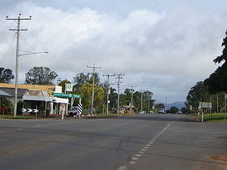
Yungaburra is a rural town and locality in the Tablelands Region, Queensland, Australia. In the 2021 census, the locality of Yungaburra had a population of 1,272 people.
The Atherton Tableland is a fertile plateau, which is part of the Great Dividing Range in Queensland, Australia. It has very deep, rich basaltic soils and the main industry is agriculture. The principal river flowing across the plateau is the Barron River, which was dammed to form the irrigation reservoir named Lake Tinaroo. Unlike many other rural areas, the Tablelands is experiencing a significant growth in population.
Kuranda is a rural town and locality on the Atherton Tableland in the Shire of Mareeba, Queensland, Australia. It is 25 kilometres (16 mi) from Cairns, via the Kuranda Range road. It is surrounded by tropical rainforest and adjacent to the Wet Tropics of Queensland World Heritage listed Barron Gorge National Park. In the 2021 census, the locality of Kuranda had a population of 3,273 people.
Tolga is a rural town and locality in the Tablelands Region, Queensland, Australia. In the 2021 census, the locality of Tolga had a population of 3,177 people.
The Daintree River is a river that rises in the Daintree Rainforest near Cape Tribulation in Far North Queensland, Australia. The river is located about 100 kilometres (62 mi) northwest of Cairns in the UNESCO World Heritage–listed Wet Tropics of Queensland. The area is now primarily a tourist attraction.
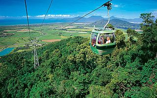
Skyrail Rainforest Cableway is a 7.5-kilometre (4.7 mi) scenic tourist cableway running above the Barron Gorge National Park, in the Wet Tropics of Queensland’s World Heritage Area in Australia. It operates from the Smithfield terminal in Cairns to the Kuranda terminal on the Atherton Tableland. It has won more than 25 awards.
Far North Queensland (FNQ) is the northernmost part of the Australian state of Queensland. Its largest city is Cairns and it is dominated geographically by Cape York Peninsula, which stretches north to the Torres Strait, and west to the Gulf Country. The waters of Torres Strait include the only international border in the area contiguous with the Australian mainland, between Australia and Papua New Guinea.
Ficus virens is a plant of the genus Ficus found in Pakistan, India, southeast Asia, through Malaysia and into Northern Australia. Its common name is white fig; it is locally known as pilkhan and in the Kunwinjku language it is called manbornde. Like many figs, its fruits are edible. One of the most famous specimens of this tree is the Curtain Fig Tree of the Atherton Tableland, near Cairns, a popular tourist attraction. Another famous example is the Tree of Knowledge in Darwin.
Alloxylon flammeum, commonly known as the Queensland tree waratah or red silky oak, is a medium-sized tree of the family Proteaceae found in the Queensland tropical rain forests of northeastern Australia. It has shiny green elliptical leaves up to 18 cm (7.1 in) long, and prominent orange-red inflorescences that appear from August to October, followed by rectangular woody seed pods that ripen in February and March. Juvenile plants have large deeply lobed pinnate leaves. Previously known as Oreocallis wickhamii, the initial specimen turned out to be a different species to the one cultivated and hence a new scientific name was required. Described formally by Peter Weston and Mike Crisp in 1991, A. flammeum was designated the type species of the genus Alloxylon. This genus contains the four species previously classified in Oreocallis that are found in Australasia.
The Shire of Eacham was a local government area of Queensland. It was located on the Atherton Tableland, a plateau forming part of the Great Dividing Range west of the city of Cairns. The shire, administered from the town of Malanda, covered an area of 1,126.4 square kilometres (434.9 sq mi), and existed as a local government entity from 1910 until 2008, when it amalgamated with several other councils in the Tableland area to become the Tablelands Region.
Mabi forests are a type of ecological community found in the Australian state of Queensland which is considered to be critically endangered and which consists of remnant patches found only either in North Queensland's Atherton Tablelands or at Shiptons Flat along the Annan River.
The Victoria Park Nature Reserve is a protected nature reserve that is located in the Northern Rivers region in the state of New South Wales, in eastern Australia. The sub-tropical jungle remnant is located an undulating high rainfall plain near Alstonville. The red-brown soil is derived from a basaltic flow from the nearby Mount Warning. Of the total land in the reserve, 8 hectares is original rainforest; and the other areas are being re-vegetated.
Malanda Falls Swimming Pool is a heritage-listed swimming pool at Malanda Falls Park, Malanda, Tablelands Region, Queensland, Australia. It was built from 1906 onwards. It was added to the Queensland Heritage Register on 5 February 2010.
Lake Eacham Hotel is a heritage-listed hotel at 6–8 Kehoe Place, Yungaburra, Tablelands Region, Queensland, Australia. It was built in 1910 by Side Brothers. It was added to the Queensland Heritage Register on 21 October 1992.
Williams' House is a heritage-listed detached house at 16–20 Cedar Street, Yungaburra, Tablelands Region, Queensland, Australia. It was built from c. 1915 to the 1940s. It was added to the Queensland Heritage Register on 21 October 1992.
East Barron is a rural locality in the Tablelands Region, Queensland, Australia. In the 2021 census, East Barron had a population of 278 people.
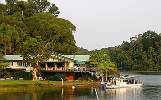
Lake Barrine is a rural locality in the Tablelands Region, Queensland, Australia. In the 2021 census, Lake Barrine had a population of 170 people.
Danbulla is a locality in the Tablelands Region, Queensland, Australia. In the 2021 census, Danbulla had a population of 88 people.
Kuranda Fig Tree Avenue is a heritage-listed avenue of trees at Coondoo Street, Kuranda, Shire of Mareeba, Queensland, Australia. It was built in 1931. It is also known as Avenue of Ficus Microcarpa and Ficus Obliqua trees. It was added to the Queensland Heritage Register on 27 July 2018.
This page is based on this Wikipedia article Text is available under the CC BY-SA 4.0 license; additional terms may apply. Images, videos and audio are available under their respective licenses.