Mutchilba, Queensland

Last updated

Map all coordinates using: OpenStreetMap  
Download coordinates as: KML
Mutchilba
Queensland
Mutchilba QLD 4872, Australia - panoramio.jpg
Mutchilba roadhouse, 2013
Australia Queensland location map.svg
Red pog.svg
Mutchilba
Coordinates 17°08′19″S145°12′33″E / 17.1386°S 145.2091°E / -17.1386; 145.2091 (Mutchilba (town centre)) Coordinates: 17°08′19″S145°12′33″E / 17.1386°S 145.2091°E / -17.1386; 145.2091 (Mutchilba (town centre))
Population495 (2016 census) [1]
 • Density1.2159/km2 (3.149/sq mi)
Established1955
Postcode(s) 4872
Elevation480 m (1,575 ft)
Area407.1 km2 (157.2 sq mi)
Time zone AEST (UTC+10:00)
LGA(s) Shire of Mareeba
State electorate(s)
Federal division(s) Kennedy
Localities around Mutchilba:
Thornborough Arriga Arriga
Dimbulah Mutchilba Tolga
Dimbulah Irvinebank Watsonville

Mutchilba is a rural town and locality in the Shire of Mareeba, in Far North Queensland, Australia. [2] [3]

Contents

Geography

Mutchilba is on the Atherton Tableland, 98 kilometres (61 mi) south-west of Cairns via the Captain Cook Highway, Kennedy Highway and State Route 27. From further west it can be accessed via the Burke Developmental Road.

The town is located in the north-west of the locality on the Mareeba-Dimbulah Road 34 kilometres (21 mi) west of Mareeba. [4]

The Great Dividing Range forms part of the eastern boundary of the locality, and the locality has the following mountains (from west to east): [4]

The Tablelands railway line enters the locality from the north-east (Arriga), passes through the town, and exits to the west (Dimbulah). [4] Historically, the locality was served by many railway station, but all are now abandoned (from west to east):

History

Mutchilba railway station was named on 2 March 1923 by the Queensland Railways Department using an Aboriginal word meaning big dead tree. [11]

A design plan for the town of Mutchilba was prepared in August 1954 as part of the development of the Mareeba-Dimbula irritation area. [12] The first town allotments were surveyed in March 1955. [2]

Mutchilba Post Office opened on 1 March 1956 (a telegraph office had been open from 1936). [13]

The town was downgraded by the Mareeba Shire Council in 1999 and has been officially a part of Dimbulah, Queensland since then. [14] On 12 October 2012 it was announced that the town is again officially recognised in the Queensland place names database. [15]

Between 2008 and 2013, Mutchilba (along with the rest of the Shire of Mareeba) was within the Tablelands Region. [16]

In the 2016 census, the locality of Mutchilba had a population of 495 people. [1]

Economy

Mutchilba is known for its large production of mangoes. [17] [18]

Education

Mutchilba State School is a government primary (Prep-6) school for boys and girls at 33 Marsterson Street ( 17°08′21″S145°12′43″E / 17.1393°S 145.2120°E / -17.1393; 145.2120 (Mutchilba State School) ). [19] [20] In 2017, the school had an enrolment of 24 students with 2 teachers and 4 non-teaching staff (2 full-time equivalent). [21]

Amenities

St Joseph's Catholic Church is in Masterson Street. It is within the Dimbulah Parish of the Roman Catholic Diocese of Cairns which is administered from the Atherton parish. [22]

Events

Mutchilba is known for the "Mango Mardi Gras", which is a celebration of the many mango farms in the region. [23]

The Feast of St Joseph is celebrated by the Catholic church on the first Friday of March with a mass followed by a barbeque. [22]

Related Research Articles

<span class="mw-page-title-main">Dimbulah, Queensland</span> Town in Queensland, Australia

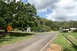
Dimbulah is a town and locality in Far North Queensland, Australia, 114 kilometres (71 mi) from Cairns by road, on the Atherton Tableland. It is within the local government area of Shire of Mareeba. In the 2016 census, the locality of Dimbulah had a population of 1,050 people.

<span class="mw-page-title-main">Chillagoe, Queensland</span> Town in Queensland, Australia

Chillagoe is a rural town and locality in the Shire of Mareeba, Queensland, Australia. In the 2016 census the locality of Chillagoe had a population of 251 people.

<span class="mw-page-title-main">Atherton, Queensland</span> Town in Queensland, Australia

Atherton is a rural town and locality in the Tablelands Region, Queensland, Australia. In the 2016 census, Atherton had a population of 7,331 people.

<span class="mw-page-title-main">Kuranda, Queensland</span> Town in Queensland, Australia

Kuranda is a rural town and locality on the Atherton Tableland in the Shire of Mareeba, Queensland, Australia. In the 2016 census, Kuranda had a population of 3,008 people. It is 25 kilometres (16 mi) from Cairns, via the Kuranda Range road. It is surrounded by tropical rainforest and adjacent to the Wet Tropics of Queensland World Heritage listed Barron Gorge National Park.

<span class="mw-page-title-main">Mareeba</span> Town in Queensland, Australia

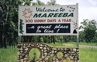
Mareeba is a rural town and locality in the Shire of Mareeba in Far North Queensland, Australia. Between 2008 and 2013, it was within the Tablelands Region. The town's name is derived from an Aboriginal word meaning meeting of the waters.

<span class="mw-page-title-main">Mount Garnet, Queensland</span> Town in Queensland, Australia

Mount Garnet is a rural town and locality in the Tablelands Region, Queensland, Australia. In the 2016 census, Mount Garnet had a population of 430 people.

<span class="mw-page-title-main">Savannahlander</span> Australian passenger train service

The Savannahlander is an Australian passenger train service that operates in Far North Queensland. It travels on the Tablelands railway line and the Etheridge railway line from the coastal city of Cairns to Forsayth.

<span class="mw-page-title-main">Mount Mulligan, Queensland</span> Town in Queensland, Australia

Mount Mulligan is a former mining town and now a rural locality in the Shire of Mareeba, Queensland, Australia. In the 2016 census Mount Mulligan had a population of 4 people.

<span class="mw-page-title-main">Walkamin, Queensland</span> Town in Queensland, Australia

Walkamin is a town and a locality in the Tablelands Region, Queensland, Australia. In the 2016 census, Walkamin recorded a population of 474 people.

<span class="mw-page-title-main">Mount Molloy, Queensland</span> Town in Queensland, Australia

Mount Molloy is a rural town and locality in the Shire of Mareeba, Queensland, Australia. In the 2016 census the locality of Mount Molloy had a population of 254 people.

<span class="mw-page-title-main">Shire of Mareeba</span> Local government area in Queensland, Australia

The Shire of Mareeba is a local government area at the base of Cape York Peninsula in Far North Queensland, inland from Cairns. The shire, administered from the town of Mareeba, covered an area of 53,491 square kilometres (20,653.0 sq mi), and existed as a local government entity from 1879 until 2008, when it amalgamated with several councils in the Atherton Tableland area to become the Tablelands Region.

<span class="mw-page-title-main">Tablelands Region</span> Local government area in Queensland, Australia

The Tablelands Region is a local government area in Far North Queensland, Australia inland from the city of Cairns. Established in 2008, it was preceded by four previous local government areas which dated back more than a century. On 1 January 2014, one of those local government areas, the Shire of Mareeba, was re-established independent of the Tablelands Region.

<span class="mw-page-title-main">Irvinebank</span> Town in Queensland, Australia

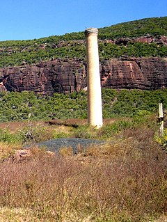
Irvinebank is a rural town and locality in the Shire of Mareeba, Queensland, Australia. In the 2016 census, the locality of Irvinebank had a population of 125 people.

<span class="mw-page-title-main">Mount Carbine, Queensland</span> Town in Queensland, Australia

Mount Carbine is a rural town and locality in the Shire of Mareeba, Queensland, Australia. In the 2016 census, the locality of Mount Carbine had a population of 101 people.

<span class="mw-page-title-main">Watsonville, Queensland</span> Town in Queensland, Australia

Watsonville is a rural town and locality in the Shire of Mareeba, Queensland, Australia. In the 2016 census Watsonville had a population of 191 people.

<span class="mw-page-title-main">Tablelands railway line, Queensland</span>

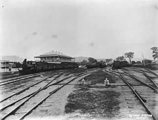
The Tablelands railway line is a railway line in North Queensland, Australia. It was opened in a series of sections between 1887 and 1916. It commences at Cairns and at its maximum extent, reached Ravenshoe at the southern end of the Atherton Tableland. The rail system served by this line was unusual for Queensland in that the majority of lines that connected to it were built by private companies and later purchased by the Queensland Government.

The Walsh River is a river located on the Cape York Peninsula of Far North Queensland, Australia.

<span class="mw-page-title-main">Almaden, Queensland</span> Town in Queensland, Australia

Almaden is a rural town and locality in the Shire of Mareeba, Queensland, Australia. In the 2016 census, the locality of Almaden had a population of 71 people.

<span class="mw-page-title-main">Biboohra, Queensland</span> Town in Queensland, Australia

Biboohra is a rural town and locality in the Shire of Mareeba, Queensland, Australia. In the 2016 census the locality of Biboohra had a population of 568 people.

Chewko is a rural locality in the Shire of Mareeba, Queensland, Australia. In the 2016 census Chewko had a population of 194 people.

References

  1. 1 2 Australian Bureau of Statistics (27 June 2017). "Mutchilba (SSC)". 2016 Census QuickStats. Retrieved 20 October 2018. OOjs UI icon edit-ltr-progressive.svg
  2. 1 2 "Mutchilba – town in Shire of Mareeba (entry 23669)". Queensland Place Names. Queensland Government . Retrieved 30 October 2019.
  3. "Mutchilba – locality in Shire of Mareeba (entry 48798)". Queensland Place Names. Queensland Government . Retrieved 30 October 2019.
  4. 1 2 3 "Queensland Globe". State of Queensland . Retrieved 25 November 2022.
  5. 1 2 3 4 "Mountain peaks and capes - Queensland". Queensland Open Data. Queensland Government. 12 November 2020. Archived from the original on 25 November 2020. Retrieved 25 November 2020.
  6. "Mount Masterton – mountain in Mareeba Shire (entry 21205)". Queensland Place Names. Queensland Government . Retrieved 25 November 2020.
  7. "Wog Hill – mountain in Mareeba Shire (entry 37804)". Queensland Place Names. Queensland Government . Retrieved 25 November 2020.
  8. "Hoot Hill – mountain in Mareeba Shire (entry 16102)". Queensland Place Names. Queensland Government . Retrieved 25 November 2020.
  9. "Mount Emerald – mountain in Mareeba Shire (entry 11608)". Queensland Place Names. Queensland Government . Retrieved 25 November 2020.
  10. 1 2 3 4 5 6 7 8 "Railway stations and sidings - Queensland". Queensland Open Data. Queensland Government. 2 October 2020. Archived from the original on 5 October 2020. Retrieved 5 October 2020.
  11. "Mutchilba – railway station in the Shire of Mareeba (entry 23670)". Queensland Place Names. Queensland Government . Retrieved 1 November 2019.
  12. "TOWNSHIP AT MUTCHILBA". Cairns Post . No. 16, 427. Queensland, Australia. 4 November 1954. p. 1. Retrieved 25 November 2022 via National Library of Australia.
  13. Premier Postal History. "Post Office List". Premier Postal Auctions. Retrieved 10 May 2014.
  14. Wiped off the map, Mutchilba fights back stuff.co.nz, 11 July 2012
  15. Tony Moore, Mutchilba back on the map, The Age, 13 October 2012
  16. "De-amalgamation". Queensland Government. Archived from the original on 26 August 2013. Retrieved 14 August 2013.
  17. "Australian mango". Rocky Creek Orchards. Retrieved 25 November 2022.
  18. Furner, Mark (20 July 2022). "Mango Road leads to good taste and good jobs". Media statements. Queensland Government. Retrieved 25 November 2022.
  19. "State and non-state school details". Queensland Government. 9 July 2018. Archived from the original on 21 November 2018. Retrieved 21 November 2018.
  20. "Mutchilba State School" . Retrieved 21 November 2018.
  21. "ACARA School Profile 2017". Archived from the original on 22 November 2018. Retrieved 22 November 2018.
  22. 1 2 "Dimbulah Parish". Roman Catholic Diocese of Cairns . Archived from the original on 18 November 2020. Retrieved 18 November 2020.
  23. Moore, Tony (10 July 2012). "Wiped off the map, Mutchilba fights back". Brisbane Times . Archived from the original on 18 November 2020. Retrieved 18 November 2020.