Watsonville, Queensland

Last updated

Watsonville
Queensland
CSIRO ScienceImage 2182 View of a mine pit after the treated water has been released.jpg
Watsonville mine pit after the treated water has been released
Australia Queensland relief location map.jpg
Red pog.svg
Watsonville
Coordinates 17°22′39″S145°18′48″E / 17.3775°S 145.3133°E / -17.3775; 145.3133 (Watsonville (town centre))
Population191 (2016 census) [1]
 • Density0.6819/km2 (1.766/sq mi)
Postcode(s) 4887
Area280.1 km2 (108.1 sq mi)
Time zone AEST (UTC+10:00)
Location
LGA(s) Shire of Mareeba
State electorate(s) Hill
Federal division(s) Kennedy
Localities around Watsonville:
Mutchilba Mutchilba Tolga
Atherton
Irvinebank Watsonville Carrington
Wongabel
Silver Valley Kalunga Herberton
Moomin

Watsonville is a rural town and locality in the Shire of Mareeba, Queensland, Australia. [2] [3] In the 2016 census Watsonville had a population of 191 people. [1]

Contents

Geography

Watsonville is 107 kilometres (66 mi) south-west of Cairns via the Bruce Highway, Gillies Range Road, State Route 25 (bypassing Atherton) and the Herberton Petford Road. From further west it can be accessed from the Burke Developmental Road at Petford.

The locality is bounded to the east and south by the Great Dividing Range with a number of named peaks within the locality:

History

Looking down towards the Rocky Bluff township, circa 1905 Rocky Bluff Battery and township ca. 1905.tif
Looking down towards the Rocky Bluff township, circa 1905

Watsonville is a former mining town. The town was named after Robert H. Watson, a tin prospector, who discovered a local deposit on 19 February 1881. The town was surveyed by William J. White on 9 March 1882. [2] [3]

Watsonville State School opened circa 1882 and closed circa 1943. [8] It was located on the block surrounded by Ann, Mary, Ethel and Edith Streets ( 17°22′44″S145°18′53″E / 17.3790°S 145.3148°E / -17.3790; 145.3148 (Watsonville State School (former)) ). [9] [10] [11] [12]

Although historically and currently Watsonville is with the Shire of Mareeba, between 2008 and 2013 Watsonville (and all other parts of the Shire of Mareeba) was within the Tablelands Region, an unpopular decision that was reversed in 2014.

At the 2011 census Watsonville recorded a population of 344. [13]

In the 2016 census Watsonville had a population of 191 people. [1]

Heritage listings

Abandoned mining equipment at the Rocky Bluff Battery Rocky Bluff Battery and Township.jpg
Abandoned mining equipment at the Rocky Bluff Battery

Watsonville has a number of heritage-listed sites, including:

Education

There are no schools in Watsonville. The nearest government primary schools are Herberton State School in neighbouring Moomin to the south-east, Atherton State School in neighbouring Atherton to the north-east, and Irvinebank State School in Irvinebank to the south-west. The nearest government secondary schools are Herbert State School (to Year 10) in Herberton to the south-east and Atherton State High School in Atherton. However, for some students, these schools may be too distant in which case distance education and boarding school are options. [12]

Attractions

Watsonville Pioneer Cemetery is on Watsonville Cemetery Access Road to the north-west of the town ( 17°22′27″S145°18′28″E / 17.3743°S 145.3079°E / -17.3743; 145.3079 (Watsonville Pioneer Cemetery) ). [15] [16] [17]

See also

Related Research Articles

<span class="mw-page-title-main">Lakeland, Queensland</span> Town in Queensland, Australia

Lakeland is a rural town and locality in the Shire of Cook, Queensland, Australia. In the 2016 census, the locality of Lakeland had a population of 299 people.

<span class="mw-page-title-main">Atherton, Queensland</span> Town in Queensland, Australia

Atherton is a rural town and locality in the Tablelands Region, Queensland, Australia. In the 2016 census, Atherton had a population of 7,331 people.

<span class="mw-page-title-main">Kuranda, Queensland</span> Town in Queensland, Australia

Kuranda is a rural town and locality on the Atherton Tableland in the Shire of Mareeba, Queensland, Australia. In the 2016 census, Kuranda had a population of 3,008 people. It is 25 kilometres (16 mi) from Cairns, via the Kuranda Range road. It is surrounded by tropical rainforest and adjacent to the Wet Tropics of Queensland World Heritage listed Barron Gorge National Park.

<span class="mw-page-title-main">Mareeba</span> Town in Queensland, Australia

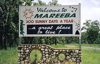
Mareeba is a rural town and locality in the Shire of Mareeba in Far North Queensland, Australia. Between 2008 and 2013, it was within the Tablelands Region. The town's name is derived from an Aboriginal word meaning meeting of the waters.

<span class="mw-page-title-main">Herberton, Queensland</span> Town in Queensland, Australia

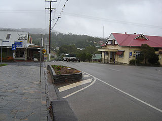
Herberton is a rural town and locality in the Tablelands Region, Queensland, Australia. In the 2016 census, the locality of Herberton had a population of 855 people.

<span class="mw-page-title-main">Mutchilba, Queensland</span> Town in Queensland, Australia

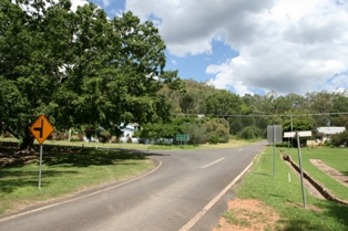
Mutchilba is a rural town and locality in the Shire of Mareeba, in Far North Queensland, Australia. It is known for its production of mangoes.

<span class="mw-page-title-main">Shire of Mareeba</span> Local government area in Queensland, Australia

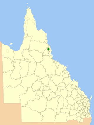
The Shire of Mareeba is a local government area at the base of Cape York Peninsula in Far North Queensland, inland from Cairns. The shire, administered from the town of Mareeba, covered an area of 53,491 square kilometres (20,653.0 sq mi), and existed as a local government entity from 1879 until 2008, when it amalgamated with several councils in the Atherton Tableland area to become the Tablelands Region.

<span class="mw-page-title-main">Shire of Eacham</span> Local government area in Queensland, Australia

The Shire of Eacham was a local government area of Queensland. It was located on the Atherton Tableland, a plateau forming part of the Great Dividing Range west of the city of Cairns. The shire, administered from the town of Malanda, covered an area of 1,126.4 square kilometres (434.9 sq mi), and existed as a local government entity from 1910 until 2008, when it amalgamated with several other councils in the Tableland area to become the Tablelands Region.

<span class="mw-page-title-main">Shire of Herberton</span> Former local government area of Australia

The Shire of Herberton was a local government area of Queensland. It was located on the Atherton Tableland, a plateau forming part of the Great Dividing Range west of the city of Cairns. The shire, administered from the town of Herberton, covered an area of 9,607.0 square kilometres (3,709.3 sq mi), and existed as a local government entity from 1895 until 2008, when it amalgamated with several other councils in the Tableland area to become the Tablelands Region.

<span class="mw-page-title-main">Shire of Atherton</span> Local government area in Queensland, Australia

The Shire of Atherton was a local government area of Queensland. It was located on the Atherton Tableland, a plateau forming part of the Great Dividing Range west of the city of Cairns. The shire, administered from the town of Atherton, covered an area of 623.1 square kilometres (240.6 sq mi), and existed as a local government entity from 1881 until 2008, when it amalgamated with several other councils in the Tableland area to become the Tablelands Region.

<span class="mw-page-title-main">Tablelands Region</span> Local government area in Queensland, Australia

The Tablelands Region is a local government area in Far North Queensland, Australia inland from the city of Cairns. Established in 2008, it was preceded by four previous local government areas which dated back more than a century. On 1 January 2014, one of those local government areas, the Shire of Mareeba, was re-established independent of the Tablelands Region.

<span class="mw-page-title-main">Irvinebank</span> Town in Queensland, Australia

Irvinebank is a rural town and locality in the Shire of Mareeba, Queensland, Australia. In the 2016 census, the locality of Irvinebank had a population of 125 people.

<span class="mw-page-title-main">Mount Carbine, Queensland</span> Town in Queensland, Australia

Mount Carbine is a rural town and locality in the Shire of Mareeba, Queensland, Australia. In the 2016 census, the locality of Mount Carbine had a population of 101 people.

<span class="mw-page-title-main">Tablelands railway line</span> Railway line in Queensland, Australia

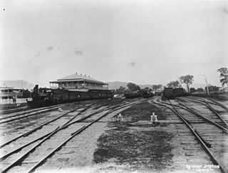
The Tablelands railway line is a railway line in North Queensland, Australia. It was opened in a series of sections between 1887 and 1916. It commences at Cairns and at its maximum extent, reached Ravenshoe at the southern end of the Atherton Tableland. The rail system served by this line was unusual for Queensland in that the majority of lines that connected to it were built by private companies and later purchased by the Queensland Government.

<span class="mw-page-title-main">Abergowrie, Queensland</span> Suburb of Shire of Hinchinbrook, Queensland, Australia

Abergowrie is a rural town and locality in the Shire of Hinchinbrook, Queensland, Australia. In the 2016 census, Abergowrie had a population of 438 people.

The Walsh River is a river located on the Cape York Peninsula of Far North Queensland, Australia.

<span class="mw-page-title-main">Stannary Hills Tramways</span> Historic site in Queensland, Australia

Stannary Hills Tramways are a heritage-listed pair of tramways at Irvinebank, Shire of Mareeba, Queensland, Australia. It was built from 1901 to 1907. It was added to the Queensland Heritage Register on 25 February 2005.

<span class="mw-page-title-main">Arriga, Queensland</span> Suburb of Shire of Mareeba, Queensland, Australia

Arriga is a rural locality in the Shire of Mareeba, Queensland, Australia. It has Queensland's largest wind farm.

<span class="mw-page-title-main">Upper Barron</span> Suburb of Tablelands Region, Queensland, Australia

Upper Barron is a rural locality in the Tablelands Region, Queensland, Australia. In the 2021 census, Upper Barron had a population of 503 people.

Moomin is a rural locality in the Tablelands Region, Queensland, Australia. In the 2016 census Moomin had a population of 133 people.

References

  1. 1 2 3 Australian Bureau of Statistics (27 June 2017). "Watsonville (SSC)". 2016 Census QuickStats. Retrieved 20 October 2018. OOjs UI icon edit-ltr-progressive.svg
  2. 1 2 "Watsonville – town in Shire of Mareeba (entry 45861)". Queensland Place Names. Queensland Government . Retrieved 23 March 2021.
  3. 1 2 "Watsonville – locality in Shire of Mareeba (entry 48923)". Queensland Place Names. Queensland Government . Retrieved 23 March 2021.
  4. 1 2 3 4 5 6 7 "Mountain peaks and capes - Queensland". Queensland Open Data. Queensland Government. 12 November 2020. Archived from the original on 25 November 2020. Retrieved 25 November 2020.
  5. "Cave Hill – mountain in Mareeba Shire (entry 6675)". Queensland Place Names. Queensland Government . Retrieved 25 November 2020.
  6. "Lion Mountain – mountain in Mareeba Shire (entry 19474)". Queensland Place Names. Queensland Government . Retrieved 25 November 2020.
  7. "Western Hill – mountain in Mareeba Shire (entry 37120)". Queensland Place Names. Queensland Government . Retrieved 25 November 2020.
  8. Queensland Family History Society (2010), Queensland schools past and present (Version 1.01 ed.), Queensland Family History Society, ISBN   978-1-921171-26-0
  9. "Queensland Two Mile series sheet 2m404" (Map). Queensland Government. 1943. Archived from the original on 14 January 2021. Retrieved 23 March 2021.
  10. "Herberton" (Map). Queensland Government. 1943. Retrieved 23 March 2021.
  11. "Town of Watsonville" (Map). Queensland Government. 1973. Archived from the original on 23 March 2021. Retrieved 23 March 2021.
  12. 1 2 "Queensland Globe". State of Queensland . Retrieved 22 March 2021.
  13. Australian Bureau of Statistics (31 October 2012). "Watsonville (State Suburb)". 2011 Census QuickStats. Retrieved 14 July 2013. OOjs UI icon edit-ltr-progressive.svg
  14. "Rocky Bluff Battery and Township (entry 601861)". Queensland Heritage Register . Queensland Heritage Council. Retrieved 14 July 2013.
  15. "Cemetery Areas - Queensland". Queensland Open Data. Queensland Government. 12 November 2020. Archived from the original on 15 November 2020. Retrieved 12 November 2020.
  16. "Cemeteries". Mareeba Shire Council. Archived from the original on 15 March 2021. Retrieved 23 March 2021.
  17. "Watsonville Cemetery - Mareeba Shire, Queensland, Australia". www.interment.net. Archived from the original on 23 September 2016. Retrieved 23 March 2021.