Cuyler, New York

Last updated

Cuyler, New York
Cuyler NY hamlet.jpg
The hamlet of Cuyler.
Cortland County NY Cuyler town highlighted.svg
Location within Cortland County and New York
Usa edcp location map.svg
Red pog.svg
Cuyler
Location in the United States
USA New York location map.svg
Red pog.svg
Cuyler
Cuyler (New York)
Coordinates: 42°43′29″N75°56′19″W / 42.72472°N 75.93861°W / 42.72472; -75.93861
Country United States
State New York
County Cortland
Government
  Type Town Council
   Town Supervisor Louanne Randall (R)
   Town Council
Members' List
Area
[1]
  Total43.51 sq mi (112.69 km2)
  Land43.48 sq mi (112.61 km2)
  Water0.03 sq mi (0.08 km2)
Elevation
1,670 ft (509 m)
Population
 (2020) [2]
  Total908
  Density21/sq mi (8.1/km2)
Time zone UTC-5 (Eastern (EST))
  Summer (DST) UTC-4 (EDT)
ZIP code
13158
Area code 607
FIPS code 36-023-19499
GNIS feature ID0978881
Website www.townofcuyler.org

Cuyler is a town in Cortland County, New York, United States. The population was 908 at the 2020 census. [2]

Contents

The town is in the northeastern corner of Cortland County and is northeast of the city of Cortland.

History

Cuyler was in the former Central New York Military Tract. The area was first settled circa 1794. The town was formed from part of the town of Truxton in 1858. In 1865, the population of the town was 1,447. [3]

The former Lehigh Valley Railroad station in Cuyler Cuyler LVRR station.jpg
The former Lehigh Valley Railroad station in Cuyler

Geography

According to the United States Census Bureau, the town has a total area of 43.5 square miles (112.7 km2), of which 0.031 square miles (0.08 km2), or 0.07%, is water. [2]

The northern town line is the border of Onondaga County, and the eastern town boundary is the border of Madison and Chenango counties.

The East Branch of the Tioughnioga River flows southwest through the town. The entire town is within the watershed of the Susquehanna River.

New York State Route 13 is a northeast-southwest highway in Cuyler.

Demographics

Historical population
CensusPop.Note
1860 1,658
1870 1,357−18.2%
1880 1,3821.8%
1890 1,096−20.7%
1900 991−9.6%
1910 881−11.1%
1920 813−7.7%
1930 748−8.0%
1940 708−5.3%
1950 704−0.6%
1960 7537.0%
1970 83611.0%
1980 8461.2%
1990 8500.5%
2000 1,03621.9%
2010 980−5.4%
2020 908−7.3%

As of the census [4] of 2020, there were 908 people, 306 households in the town. The population density was 23.8 people per square mile (9.2/km2). There were 406 housing units at an average density of 9.3 per square mile (3.6/km2). The racial makeup of the town was 92% White, 0.4% Native American, 2.0% from other races, and 5.4% from two or more races. Hispanic or Latino of any race were 3.3% of the population. There are zero Asians or African Americans living in Cuyler as of the 2020 census.

There were 306 households, of which 51.3% were married couples living together, 13.4% had a female householder with no spouse present, and 24.2% had a male householder with no spouse present. The average household size was 2.97.

In the town, the population is spread out, with 7.2% under the age of 5, 15.7% from 5 to 17, 58.9% from 18 to 64, and 18.2% who were 65 years of age or older.

The median income for a household in the town was $70,323. 15.9% of the population is below the poverty line, including 25.1% of those under age 18.

Communities and locations in Cuyler

Related Research Articles

<span class="mw-page-title-main">Triangle, New York</span> Town in New York, United States

Triangle is a town in Broome County, New York, United States. The population was 2,946 at the 2010 census. The town's primary settlement is the village of Whitney Point.

East Randolph is a hamlet, census-designated place, and former village in Cattaraugus County, New York, United States. The population was 620 at the 2010 census. East Randolph is adjacent to the northeast part of the former village of Randolph and is mostly within the town of Randolph, with a small part inside the town of Conewango. Their area code is 716.
<span class="mw-page-title-main">Lincklaen, New York</span> Town in New York, United States

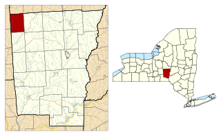
Lincklaen is a town in Chenango County, New York, United States. The population was 396 at the 2010 census. The town was named after Colonel John Lincklaen, an agent of the Holland Land Company and a land owner. The town is in the northwestern corner of the county, northwest of the city Norwich and northeast of Cortland.

<span class="mw-page-title-main">Pitcher, New York</span> Town in New York, United States

Pitcher is a town in Chenango County, New York, United States. The population was 803 at the 2010 census. The town is named after Nathaniel Pitcher, the eighth governor of New York. The town is on the western border of Chenango County, west of the city of Norwich.

<span class="mw-page-title-main">Smithville, New York</span> Town in New York, United States

Smithville is a town in Chenango County, New York, United States. The population was 1,330 at the 2010 census. The town is at the western border of Chenango County, west of the city of Norwich.

<span class="mw-page-title-main">Cincinnatus, New York</span> Town in New York, United States

Cincinnatus is a small town in Cortland County, New York, United States. The population was 910 at the 2020 census. The town is named after the Roman general Lucius Quinctius Cincinnatus. It is in the eastern part of the county and is east of the city of Cortland.

<span class="mw-page-title-main">Freetown, New York</span> Town in New York, United States

Freetown is a town in Cortland County, New York, United States. The population was 757 at the 2010 census. Freetown is in the southeastern part of the county and is southeast of Cortland.
<span class="mw-page-title-main">Lapeer, New York</span> Town in New York, United States

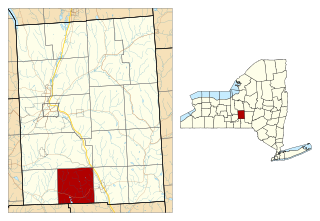
Lapeer is a town in Cortland County, New York, United States. The population was 767 at the 2010 census. Lapeer is on the southern border of Cortland County and is south of the city of Cortland.

<span class="mw-page-title-main">Preble, New York</span> Town in New York, United States

Preble is a town in Cortland County, New York, United States. The population was 1,393 at the 2010 census. The town is named after Commodore Edward Preble, a naval hero.
<span class="mw-page-title-main">Scott, New York</span> Town in New York, United States

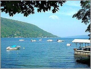
Scott is a town in Cortland County, New York, United States. The population was 1,176 at the 2010 census. The town was named after General Winfield Scott. It is in the northwestern corner of Cortland County and is northwest of the City of Cortland.
<span class="mw-page-title-main">Solon, New York</span> Town in New York, United States

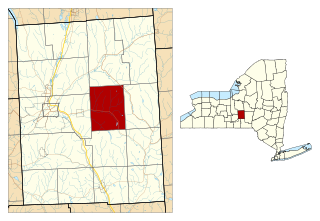
Solon is a town in Cortland County, New York, United States. The town had a total population of 1,079 as of the 2010 census. The name of the town comes from the Greek lawmaker Solon.
<span class="mw-page-title-main">Taylor, New York</span> Town in New York, United States

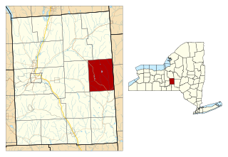
Taylor is a town in Cortland County, New York, United States. The town is in the eastern part of the county and is east of Cortland. The population was 523 at the 2010 census. The town is named after General Zachary Taylor, later the 12th president of the United States.
<span class="mw-page-title-main">Truxton, New York</span> Town in New York, United States

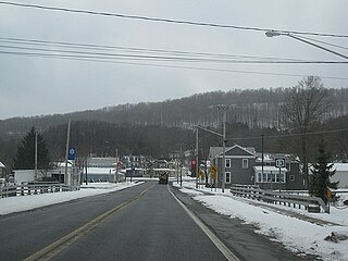
Truxton is a town in Cortland County, New York, United States. The population was 1,133 at the 2010 census. The town is named for Commodore Thomas Truxtun, a privateer in the American Revolution and one of the US Navy's first commanding officers.

<span class="mw-page-title-main">Virgil, New York</span> Town in New York, United States

Virgil is a town in Cortland County, New York, United States. The population was 2,401 at the 2010 census. The name is from the Roman poet Virgil. The town is in the southwestern part of Cortland County and is south of the city of Cortland.

<span class="mw-page-title-main">Willet, New York</span> Town in New York, United States

Willet is a town in Cortland County, New York, United States. The population was 1,043 at the 2010 census. The town is named after Colonel Marinus Willet. It is in the southeast corner of the county, southeast of the City of Cortland.

<span class="mw-page-title-main">Sheldon, New York</span> Town in New York, United States

Sheldon is an incorporated town in Wyoming County, New York. The population was 2,409 at the 2010 census. The Town of Sheldon is on the west border of Wyoming County. The town is southeast of Buffalo.
<span class="mw-page-title-main">Homer, New York</span> Town in New York, United States

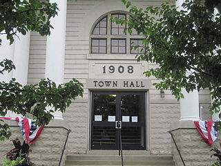
Homer is a town in Cortland County, New York, United States of America. The population was 6,405 at the 2010 census. The name is from the Greek poet Homer.

<span class="mw-page-title-main">DeRuyter, New York</span> Town in New York, United States

DeRuyter is a town in Madison County, New York, United States. The population was 1,589 at the 2010 census. The town is named after Michiel Adriaenszoon de Ruyter, a famous admiral in the Dutch navy. The name de Ruyter means "the Rider".
<span class="mw-page-title-main">Fabius, New York</span> Town in New York, United States

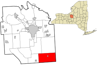
Fabius is a town in Onondaga County, New York, United States. As of the 2020 Census, the population was 2,006. The classical name of the town was assigned by a clerk interested in the classics.

Groton is a town in Tompkins County, New York, United States. The population was 5,950 at the 2010 census. The name is taken from Groton, Massachusetts.

References

  1. "2016 U.S. Gazetteer Files". United States Census Bureau. Retrieved July 4, 2017.
  2. 1 2 3 "Census - Geography Identifiers". U.S. Census Bureau. Retrieved February 9, 2022.
  3. Child, Hamilton (1869). "Early Town Histories". Tromptown Historical Society. Retrieved February 9, 2022.
  4. "U.S. Census website". United States Census Bureau . Retrieved February 9, 2022.

42°44′14″N75°56′55″W / 42.73722°N 75.94861°W / 42.73722; -75.94861