Freetown, New York

Last updated

Freetown, New York
Cortland County NY Freetown town highlighted.svg
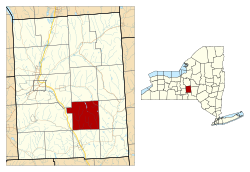
Location within Cortland County and New York
Usa edcp location map.svg
Red pog.svg
Freetown
Location in the United States
USA New York location map.svg
Red pog.svg
Freetown
Freetown (New York)
Coordinates: 42°31′58″N76°0′57″W / 42.53278°N 76.01583°W / 42.53278; -76.01583
Country United States
State New York
County Cortland
Government
  Type Town Council
   Town Supervisor Thomas Vanderploeg (Conservative)
   Town Council
Members' List
Area
[1]
  Total25.63 sq mi (66.38 km2)
  Land25.49 sq mi (66.01 km2)
  Water0.14 sq mi (0.37 km2)
Elevation
1,565 ft (477 m)
Population
 (2010)
  Total757
  Estimate 
(2016) [2]
765
  Density30.02/sq mi (11.59/km2)
Time zone UTC-5 (Eastern (EST))
  Summer (DST) UTC-4 (EDT)
ZIP code
13803
Area code 607
FIPS code 36-023-27496
GNIS feature ID0978974
Website freetownny.org

Freetown is a town in Cortland County, New York, United States. The population was 757 at the 2010 census. [3] Freetown is in the southeastern part of the county and is southeast of Cortland.

Contents

History

Freetown was in the former Central New York Military Tract within a tract township called "Cincinnatus".

The region was first settled circa 1800.

Freetown was formed from part of the town of Cincinnatus in 1818. In 1820, the town was increased in size by an addition from the town of Virgil.

Geography

According to the United States Census Bureau, Freetown has a total area of 25.6 square miles (66.4 km2), of which 25.5 square miles (66.0 km2) is land and 0.15 square miles (0.4 km2), or 0.55%, is water. [3]

New York State Route 41 crosses the northeastern part of Freetown. The town drains to the Otselic River to the east and the Tioughnioga River to the west, but both rivers are outside the town boundaries. The entire town is part of the Susquehanna River watershed.

Demographics

Historical population
CensusPop.Note
1820 663
1830 1,05158.5%
1840 950−9.6%
1850 9550.5%
1860 9812.7%
1870 906−7.6%
1880 844−6.8%
1890 677−19.8%
1900 610−9.9%
1910 551−9.7%
1920 485−12.0%
1930 418−13.8%
1940 51022.0%
1950 5344.7%
1960 5421.5%
1970 522−3.7%
1980 5729.6%
1990 68820.3%
2000 78914.7%
2010 757−4.1%
2016 (est.)765 [2] 1.1%
U.S. Decennial Census [4]

As of the census [5] of 2000, there were 789 people, 267 households, and 206 families residing in the town. The population density was 30.9 inhabitants per square mile (11.9/km2). There were 321 housing units at an average density of 12.6 per square mile (4.9/km2). The racial makeup of the town was 98.35% White, 0.13% African American, 0.13% Native American, and 1.39% from two or more races.

There were 267 households, out of which 39.7% had children under the age of 18 living with them, 64.8% were married couples living together, 6.7% had a female householder with no husband present, and 22.5% were non-families. 14.6% of all households were made up of individuals, and 4.1% had someone living alone who was 65 years of age or older. The average household size was 2.96 and the average family size was 3.20.

In the town, the population was spread out, with 31.4% under the age of 18, 6.7% from 18 to 24, 30.8% from 25 to 44, 22.4% from 45 to 64, and 8.6% who were 65 years of age or older. The median age was 34 years. For every 100 females, there were 116.2 males. For every 100 females age 18 and over, there were 106.5 males.

The median income for a household in the town was $34,327, and the median income for a family was $36,477. Males had a median income of $26,339 versus $14,946 for females. The per capita income for the town was $12,969. About 10.0% of families and 13.3% of the population were below the poverty line, including 23.2% of those under age 18 and 12.8% of those age 65 or over.

Communities and locations in Freetown

Related Research Articles

<span class="mw-page-title-main">Triangle, New York</span> Town in New York, United States

Triangle is a town in Broome County, New York, United States. The population was 2,946 at the 2010 census. The town's primary settlement is the village of Whitney Point.

<span class="mw-page-title-main">Summerhill, New York</span> Town in New York, United States

Summerhill is a town in Cayuga County, New York, United States. The population was 1,217 at the 2010 census. The town name is that of a location in Ireland. Summerhill is in the southeastern corner of the county and is northeast of Ithaca.

<span class="mw-page-title-main">Lincklaen, New York</span> Town in New York, United States

Lincklaen is a town in Chenango County, New York, United States. The population was 396 at the 2010 census. The town was named after Colonel John Lincklaen, an agent of the Holland Land Company and a land owner. The town is in the northwestern corner of the county, northwest of the city Norwich and northeast of Cortland.

<span class="mw-page-title-main">Pitcher, New York</span> Town in New York, United States

Pitcher is a town in Chenango County, New York, United States. The population was 803 at the 2010 census. The town is named after Nathaniel Pitcher, the eighth governor of New York. The town is on the western border of Chenango County, west of the city of Norwich.

<span class="mw-page-title-main">Smithville, New York</span> Town in New York, United States

Smithville is a town in Chenango County, New York, United States. The population was 1,330 at the 2010 census. The town is at the western border of Chenango County, west of the city of Norwich.

<span class="mw-page-title-main">Cincinnatus, New York</span> Town in New York, United States

Cincinnatus is a small town in Cortland County, New York, United States. The population was 910 at the 2020 census. The town is named after the Roman general Lucius Quinctius Cincinnatus. It is in the eastern part of the county and is east of the city of Cortland.

<span class="mw-page-title-main">Cortlandville, New York</span> Town in New York, United States

Cortlandville is a town in Cortland County, New York, United States. The population was 8,509 at the 2010 census.

<span class="mw-page-title-main">Cuyler, New York</span> Town in New York, United States

Cuyler is a town in Cortland County, New York, United States. The population was 908 at the 2020 census.

<span class="mw-page-title-main">Harford, New York</span> Town in New York, United States

Harford is a town in Cortland County, New York, United States. The population was 943 at the 2010 census. Harford is in the southwestern corner of Cortland County and is south of Cortland.

<span class="mw-page-title-main">Lapeer, New York</span> Town in New York, United States

Lapeer is a town in Cortland County, New York, United States. The population was 767 at the 2010 census. Lapeer is on the southern border of Cortland County and is south of the city of Cortland.

<span class="mw-page-title-main">Preble, New York</span> Town in New York, United States

Preble is a town in Cortland County, New York, United States. The population was 1,393 at the 2010 census. The town is named after Commodore Edward Preble, a naval hero.

<span class="mw-page-title-main">Scott, New York</span> Town in New York, United States

Scott is a town in Cortland County, New York, United States. The population was 1,176 at the 2010 census. The town was named after General Winfield Scott. It is in the northwestern corner of Cortland County and is northwest of the City of Cortland.

<span class="mw-page-title-main">Solon, New York</span> Town in New York, United States

Solon is a town in Cortland County, New York, United States. The town had a total population of 1,079 as of the 2010 census. The name of the town comes from the Greek lawmaker Solon.

<span class="mw-page-title-main">Taylor, New York</span> Town in New York, United States

Taylor is a town in Cortland County, New York, United States. The town is in the eastern part of the county and is east of Cortland. The population was 523 at the 2010 census. The town is named after General Zachary Taylor, later the 12th president of the United States.

<span class="mw-page-title-main">Truxton, New York</span> Town in New York, United States

Truxton is a town in Cortland County, New York, United States. The population was 1,133 at the 2010 census. The town is named for Commodore Thomas Truxtun, a privateer in the American Revolution and one of the US Navy's first commanding officers.

<span class="mw-page-title-main">Virgil, New York</span> Town in New York, United States

Virgil is a town in Cortland County, New York, United States. The population was 2,401 at the 2010 census. The name is from the Roman poet Virgil. The town is in the southwestern part of Cortland County and is south of the city of Cortland.

<span class="mw-page-title-main">Willet, New York</span> Town in New York, United States

Willet is a town in Cortland County, New York, United States. The population was 1,043 at the 2010 census. The town is named after Colonel Marinus Willet. It is in the southeast corner of the county, southeast of the City of Cortland.

<span class="mw-page-title-main">Homer, New York</span> Town in New York, United States

Homer is a town in Cortland County, New York, United States of America. The population was 6,405 at the 2010 census. The name is from the Greek poet Homer.

<span class="mw-page-title-main">Marathon, New York</span> Town in New York, United States

Marathon is a town in Cortland County, New York, United States. The population was 1,967 at the 2010 census.

<span class="mw-page-title-main">Fabius, New York</span> Town in New York, United States

Fabius is a town in Onondaga County, New York, United States. As of the 2020 Census, the population was 2,006. The classical name of the town was assigned by a clerk interested in the classics.

References

  1. "2016 U.S. Gazetteer Files". United States Census Bureau. Retrieved July 4, 2017.
  2. 1 2 "Population and Housing Unit Estimates" . Retrieved June 9, 2017.
  3. 1 2 "Geographic Identifiers: 2010 Demographic Profile Data (G001): Freetown town, Cortland County, New York". U.S. Census Bureau, American Factfinder. Archived from the original on February 12, 2020. Retrieved December 16, 2014.
  4. "Census of Population and Housing". Census.gov. Retrieved June 4, 2015.
  5. "U.S. Census website". United States Census Bureau . Retrieved January 31, 2008.

42°31′19″N76°2′10″W / 42.52194°N 76.03611°W / 42.52194; -76.03611