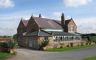
Birdforth is a village and civil parish in the Hambleton district of North Yorkshire, England. According to the 2001 census it had a population of 13. The population remained less than 100 at the 2011 Census. Details are included in the civil parish of Long Marston, North Yorkshire. The village is on the A19 road, about six miles south of Thirsk.
Birdsall is a village and civil parish in North Yorkshire, England. According to the 2001 census it had a population of 180, increasing to 343 at the 2011 Census. The village is about four miles south of Malton and the parish also includes the village of North Grimston.
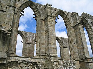
Bolton Abbey is a village and civil parish in the Craven district of North Yorkshire, England, 22 miles (35 km) north-west of Leeds. The village lies in Wharfedale, near the southern edge of the Yorkshire Dales National Park, and just north of the border with West Yorkshire.

Brearton is a village and civil parish in the Harrogate borough of North Yorkshire, England, situated about 3 miles (4.8 km) north of Knaresborough. The village is mentioned in the Domesday Book and its name derives from the Old English Brer-Tun, which means the town where the briars grew.

Burythorpe is a village and civil parish in North Yorkshire, England, about 4 miles (6 km) south of Malton. According to the 2001 census it had a population of 289, reducing marginally to 286 at the Census 2011. The Whitegrounds barrow is nearby.

Overton is a small village and civil parish in the Hambleton district of North Yorkshire, England, about 4 miles (6.4 km) north-west of York. The population of civil parish taken at the 2011 Census was less than 100. Details are included in the civil parish of Shipton, North Yorkshire. The East Coast Main Line passes to the east, not far from the village.

Litton is a village and civil parish in Littondale in the Yorkshire Dales in England. It lies in the Craven District of North Yorkshire, 1.5 miles (2.4 km) up Littondale from Arncliffe. From Litton a footpath leads 3 miles (4.8 km) over the fells to the north east to Buckden in Wharfedale. The population of the civil parish was estimated at 70 in 2015.

Weeton is a village and civil parish in the Harrogate district of North Yorkshire, England.

Eryholme is a village and civil parish in North Yorkshire, England. As the population remained less than 100 in the 2011 census, information is included with that of Dalton-on-Tees.

Hornby is a village and civil parish in the Hambleton district of North Yorkshire, England. It lies on a minor road between Great Smeaton and Appleton Wiske.

Melmerby is a village and civil parish in North Yorkshire, England. It lies in Coverdale in the Yorkshire Dales about 3 miles (4.8 km) south-west of Leyburn. Its neighbours are the villages of Carlton and Agglethorpe. The population of the civil parish was estimated at 40 in 2015.

Satron is a hamlet in Swaledale, North Yorkshire, England. It lies 0.6 miles (1 km) south west of Gunnerside on the opposite bank of the River Swale. It is in the civil parish of Muker, but used to be in the ancient parish of Grinton.

Hunton is a village and civil parish about 3 miles (4.8 km) south of Catterick Garrison and 6 miles (10 km) north west of Bedale, in North Yorkshire, England. It is part of the Richmondshire district of North Yorkshire, and at the 2001 census had a population of 420, decreasing to 414 at the 2011 census. The name of the village derives from Old English and means the town of the huntsmen, or where the hunts hounds were kept.
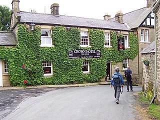
Lofthouse is a small village in Nidderdale in the Harrogate district of North Yorkshire, England about a mile south of Middlesmoor. It is the principal settlement in the civil parish of Fountains Earth. Lofthouse has a primary school, memorial village hall and public house, the Crown Hotel. The post office in the village closed in August 2014, and was replaced by a post office in the cafe at nearby How Stean Gorge, also now closed.

Timble is a village in the Harrogate district of North Yorkshire, England. It is situated on the slopes of the Washburn valley, north of Otley and close to Swinsty and Fewston reservoirs.

Kirkby is a village and civil parish in Hambleton district of North Yorkshire, England, near Great Busby and 2 miles (3.2 km) south of Stokesley. The village is mentioned in the Domesday Book as belonging to Uhtred. The name of the village derives from the Old Norse kirkju-býr, which means church with a village. At the 2001 Census, the population of the village was recorded at 313, dropping slightly to 309 at the 2011 Census. In 2015, North Yorkshire County Council estimated the population to be 310.

Maunby is a village and civil parish in the Hambleton district of North Yorkshire, England, about six miles south of Northallerton and on the River Swale. The population is estimated at around 150.
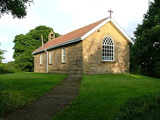
Middleton-on-Leven is a hamlet and civil parish in the Hambleton District of North Yorkshire, England. At the 2011 Census, the population was less than 100, and was recorded with the civil parish of Rudby. In the 2001 census, the parish had a population of 97.

Seamer is a village and civil parish in the Hambleton district of North Yorkshire, England, near the border with the Borough of Stockton-on-Tees and 2 miles (3 km) northwest of Stokesley. According to the 2011 census, the population of the village was 566, which North Yorkshire County Council estimated had dropped to 560 by 2015.
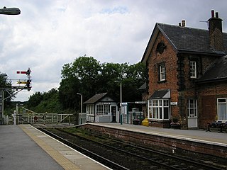
Cattal is a village and civil parish in the Borough of Harrogate district of North Yorkshire, England, about 6 miles (9.7 km) east of Knaresborough, and is located 12 miles (19 km) west of the city of York. Cattal is located on the River Nidd. Despite being a small village it is served by Cattal railway station on the Harrogate line ; the railway station generally provides an hourly service to the nearby cities of York and Leeds.


