Dahomy, Mississippi

Last updated
Dahomy, Mississippi
USA Mississippi location map.svg
Red pog.svg
Dahomy, Mississippi
Usa edcp location map.svg
Red pog.svg
Dahomy, Mississippi
Coordinates: 33°40′28″N90°59′06″W / 33.67444°N 90.98500°W / 33.67444; -90.98500 Coordinates: 33°40′28″N90°59′06″W / 33.67444°N 90.98500°W / 33.67444; -90.98500
Country United States
State Mississippi
County Bolivar
Elevation
141 ft (43 m)
Time zone UTC-6 (Central (CST))
  Summer (DST) UTC-5 (CDT)
GNIS feature ID711172 [1]

Dahomy is an unincorporated community in Bolivar County, Mississippi, United States. [1]

History

The Dahomey Plantation was founded in 1833 by F.G. Ellis, who named it after Dahomey, the homeland of his slaves. [2] The plantation became the largest cotton plantation in the world. [3]

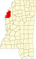
The settlement of Dahomy was likely established when the Louisville, New Orleans and Texas Railway was completed through the plantation in the 1880s. [4]

A post office was established prior to 1907 and closed in 1937. [3] [5]

In 1991, 9,691 acres (3,922 ha) of the original Dahomey Plantation was used to established the Dahomey National Wildlife Refuge, located 2.5 mi (4.0 km) east of the settlement of Dahomy. [2] [6]

Related Research Articles

Sunflower River

The Sunflower River is one of the main tributaries of the Yazoo River in the U.S. state of Mississippi. It is navigable by barge for 50 miles. It rises in De Soto County, Mississippi near the Tennessee border and flows south for 100 miles to the Yazoo River, a major tributary of the Mississippi River. At Clarksdale, the county seat of Coahoma County, the annual Sunflower River Blues & Gospel Festival is held.

Wichita Mountains Wildlife Refuge

Wichita Mountains Wildlife Refuge, located in southwestern Oklahoma near Lawton, has protected unique wildlife habitats since 1901 and is the oldest managed wildlife facility in the United States Fish and Wildlife Service system. Measuring about 59,020 acres (238.8 km2), the refuge hosts a great diversity of species: 806 plant species, 240 species of birds, 36 fish, and 64 reptiles and amphibians are present. The refuge's location in the geologically unique Wichita Mountains and its areas of undisturbed mixed grass prairie make it an important conservation area. The Wichitas are approximately 500 million years old.

Wayside, Mississippi Unincorporated community in Mississippi, United States

Wayside is an unincorporated community in Washington County, Mississippi, United States.

Dahomey National Wildlife Refuge

Dahomey National Wildlife Refuge is located 15 miles (24 km) southwest of Cleveland, Mississippi, and 2.5 mi (4.0 km) east of the settlement of Dahomy. It was established in 1990 when the Nature Conservancy (TNC) purchased 9,269 acres (37.51 km2) and leased the land back to the United States Fish and Wildlife Service for management. In 1993, the Service completed acquisition of the TNC lands. One additional 162-acre (0.66 km2) tract was purchased by the Mississippi Department of Transportation (MDOT) and turned over to the Service in 1991. A 260-acre 16th section tract is leased from the West Bolivar School Board bringing the total land base to 9,691 acres (39.22 km2). The refuge is the largest remaining tract of bottomland hardwood-forested wetlands in the northwest portion of Mississippi.

Slade National Wildlife Refuge

Slade National Wildlife Refuge is a 3,000-acre (12 km2) National Wildlife Refuge in Kidder County, North Dakota. It was established in 1941 when the property was donated by G.T. Slade, a Northern Pacific Railroad executive. It is managed under the Long Lake National Wildlife Refuge. It contains Harker Lake and Upper Harker Lake.

Heathman, Mississippi Unincorporated community in Mississippi, United States

Heathman is an unincorporated community in Sunflower County, Mississippi, United States. Heathman is located within the Mississippi Delta near U.S. Route 82 on Heathman Road, approximately 2 miles (3.2 km) west of Indianola and 2 miles (3.2 km) east of Holly Ridge.

Eagles Nest, Mississippi Unincorporated community in Mississippi, United States

Eagles Nest is an unincorporated community located in Coahoma County, Mississippi, United States. Eagles Nest is approximately 2 miles (3.2 km) south of Jonestown and approximately 11 miles (18 km) west of Belen. Eagles Nest is named for the former plantation of James L. Alcorn, which in turn received its name from an eagle's nest that was built near the site. The community is located on the former Louisville, New Orleans and Texas Railway. A post office operated under the name Eagles Nest from 1887 to 1909.

Eutaw, Mississippi Ghost town in Mississippi, United States

Eutaw is a ghost town in Bolivar County, Mississippi, United States. The settlement had a port on the Mississippi River called "Eutaw Landing."

Artonish, Mississippi Ghost town in Mississippi, United States

Artonish is a ghost town located in Wilkinson County, Mississippi, United States. South of the town was Artonish Landing, located on a stretch of the Mississippi River known as the "Homochitto Cutoff".

Agency, Mississippi Ghost town in Mississippi, United States

Agency is a ghost town located in Oktibbeha County, Mississippi, United States.

Hutchins Landing, Mississippi Ghost town in Mississippi, United States

Hutchins Landing is a ghost town in Adams County, Mississippi, United States.

Singleton, Winston County, Mississippi Ghost town in Mississippi, United States

Singleton is a ghost town in Winston County, Mississippi, United States.

Leota, Mississippi Ghost town in Mississippi, United States

Leota is a ghost town located in Washington County, Mississippi, United States. The settlement, along with its river port Leota Landing, were at one time located directly on the Mississippi River.

Refuge, Mississippi Unincorporated community in Mississippi, United States

Refuge is an unincorporated community located in Washington County, Mississippi, United States.

Huntington, Mississippi Ghost town in Mississippi, United States

Huntington is a ghost town in Bolivar County, Mississippi, United States.

Valena, Mississippi Ghost town in Mississippi, United States

Valena is a ghost town in Attala County, Mississippi, United States.

Peyton, Claiborne County, Mississippi Unincorporated community in Mississippi, United States

Peyton is an unincorporated community in Claiborne County, Mississippi, United States.

Alamucha, Mississippi Unincorporated community in Mississippi, United States

Alamucha is an unincorporated community in Lauderdale County, Mississippi, United States.

Cannonsburg, Mississippi Unincorporated community in Mississippi, United States

Cannonsburg is an unincorporated community in Jefferson County, Mississippi, United States.

Bewelcome, Mississippi Unincorporated community in Mississippi, United States

Bewelcome is an unincorporated community in Amite County, Mississippi, United States.

References

  1. 1 2 U.S. Geological Survey Geographic Names Information System: Dahomy
  2. 1 2 "Dahomey National Wildlife Refuge Habitat Management Plan". U.S. Department of the Interior, Fish and Wildlife Service, Southeast Region. 2013.
  3. 1 2 Rowland, Dunbar (1907). Mississippi: Comprising Sketches of Counties, Towns, Events, Institutions, and Persons, Arranged in Cyclopedic Form. 1. Southern Historical Publishing Association. p.  603.
  4. Howe, Tony. "Louisville, New Orleans & Texas Railway". Mississippi Rails. Retrieved July 23, 2017.
  5. U.S. Geological Survey Geographic Names Information System: Dahomy Post Office (historical)
  6. "About the Refuge". U.S. Fish and Wildlife Service. January 9, 2014.