
Castletown is a town in the Isle of Man, geographically within the historical parish of Malew but administered separately. Lying at the south of the island, it was the Manx capital until 1869. The centre of town is dominated by Castle Rushen, a well-preserved medieval castle, originally built for a Viking king.
Onchan is a village in the parish of Onchan on the Isle of Man. It is at the north end of Douglas Bay. Administratively a district, it has the second largest population of settlements on the island, after Douglas, with which it forms a conurbation.

Peel is a seaside town and small fishing port in the Isle of Man, in the historic parish of German but administered separately. Peel is the third largest town in the island after Douglas and Ramsey but the fourth largest settlement, as Onchan has the second largest population but is classified as a village. Until 2016 Peel was also a House of Keys constituency, electing one Member of the House of Keys (MHK), who, from September 2015, was Ray Harmer. Peel has a ruined castle on St Patrick's Isle, and a cathedral, seat of the Diocese of Sodor and Man.
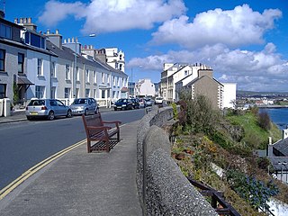
Port St Mary is a village district in the south-west of the Isle of Man. The village takes its name from the former Chapel of St Mary which is thought to have overlooked Chapel Bay in the village. Its population is 1,953 according to the 2011 census. In the 19th century it was sometimes called Port-le-Murray.

Port Erin is a seaside village in the south-west of the Isle of Man, in the historic parish of Rushen. It was previously a seaside resort before the decline of the tourist trade. Administratively it is designated as a village district, with its own board of commissioners. The district covers around 1 square mile, and is adjacent to: Port St Mary to the south-east; the main part of Arbory and Rushen parish district to the north and east; the sea to the west; and an exclave of Arbory and Rushen parish district to the south. Following recent residential expansion, the settlement is now contiguous with that of Port St Mary, and on 18 July 2018 Tynwald authorised a public enquiry into the proposed expansion of the district boundary to include some of this expansion.

The Diocese of Sodor and Man is a diocese of the Church of England. Originally much larger, today it covers just the Isle of Man and its adjacent islets. Today, the bishop's office is in Douglas and the cathedral is in Peel. The diocese is not generally called either "Sodor diocese" or "Man diocese".

Peel Castle is a castle in Peel on the Isle of Man, originally constructed by Vikings. The castle stands on St Patrick's Isle which is connected to the town by a causeway. It is now owned by Manx National Heritage and is open to visitors during the summer.

The Cathedral Church of Saint German or Peel Cathedral, rebranded as Cathedral Isle of Man, is located in Peel, Isle of Man. The cathedral is also one of the parish churches in the parish of the West Coast, which includes the town of Peel. Built in 1879–84, it was made the cathedral by Act of Tynwald in 1980.

The culture of the Isle of Man is influenced by its Celtic and, to a lesser extent, its Norse origins, though its close proximity to the United Kingdom, popularity as a UK tourist destination, and recent mass immigration by British migrant workers has meant that British influence has been dominant since the Revestment period. Recent revival campaigns have attempted to preserve the surviving vestiges of Manx culture after a long period of Anglicisation, and significant interest in the Manx language, history and musical tradition has been the result.

Sodor is a fictional island featured as the setting for The Railway Series books by the Rev. Wilbert Awdry, begun in 1945, and for the popular Thomas & Friends television series since 1984. It is depicted as being located in the Irish Sea, between the Isle of Man and the English mainland near Barrow-in-Furness in Cumbria.
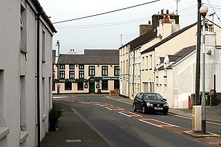
Ballasalla is a village in the parish of Malew in the south-east of the Isle of Man. The village is situated close to the Isle of Man Airport and 2 miles (3 km) north-east of the town of Castletown.

Manx National Heritage is the national heritage organisation for the Isle of Man. The organisation manages a significant proportion of the island’s physical heritage assets including over 3,000 acres of coastline and landscape. It holds property, archives, artwork, library and museum collections in trust for the Manx nation. It is the Isle of Man's statutory heritage agency and an Isle of Man registered charity (№ 603).
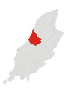
Michael is one of the six sheadings of the Isle of Man. It is located on the west of the island and consists of the three historic parishes of Ballaugh, Jurby and Michael.
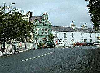
Ballaugh is a small village on the Isle of Man in the parish of the same name, in the sheading of Michael. It is the only village in the parish.
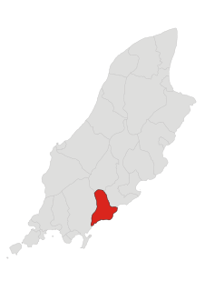
Santon, historically Santan, is one of the seventeen historic parishes of the Isle of Man.

Patrick is one of the seventeen historic parishes of the Isle of Man.

Niarbyl, meaning "the tail" in Manx for the way it extends into the Irish Sea, is a rocky promontory on the southwest coast of the Isle of Man between Port Erin and Peel. It is best known for its spectacular sea views which include the Calf of Man and, on clear days, the mountains of Ireland.

St Patrick's Church is a parish church of the Church of England in Jurby parish, near the northwest coast of the Isle of Man. Scotland and Ireland can be seen across the Irish Sea on a moderately clear day. The church also has views down the west coast to Peel, across the northern plain of the island, and to the central hills.


