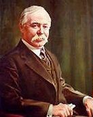
Marcus Daly was an Irish-born American businessman known as one of the three "Copper Kings" of Butte, Montana, United States.

Anaconda, county seat of Deer Lodge County, which has a consolidated city-county government, is located in southwestern Montana, United States. Located at the foot of the Anaconda Range, the Continental Divide passes within 8 mi (13 km) south of the community. As of the 2020 census the population of the consolidated city-county was 9,421, and the US Census Bureaus's 2015-2019 American Community Survey showed a median household income of $41,820. Anaconda had earlier peaks of population in 1930 and 1980, based on the mining industry. As a consolidated city-county area, it ranks as the ninth most populous city in Montana, but as only a city is far smaller. Central Anaconda is 5,335 ft (1,626 m) above sea level, and is surrounded by the communities of Opportunity and West Valley.

Rossland is in the West Kootenay region of south central British Columbia. High in the Monashee Mountains, the city lies immediately east of the intersections of BC highways 3B and 22. The facilities provide a winter base for the nearby multi-peak ski hills of the Red Mountain Resort. In the non-winter months Rossland is frequented by mountain bikers, with golf and fishing options nearby as well.

Creston is a town in the Kootenay region of southeastern British Columbia, Canada.
Princeton is a town municipality in the Similkameen region of southern British Columbia, Canada. The former mining and railway hub lies at the confluence of the Tulameen into the Similkameen River, just east of the Cascade Mountains. It is at the junction of BC Highway 3 and 5A.
Hedley is an unincorporated community near the mouth of Hedley Creek in the Similkameen region of southern British Columbia. The former mining town, on BC Highway 3, is by road about 74 kilometres (46 mi) southwest of Penticton and 38 kilometres (24 mi) southeast of Princeton.
Eholt is in the Boundary Country region of south central British Columbia. This ghost town, on BC Highway 3, is by road about 27 kilometres (17 mi) northwest of Grand Forks and 14 kilometres (9 mi) northeast of Greenwood.

Greenwood is a city in south central British Columbia. It was incorporated in 1897 and was formerly one of the principal cities of the Boundary Country smelting and mining district. It was incorporated as a city originally and has retained that title despite the population decline following the closure of the area's industries.
Warfield is a village at the bottom of the Rossland hill, immediately west of Trail, in the West Kootenay region of southern British Columbia.
The Anaconda Copper Mining Company, known as the Amalgamated Copper Company from 1899 to 1915, was an American mining company headquartered in Butte, Montana. It was one of the largest trusts of the early 20th century and one of the largest mining companies in the world for much of the 20th century.
The Boundary Country is a historical designation for a district in southern British Columbia lying, as its name suggests, along the boundary between Canada and the United States. It lies to the east of the southern Okanagan Valley and to the west of the West Kootenay. It is often included in descriptions of both of those regions but historically has been considered a separate region. Originally inclusive of the South Okanagan towns of Osoyoos and Oliver, today the term continues in use to refer to the valleys of the Kettle, West Kettle, and Granby Rivers and of Boundary and Rock Creeks and that of Christina Lake and of their various tributaries, all draining the south slope of the Monashee Mountains. The term Boundary District as well as the term Boundary Country can both refer to the local mining division of the British Columbia Ministry of Mines, Energy and Petroleum Resources.
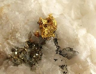
The Atlantic Cable Quartz Lode is a gold mine in Deer Lodge County, Montana. The mine is located in the southwestern area of Montana, between Drummond and Anaconda along the Pintler Scenic Route on Montana Highway 1, east of Georgetown Lake.
The Detroit Copper Mining Company was an American copper mining and smelting operation based in Morenci, Arizona. Incorporated in July 1872, it existed as an independent company until 1897, when a controlling interest in the company was purchased by the predecessor of the Phelps Dodge Corporation. It continued to exist as a subsidiary of Phelps Dodge & Co until 1917, when all Phelps Dodge operations in the area were consolidated into the new Phelps Dodge Corporation, Morenci Branch.

Rock Creek is a settlement in the Boundary Country region of south central British Columbia. The unincorporated settlement is mostly on the southwest side of the Kettle River at the confluence with Rock Creek. The place lies at the junction of BC Highway 33, and BC Highway 3.
The Columbia and Western Railway (C&W) was a historic, and initially narrow gauge, railway in southern British Columbia.

Trail is a city in the West Kootenay region of the Interior of British Columbia, Canada. It was named after the Dewdney Trail, which passed through the area. The town was first called Trail Creek or Trail Creek Landing, and the name was shortened to Trail in 1897.
Granby Consolidated Mining, Smelting and Power Co. was established by charter to operate in the Boundary region of southern British Columbia. Primarily involved in the mining and smelting of copper, the conglomerate became a publicly traded company. The various corporate operating names within the former group mostly specified the Granby identity.
Anaconda is an unincorporated community south of the confluence of Eholt and Boundary creeks in the Boundary Country region of south central British Columbia. About 43 kilometres (27 mi) west of Grand Forks, and 82 kilometres (51 mi) east of Osoyoos, on Highway 3, the neighbourhood is immediately south of Greenwood.

Terraville is a ghost town in Lawrence County, South Dakota, United States. It was founded in 1877 as a mining camp and later evolved into a town. It was purchased by the Homestake Mining Company and was destroyed in 1982 to make way for a new mine.

Silver Bell is a ghost town in the Silver Bell Mountains in Pima County, Arizona, United States. The name "Silver Bell" refers to a more recent ghost town, which was established in 1954 and abandoned in 1984. The original town, established in 1904, was named "Silverbell" and abandoned in the early 1930s. Both towns were utilized and later abandoned due to the mining of copper in the area.
