
Juab County is a county in western Utah, United States. As of the 2020 United States Census, the population was 11,786. Its county seat and largest city is Nephi.

Sevier County is a county in Utah, United States. As of the 2020 United States Census, the population was 21,522. Its county seat and largest city is Richfield.

The Deschutes River in central Oregon is a major tributary of the Columbia River. The river provides much of the drainage on the eastern side of the Cascade Range in Oregon, gathering many of the tributaries that descend from the drier, eastern flank of the mountains. The Deschutes provided an important route to and from the Columbia for Native Americans for thousands of years, and then in the 19th century for pioneers on the Oregon Trail. The river flows mostly through rugged and arid country, and its valley provides a cultural heart for central Oregon. Today the river supplies water for irrigation and is popular in the summer for whitewater rafting and fishing.

The Feather River is the principal tributary of the Sacramento River, in the Sacramento Valley of Northern California. The river's main stem is about 73 miles (117 km) long. Its length to its most distant headwater tributary is just over 210 miles (340 km). The main stem Feather River begins in Lake Oroville, where its four long tributary forks join—the South Fork, Middle Fork, North Fork, and West Branch Feather Rivers. These and other tributaries drain part of the northern Sierra Nevada, and the extreme southern Cascades, as well as a small portion of the Sacramento Valley. The total drainage basin is about 6,200 square miles (16,000 km2), with approximately 3,604 square miles (9,330 km2) above Lake Oroville.

Deep Creek Lake State Park is a public recreation area occupying more than 1,100 acres (450 ha) on the northeast side of Deep Creek Lake in Garrett County, Maryland, in the United States. The park features water activities, camping facilities, and recreational trails and is located about 18 miles (29 km) south of Interstate 68 on U.S. Route 219.

Fort Peck Lake, or Lake Fort Peck, is a major reservoir in Montana, formed by the Fort Peck Dam on the Missouri River. The lake lies in the eastern prairie region of Montana approximately 140 miles (230 km) east of Great Falls and 120 miles (190 km) north of Billings, reaching into portions of six counties.

Curecanti National Recreation Area is a National Park Service unit located on the Gunnison River in western Colorado. Established in 1965, Curecanti National Recreation Area is responsible for developing and managing recreational facilities on three reservoirs, Blue Mesa Reservoir, Morrow Point Reservoir and Crystal Reservoir, constructed on the upper Gunnison River in the 1960s by the U.S. Bureau of Reclamation to better utilize the vital waters of the Colorado River and its major tributaries. A popular destination for boating and fishing, Curecanti offers visitors two marinas, traditional and group campgrounds, hiking trails, boat launches, and boat-in campsites. The state's premiere lake trout and Kokanee salmon fisheries, Curecanti is a popular destination for boating and fishing, and is also a popular area for ice-fishing in the winter months.
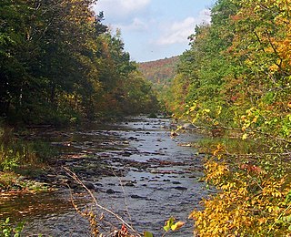
Rondout Creek is a 63.3-mile-long (101.9 km) tributary of the Hudson River in Ulster and Sullivan counties, New York, United States. It rises on Rocky Mountain in the eastern Catskills, flows south into Rondout Reservoir, part of New York City's water supply network, then into the valley between the Catskills and the Shawangunk Ridge, where it goes over High Falls and finally out to the Hudson at Kingston, receiving along the way the Wallkill River.

Sleepy Creek Lake is a 205-acre (0.8 km2) impoundment of the Meadow Branch of Sleepy Creek in Berkeley County in West Virginia's Eastern Panhandle. The reservoir is located entirely within the Sleepy Creek Wildlife Management Area.

The west end of U.S. Route 40 (US-40) is in the U.S. state of Utah at Silver Creek Junction in Silver Summit with Interstate 80. From there it heads southeast through Heber City and east into Colorado on its way to the Mid-Atlantic.

Anderson Lake, also known as Anderson Reservoir, is an artificial lake in Morgan Hill, located in southern Santa Clara County, California. The reservoir is formed by the damming of Coyote Creek just below its confluence with Las Animas Creek. A 4,275-acre (1,730 ha) county park surrounds the reservoir and provides limited fishing, picnicking, and hiking activities. Although swimming is prohibited, boating, water-skiing, and jet-skiing are permitted in the reservoir.

The North Fork Kings River is a 40.3-mile (64.9 km) tributary of the Kings River, in the U.S. state of California. The river's main stem is entirely within Fresno County, and its watershed drains about 387 square miles (1,000 km2) of the southern Sierra Nevada mountain range.

The Juab Valley is a 40-mile (64 km) long valley located on the eastern edge of Juab County, Utah, United States.
Cross Run is a tributary of Catawissa Creek in Luzerne County, Pennsylvania, in the United States. It is approximately 1.1 miles (1.8 km) long and flows through Hazle Township. The stream is in the United States Geological Survey quadrangle of Conyngham. The stream has two reservoirs on it and has been used as a water supply for Hazleton since at least the late 1800s or early 1900s. Both of the stream's reservoirs have dams. The stream has one unnamed tributary. Cross Run and its unnamed tributary are considered by the Pennsylvania Department of Environmental Protection to be impaired for part of their lengths.

The Swift Creek Reservoir is a 1,700 acres (690 ha), 5,200,000,000 US gallons (2.0×10¹⁰ L; 4.3×10⁹ imp gal), man made lake in Chesterfield County, Virginia. It is 20–25 feet (6.1–7.6 m) deep at the channel and 6–12 feet (1.8–3.7 m) deep on average. It provides 20 percent of the county's water supply, and has a watershed area of 61.9 square miles (160 km2). It is fed by eight tributary creeks: Little Tomahawk Creek, Tomahawk Creek, Swift Creek, Otterdale Creek, Deep Creek, West Branch, Dry Creek, and Fuqua Creek. The reservoir provides drinking water and a recreational area to Chesterfield residents. Access to the reservoir is limited to a public parking bridge, located on Genito Road, as well as from Sunday Park, which is limited to residents of the Brandermill community, in addition to various private docks and launches found throughout the Brandermill and Woodlake communities.

