Dexter, New Mexico

Last updated

Dexter, New Mexico, U.S.
Chaves County New Mexico Incorporated and Unincorporated areas Dexter Highlighted.svg
Location of Dexter, New Mexico
Usa edcp location map.svg
Red pog.svg
Dexter, New Mexico, U.S.
Location in the United States
Coordinates: 33°11′46″N104°22′13″W / 33.19611°N 104.37028°W / 33.19611; -104.37028
Country United States
State New Mexico
County Chaves
Area
[1]
  Total0.79 sq mi (2.05 km2)
  Land0.73 sq mi (1.89 km2)
  Water0.06 sq mi (0.16 km2)
Elevation
3,465 ft (1,056 m)
Population
 (2020) [2]
  Total1,074
  Density1,473.25/sq mi (568.50/km2)
Time zone UTC-7 (Mountain (MST))
  Summer (DST) UTC-6 (MDT)
ZIP code
88230
Area code 575
FIPS code 35-20620
GNIS feature ID0888359

Dexter is a town in Chaves County, New Mexico, United States. The population was 1,266 at the time of the 2010 census. [3]

Contents

Geography

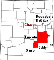
Dexter is located in south-central Chaves County at 33°11′46″N104°22′13″W / 33.19611°N 104.37028°W / 33.19611; -104.37028 (33.196062, -104.370222), [4] approximately 2 miles (3 km) west of the Pecos River. New Mexico State Road 2 passes through the town, leading northwest 17 miles (27 km) to Roswell, the county seat, and southeast 6 miles (10 km) to Hagerman.

According to the United States Census Bureau, Dexter has a total area of 0.81 square miles (2.1 km2), of which 0.73 square miles (1.9 km2) is land and 0.077 square miles (0.2 km2), or 7.88%, is water. [3]

Demographics

Historical population
CensusPop.Note
1910 242
1920 33337.6%
1930 45937.8%
1940 73459.9%
1950 7846.8%
1960 88512.9%
1970 746−15.7%
1980 88218.2%
1990 8981.8%
2000 1,23537.5%
2010 1,2662.5%
2020 1,074−15.2%
U.S. Decennial Census [5] [2]

As of the census [6] of 2000, there were 1,235 people, 390 households, and 333 families residing in the town. The population density was 1,681.2 inhabitants per square mile (649.1/km2). There were 434 housing units at an average density of 590.8 per square mile (228.1/km2). The racial makeup of the town was 60.00% White, 0.24% African American, 0.73% Native American, 35.47% from other races, and 3.56% from two or more races. Hispanic or Latino of any race were 71.17% of the population.

There were 390 households, out of which 47.9% had children under the age of 18 living with them, 62.3% were married couples living together, 17.7% had a female householder with no husband present, and 14.6% were non-families. 11.5% of all households were made up of individuals, and 4.9% had someone living alone who was 65 years of age or older. The average household size was 3.17 and the average family size was 3.39.

In the town, the population was spread out, with 35.3% under the age of 18, 9.9% from 18 to 24, 27.4% from 25 to 44, 17.1% from 45 to 64, and 10.3% who were 65 years of age or older. The median age was 30 years. For every 100 females, there were 94.8 males. For every 100 females age 18 and over, there were 86.7 males.

The median income for a household in the town was $30,707, and the median income for a family was $31,316. Males had a median income of $23,950 versus $16,591 for females. The per capita income for the town was $10,239. About 14.8% of families and 14.9% of the population were below the poverty line, including 16.2% of those under age 18 and 31.5% of those age 65 or over.

Notable person

Related Research Articles

<span class="mw-page-title-main">Chaves County, New Mexico</span> County in New Mexico, United States

Chaves County is a county in New Mexico, United States. As of the 2020 census, the population was 65,157. Its county seat is Roswell. Chaves County was named for Colonel Jose Francisco Chaves, a military leader there during the Civil War and later in Navajo campaigns. The county was created by the New Mexico Territorial Legislature on February 25, 1889, out of land from Lincoln County.

<span class="mw-page-title-main">Paauilo, Hawaii</span> Census-designated place in Hawaii, U.S.

Pa'auilo is a census-designated place (CDP) in Hawaiʻi County, Hawaii, United States. The population was 618 at the 2020 census.

<span class="mw-page-title-main">Mapleton, Maine</span> Town in the state of Maine, United States

Mapleton is a town in Aroostook County, Maine, United States. The population was 1,886 at the 2020 census.

<span class="mw-page-title-main">Masardis, Maine</span> Town in Maine, United States

Masardis is a town in Aroostook County, Maine, United States. The population was 204 at the 2020 census.

Exeter is a town in Penobscot County, Maine, United States. The population was 963 at the 2020 census.

Lakeville is a town in Penobscot County, Maine, United States. The population was 104 at the 2020 census.

<span class="mw-page-title-main">Mussey Township, Michigan</span> Civil township in Michigan, United States

Mussey Township is a civil township of St. Clair County in the U.S. state of Michigan. The population was 4,206 at the 2010 Census.

<span class="mw-page-title-main">Dexter, Missouri</span> City in Missouri, United States

Dexter is a city in Stoddard County, Missouri, United States, founded in 1873. The population was 7,864 at the 2010 census.

<span class="mw-page-title-main">Hagerman, New Mexico</span> Town in New Mexico, United States

Hagerman is a town in Chaves County, New Mexico, United States. The population was 1,251 at the 2010 census.

<span class="mw-page-title-main">Lake Arthur, New Mexico</span> Town in New Mexico, United States

Lake Arthur is a town in Chaves County, New Mexico, United States. The population was 436 at the 2010 census.

<span class="mw-page-title-main">Benton, Columbia County, Pennsylvania</span> Borough in Pennsylvania, United States

Benton is a borough in Columbia County, Pennsylvania, United States. It is part of Northeastern Pennsylvania. The population was 824 at the 2020 census. It is part of the Bloomsburg-Berwick micropolitan area.

<span class="mw-page-title-main">Valley-Hi, Pennsylvania</span> Borough in Pennsylvania, United States

Valley-Hi is a borough in Fulton County, Pennsylvania, United States. The population was 7 at the 2020 census.

<span class="mw-page-title-main">Garfield, Texas</span> CDP in Texas, United States

Garfield is a census-designated place (CDP) in Travis County, Texas, United States. As of the 2020 census, the CDP population was 1,825.

<span class="mw-page-title-main">Cleveland, Virginia</span> Town in Virginia, United States

Cleveland is a town in central Russell County, Virginia, United States. The population was 128 at the 2010 census.

<span class="mw-page-title-main">Mayville, Clark County, Wisconsin</span> Town in Wisconsin, United States

Mayville is a town in Clark County in the U.S. state of Wisconsin. The population was 919 at the 2000 census.

<span class="mw-page-title-main">Union, Eau Claire County, Wisconsin</span> Town in Wisconsin, United States

Union is a town in Eau Claire County, Wisconsin, United States. The population was 2,663 at the 2010 census. The unincorporated communities of Truax and Union are located in the town.

Friendship is a town in Fond du Lac County, Wisconsin, United States. The population was 2,406 at the 2000 census. The unincorporated communities of Dexter and Van Dyne are located within the town.

<span class="mw-page-title-main">Brooklyn, Green County, Wisconsin</span> Town in Wisconsin, United States

Brooklyn is a town in Green County, Wisconsin, United States. The population was 1,108 at the 2020 census. The unincorporated community of Attica is located in the town. Section one of the Town of Brooklyn contains the portion of the village of Brooklyn that lies in Green County.

<span class="mw-page-title-main">Blue Mounds (town), Wisconsin</span> Town in Wisconsin, United States

Blue Mounds is a town in Dane County, Wisconsin, United States. The population was 899 at the 2020 census. The Village of Blue Mounds is located within the town.

<span class="mw-page-title-main">De Baca County, New Mexico</span> County in New Mexico, United States

De Baca County is a county in the U.S. state of New Mexico. As of the 2020 census, the population was 1,698, making it New Mexico's second-least populous county. Its county seat is Fort Sumner. The county is named for Ezequiel Cabeza De Baca, the second elected Governor of New Mexico.

References

  1. "ArcGIS REST Services Directory". United States Census Bureau. Retrieved October 12, 2022.
  2. 1 2 "Census Population API". United States Census Bureau. Retrieved October 12, 2022.
  3. 1 2 "Geographic Identifiers: 2010 Demographic Profile Data (G001): Dexter town, New Mexico". U.S. Census Bureau, American Factfinder. Archived from the original on February 12, 2020. Retrieved October 16, 2014.
  4. "US Gazetteer files: 2010, 2000, and 1990". United States Census Bureau. February 12, 2011. Retrieved April 23, 2011.
  5. "Census of Population and Housing". Census.gov. Retrieved June 4, 2015.
  6. "U.S. Census website". United States Census Bureau . Retrieved January 31, 2008.