Dimiao

Last updated
Dimiao
Municipality of Dimiao
Dimiao Bohol 1.jpg
National Road in Dimiao
Flag of Dimiao, Bohol.png
Ph locator bohol dimiao.png
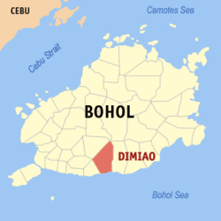
Map of Bohol with Dimiao highlighted
OpenStreetMap
Dimiao
Philippines location map (square).svg
Red pog.svg
Dimiao
Location within the Philippines
Coordinates: 9°37′N124°10′E / 9.62°N 124.17°E / 9.62; 124.17
Country Philippines
Region Central Visayas
Province Bohol
District 3rd district
Founded 22 January 1769
Barangays 35 (see Barangays)
Government
[1]
  Type Sangguniang Bayan
   Mayor Randolph L. Ang
   Vice Mayor Gilberto C. Lagua
   Representative Kristine Alexie B. Tutor
   Municipal Council
Members
   Electorate 11,141 voters (2022)
Area
[2]
  Total135.75 km2 (52.41 sq mi)
Elevation
68 m (223 ft)
Highest elevation
494 m (1,621 ft)
Lowest elevation
0 m (0 ft)
Population
 (2020 census) [3]
  Total14,889
  Density110/km2 (280/sq mi)
   Households
3,457
Economy
   Income class 4th municipal income class
   Poverty incidence
22.20
% (2018) [4]
   Revenue 94.72 million (2020)
   Assets 312.5 million (2020)
   Expenditure 91.06 million (2020)
   Liabilities 89.47 million (2020)
Service provider
  ElectricityBohol 1 Electric Cooperative (BOHECO 1)
Time zone UTC+8 (PST)
ZIP code
6305
PSGC
IDD : area code +63(0)38
Native languages Boholano dialect
Cebuano
Tagalog

Dimiao, officially the Municipality of Dimiao (Cebuano : Munisipalidad sa Dimiao; Tagalog : Bayan ng Dimiao), is a 4th class municipality in the province of Bohol, Philippines. According to the 2020 census, it has a population of 14,889 people. [3]

Contents

The municipality of Dimiao, including its church and municipal hall, lies alongside the C.P.G. circumferential road on the southern coast of the island, about 36 kilometres (22 mi) east of Tagbilaran. [5]

History

When the parish was founded is uncertain, although baptism records dates back to the year 1750. It is one of the older municipalities of Bohol, with a population of 8,820 in 1897. This town used to cover a large area that included the municipalities of Valencia and Lila. In 1867, Valencia was separated from Dimiao because of increased population, and Lila was made an independent municipality on 1 January 1915. [6]

Geography

Barangays

Dimiao is politically subdivided into 35 barangays. Each barangay consists of puroks and some have sitios.

PSGC Barangay Population ±% p.a.
2020 [3] 2010 [7]
071220001 Abihid 2.3% 343 333 0.30%
071220002 Alemania 1.1% 167 208 −2.17%
071220003 Baguhan 2.2% 334 324 0.30%
071220004 Bakilid 1.1% 164 165 −0.06%
071220005 Balbalan 1.9% 278 273 0.18%
071220006 Banban 3.5% 520 521 −0.02%
071220007 Bauhugan 2.1% 316 308 0.26%
071220008 Bilisan 1.1% 164 161 0.18%
071220009 Cabagakian 3.7% 545 649 −1.73%
071220010 Cabanbanan 2.4% 352 416 −1.66%
071220011 Cadapagan 3.1% 469 445 0.53%
071220012 Cambacol 1.7% 256 248 0.32%
071220013 Cambayaon 2.8% 415 372 1.10%
071220014 Canhayupon 4.4% 661 669 −0.12%
071220015 Canlambong 3.2% 477 526 −0.97%
071220016 Casingan 1.3% 199 207 −0.39%
071220017 Catugasan 1.8% 267 313 −1.58%
071220018 Datag 1.6% 241 221 0.87%
071220019 Guindaguitan 2.9% 437 455 −0.40%
071220020 Guingoyuran 3.5% 514 538 −0.46%
071220021 Ile 1.7% 254 269 −0.57%
071220022 Lapsaon 2.8% 424 455 −0.70%
071220023 Limokon Ilaod 3.5% 526 641 −1.96%
071220024 Limokon Ilaya 4.4% 654 724 −1.01%
071220025 Luyo 5.6% 836 960 −1.37%
071220026 Malijao 2.0% 295 319 −0.78%
071220027 Oac 4.9% 732 805 −0.95%
071220028 Pagsa 2.2% 332 309 0.72%
071220029 Pangihawan 1.3% 187 242 −2.54%
071220031 Puangyuta 2.1% 312 297 0.49%
071220030 Sawang 3.5% 514 491 0.46%
071220033 Tangohay 4.5% 671 635 0.55%
071220036 Taongon Cabatuan 3.6% 533 594 −1.08%
071220038 Taongon Canandam 4.6% 683 802 −1.59%
071220037 Tawid Bitaog 2.0% 292 271 0.75%
Total14,88915,166−0.18%

Climate

Climate data for Dimiao, Bohol
MonthJanFebMarAprMayJunJulAugSepOctNovDecYear
Average high °C (°F)28
(82)
29
(84)
30
(86)
31
(88)
31
(88)
30
(86)
30
(86)
30
(86)
30
(86)
29
(84)
29
(84)
29
(84)
30
(85)
Average low °C (°F)23
(73)
22
(72)
23
(73)
23
(73)
24
(75)
25
(77)
24
(75)
24
(75)
24
(75)
24
(75)
23
(73)
23
(73)
24
(74)
Average precipitation mm (inches)102
(4.0)
85
(3.3)
91
(3.6)
75
(3.0)
110
(4.3)
141
(5.6)
121
(4.8)
107
(4.2)
111
(4.4)
144
(5.7)
169
(6.7)
139
(5.5)
1,395
(55.1)
Average rainy days18.614.816.516.723.926.425.624.124.426.323.720.5261.5
Source: Meteoblue [8]

Demographics

Population census of Dimiao
YearPop.±% p.a.
1903 8,650    
1918 10,497+1.30%
1939 10,213−0.13%
1948 10,673+0.49%
1960 9,315−1.13%
1970 10,009+0.72%
1975 11,225+2.33%
1980 10,845−0.69%
1990 11,697+0.76%
1995 12,372+1.06%
2000 14,151+2.92%
2007 14,187+0.04%
2010 15,166+2.46%
2015 14,364−1.03%
2020 14,889+0.71%
Source: Philippine Statistics Authority [9] [7] [10] [11]

Economy

The people of Dimiao lives on farming, tubâ-gathering, rope-making and fishing since it is located along the coast. Rice, corn, maguey, copra, rope, mango and tubâ are their most important products.

Attractions

Town hall Dimiao Bohol 2.jpg
Town hall
Catholic Church Dimiaochurch.jpg
Catholic Church

The town of Dimiao has its share of Bohol's list of natural and man-made attractions.

Dimiao Church
The San Nicholas Church is one of the oldest stone churches of Bohol, built in the later half of the 19th century. It is identified by its twin bell towers either side of the church's front façade, and it is dedicated to San Nicolas Tolentino, who is also the town's patron saint and whose feast day is celebrated 10 September. [19] In front of the church building is a tower with the image of the Sacred Heart of Jesus where the "hugos" is done during dawn rites (salubong) of Easter Sunday. The church houses some relics from the Spanish Regime and is being preserved.
The building behind the church served once as a convent but is now a school. Fronting the Sacred Heart tower is a monument dedicated to the Philippines' national hero, José Rizal. Across from the church, across the circumferential road lies the municipal hall, a typical Spanish-designed building with prominent arched windows, white painted walls and red roof.
Ermita Ruins
The Ermita Ruins are the ruins of a coralline limestone structure built during the Spanish Regime. It lies parallel to the nave of the St. Nicholas Tolentino Church. It was allegedly used as a military fortress, a chapel and a burial site of the members of the Spanish clergy. Archaeological excavations were undertaken in 1995 and 1998 in a quest to uncover its mysterious past.
Balbalan Beach
Balbalan Beach lies on a long stretch of white sandy beach facing the Mindanao Sea. It is only five minutes drive away from the town center in Balbalan. The waters are unpolluted and crystal clear, very ideal for swimming. Out in the deep are colorful coral reefs. Sailing is also a pastime in the area but make sure that you finished all of your activities before the sunsets or else, manananggals will feast on your poor body when you are out in the open at night. This is how the town got its name, balbal means to eat out the innards of humans like an animal, in reference to the manananggals in the area...or if you really want to stay here at night, better bring out some big guns with a dash of holy guidance after a priestly confession.
Seaside Beach Resort
Seaside Beach Resort once called Imelda Beach in Luyo boast a stretch of white sand fringed with tall coconut palm trees. The waters are clear and unpolluted. The beach is fairly accessible, lying along the National Highway. It was once the venue of an encampment of the Boys and Girls Scouts of Bohol. On clear sunny days, Camiguin Island with the silhouette of Mount Hibok-Hibok can be seen.
Dimiao Twin Falls
The Dimiao Twin Falls cascades over a cliff, 14 kilometres (8.7 mi) away from the highway. Its rugged pathway is a challenge to trekkers who are rewarded with a panoramic view of the falls upon arrival. Dry land near the foot of the falls is ideal for picnics.
Pahangog Twin Falls and Caverns
The Pahangog Twin Falls cascades over a 30-metre (98 ft) high cliff surrounded by a lush forest of tropical trees and flora. A natural basin carved out from underneath the falling waters serves as a natural swimming pool for bathers. Two caves lie near the falls with rock formations carved by centuries of gushing waters; one cavern has a naturally-contoured basin that fills up with water before flowing outwards from the cave.
Ingkumhan Falls
At Bahugan.
Dam-agan Falls
At Catugasan.
Rice Terraces
Although not as large nor prominent as the rice terraces of Banaue, the terraces look like a velvety green layered field, and during near-harvest season, the fields turn into gold.
MacArthur's Cap
The MacArthur's Cap is a rock formation resembling an army officer's cap that one encounters when entering the town of Dimiao. The rock formation has become an emblem and called such at the successful return of General Douglas MacArthur, upon the defeat of the Japanese Army during World War II.
Badiang Peak
Badiang Peak is a rugged mountain of Dimiao which can be visited by trekkers and mountain climbers. Hours of trekking along pathways and climbing over boulders are rewarded with a panoramic view of Dimiao and its neighboring lowlands from the mountain peak.
Fish Sanctuary
At Taongon Can-andam

Education

The town has schools scattered throughout the barangays. Those located at the town proper are the Banban Elementary School, the Dimiao National High School and a private one, the St. Nicholas Academy. 90% of the inhabitants are literate and most speak some English and Filipino.

Related Research Articles

<span class="mw-page-title-main">Dauin</span> Municipality in Negros Oriental, Philippines

Dauin, officially the Municipality of Dauin is a 4th class municipality in the province of Negros Oriental, Philippines. According to the 2020 census, it has a population of 30,018 people.

<span class="mw-page-title-main">Samboan</span> Municipality in Cebu, Philippines

Samboan, officially the Municipality of Samboan, is a 5th class municipality in the province of Cebu, Philippines. According to the 2020 census, it has a population of 20,373 people.

<span class="mw-page-title-main">Alicia, Bohol</span> Municipality in Bohol, Philippines

Alicia, officially the Municipality of Alicia, is a 4th class municipality in the province of Bohol, Philippines. According to the 2020 census, it has a population of 24,374 people.

<span class="mw-page-title-main">Antequera, Bohol</span> Municipality in Bohol, Philippines

Antequera, officially the Municipality of Antequera, is a 4th class municipality in the province of Bohol, Philippines. According to the 2020 census, it has a population of 14,990 people.

<span class="mw-page-title-main">Baclayon</span> Municipality in Bohol, Philippines

Baclayon, officially the Municipality of Baclayon, is a 4th class municipality in the province of Bohol, Philippines. According to the 2020 census, it has a population of 22,461 people.

<span class="mw-page-title-main">Bilar, Bohol</span> Municipality in Bohol, Philippines

Bilar, officially the Municipality of Bilar, is a 4th class municipality in the province of Bohol, Philippines. According to the 2020 census, it has a population of 18,512 people.

<span class="mw-page-title-main">Catigbian</span> Municipality in Bohol, Philippines

Catigbian, officially the Municipality of Catigbian, is a 4th class municipality in the province of Bohol, Philippines. According to the 2020 census, it has a population of 23,805 people.

<span class="mw-page-title-main">Dauis</span> Municipality in Bohol, Philippines

Dauis, officially the Municipality of Dauis, is a 4th class municipality in the province of Bohol, Philippines. According to the 2020 census, it has a population of 52,492 people. The town has many fine beaches, resorts, and a historic church, built in the 17th century. The Hinagdanan Cave is also a draw for tourists.

<span class="mw-page-title-main">Duero, Bohol</span> Municipality in Bohol, Philippines

Duero, officially the Municipality of Duero, is a 4th class municipality in the province of Bohol, Philippines. According to the 2020 census, it has a population of 18,861 people.

<span class="mw-page-title-main">Jagna</span> Municipality in Bohol, Philippines

Jagna, officially the Municipality of Jagna, is a 3rd class municipality in the province of Bohol, Philippines. According to the 2020 census, it has a population of 35,832 people.

<span class="mw-page-title-main">Lila, Bohol</span> Municipality in Bohol, Philippines

Lila, officially the Municipality of Lila, is a 5th class municipality in the province of Bohol, Philippines. According to the 2020 census, it has a population of 12,240 people.

<span class="mw-page-title-main">Loay, Bohol</span> Municipality in Bohol, Philippines

Loay, officially the Municipality of Loay, is a 5th class municipality in the province of Bohol, Philippines. According to the 2020 census, it has a population of 17,855 people.

<span class="mw-page-title-main">Loon, Bohol</span> Municipality in Bohol, Philippines

Loon, officially the Municipality of Loon, is a 2nd class municipality in the province of Bohol, Philippines which was established in 1753. According to the 2020 census, it has a population of 44,224 people.

<span class="mw-page-title-main">Mabini, Bohol</span> Municipality in Bohol, Philippines

Mabini, officially the Municipality of Mabini, is a 4th class municipality in the province of Bohol, Philippines. According to the 2020 census, it has a population of 28,701 people.

<span class="mw-page-title-main">Maribojoc</span> Municipality in Bohol, Philippines

Maribojoc, officially the Municipality of Maribojoc, is a 4th class municipality in the province of Bohol, Philippines. According to the 2020 census, it has a population of 22,178 people.

<span class="mw-page-title-main">Panglao, Bohol</span> Municipality in Bohol, Philippines

Panglao, officially the Municipality of Panglao, is a 4th class municipality in the province of Bohol, Philippines. According to the 2020 census, it has a population of 39,839 people.

<span class="mw-page-title-main">San Isidro, Bohol</span> Municipality in Bohol, Philippines

San Isidro, officially the Municipality of San Isidro, is a 5th class municipality in the province of Bohol, Philippines. According to the 2020 census, it has a population of 9,909 people.

<span class="mw-page-title-main">Sikatuna, Bohol</span> Municipality in Bohol, Philippines

Sikatuna, officially the Municipality of Sikatuna, is a 5th class municipality in the province of Bohol, Philippines. According to the 2020 census, it has a population of 6,906 people.

<span class="mw-page-title-main">Trinidad, Bohol</span> Municipality in Bohol, Philippines

Trinidad, officially the Municipality of Trinidad, is a 3rd class municipality in the province of Bohol, Philippines. According to the 2020 census, it has a population of 35,119 people.

<span class="mw-page-title-main">Valencia, Bohol</span> Municipality in Bohol, Philippines

Valencia, officially the Municipality of Valencia, is a 4th class municipality in the province of Bohol, Philippines. According to the 2020 census, it has a population of 28,392 people.

References

  1. Municipality of Dimiao | (DILG)
  2. "2015 Census of Population, Report No. 3 – Population, Land Area, and Population Density" (PDF). Philippine Statistics Authority. Quezon City, Philippines. August 2016. ISSN   0117-1453. Archived (PDF) from the original on May 25, 2021. Retrieved July 16, 2021.
  3. 1 2 3 Census of Population (2020). "Region VII (Central Visayas)". Total Population by Province, City, Municipality and Barangay. Philippine Statistics Authority . Retrieved 8 July 2021.
  4. "PSA Releases the 2018 Municipal and City Level Poverty Estimates". Philippine Statistics Authority. 15 December 2021. Retrieved 22 January 2022.
  5. "Welcome to Dimiao Bohol". www.bohol-philippines.com. Retrieved February 7, 2019.
  6. "Municipality of Dimiao". Province of Bohol. Retrieved 30 January 2015.
  7. 1 2 Census of Population and Housing (2010). "Region VII (Central Visayas)". Total Population by Province, City, Municipality and Barangay. National Statistics Office . Retrieved 29 June 2016.
  8. "Dimiao: Average Temperatures and Rainfall". Meteoblue. Retrieved 9 May 2020.
  9. Census of Population (2015). "Region VII (Central Visayas)". Total Population by Province, City, Municipality and Barangay. Philippine Statistics Authority . Retrieved 20 June 2016.
  10. Censuses of Population (1903–2007). "Region VII (Central Visayas)". Table 1. Population Enumerated in Various Censuses by Province/Highly Urbanized City: 1903 to 2007. National Statistics Office.
  11. "Province of Bohol". Municipality Population Data. Local Water Utilities Administration Research Division. Retrieved 17 December 2016.
  12. "Poverty incidence (PI):". Philippine Statistics Authority. Retrieved December 28, 2020.
  13. "Estimation of Local Poverty in the Philippines" (PDF). Philippine Statistics Authority. 29 November 2005.
  14. "2003 City and Municipal Level Poverty Estimates" (PDF). Philippine Statistics Authority. 23 March 2009.
  15. "City and Municipal Level Poverty Estimates; 2006 and 2009" (PDF). Philippine Statistics Authority. 3 August 2012.
  16. "2012 Municipal and City Level Poverty Estimates" (PDF). Philippine Statistics Authority. 31 May 2016.
  17. "Municipal and City Level Small Area Poverty Estimates; 2009, 2012 and 2015". Philippine Statistics Authority. 10 July 2019.
  18. "PSA Releases the 2018 Municipal and City Level Poverty Estimates". Philippine Statistics Authority. 15 December 2021. Retrieved 22 January 2022.
  19. "Bohol Festivals Timetable". www.bohol-philippines.com. Retrieved 2019-03-18.

Sources

"Ermita Ruins". Municipality of Dimiao. 2010. Archived from the original on 28 October 2012.