Martin County is a county located in the U.S. state of North Carolina. As of the 2020 census, the population was 22,031. Its county seat is Williamston.

Lenoir County is a county in the U.S. state of North Carolina. As of the 2020 census, its population was 55,122. Its county seat is Kinston, located on the Neuse River, across which the county has its territory.

Greene County is a county located in the U.S. state of North Carolina. As of the 2020 census, the population was 20,451. Its county seat is Snow Hill.

Kinston is a city in Lenoir County, North Carolina, United States, with a population of 19,900 as of the 2020 census. It has been the county seat of Lenoir County since its formation in 1791. Kinston is located in the coastal plains region of eastern North Carolina.

Grifton is a town in Lenoir and Pitt counties, North Carolina, United States. The population was 2,617 at the 2010 Census. The Pitt County portion of the town is a part of the Greenville, NC Metropolitan Statistical Area located in North Carolina's Inner Banks region.

The Battle of Kinston was fought on December 14, 1862, in Lenoir County, North Carolina, near the town of Kinston, as part of the Goldsboro Expedition of the American Civil War.

U.S. Route 258 is a spur of US 58 in the U.S. states of North Carolina and Virginia. The U.S. Highway runs 220.15 miles (354.30 km) from US 17 Business and NC 24 Business in Jacksonville, North Carolina north to Virginia State Route 143 at Fort Monroe in Hampton, Virginia. In North Carolina, US 258 connects Jacksonville with the Inner Banks communities of Kinston, Snow Hill, Farmville, Tarboro, and Murfreesboro. The U.S. Highway continues through the Virginia city of Franklin, where the highway intersects US 58, and the town of Smithfield on its way to the Hampton Roads metropolitan area. US 258 crosses the James River on the James River Bridge and follows Mercury Boulevard through Newport News and Hampton.
The Battle of Wyse Fork, also known as the Battle of Kinston, was a battle fought in the Carolinas Campaign of the American Civil War, resulting in a Union Army victory.

The Brushy Mountains are a mountain range located in northwestern North Carolina. They are an isolated "spur" of the much larger Blue Ridge Mountains, separated from them by the Yadkin River valley. A deeply eroded range, they move from the southwest to the northeast, and cross five counties in North Carolina: Caldwell, Alexander, Wilkes, Iredell, and Yadkin.

The early province of Carolana was the land forming the southern English colonies, spanning from 31° to 36° north latitude. In 1629, King Charles I of England granted the territory to his attorney general Sir Robert Heath. The original charter claimed the land from Albemarle Sound in present-day North Carolina, to the St. Johns River in the south, just miles below the current Florida-Georgia state line. The region as a whole comprised all or parts of the modern-day states of Louisiana, Mississippi, Alabama, Florida, Georgia, South Carolina and North Carolina. Charles I named the colony for himself, the name Carolana being derived from Carolus, the Latin form of Charles.

North Carolina Highway 11 is a primary state highway in the U.S. state of North Carolina. Traveling 193.2 miles (310.9 km) in a north–south alignment through Eastern North Carolina, it connects the towns and cities of Wallace, Kenansville, Kinston, Greenville and Murfreesboro.

Tick Bite is an unincorporated community on the Contentnea Creek near Grifton in Lenoir County, North Carolina, United States. The only business in the community was a quarry.
Lenoir Community College (LCC) is a public community college in Lenoir County, North Carolina. LCC's main campus is located in the city of Kinston in Lenoir County and it has satellite institutions in Greene and Jones counties. It is part of the North Carolina Community College System. LCC serves approximately 3,500 curriculum students and 12,500 extension students annually.
Henry Mouzon II was a colonial-era American patriot and renowned civil engineer. He prepared the definitive survey of the North and South Carolina Colonies prior to the start of the American Revolutionary War. He served as an officer of the Continental Line and as a militia officer in Francis Marion's Brigade, where he distinguished himself in the Battle of Black Mingo.

Fort Dobbs was an 18th-century fort in the Yadkin–Pee Dee River Basin region of the Province of North Carolina, near what is now Statesville in Iredell County. Used for frontier defense during and after the French and Indian War, the fort was built to protect the American settlers of the western portion of what was then Rowan County, and served as a vital outpost for soldiers, traders, and colonial officials. Fort Dobbs' primary structure was a blockhouse with log walls, surrounded by a shallow ditch, and by 1761, a palisade. It was intended to provide protection from French-allied Native Americans such as the Shawnee and Delaware, and French raids into North Carolina.

North Carolina Highway 241 (NC 241) is a primary state highway in the U.S. state of North Carolina. NC 241 travels for 9.1 miles (14.6 km) from NC 41 and NC 111 in Beulaville to NC 11 in Pink Hill. Outside of Beulaville and Pink Hill, NC 241 is a rather straight, predominantly rural route. The highway travels through Duplin County for 7.6 miles (12.2 km) while traveling 1.5 miles (2.4 km) in Lenoir County.

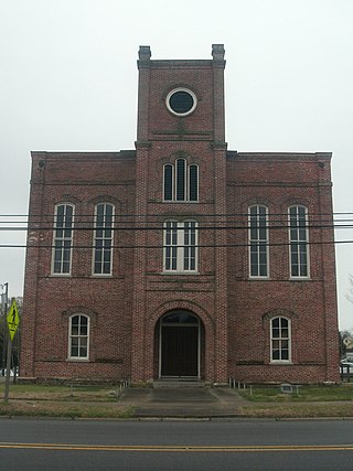
Harmony Hall, also known as the Peebles House, is a historic building located at 109 East King Street in Kinston, North Carolina, United States. The 18th-century house, the oldest building in Kinston, was owned by North Carolina's first elected governor. The house briefly served as the de facto state capitol during the Revolutionary War. The building has been expanded and renovated throughout its history, transitioning from the Georgian and Federal styles to Greek Revival. One of the prominent features of the house is the two-story porch on the facade. Harmony Hall was added to the National Register of Historic Places (NRHP) in 1971 and serves as a house museum operated by the Lenoir County Historical Association.
The Whitfield family was a prominent American political family of the Southern states. The Whitfields formed the American branch of the British Whitfield family - having descended from the British aristocracy, particularly the Earls of Kilmorey and having established colonial residency under Sir. Thomas Whitfield, whom headed East India Trading for the British Empire. In early days of Colonial America, the family emigrated to Virginia in the seventeenth century, particularly, Nansemond County, Virginia from Lancashire, England.
Abraham Sheppard was a merchant-planter, sheriff, legislator, and officer during the American Revolutionary War from North Carolina. He lived in Dobbs County, North Carolina on a plantation called Contentnea.
Hugh Talmage Lefler was a historian known for his work on the history of North Carolina.
