
DuPage County is a county in the U.S. state of Illinois, and one of the collar counties of the Chicago metropolitan area. As of the 2010 census, the population was 916,924, making it Illinois' second-most populous county. Its county seat is Wheaton. DuPage County has become mostly developed and suburbanized, although some pockets of farmland remain in the county's western and northern parts. The county has a high socioeconomic profile and residents of Hinsdale, Naperville and Oak Brook include some of the wealthiest people in the Midwest. On the whole, the county enjoys above average median household income levels and low overall poverty levels when compared to the national average. In 2018, Niche ranked two DuPage municipalities amongst the top 20 best places to live in America.

Scottdale is a census-designated place (CDP) in DeKalb County, Georgia, United States. The population was 10,631 at the 2010 census.
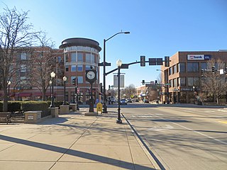
Downers Grove is a village in DuPage County, Illinois, United States. It was founded in 1832 by Pierce Downer, whose surname serves as the eponym for the village. It is a southwestern suburb of Chicago in the I-55 Corridor.
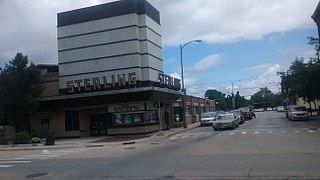
Sterling is a city in Whiteside County, Illinois, United States. The population was 15,370 at the 2010 census, down from 15,451 in 2000. Formerly nicknamed "Hardware Capital of the World", Sterling has long been associated with manufacturing and the steel industry.

La Porte is a city in LaPorte County, Indiana, United States, of which it is the county seat. Its population was estimated to be 21,569 in 2019. It is one of the two principal cities of the Michigan City-La Porte, Indiana Metropolitan Statistical Area, which is included in the Chicago–Naperville–Michigan City, Illinois–Indiana–Wisconsin Combined Statistical Area.

Vestal is a town within Broome County in the Southern Tier of New York, and lies between the Susquehanna River and the Pennsylvania border. As of the 2010 census, the population was 28,043.

Pottsville is a city in, and the county seat of, Schuylkill County, Pennsylvania, United States. The population was 14,324 at the 2010 census, and is the principal city of the Pottsville, PA Micropolitan Statistical Area. The city lies along the west bank of the Schuylkill River, 52 miles (84 km) south of Wilkes-Barre. It is located in Pennsylvania's Coal Region.
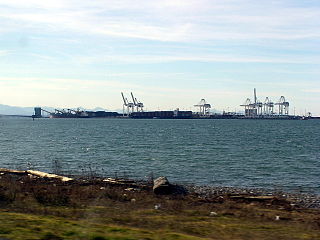
Tsawwassen is a suburban, mostly residential community located on a peninsula in the southwestern corner of the City of Delta in British Columbia, Canada. Tsawwassen provides the only road access to the American territory on the southern tip of the peninsula, the community of Point Roberts, Washington, via 56th Street. It is also the location of Tsawwassen Ferry Terminal, part of the BC Ferries, built in 1959 to provide foot-passenger and motor vehicle access from the Lower Mainland to the southern part of Vancouver Island and the southern Gulf Islands. Because Tsawwassen touches a shallow bank, the ferry terminal is built at the southwestern end of a 3 km (1.9 mi) long causeway that juts out into the Strait of Georgia. The ferry dock and causeway are part of Highway 17. Boundary Bay Airport, a major training hub for local and international pilots which also provides local airplane and helicopter service, is located ten minutes away. The Roberts Bank Superport is also located near Tsawwassen.
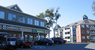
Clayton Park is a suburb of Halifax, Nova Scotia, Canada.

Marquette Park, the largest park on the southwest side of Chicago, Illinois, at 323 acres (1.31 km2), is located at 41.768°N 87.703°W in the city's Chicago Lawn neighborhood. The park is named for Father Jacques Marquette (1637–1675).
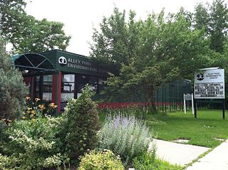
Alley Pond Park is the second-largest public park in Queens, New York City, occupying 655.3 acres (265.2 ha). The park is bordered to the east by Douglaston, to the west by Bayside, to the north by Little Neck Bay, and to the south by Union Turnpike. Cross Island Parkway travels north-south through the park, while the Long Island Expressway and Grand Central Parkway travel east-west through the park. The park primarily consists of woodlands south of the Long Island Expressway and meadowlands north of the expressway. It is run and operated by the New York City Department of Parks and Recreation.
Kennedy Grove Regional Recreation Area,(KGRRA), also known simply as Kennedy Grove, is located in West Contra Costa County, California at the base of San Pablo Dam. The nearest city is El Sobrante, California. Created in 1967, it contains a three-mile hiking trail with an elevation of 760 feet (230 m). The Grove features many large eucalyptus trees, picnic areas, volleyball nets, playgrounds, and horseshoe pits. Bird watching is popular here because hawks are almost always spotted. Some hikers have reported seeing golden and bald eagles around the reservoir. There is no camping allowed. Parking is $5 with an extra $2 fee for a dog. Dogs have to be on the leash around the lawn but they are allowed off the leash in remote parts of the park. The park is open from 8 a.m. to dusk.

Perkerson Park is a 50-acre (200,000 m2) park in the Capitol View/Sylvan Hills neighborhoods of Atlanta, Georgia with everything from a splash pad to an elaborate playground to recreational fields, all under the shady canopy of huge oak trees. Park is open 6:00 AM to 11:00 PM daily.

Downers Grove Township is one of nine townships in DuPage County, Illinois, USA. As of the 2010 census, its population was 146,795 and it contained 60,438 housing units. It is the largest township in the county, both in terms of area and population.

York Township is one of nine townships in DuPage County, Illinois, USA. As of the 2010 census, its population was 123,449 and it contained 51,557 housing units.

Llandaff Fields is a large parkland spanning parts of central and northern Cardiff, Wales.

Ferry Point Park is a 413.8-acre (167.5 ha) park in the Bronx, New York City. The park site is a peninsula projecting into the East River roughly opposite the College Point and Malba neighborhoods of Queens. The park is located on the eastern shore of Westchester Creek, adjacent to the neighborhood of Throggs Neck. The park is operated by the New York City Department of Parks and Recreation. The Hutchinson River Expressway crosses the park to the Bronx-Whitestone Bridge, splitting it into east and west sides.
Open Road Park is a small park in East Village, Manhattan, New York City, located east of First Avenue between 11th and 12th Streets. It is among the larger green spaces created in the East Village as a result of community organizing. The site of this park was taken over in 1993 by Open Road, a neighborhood nonprofit that developed the lot into a community garden and playground. Prior to its use as a park, the site was used for many purposes that reflect on the history of the surrounding neighborhood.
