The Godavari is India's second longest river after the Ganga River and drains the third largest basin in India, covering about 10% of India's total geographical area. Its source is in Trimbakeshwar, Nashik, Maharashtra. It flows east for 1,465 kilometres (910 mi), draining the states of Maharashtra (48.6%), Telangana (18.8%), Andhra Pradesh (4.5%), Chhattisgarh (10.9%) and Odisha (5.7%). The river ultimately empties into the Bay of Bengal through an extensive network of distributaries. Measuring up to 312,812 km2 (120,777 sq mi), it forms one of the largest river basins in the Indian subcontinent, with only the Ganga and Indus rivers having a larger drainage basin. In terms of length, catchment area and discharge, the Godavari is the largest in peninsular India, and had been dubbed as the Dakshina Ganga.
Khammam is the city in Khammam district of the Indian state of Telangana. It is the fourth largest city in the state. It is the headquarters of the Khammam district and Khammam mandal also. It is located about 193 kilometres (120 mi) east of the state capital, Hyderabad, 61 kilometres (38 mi) from Suryapet, 120 kilometres (75 mi) from Warangal and also it is located about 121 kilometres (75 mi) North of the Andhra Pradesh state capital, Amaravathi. The river Munneru flows on the western side of the city. As of 2011 census of India, Khammam urban agglomeration has a population of 313,504. However, on 19 October 2012, the civic body of Khammam was upgraded to a municipal corporation. Post- upgradation to corporation, the population of Khammam was approximated to be 3,07,000.

East Godavari is a district in the Coastal Andhra region of Andhra Pradesh, India. Its district headquarters is at Rajamahendravaram.

Bhadrachalam is a census town in Bhadradri Kothagudem district in the Indian state of Telangana. It is an important Hindu pilgrimage town with the Bhadrachalam Temple of Rama, situated on the banks of Godavari River. It is located 312 kilometres (194 mi) east of state capital, Hyderabad,115 kilometres (71 mi) from Khammam,178 kilometres (111 mi) from Suryapet,180 kilometres (112 mi) from Warangal,187 kilometres (116 mi) from Vijayawada,220 kilometres (137 mi) and 350 kilometres (217 mi) from Visakhapatnam.

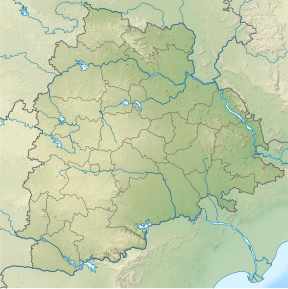
Telangana is a state in India situated in the southern part of the Indian peninsula on the high Deccan Plateau. It was the eleventh largest state and the twelfth most populated state in India as per the 2011 census. On 2 June 2014, the area was separated from the northwestern part of United Andhra Pradesh as the newly formed state of Telangana, with Hyderabad as its capital.

Khammam district is a district in the eastern region of the Indian state of Telangana. The city of Khammam is the district headquarters. The district shares boundaries with Suryapet, Mahabubabad, Bhadradri districts and with Eluru and NTR districts.

Hanamkonda district, is a district located in the northern region of the Indian state of Telangana. The district headquarters are located at Hanamakonda. The district borders the districts of Jangaon, Karimnagar, Warangal, Bhupalpally and Siddipet.

Mulugu district is a district in the Indian state of Telangana. Its headquarters is the town of Mulugu. Mulugu district is the least populated district with 2,94,671 in the state. Mulugu district has the fewest mandals in the state with nine mandals. It currently borders Warangal, Mahabubabad, Jayashankar Bhupalpally and Bhadradri districts and with the state of Chhattisgarh.

The Polavaram Project is an under construction multi-purpose irrigation project on the Godavari River in the Eluru District and East Godavari District in Andhra Pradesh. The project has been accorded National project status by the Central Government of India. Its reservoir back water spreads up to the Dummugudem Anicut and approx 115 km on Sabari River side. Thus back water spreads into parts of Chhattisgarh and Odisha States. It gives major boost to tourism sector in Godavari Districts as the reservoir covers the famous Papikonda National Park, Polavaram hydro electric project (HEP) and National Waterway 4 are under construction on left side of the river. It is located 40 km to the upstream of Sir Arthur Cotton Barrage in Rajamahendravaram City and 25 km from Rajahmundry Airport.
Mulugu is a town in Mulugu district, Telangana. It is the headquarters of the district, which was formed in 2019 after Jayashankar Bhupalpally district was split. Prior to the reorganization of districts that created Jayashankar Bhupalpally district, Mulugu was a part of the Warangal district. It lies on National Highway 163.
Bhadrachalam revenue division is an administrative division in the Bhadradri Kothagudem of the Indian state of Telangana. It is one of the 2 revenue divisions in the district which consists of 8 mandals under its administration. Bhadrachalam is the divisional headquarters of the division. The Bhadrachalam Revenue Division was originally part of East Godavari district of Andhra Pradesh up to 1959, after which it was merged through GO No. 553 on 17 Nov 1959 into Khammam district. Ashwaraopeta was also part of West Godavari district up to 1959. It was merged in Telangana region after the formation of Andhra Pradesh State with 29 states. In 2014, it was re-merged in Andhra Pradesh State with 13 districts, after the formation of Telangana state for the completion of Polavaram dam project.
The Andhra Pradesh Reorganisation Act of 2014, commonly known as the Telangana Act, is an Act of Indian Parliament that split the state of Andhra Pradesh into Telangana and the residuary Andhra Pradesh state, as an outcome of the Telangana movement. The Act defined the boundaries of the two states, determined how the assets and liabilities were to be divided, and laid out the status of Hyderabad as the permanent capital of new Telangana state and temporary capital of the Andhra Pradesh state.

Koya are an Indian tribal community found in the states of Andhra Pradesh, Telangana, Chhattisgarh, and Odisha. Koyas call themselves Koitur in their dialect. The Koyas speak the Koya language, also known as Koya basha, which is a Dravidian language related to Gondi.

Warangal district, formerly Warangal Rural district, is a district in the Indian state of Telangana. The district shares boundaries with Mahabubabad, Jangaon, Hanamkonda, Mulugu and Bhupalpally districts.

Mahabubabad district also known as Manukota district is a district in the Indian state of Telangana. The district was carved out from the erstwhile Warangal district following the re-organisation of districts in the state in October 2016. The district shares boundaries with Suryapet, Khammam, Bhadradri, Warangal, Mulugu and Jangaon districts.
Bhadradri Kothagudem is a district in the east of the Indian state of Telangana. Kothagudem is the district headquarters. It is the largest district in Telangana, with an area of 7483 km2. It borders the districts Khammam, Mahabubabad, Mulugu, Eluru and East Godavari, and shares a boundary with the bordering states Chhattisgarh and Andhra Pradesh. The district comprises 24 mandals and 2 revenue divisions, Kothagudem and Bhadrachalam.

Jayashankar Bhupalpally district is a district in the Indian state of Telangana. The district headquarters are located at Bhupalpally. It was a part of the erstwhile Warangal district and Karimnagar district prior to the re-organisation of districts in the state. The district share boundaries with Karimnagar, Mancherial, Peddapalli, Hanamkonda, Warangal, and Mulugu districts and with the state boundary of Maharashtra and Chhattisgarh. The world's largest multi-stage lift irrigation project Kaleshwaram Lift Irrigation Project is in Jayashankar Bhupalpally District and Jayashankar Bhupalpally District falls Under naxal affected district as per Red corridor.