
The South Bay is a region of the Los Angeles metropolitan area, located in the southwest corner of Los Angeles County. The name stems from its geographic location stretching along the southern shore of Santa Monica Bay. The South Bay contains sixteen cities plus portions of the City of Los Angeles and unincorporated portions of the county. The area is bounded by the Pacific Ocean on the south and west and generally by the City of Los Angeles on the north and east.
Carson is a city in the South Bay and the Harbor regions of Los Angeles County, California, located 13 miles (21 km) south of downtown Los Angeles and approximately 14 miles (23 km) away from Los Angeles International Airport. It was Incorporated on February 20, 1968. The city is locally known for its plurality of Filipino-Americans and immigrants. As of the 2020 United States Census, the city had a population of 95,558.
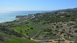
The Portuguese Bend region is the largest area of natural vegetation remaining on the Palos Verdes Peninsula, in Los Angeles County, California. Though once slated for development including the projected route of Crenshaw Boulevard, the area is geologically unstable and is unsuitable for building.
The Battle of Dominguez Rancho, or the Battle of the Old Woman's Gun, was a military engagement of the Mexican–American War that took place on October 8–9, 1846, within Manuel Dominguez's 75,000 acre Rancho San Pedro. Captain José Antonio Carrillo, leading fifty California troops, successfully held off an invasion of Pueblo de Los Angeles by some 300 United States Marines, capturing for the first time in the few instances of U.S. history the U.S. Colors upon the battlefield, while under the command of US Navy Captain William Mervine, who was attempting to recapture the town after the Siege of Los Angeles. By strategically running horses across the dusty Dominguez Hills, while transporting their single small cannon to various sites, Carrillo and his troops convinced the Americans they had encountered a large enemy force. Faced with heavy casualties and the superior fighting skills displayed by the Californios, the remaining Marines were forced to retreat to their ships docked in San Pedro Bay.
General José María Flores (1818–1866) was a captain in the Mexican Army and was a member of la otra banda. He was appointed Governor and Comandante Generalpro tem of Alta California from November 1846 to January 1847, and defended California against the Americans during the Mexican–American War.

Rancho de los Palos Verdes was a 31,629-acre (128.00 km2) Mexican land grant in present-day Los Angeles County, California given in 1846 by Governor Pío Pico to José Loreto and Juan Capistrano Sepulveda. The name means "ranch of the green trees". The grant encompassed the present-day cities of the Palos Verdes Peninsula, as well as portions of San Pedro and Torrance.

Don Manuel Domínguez e Ybáñez (1803–1882) was a Californio ranchero, politician, and a signer of the California Constitution in 1849. He served as two terms as Alcalde of Los Angeles (mayor). He was one of the largest landowners in Southern California, having inherited Rancho San Pedro in 1825, one of the largest ranchos in California. He was one of the founders of the cities of Carson and Compton and of the fishing village of San Pedro. Today, California State University, Dominguez Hills and the communities of Rancho Dominguez, East Rancho Dominguez, and West Rancho Dominguez bear his family's name.
Rancho San Pedro was one of the first California land grants and the first to win a patent from the United States. The Spanish Crown granted the 75,000 acres (300 km2) of land to soldier Juan José Domínguez in 1784, with his descendants validating their legal claim with the Mexican government at 48,000 acres (190 km2) in 1828, and later maintaining their legal claim through a United States patent validating 43,119 acres (174.50 km2) in 1858. The original Spanish land grant included what today consists of the Pacific coast cities of Los Angeles harbor, San Pedro, the Palos Verdes peninsula, Torrance, Redondo Beach, Hermosa Beach, and Manhattan Beach, and east to the Los Angeles River, including the cities of Lomita, Gardena, Harbor City, Wilmington, Carson, Compton, and western portions of Long Beach and Paramount.

The Los Angeles International Air Meet was among the earliest airshows in the world and the first major airshow in the United States. It was held in Los Angeles County, California, at Dominguez Field, southwest of the Dominguez Rancho Adobe in present-day Rancho Dominguez, California. Spectator turnout numbered approximately 254,000 over 11 days of ticket sales. The Los Angeles Times called it "one of the greatest public events in the history of the West."
Leonardo Cota (1816–1887) was a Captain with the Californios in the Mexican–American War; and later a Los Angeles County Supervisor.

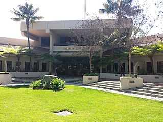
The Dominguez Rancho Adobe is California Historical Landmark Number 152, and in 1976 was placed on the National Register of Historic Places by the United States Department of the Interior.

Rancho Las Vírgenes was a 17,760-acre (71.9 km2) land grant in the Santa Monica Mountains and Simi Hills, in present day western Los Angeles County, California. The lands of the Rancho Las Vírgenes included present day Agoura Hills, Oak Park, and Westlake Village and part of the Santa Monica Mountains.
Rancho Dominguez is an unincorporated community in Los Angeles County, California, United States. Rancho Dominguez is located between the cities of Compton, Long Beach and Carson.

Rancho La Ciénega ó Paso de la Tijera was a 4,219-acre (17.07 km2) Mexican land grant in present day Los Angeles County, California given in 1843 by Governor Manuel Micheltorena to Vicente Sánchez. "La Cienega" is derived from the Spanish word ciénega, which means swamp or marshland and refers to the natural springs and wetlands in the area between Beverly Hills and Park La Brea and the Baldwin Hills range.
Rancho Las Ciénegas was a 4,439-acre (17.96 km2) Mexican land grant in present-day Los Angeles County, California given in 1823 to Francisco Avila by Governor Luis Antonio Argüello. "La Ciénega" is derived from the Spanish word ciénega, which means swamp or marshland and refers to the natural springs and wetlands in the area between the Baldwin Hills range and Baldwin Hills district, and Beverly Hills. The rancho was north of Rancho La Ciénega ó Paso de la Tijera and east of present-day La Cienega Boulevard between Wilshire Boulevard and Jefferson Boulevard. The Los Angeles River would periodically change course historically, and flowed westerly through the rancho's lowlands to Ballona Creek and the Santa Monica Bay until 1825, when it returned to the southerly course through Rancho San Pedro to San Pedro Bay.

Rancho San Jacinto Viejo was a 35,503-acre (143.68 km2) Mexican land grant in present-day Riverside County, California given in 1842 by Governor Pro-tem Manuel Jimeno to José Antonio Estudillo. At the time of the US Patent, Rancho San Jacinto Viejo was a part of San Diego County. The County of Riverside was created by the California Legislature in 1893 by taking land from both San Bernardino and San Diego Counties. The grant encompassed present-day Hemet and San Jacinto.
George Cady Carson (1832–1901) was a merchant, road builder, rancher and member of the Los Angeles, California, Common Council in the 1850s.
Domínguez is a surname of Spanish origin. Domínguez may also refer to:

The Los Angeles Harbor Region, sometimes truncated to simply The Harbor, takes up a large portion of southern Los Angeles County, California. The area is impacted by the harbor complex consisting of the Port of Los Angeles and the Port of Long Beach.

Jose Dolores Sepulveda Adobe is an adobe home built in 1818. It is located at the Rancho de los Palos Verdes in Torrance, California. The Jose Dolores Sepulveda Adobe was designated a California Historic Landmark on Jan. 03, 1944. The Jose Dolores Sepulveda Adobe was built by José Dolores Sepúlveda de Redondo, his son was Mayor of Los Angeles from 1837 to 1848. José Dolores Sepúlveda's father was José Loreto Sepúlveda (1764–1808). The location is now a private residence in Torrance. The original Adobe is gone, but the current homeowner renovated the house to reflect the Rancho history. Rancho de los Palos Verdes means "range of green trees". The Rancho is now the present-day cities of the Palos Verdes Peninsula, as well as portions of San Pedro and Torrance.

