Darwin is the capital city of the Northern Territory, Australia. With an estimated population of 147,255 as of 2019, the city contains the majority of the residents of the sparsely populated Northern Territory.

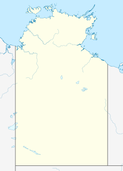
The Northern Territory is an Australian territory in the central and central northern regions of Australia. The Northern Territory shares its borders with Western Australia to the west, South Australia to the south, and Queensland to the east. To the north, the territory looks out to the Timor Sea, the Arafura Sea and the Gulf of Carpentaria, including Western New Guinea and other islands of the Indonesian archipelago.
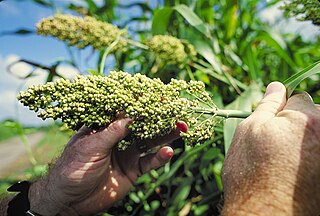
Sorghum is a genus of about 25 species of flowering plants in the grass family (Poaceae). Some of these species are grown as cereals for human consumption and some in pastures for animals. One species is grown for grain, while many others are used as fodder plants, either cultivated in warm climates worldwide or naturalized in pasture lands.

Humpty Doo is a small town in Australia's Northern Territory, situated just south of the Arnhem Highway, approximately 40 km from Darwin. At the 2016 census, Humpty Doo had a population of 4,380 people. Its local government area is Litchfield Municipality. The town is a popular stopping point for tourists travelling between Darwin and Kakadu National Park, and boasts many attractions of its own. The main industries are agriculture and tourism; however, most residents commute to Darwin or Palmerston for work, and many regard it as a dormitory town.
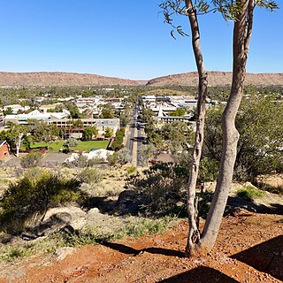
Alice Springs is the third-largest town in the Northern Territory of Australia. Known as Stuart until 31 August 1933, the name Alice Springs was given by surveyor William Whitfield Mills after Alice, Lady Todd, wife of the telegraph pioneer Sir Charles Todd. Known colloquially as 'The Alice' or simply 'Alice', the town is situated roughly in Australia's geographic centre. It is nearly equidistant from Adelaide and Darwin.

Katherine is a town in the Northern Territory of Australia. It is situated on the Katherine River, after which it is named, 320 kilometres (200 mi) southeast of Darwin. It is the fourth largest settlement in the Territory and is known as the place where "The outback meets the tropics". Katherine had an urban population of approximately 6,300 at the 2016 Census.

The Ord River is a 651-kilometre long (405 mi) river in the Kimberley region of Western Australia. The river's catchment covers 55,100 square kilometres (21,274 sq mi).
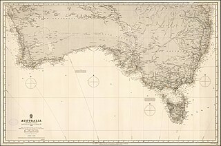
The term Southern Australia is generally considered to refer to the states and territories of Australia of New South Wales, Victoria, Tasmania, the Australian Capital Territory and South Australia. The part of Western Australia south of latitude 26° south — a definition widely used in law and state government policy — is also usually included.

The unofficial geographic term Northern Australia includes those parts of Queensland and Western Australia north of latitude 26° and all of the Northern Territory. Those local government areas of Western Australia and Queensland that lie partially in the north are included.

Adelaide River is a small but historically significant town located at the crossing of the Stuart Highway over the Adelaide River in the Northern Territory of Australia. The town is upstream of the Adelaide and Mary River Floodplains Important Bird Area. At the 2016 census, Adelaide River had a population of 353. Adelaide River is part of the Coomalie Shire and is the second largest settlement in the local government area.
Ti-Tree is a town and locality in the Northern Territory of Australia located on the Stuart Highway about 1,109 kilometres (689 mi) south of the territory capital of Darwin and about 193 km north of the municipal seat in Alice Springs.
The Alaska Agricultural and Forestry Experiment Station (AFES) was established in 1898 in Sitka, Alaska, also the site of the first agricultural experiment farm in what was then Alaska Territory. Today the station is administered by the University of Alaska Fairbanks through the School of Natural Resources and Agricultural Sciences. Facilities and programs include the Fairbanks Experiment Farm, the Georgeson Botanical Garden, the Palmer Research and Extension Center, the Matanuska Experiment Farm, and the Reindeer Research Program.

Batchelor is a town in the Northern Territory of Australia. The town is the current seat and largest town of the Coomalie Shire local government area. It is located 98 kilometres (61 mi) south of the territory capital, Darwin. A number of residents commute to Darwin and its suburbs for work. In the 2016 census, Batchelor recorded a population of 507 people, with 36% of Aboriginal and Torres Strait Islander origin.
Elliott is a town in Northern Territory of Australia. It is almost halfway between Darwin and Alice Springs on the Stuart Highway. The town is in the Yapurkulangu ward of the Barkly Region. At the 2016 census, Elliott had a population of 339.

Andropogon gayanus. commonly known as gamba grass, Rhodesian blue grass, tambuki grass, and other names, is a species of grass native to most of the tropical and subtropical savannas of Africa.
Tortilla Flats is a rural locality in the Coomalie Shire, Northern Territory, Australia. It is located approximately 105 kilometres (65 mi) south east of the Territory capital Darwin. The locality is named after a farm established in 1958 by the Australian Government to conduct agricultural experiments. It was also the site of an artillery and weapons range used by Australian and US forces during the Second World War. The land surrounding the locality is sparsely populated and mainly set aside for pastoral uses.
Timber Creek, traditionally known as Makalamayi, is an isolated small town on the banks of the Victoria River in the Northern Territory of Australia. The Victoria Highway passes through the town, which is the only significant settlement between the Western Australia border and the town of Katherine to the east. Timber Creek is approximately 600 kilometres (370 mi) south of Darwin, in an area known for its scenic escarpments and boab trees.
The Black Jungle Conservation Reserve is a protected area in the Northern Territory of Australia near the territorial capital of Darwin. The rural area of Darwin and its development has a contrasting history to the more southern regions and their rural zones. The development of the rural area around Darwin occurred after 1950 as agricultural ventures were trialed. Prior to this the area was tropical savanna with pockets of monsoon rainforest and melaleuca swamps, unchanged for thousands of years, except by the traditional Aboriginal owners of the land who hunted and gathered and managed the landscape with fire. Black Jungle Conservation Reserve is a part of the Adelaide River Coastal Floodplain system which encompasses Black Jungle and Lambells Lagoon Conservation Reserves, Fogg Dam, Leaning Tree Lagoon Nature Park, Melacca Swamp and Djukbinj National Park. These Reserves encompass a range of wetland types and form part of the internationally significant Adelaide River floodplain.
Fleming is a town and locality in the Northern Territory of Australia located about 162 kilometres (101 mi) south of the territory capital of Darwin.
Douglas-Daly is a locality in the Northern Territory of Australia located about 154 kilometres (96 mi) south of the territory capital of Darwin.