
Hydrology is the scientific study of the movement, distribution, and management of water on Earth and other planets, including the water cycle, water resources, and drainage basin sustainability. A practitioner of hydrology is called a hydrologist. Hydrologists are scientists studying earth or environmental science, civil or environmental engineering, and physical geography. Using various analytical methods and scientific techniques, they collect and analyze data to help solve water related problems such as environmental preservation, natural disasters, and water management.

An aquifer is an underground layer of water-bearing, permeable rock, rock fractures, or unconsolidated materials. Groundwater from aquifers can be extracted using a water well. Water from aquifers can be sustainably harvested through the use of qanats. Aquifers vary greatly in their characteristics. The study of water flow in aquifers and the characterization of aquifers is called hydrogeology. Related terms include aquitard, which is a bed of low permeability along an aquifer, and aquiclude, which is a solid, impermeable area underlying or overlying an aquifer, the pressure of which could create a confined aquifer. The classification of aquifers is as follows: Saturated versus unsaturated; aquifers versus aquitards; confined versus unconfined; isotropic versus anisotropic; porous, karst, or fractured; transboundary aquifer.

Groundwater is the water present beneath Earth's surface in rock and soil pore spaces and in the fractures of rock formations. About 30 percent of all readily available freshwater in the world is groundwater. A unit of rock or an unconsolidated deposit is called an aquifer when it can yield a usable quantity of water. The depth at which soil pore spaces or fractures and voids in rock become completely saturated with water is called the water table. Groundwater is recharged from the surface; it may discharge from the surface naturally at springs and seeps, and can form oases or wetlands. Groundwater is also often withdrawn for agricultural, municipal, and industrial use by constructing and operating extraction wells. The study of the distribution and movement of groundwater is hydrogeology, also called groundwater hydrology.

Hydrogeology is the area of geology that deals with the distribution and movement of groundwater in the soil and rocks of the Earth's crust. The terms groundwater hydrology, geohydrology, and hydrogeology are often used interchangeably.

A hydrograph is a graph showing the rate of flow (discharge) versus time past a specific point in a river, channel, or conduit carrying flow. The rate of flow is typically expressed in cubic meters or cubic feet per second . Hydrographs often relate change of precipitation to change of discharge over time. It can also refer to a graph showing the volume of water reaching a particular outfall, or location in a sewerage network. Graphs are commonly used in the design of sewerage, more specifically, the design of surface water sewerage systems and combined sewers.
In hydrology, a well test is conducted to evaluate the amount of water that can be pumped from a particular water well. More specifically, a well test will allow prediction of the maximum rate at which water can be pumped from a well, and the distance that the water level in the well will fall for a given pumping rate and duration of pumping.
In hydrogeology, an aquifer test is conducted to evaluate an aquifer by "stimulating" the aquifer through constant pumping, and observing the aquifer's "response" (drawdown) in observation wells. Aquifer testing is a common tool that hydrogeologists use to characterize a system of aquifers, aquitards and flow system boundaries.
Saltwater intrusion is the movement of saline water into freshwater aquifers, which can lead to groundwater quality degradation, including drinking water sources, and other consequences. Saltwater intrusion can naturally occur in coastal aquifers, owing to the hydraulic connection between groundwater and seawater. Because saline water has a higher mineral content than freshwater, it is denser and has a higher water pressure. As a result, saltwater can push inland beneath the freshwater. In other topologies, submarine groundwater discharge can push fresh water into saltwater.
In science and engineering, hydraulic conductivity, is a property of porous materials, soils and rocks, that describes the ease with which a fluid can move through the pore space, or fractures network. It depends on the intrinsic permeability of the material, the degree of saturation, and on the density and viscosity of the fluid. Saturated hydraulic conductivity, Ksat, describes water movement through saturated media. By definition, hydraulic conductivity is the ratio of volume flux to hydraulic gradient yielding a quantitative measure of a saturated soil's ability to transmit water when subjected to a hydraulic gradient.

Hydraulic head or piezometric head is a specific measurement of liquid pressure above a vertical datum.
A cone of depression occurs in an aquifer when groundwater is pumped from a well. In an unconfined aquifer, this is an actual depression of the water levels. In confined aquifers (artesian), the cone of depression is a reduction in the pressure head surrounding the pumped well.
Baseflow is the portion of the streamflow that is sustained between precipitation events, fed to streams by delayed pathways. It should not be confused with groundwater flow. Fair weather flow is also called base flow.

Groundwater recharge or deep drainage or deep percolation is a hydrologic process, where water moves downward from surface water to groundwater. Recharge is the primary method through which water enters an aquifer. This process usually occurs in the vadose zone below plant roots and is often expressed as a flux to the water table surface. Groundwater recharge also encompasses water moving away from the water table farther into the saturated zone. Recharge occurs both naturally and through anthropogenic processes, where rainwater and or reclaimed water is routed to the subsurface.

Overdrafting is the process of extracting groundwater beyond the equilibrium yield of an aquifer. Groundwater is one of the largest sources of fresh water and is found underground. The primary cause of groundwater depletion is the excessive pumping of groundwater up from underground aquifers.
Groundwater models are computer models of groundwater flow systems, and are used by hydrologists and hydrogeologists. Groundwater models are used to simulate and predict aquifer conditions.

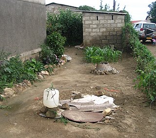
A well is an excavation or structure created in the ground by digging, driving, or drilling to access liquid resources, usually water. The oldest and most common kind of well is a water well, to access groundwater in underground aquifers. The well water is drawn up by a pump, or using containers, such as buckets or large water bags that are raised mechanically or by hand. Water can also be injected back into the aquifer through the well. Wells were first constructed at least eight thousand years ago and historically vary in construction from a simple scoop in the sediment of a dry watercourse to the qanats of Iran, and the stepwells and sakiehs of India. Placing a lining in the well shaft helps create stability, and linings of wood or wickerwork date back at least as far as the Iron Age.

Dewatering is the removal of water from a location. This may be done by wet classification, centrifugation, filtration, or similar solid-liquid separation processes, such as removal of residual liquid from a filter cake by a filter press as part of various industrial processes.
Groundwater pollution occurs when pollutants are released to the ground and make their way into groundwater. This type of water pollution can also occur naturally due to the presence of a minor and unwanted constituent, contaminant, or impurity in the groundwater, in which case it is more likely referred to as contamination rather than pollution. Groundwater pollution can occur from on-site sanitation systems, landfill leachate, effluent from wastewater treatment plants, leaking sewers, petrol filling stations, hydraulic fracturing (fracking) or from over application of fertilizers in agriculture. Pollution can also occur from naturally occurring contaminants, such as arsenic or fluoride. Using polluted groundwater causes hazards to public health through poisoning or the spread of disease.
The State of California enforces several methodologies through technical innovation and scientific approach to combat saltwater intrusion in areas vulnerable to saltwater intrusion. Seawater intrusion is either caused by groundwater extraction or increased in sea level. For every 1-foot of freshwater depression (0.30 m), sea-salty waters rises 40 feet (12 m) as the cone of depression forms. Salinization of groundwater is one of the main water pollution ever produced by mankind or from natural processes. It degrades water quality to the point it passes acceptable drink water and irrigation standards.