
Dumfries and Galloway is one of 32 unitary council areas of Scotland and is located in the western Southern Uplands. It comprises the historic counties of Dumfriesshire, Kirkcudbrightshire, and Wigtownshire, the latter two of which are collectively known as Galloway. The administrative centre and largest settlement is the town of Dumfries. The second largest town is Stranraer, 75 miles to the west on the Irish Sea coast.

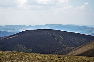
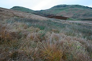
Queensberry is a hill in the Lowther Hills range, part of the Southern Uplands of Scotland. The most southerly mountain in the range, it lies in the parish of Kirkpatrick-Juxta and is a prominent landmark throughout Dumfriesshire. It is frequently climbed from the Daer Reservoir to the north and the minor roads to its south and east. As well as being a placename of multiple addresses throughout southern Scotland, the hill also lend its name to the Duke of Queensberry and Marquess of Queensberry peerages and, subsequently, 'Queensberry Rules' in the sport of boxing.

The Moorfoot Hills are a range of hills south of Edinburgh in east central Scotland, one of the ranges which collectively form the Southern Uplands.
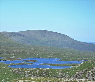
Shalloch on Minnoch is a hill in the Range of the Awful Hand, a sub-range of the Galloway Hills range, part of the Southern Uplands of Scotland. It is frequently climbed from Stinchar bridge to the north, or as part of a full traverse of the range.

The Lowther Hills, also sometimes known as the Lowthers, are an extensive area of hill country in the Southern Uplands of Scotland, though some sub-ranges of hills in this area also go under their own local names - see "Hillwalking" below. They form a roughly rhomboidal or lozenge shape on the map with the acute angles being to north and south. It has river valleys along its boundaries to north east (Clydesdale) and south west (Nithsdale) which carry the two largest arterial routes northwards into the west side of the Central Belt of Scotland. A string of small towns have long since developed along these routes. Most of the Lowther Hills lie in the Administrative County of Dumfries and Galloway, though part in the administrative county of South Lanarkshire moves into them around the village of Leadhills and the Daer Reservoir.

Croft Head is a hill in the Ettrick Hills range, part of the Southern Uplands of Scotland. It offers unobstructed views to the Solway Firth, the fells and mountains of Cumbria and the Pennines to the south and east. To the north, the major Moffat Hills are close by and to the west, Queensberry, the Lowthers and many of the Galloway Hills can be seen. Its summit is easily reached from Moffat by taking the Southern Upland Way path east from the Moffat water bridge near Craigbeck. A quite dramatic ridge loop is possible by climbing north on the forestry fire road shortly after Craigbeck Hope cottage via Gateshaw Rig to Croft Head's summit and descending via Cat Shoulder to the junction of the SUW and the Selcoth burn pass.

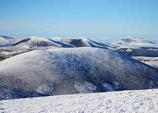
Green Lowther is a hill in the Lowther Hills range, part of the Southern Uplands of Scotland. It is the highest point of the Lowther Hills and lies in Lanarkshire, east of the town of Sanquhar. A microwave array once stood at the summit, however a telecommunications mast remains next to a transmitter station. The private service road which makes its way up neighbouring Lowther Hill, continuing over Green Trough to the summit is the second highest paved road in Britain after Great Dun Fell in the Pennines and the highest road of any kind in Scotland.
Cramalt Craig is a hill in the Manor Hills range, part of the Southern Uplands of Scotland. The second highest in the range and third highest in southern Scotland, it was previously also a Corbett until a 2013 survey by Alan Dawson found the col between it and Broad Law to be a few metres short of 500 ft. It is climbed almost solely from its southern sides at the Megget Stane or Cramalt Farm, taking in the neighbouring hills.
The Manor Hills, also known as the Tweedsmuir Hills, are a range of hills south of Peebles in the Scottish Borders, one of the ranges which collectively form the Southern Uplands. They are separated from the Moffat Hills by the Talla Reservoir, Megget Reservoir and St. Mary's Loch, the Moorfoot Hills by the A72 and the Culter Hills in South Lanarkshire by the A701. The western portion of the hills are designated as the 'Tweedsmuir Hills' Site of Special Scientific Interest and the 'Upper Tweeddale' National Scenic Area, with the major tributary rivers designated as Special Areas of Conservation.
Lowther Hill is a hill in the Lowther Hills range, part of the Southern Uplands of Scotland. Although the hill lends its name to the range, it is the second highest point of the Lowther Hills and lies on the border between Lanarkshire and Dumfries and Galloway, east of the town of Sanquhar, however the true summit lies just within Lanarkshire. The hill can be seen from a great distance in almost every direction throughout the central Southern Uplands when at height, in part due to its summit being topped by a radar station owned by NATS, the radome being colloquially known as "the golf ball". Access to the station is via a private service road starting in Wanlockhead, the highest village in Scotland. Although motor vehicle access is restricted, the road is popular with hillwalkers and cyclists, using it as a means of easy access to the top of the hill or for recreation. Continuing on to the highest of the range, Green Lowther, it is the second highest paved road in Britain and the highest in Scotland. Lowther Hill is also the highest point of the 344 km Southern Upland Way, passing just short of the summit at around 710m.

Black Law is a hill in the Manor Hills range, part of the Southern Uplands of Scotland. One of the more remote Donalds, it does not easily combine into a round with other hills in the area and requires traversing rough terrain to reach the top. Common ascents are as part of an extended Dun Rig Horseshoe to the north-east, from the south at the Megget Reservoir or, most easily, from the Manor Valley itself.

Ballencleuch Law is a hill in the Lowther Hills range, part of the Southern Uplands of Scotland. Surrounded on most sides by tracks or roads, there are various routes to the summit, but the most frequent ascents are from Durisdeer or the Daer Reservoir.
Stob Law is a hill in the Manor Hills range, part of the Southern Uplands of Scotland. It is normally climbed as an outlier of the Dun Rig horseshoe, starting from Peebles.

Wedder Law is a hill in the Lowther Hills range, part of the Southern Uplands of Scotland. With a flat, featureless summit, it is normally ascended as part of a round of the neighbouring hills.
Drumelzier Law is a hill in the Manor Hills range, part of the Southern Uplands of Scotland. It is often ascended from Drumelzier itself or Stanhope farm to the west, but ascents from the Manor Valley to the east are also common.
Scaw'd Law is a hill in the Lowther Hills range, part of the Southern Uplands of Scotland. The Dumfries and Galloway-South Lanarkshire border runs along its summit, which is notable for having two similar rounded tops; the top 300m to the north is likely the true summit. Surrounded on most sides by tracks or roads, there are various routes to the summit, but the most frequent ascents are from Durisdeer or the Daer Reservoir.
Comb Law is a hill in the Lowther Hills range, part of the Southern Uplands of Scotland. The second lowest Donald in the area south of the A702 road, it is surrounded on most sides by tracks or roads and there are various routes to the summit, but the easiest ascent is from the Daer Reservoir.

East Mount Lowther is a hill in the Lowther Hills range, part of the Southern Uplands of Scotland. The hill is most often climbed as a detour before or after ascending Lowther Hill, however much longer approaches from the south utilising ancient pathways such as the medieval Enterkin Pass are also possible - a viewpoint indicator is located at the summit.

Lousie Wood Law is a hill in the Lowther Hills range, part of the Southern Uplands of Scotland. The terminal northeast Donald on the main ridge in the northern portion of the Lowthers range, it is most easily climbed from its northern and eastern flanks.
Earncraig Hill is a hill in the Lowther Hills range, part of the Southern Uplands of Scotland. The lowest and craggiest Donald hill in the range, it lies on the border between Dumfries and Galloway and South Lanarkshire, helping form the source of the River Clyde. It is most quickly ascended from the Daer Reservoir to the north or from Mitchellslacks to the south, passing by Burleywhag bothy.


