
Madison Parish is a parish located on the northeastern border of the U.S. state of Louisiana, in the delta lowlands along the Mississippi River. As of the 2020 census, the population was 10,017. Its parish seat is Tallulah. The parish was formed in 1839.

Bradfield is a civil parish in the City of Sheffield, in South Yorkshire, England.

In England, a civil parish is a type of administrative parish used for local government. It is a territorial designation which is the lowest tier of local government. Civil parishes can trace their origin to the ancient system of parishes, which for centuries were the principal unit of secular and religious administration in most of England and Wales. Civil and religious parishes were formally split into two types in the 19th century and are now entirely separate. Civil parishes in their modern form came into being through the Local Government Act 1894, which established elected parish councils to take on the secular functions of the parish vestry.

The Parishes of the Church of Sweden are subdivisions within the Church of Sweden that historically were called socken but nowadays are called församling. Similar units were used for municipal (landskommun) and cadastral purposes until the 20th century.
A parish is an administrative division used by several countries. To distinguish it from an ecclesiastical parish, the term civil parish is used in some jurisdictions, as noted below.

Aldborough is a village 7 miles (11 km) in the civil parish of Boroughbridge, to the north-east of Knaresborough, in North Yorkshire, England.

Kilcloon or Kilclone is a parish situated in the south-east of County Meath in Ireland. Kilcloon parish is largely rural and contains the village of Kilcloon itself and the neighbouring villages of Batterstown and Mulhussey. The parish church is located at Ballynare Cross Roads in the village of Kilcloon with chapels in Kilcock and Batterstown.
Harrowden is a one-street hamlet in the civil parish of Shortstown, Bedfordshire, England.

Myton-on-Swale is a village and civil parish in North Yorkshire, England. It is about 3 miles east of Boroughbridge and on the River Swale.
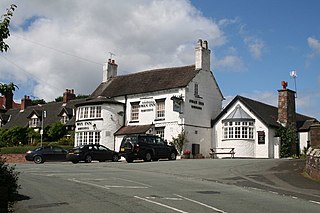
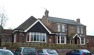
Wybunbury is a village and civil parish in the unitary authority of Cheshire East and the ceremonial county of Cheshire, England. The village lies 3¼ miles to the south east of Nantwich and 3¾ miles to the south of Crewe. The parish also includes the settlements of Clannor Heath, Daisy Hill, The Flag, Pinfold and parts of Blakelow, Haymoor Green and Howbeck Bank. Nearby villages include Hough, Shavington, Stapeley and Walgherton. The A51 runs east–west through the south-western corner of the parish.
Shotwick Park is a small settlement and former civil parish, in the unitary authority of Cheshire West and Chester and the ceremonial county of Cheshire, England. Located between the villages of Shotwick and Saughall, it is approximately 8 km (5.0 mi) north west of Chester and close to the Welsh border. The civil parish was abolished on 1 April 2015 to form Saughall and Shotwick Park, with part also incorporated into the parish of Puddington.

Dunkeswell is a village and civil parish in East Devon, England, located about 5 miles (8.0 km) north of the town of Honiton. At the 2001 census, the parish had a population of 1,553, reducing to 1,361 at the 2011 Census. There is an electoral ward with the same name whose population at the above census was 2,000. The parish is surrounded, clockwise from the north, by the parishes of Hemyock, Luppitt, Combe Raleigh, Awliscombe, Broadhembury and Sheldon.

Tatton is a former civil parish, now in the parish of Millington and Rostherne, in the Cheshire East district and ceremonial county of Cheshire in England. It lay to the north of Knutsford and mostly covered Tatton Park. At the 2001 census, it had a population of 35. The parish did not have a parish council.
Churton by Aldford is a former civil parish, now in the parish of Churton, in the borough of Cheshire West and Chester and ceremonial county of Cheshire in England. In 2001 it had a population of 136. The parish included the northern part of the village of Churton. It is associated with the nearby Church of England parish of St John the Baptist, Aldford, the nearest place of public worship.

Churton by Farndon is a former civil parish, now in the parish of Churton, in the borough of Cheshire West and Chester and ceremonial county of Cheshire in England. In 2001 it had a population of 146, increasing to 153 at the 2011 Census. The parish included the southern part of the village of Churton.

Claverton is a former civil parish, now in the parish of Eaton and Eccleston, in the borough of Cheshire West and Chester and ceremonial county of Cheshire in England. In 2001 it had a population of 7. The parish included the site of The King's School. The civil parish was abolished in 2015 to form Eaton and Eccleston.
Poulton is a settlement and former civil parish, now in the parish of Poulton and Pulford, in the Cheshire West and Chester, in the ceremonial county of Cheshire, England. In 2001 census the parish had a recorded population of 92.

Civil parishes are units of territory in the island of Ireland that have their origins in old Gaelic territorial divisions. They were adopted by the Anglo-Norman Lordship of Ireland and then by the Elizabethan Kingdom of Ireland, and were formalised as land divisions at the time of the Plantations of Ireland. They no longer correspond to the boundaries of Roman Catholic or Church of Ireland parishes, which are generally larger. Their use as administrative units was gradually replaced by Poor Law Divisions in the 19th century, although they were not formally abolished. Today they are still sometimes used for legal purposes, such as to locate property in deeds of property registered between 1833 and 1946.

Lower Dunsforth is a village in the civil parish of Dunsforths, in North Yorkshire, England. It was recorded in the Domesday Book (1086) as Doneforde/Dunesford/Dunesforde. St Mary's church was rebuilt in the 1860s with a buttressed spire.
Dunsforths is a civil parish in the former Harrogate district of North Yorkshire, England. It contains five listed buildings that are recorded in the National Heritage List for England. All the listed buildings are designated at Grade II, the lowest of the three grades, which is applied to "buildings of national importance and special interest". The parish contains the villages of Lower Dunsforth and Upper Dunsforth, and the surrounding area. All the listed buildings are in Lower Dunsforth, and consist of a church, a former vicarage and associated structures, a farmhouse and a farm building.

