Dysart, Queensland

Last updated

Map all coordinates using: OpenStreetMap  
Download coordinates as: KML
Dysart
Queensland
Saraji coal mine, Dysart, Queensland, 2012.jpg
Saraji coal mine, Dysart, 2012
Australia Queensland location map.svg
Red pog.svg
Dysart
Coordinates 22°35′08″S148°21′03″E / 22.5855°S 148.3508°E / -22.5855; 148.3508 (Dysart (town centre)) Coordinates: 22°35′08″S148°21′03″E / 22.5855°S 148.3508°E / -22.5855; 148.3508 (Dysart (town centre))
Population2,918 (2021 census) [1]
 • Density0.84350/km2 (2.1847/sq mi)
Established1973
Postcode(s) 4745
Elevation223 m (732 ft)
Area3,459.4 km2 (1,335.7 sq mi)
Time zone AEST (UTC+10:00)
Location
LGA(s) Isaac Region
State electorate(s) Burdekin
Federal division(s) Capricornia
Mean max tempMean min tempAnnual rainfall
34 °C
93 °F
10 °C
50 °F
590 mm
23.2 in
Localities around Dysart:
Winchester
Gemini Mountains
Coppabella Valkyrie
Wolfang
Cheeseborough
Dysart May Downs
Retro
Lowestoff
Cotherstone
Mount Macarthur
Belcong
Middlemount
Bundoora

Dysart is a town and a locality in the Isaac Region, Queensland, Australia. [2] [3] It is a service centre for mines and grazing properties in the district. At the 2021 census, the locality had a population of 2,918. [1] Most residents are employed by the coal mines.[ citation needed ]

Contents

Geography

Railways

The locality is served by the Goonyella railway network which connects the Bowen Basin coalfields with the coal wharves at Hay Point on the coast. The locality is served by numerous railway stations (from north to south):

Mountains

The terrain is mountainous, with the following named peaks (from north to south):

History

Prussian explorer Ludwig Leichhardt explored the region in 1845 being the first European to do so. This included climbing to the summit of nearby Campbells Peak and allegedly building a stone cairn there. [17]

The town of Dysart was established in 1973 to support the Saraji coal mine with the Post Office opening on 8 October 1973. [18] [19] The name Dysart comes from the name of a pastoral run and a parish in the area; it means a retreat for monks and hence solitude in Irish Gaelic. [2]

Dysart State School opened on 21 May 1973. [20] A secondary department was added in 1979, which operated until Dysart State High School opened on 20 September 1980. [21]

The Dysart Library opened in 1982. [22]

At the 2011 census, the town of Dysart had a population of 3,003 people. [23] At the 2016 census, the locality had a population of 2,991 people. [24]

Economy

Norwich Park coal mine was located 15 kilometres (9.3 mi) south of the town. [25] It closed on 11 April 2012, after 32 years of operation. [26] Following its closure, its miners were relocated to the Saraji Mine, which is located 26 kilometres (16 mi) north of the town, [25] and has one of the largest coal reserves in Asia and the world. [27] In 2020, the Norwich Park mine reopened under the new name Saraji South. [28]

Housing

According to the Real Estate Institute of Queensland in 2011, Dysart had a median rent of $1,200 a week for a house, making it the most expensive in Queensland. [29] In 2012, the median house price in the town was $475,000. [30] The closure of the Norwich Park Mine was expected to bring property prices down. [25] In August 2015, rental price for a three-bedroom home in Dysart started at $130 a week. [31]

Education

Dysart State School is a government primary (Prep-6) school for boys and girls at Garnham Drive ( 22°35′16″S148°20′51″E / 22.5877°S 148.3475°E / -22.5877; 148.3475 (Dysart State School) ). [32] [33] In 2018, the school had an enrolment of 347 students with 25 teachers (24 full-time equivalent) and 15 non-teaching staff (9 full-time equivalent). [34]

Dysart State High School is a government secondary (7-12) school for boys and girls at Edgerley Street ( 22°35′02″S148°21′17″E / 22.5840°S 148.3548°E / -22.5840; 148.3548 (Dysart State High School) ). [32] In 2018, the school had an enrolment of 162 students with 17 teachers (16 full-time equivalent) and 20 non-teaching staff (13 full-time equivalent). [34]

Sport

Rugby league is a popular sport in Dysart. Dysart junior team is named 'Dysart Bulls' with team colours of red, black and white. The senior team is also called 'Dysart Bulls' and has about six home games a year. The Bulls were the junior home team of Matt Sing, who played 24 State of Origin Games for Queensland.

Dysart also has a very popular soccer team, the Dysart Devils.

Amenities

The Isaac Regional Council operates a public library located in Shannon Crescent, Dysart. [35]

Events

Dysart is home to Norwich Park Mines Day, held to increase the public's knowledge of the mining industry.

Attractions

A monument to the coal and rail industry consisting of a large truck and coal wagon is located at the northern entrance to the town. [36]

Related Research Articles

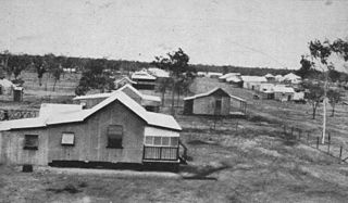
Moranbah is a coal mining town and locality in the Isaac Region, Queensland, Australia. In the 2016 census, the locality of Moranbah had a population of 8,735 people.

<span class="mw-page-title-main">Mount Garnet, Queensland</span> Town in Queensland, Australia

Mount Garnet is a rural town and locality in the Tablelands Region, Queensland, Australia. In the 2016 census, Mount Garnet had a population of 430 people.

<span class="mw-page-title-main">Comet, Queensland</span> Town in Queensland, Australia

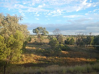
Comet is a historical rich rural town and locality in the Central Highlands Region, Queensland, Australia. In the 2016 census, the locality of Comet had a population of 498 people.

<span class="mw-page-title-main">Saraji coal mine</span> Mine in Queensland, Australia

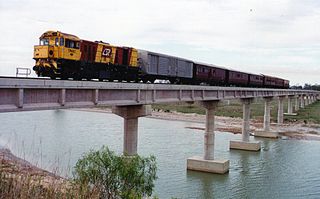
The Saraji Coal Mine is a coal mine located near Dysart in the Central Queensland region of Australia. The mine has coal reserves amounting to 648 million tonnes of coking coal, one of the largest coal reserves in Asia and the world. The mine has an annual production capacity of 10 million tonnes of coal. It is located in the Bowen Basin, an area with significant coal deposits and numerous mines. It is owned by the BHP Mitsubishi Alliance (BMA).

<span class="mw-page-title-main">Mount Coolon, Queensland</span> Suburb of Whitsunday Region, Queensland, Australia

Mount Coolon is a rural town and locality in the Whitsunday Region, Queensland, Australia. In the 2016 census, the locality of Mount Coolon had a population of 64 people.

<span class="mw-page-title-main">Springlands, Queensland</span> Suburb of Whitsunday Region, Queensland, Australia

Springlands is a rural locality in the Whitsunday Region, Queensland, Australia.

Yalboroo is a rural town and locality in the Mackay Region, Queensland, Australia. In the 2016 census, the locality of Yalboroo had a population of 170 people.

<span class="mw-page-title-main">Ogmore, Queensland</span> Town in Queensland, Australia

Ogmore is a rural town and coastal locality in the Livingstone Shire, Queensland, Australia. In the 2016 census, the locality of Ogmore had a population of 105 people.

<span class="mw-page-title-main">Kalpowar</span> Town in Queensland, Australia

Kalpowar is a town in the North Burnett Region and a locality split between the North Burnett Region and the Bundaberg Region, in Queensland, Australia. In the 2016 census, the locality of Kalpowar had a population of 67 people.

Mount Pelion is a rural locality in the Mackay Region, Queensland, Australia. In the 2016 census, Mount Pelion had a population of 125 people.

Iveragh is a rural locality in the Gladstone Region, Queensland, Australia.

<span class="mw-page-title-main">Clumber, Queensland</span> Suburb of Scenic Rim Region, Queensland, Australia

Clumber is a rural locality in the Scenic Rim Region, Queensland, Australia. In the 2016 census, Clumber had a population of 60 people.

Albinia is a locality in the Central Highlands Region, Queensland, Australia. In the 2016 census, Albinia had a population of 112 people.

Minerva is a rural locality in the Central Highlands Region, Queensland, Australia. At the 2021 census, Minerva had a population of 55 people.

Cotherstone is a rural locality in the Central Highlands Region, Queensland, Australia. At the 2021 census, Cotherstone had a population of 0 people.

<span class="mw-page-title-main">Mount Alma, Queensland</span> Suburb of Gladstone Region, Queensland, Australia

Mount Alma is a rural locality in the Gladstone Region, Queensland, Australia. In the 2016 census, Mount Alma had a population of 47 people.

Laglan is a rural locality in the Isaac Region, Queensland, Australia. In the 2016 census Laglan had a population of 3 people, but its boundaries have subsequently changed.

<span class="mw-page-title-main">Gemini Mountains, Queensland</span> Suburb of Isaac Region, Queensland, Australia

Gemini Mountains is a rural locality in the Isaac Region, Queensland, Australia. At the 2021 census, Gemini Mountains had a population of 65 people.

Mount Howe is a rural locality in the Maranoa Region, Queensland, Australia. In the 2016 census Mount Howe had a population of 3 people.

Mount Bindango is a rural locality in the Maranoa Region, Queensland, Australia. In the 2016 census Mount Bindango had a population of 33 people.

References

  1. 1 2 "2021 Dysart (Qld), Census All persons QuickStats | Australian Bureau of Statistics". abs.gov.au. Archived from the original on 28 June 2022. Retrieved 28 June 2022.
  2. 1 2 "Dysart – town in Isaac Region (entry 10988)". Queensland Place Names. Queensland Government . Retrieved 5 August 2017.
  3. "Dysart – locality in Isaac Region (entry 49385)". Queensland Place Names. Queensland Government . Retrieved 5 August 2017.
  4. 1 2 3 4 5 6 7 8 9 "Railway stations and sidings – Queensland". Queensland Open Data. Queensland Government. 2 October 2020. Archived from the original on 5 October 2020. Retrieved 5 October 2020.
  5. 1 2 3 4 5 6 7 8 9 10 11 "Mountain peaks and capes – Queensland". Queensland Open Data. Queensland Government. 12 November 2020. Archived from the original on 25 November 2020. Retrieved 25 November 2020.
  6. "Walkers Peak – mountain in Isaac Region (entry 36241)". Queensland Place Names. Queensland Government . Retrieved 25 November 2020.
  7. "Mount Phillips – mountain in Isaac Region (entry 26569)". Queensland Place Names. Queensland Government . Retrieved 25 November 2020.
  8. "Mount Walker – mountain in Isaac Region (entry 36224)". Queensland Place Names. Queensland Government . Retrieved 25 November 2020.
  9. "Campbell Peak – mountain in Isaac Region (entry 5980)". Queensland Place Names. Queensland Government . Retrieved 25 November 2020.
  10. "Lords Table Mountain – mountain in Isaac Region (entry 20085)". Queensland Place Names. Queensland Government . Retrieved 25 November 2020.
  11. "Gilberts Dome – mountain in Isaac Region (entry 13743)". Queensland Place Names. Queensland Government . Retrieved 25 November 2020.
  12. "Browns Peak – mountain in Isaac Region (entry 4773)". Queensland Place Names. Queensland Government . Retrieved 25 November 2020.
  13. "Charleys Peak – mountain in Isaac Region (entry 6915)". Queensland Place Names. Queensland Government . Retrieved 25 November 2020.
  14. "Eastern Peak – mountain in Isaac Region (entry 11114)". Queensland Place Names. Queensland Government . Retrieved 25 November 2020.
  15. "Mount Dalrymple – mountain in Isaac Region (entry 9250)". Queensland Place Names. Queensland Government . Retrieved 25 November 2020.
  16. "Expedition Peak – mountain in Isaac Region (entry 12088)". Queensland Place Names. Queensland Government . Retrieved 25 November 2020.
  17. "Dysart". Isaac Regional Council. Archived from the original on 20 October 2018. Retrieved 20 October 2018.
  18. "Dysart". Isaac Regional Council . Archived from the original on 21 March 2022. Retrieved 17 July 2022.
  19. Premier Postal History. "Post Office List". Premier Postal Auctions. Archived from the original on 15 May 2014. Retrieved 10 May 2014.
  20. "Opening and closing dates of Queensland Schools". Queensland Government . Retrieved 18 April 2019.
  21. "Our school". Dysart State High School. 26 February 2020. Archived from the original on 22 March 2022. Retrieved 17 July 2022.
  22. "Queensland Public Libraries Statistical Bulletin 2016-2017" (PDF). Public Libraries Connect. Archived (PDF) from the original on 30 January 2018. Retrieved 11 January 2018.
  23. Australian Bureau of Statistics (31 October 2012). "Dysart (Urban Centre/Locality)". 2011 Census QuickStats. Retrieved 9 November 2013. OOjs UI icon edit-ltr-progressive.svg
  24. Australian Bureau of Statistics (27 June 2017). "Dysart (SSC)". 2016 Census QuickStats. Retrieved 27 January 2020. OOjs UI icon edit-ltr-progressive.svg
  25. 1 2 3 Larry Schlesinger (19 April 2012). "Mine closure expected to bring down rents and prices in Dysart, Queensland: Agents". Property Observer. Private Media. Archived from the original on 29 May 2012. Retrieved 11 May 2012.
  26. Kim Honan (11 May 2012). "Big Queensland coal mine shuts down". ABC Rural. Australian Broadcasting Corporation. Archived from the original on 13 May 2012. Retrieved 11 May 2012.
  27. "Bowen Basin coal mines". bowenbasin.com. 2012. Retrieved 3 July 2013.
  28. "Saraji East Mining Lease Project Environmental Impact Statement" (PDF). BHP.com. Retrieved 24 October 2022.
  29. John McCarthy (18 April 2011). "Miners pay $90,000 in rent in Queensland towns". The Telegraph. News Limited. Retrieved 11 May 2012.
  30. Kate Bastable (24 February 2012). "Cashing in and getting out". The Satellite. Retrieved 11 May 2012.
  31. "Results for properties for rent in Dysart, QLD 4745". REA Group. Archived from the original on 19 August 2015. Retrieved 19 August 2015.
  32. 1 2 "State and non-state school details". Queensland Government. 9 July 2018. Archived from the original on 21 November 2018. Retrieved 21 November 2018.
  33. "Dysart State School". Dysart State School. 26 February 2020. Archived from the original on 6 March 2022. Retrieved 17 July 2022.
  34. 1 2 "ACARA School Profile 2018". Australian Curriculum, Assessment and Reporting Authority. Archived from the original on 27 August 2020. Retrieved 28 January 2020.
  35. "Dysart Library". Public Libraries Connect. Archived from the original on 11 January 2018. Retrieved 11 January 2018.
  36. "Dysart". Isaac Regional Council. Archived from the original on 21 March 2012. Retrieved 11 April 2012.