Palmgrove National Park

Last updated

Palmgrove National Park
Queensland

Black-breasted Button-quail male inskip.JPG

The park is an important site for black-breasted buttonquails
Australia Queensland location map.svg
Red pog.svg
Palmgrove National Park
Nearest town or city Moura
Coordinates 24°55′35″S149°24′56″E / 24.92639°S 149.41556°E / -24.92639; 149.41556 Coordinates: 24°55′35″S149°24′56″E / 24.92639°S 149.41556°E / -24.92639; 149.41556
Established 1991
Area 256 km2 (98.8 sq mi)
Managing authorities Queensland Parks and Wildlife Service
See also Protected areas of Queensland

Palmgrove is a national park in south-central Queensland, Australia. It lies about 185 km north-north-east of Roma and 458 km north-west of Brisbane. It is listed as a National Park (Scientific) under the Nature Conservation Act 1992, so giving it the highest level of protection possible under the Act. It was established in order to protect species and ecosystems of exceptional scientific value. [1] It is located within the Dawson River catchment area. [2]

Queensland North-east state of Australia

Queensland is the second-largest and third-most populous state in the Commonwealth of Australia. Situated in the north-east of the country, it is bordered by the Northern Territory, South Australia and New South Wales to the west, south-west and south respectively. To the east, Queensland is bordered by the Coral Sea and Pacific Ocean. To its north is the Torres Strait, with Papua New Guinea located less than 200 km across it from the mainland. The state is the world's sixth-largest sub-national entity, with an area of 1,852,642 square kilometres (715,309 sq mi).

Australia Country in Oceania

Australia, officially the Commonwealth of Australia, is a sovereign country comprising the mainland of the Australian continent, the island of Tasmania and numerous smaller islands. It is the largest country in Oceania and the world's sixth-largest country by total area. The neighbouring countries are Papua New Guinea, Indonesia and East Timor to the north; the Solomon Islands and Vanuatu to the north-east; and New Zealand to the south-east. The population of 25 million is highly urbanised and heavily concentrated on the eastern seaboard. Australia's capital is Canberra, and its largest city is Sydney. The country's other major metropolitan areas are Melbourne, Brisbane, Perth and Adelaide.

Roma, Queensland Town in Queensland, Australia

Roma is a town, locality and the administrative centre in the Maranoa Region, Queensland, Australia. The town was incorporated in 1867 and is named after Lady Diamantina Bowen, the wife of Sir George Bowen, the Governor of Queensland at the time. At the 2016 census, Roma had a population of 6,848..

Contents

Description

Palmgrove lies in moderately dry, dissected sandstone country. The vegetation includes a variety of eucalypt woodland and forest communities as well as vine and Acacia thickets. The area is rugged and isolated; access is difficult and the park is not open to the general public. [1]

Sandstone A clastic sedimentary rock composed mostly of sand-sized particles

Sandstone is a clastic sedimentary rock composed mainly of sand-sized mineral particles or rock fragments.

Eucalypt is a descriptive name for woody plants with capsule fruiting bodies belonging to seven closely related genera found across Australasia: Eucalyptus, Corymbia, Angophora, Stockwellia, Allosyncarpia, Eucalyptopsis and Arillastrum.

Woodland low-density forest forming open habitats with plenty of sunlight and limited shade

A woodland or wood is a low-density forest forming open habitats with plenty of sunlight and limited shade. Woodlands may support an understory of shrubs and herbaceous plants including grasses. Woodland may form a transition to shrubland under drier conditions or during early stages of primary or secondary succession. Higher density areas of trees with a largely closed canopy that provides extensive and nearly continuous shade are referred to as forests.

Flora and fauna

Threatened ecosystems present in the park include: [1]

<i>Acacia harpophylla</i> species of plant

Acacia harpophylla, commonly known as brigalow, brigalow spearwood or orkor is an endemic tree of Australia. It is found in central and coastal Queensland to northern New South Wales. It can reach up to 25 metres tall and forms extensive open-forest communities on clay soils.

<i>Eucalyptus cambageana</i> species of plant

Eucalyptus cambageana, commonly known as the Dawson River blackbutt, Dawson gum or Coowarra box, is a species of tree that is endemic in Queensland, Australia. It is a medium-sized tree with hard, rough bark on the lower trunk, smooth white to cream-coloured bark above, lance-shaped or curved adult leaves, flower buds in groups of seven, white flowers and cup-shaped to funnel-shaped fruit.

<i>Casuarina cristata</i> species of plant

Casuarina cristata is an Australian tree of the sheoak family Casuarinaceae known as belah. It is native to a band across inland eastern Australia.

Northern quolls have been recorded in the park. [1]

Northern quoll species of mammal

The northern quoll, also known as the northern native cat, the North Australian native cat, the satanellus or the njanmak, is a carnivorous marsupial native to Australia.

Important Bird Area

The park has been identified by BirdLife International as an Important Bird Area (IBA) because it supports an isolated, and the westernmost, population (over 10 pairs) of black-breasted buttonquails, listed as vulnerable. The rare and threatened ecosystems contained in the park are buttonquail habitat. [3] Glossy black cockatoos, also considered to be vulnerable, are present. [1]

BirdLife International is a global partnership of conservation organisations that strives to conserve birds, their habitats, and global biodiversity, working with people towards sustainability in the use of natural resources. It is the world's largest partnership of conservation organisations, with over 120 partner organisations.

Important Bird Area area recognized as being globally important habitat for the conservation of birds populations

An Important Bird and Biodiversity Area (IBA) is an area identified using an internationally agreed set of criteria as being globally important for the conservation of bird populations.

Black-breasted buttonquail species of bird

The black-breasted buttonquail is a rare buttonquail endemic to eastern Australia, where it is usually found in rainforest. Like other buttonquails, it is unrelated to the true quails. The black-breasted buttonquail is a plump quail-shaped bird of predominantly marbled black, rufous and pale brown, marked prominently with white spots and stripes, and white eyes. Like other buttonquails, the female is larger and more distinctively coloured than the male. Measuring up to 20 cm (8 in), it has a black face and chin, sprinkled with fine white markings. The smaller male measures up to 18 cm (7.5 in) and lacks the black markings. The black-breasted buttonquail is rated as near threatened on the International Union for Conservation of Nature (IUCN)'s Red List of Endangered species.

See also

Related Research Articles

Brisbane Water National Park Protected area in New South Wales, Australia

The Brisbane Water National Park is a protected national park that is located in the Central Coast region of New South Wales, in eastern Australia. The 11,506-hectare (28,430-acre) national park is situated 47 kilometres (29 mi) north of Sydney, 10 kilometres (6.2 mi) west of Woy Woy, and 12 kilometres (7.5 mi) southwest of Gosford.

Conondale National Park Protected area in Queensland, Australia

Conondale National Park is 130 km north of Brisbane in the Sunshine Coast Hinterland near the town of Conondale in the south east Queensland bioregion. The park covers an area of 35,648 hectares protecting large areas of subtropical rainforest, woodlands, wet and dry sclerophyll forest including Queensland’s tallest tree. The park contains areas of regenerating forest which have been previously logged; areas of forest plantations also border the park. The park is currently managed by the Department of National Parks, Recreation, Sports and Racing (NPRSR) under the Nature Conservation Act 1992.

Erringibba National Park Protected area in Queensland, Australia

Erringibba is a national park at Glenmorgan in the far west of the Darling Downs region of southern Queensland, Australia, 329 km west of Brisbane. The park was established in 1999 and covers 8.77 km2 (3.39 sq mi). The park lies within the catchment area of the Condamine River and the Brigalow Belt South bioregion.

Mooloolah River National Park Protected area in Queensland, Australia

The Mooloolah River National Park is a nationally protected area located on the Sunshine Coast, Queensland. It covers an area of 830.9 hectares and is bordered by the Mooloolah River to the east, Claymore and Dixon Roads to the west, and the Lower Mooloolah River Environmental Reserve to the south. It is bisected by the Sunshine Motorway with the northern, 161.93 hectare component of the Park being a later addition. The Park was initially vacant crown land prior to national park designation in 1960. Surrounding land uses include livestock grazing, urban development and the campus of the University of the Sunshine Coast. It is the second largest mainland park on the coastal lowlands in South East Queensland after Noosa National Park and represents an example of low-lying coastal floodplain distinctive of the region.

Taunton National Park Protected area in Queensland, Australia

Taunton National Park is situated near the town of Dingo approximately 135 km inland from Rockhampton in eastern Central Queensland, Australia. The park encompasses an area of 11,626 ha within the Northern Brigalow Belt bioregion of Queensland; a region widely recognised to contain considerable biodiversity.

Ethiopian Highlands mountain range

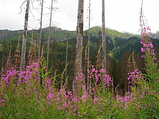
The Ethiopian Highlands is a rugged mass of mountains in Ethiopia, situated in the Horn region in northeast Africa. It forms the largest continuous area of its elevation in the continent, with little of its surface falling below 1,500 m (4,900 ft), while the summits reach heights of up to 4,550 m (14,930 ft). It is sometimes called the Roof of Africa due to its height and large area. Most of the Ethiopian Highlands are part of central and northern Ethiopia, and its northernmost portion reaches into Eritrea.

Carnarvon Gorge

Carnarvon Gorge is located in the Southern Brigalow Belt bioregion in Central Queensland (Australia), 593 km northwest of Brisbane. Primarily created by water erosion, Carnarvon Gorge is around 30 kilometres long, located in Carnarvon National Park, and six hundred metres deep at the mouth. It is the most visited feature within Carnarvon National Park due to the diversity of experiences it contains and the ease with which it can be accessed. The closest towns are Injune and Rolleston.

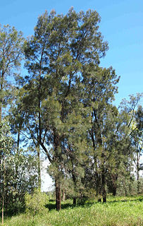
Brachychiton rupestris, commonly known as the narrow-leaved bottle tree or Queensland bottle tree, is a tree in the family Malvaceae native to Queensland, Australia. Discovered and described by Sir Thomas Mitchell and John Lindley in 1848, it gained its name from its bulbous trunk, which can be up to 3.5 metres (11 ft) diameter at breast height (DBH). Reaching 10–25 metres (33–82 ft) high, the Queensland bottle tree is deciduous, losing its leaves between September and December. The leaves are simple or divided, with one or more narrow leaf blades up to 11 centimetres (4 in) long and 2 centimetres (0.8 in) wide. Cream-coloured flowers appear from September to November, and are followed by woody boat-shaped follicles that ripen from November to May. No subspecies are recognised.

Scenic Rim mountains in Australia

The Scenic Rim is a group of forested mountain ranges of the Great Dividing Range straddling the border between south-eastern Queensland and north-eastern New South Wales, Australia.

Wildlife of Djibouti

The Wildlife of Djibouti, consisting of flora and fauna, is in a harsh landscape with forest accounting for less than one percent of the total area of the country. The flora and fauna species are most found in the northern part of the country in the ecosystem of the Day Forest National Park at an average altitude 1,500 metres (4,900 ft), including the massif Goda, with a peak of 1,783 metres (5,850 ft). It covers an area of 3.5 square kilometres (1.4 sq mi) of Juniperus procera forest, with many of the trees rising to 20 metres (66 ft) height. This forest area is the main habitat of critically endangered and endemic Djibouti francolin, and another recently noted vertebrate, Platyceps afarensis. The area also contains many species of woody and herbaceous plants, including boxwood and olive trees, which account for sixty percent of the total identified species in the country.

Red-chested buttonquail species of bird

The red-chested buttonquail is a species of bird in the family Turnicidae. It is endemic to Australia. The species is generally regarded as widespread, although uncommon, in New South Wales, Queensland, northern Western Australia and the Northern Territory, and classified as Vulnerable in Victoria.

Lake Galilee is a semi-arid saline lake located in the Desert Uplands region of Central West Queensland. The lake is about 36 kilometres long, up to 12.5 kilometres wide and covers approximately 25,700 hectares.

Brigalow Belt

The Brigalow Belt is a wide band of acacia wooded grassland that runs between tropical rainforest of the coast and the semi-arid interior of Queensland, Australia. See Interim Biogeographic Regionalisation for Australia for the IBRA definitions of the Brigalow Belt South (BBS) and the Brigalow Belt North (BBN) bioregions. The Northern and Southern Brigalow Belts are two of the 85 bioregions across Australia and the 15 bioregions in Queensland. Together they form most of the Brigalow tropical savanna ecoregion.

Phước Bình National Park national park

Phước Bình National Park is a national park in the commune of Phước Bình, Bác Ái District, Ninh Thuận Province. It is located 62 km north-west from Phan Rang town, the capital of Ninh Thuận Province, on the border with Lâm Đồng and Khánh Hòa provinces. Phước Bình National Park was classified as a nature reserve by Decision 125/2002/QD dated 26 September 2002. On 8 June 2006 it was established as a national park under Decision number 822/QĐ-TTg dated 8 June 2006 by then Vice Prime Minister of Vietnam Nguyễn Tấn Dũng.

Alwal National Park Protected area in Queensland, Australia

Alwal National Park is a national park in the Shire of Cook on the Cape York Peninsula in Far North Queensland, Australia.

Annan River National Park Protected area in Queensland, Australia

Annan River National Park is a national park on Cape York Peninsula in Far North Queensland, Australia. The Annan River from which the park gets its name, marks the northern and western extent of the park. To the east of the park is Walker Bay in the Coral Sea. The park was gazetted in 2006.

References

  1. 1 2 3 4 5 BirdLife International. (2011). Important Bird Areas factsheet: Palmgrove. Downloaded from http://www.birdlife.org on 13/09/2011.
  2. "Palmgrove National Park (Scientific) — facts and maps, WetlandInfo". Department of Environment and Heritage Protection. Retrieved 13 July 2013.
  3. "IBA: Palmgrove". Birdata. Birds Australia. Retrieved 2011-09-13.