
The Oxley Wild Rivers National Park is a protected national park that is located in the Northern Tablelands region of New South Wales, Australia in the Port Macquarie-Hastings City Council and Walcha Shire councils. The 145,223-hectare (358,850-acre) park is situated 445 kilometres (277 mi) north of Sydney and is named in memory of the Australian explorer John Oxley, who passed through the area in 1818 and is one of the largest national parks in New South Wales.
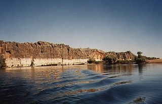
Danggu (Geikie) Gorge National Park is a national park in the Kimberley region of Western Australia, 1,837 kilometres (1,141 mi) northeast of Perth and approximately 420 km (261 mi) east of Broome by road. The gorge was originally named in honour of Sir Archibald Geikie, the Director General of Geological Survey for Great Britain and Ireland when it was given its European name in 1883. Sir Archibald never visited the gorge and the National Park is progressively being officially changed to the Bunuba traditional owners name of Danggu. It is part of the Balili Conservation Park.

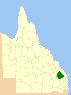
Blackdown Tableland is a national park in the Central Highlands Region, Queensland, Australia.

Cania Gorge is a national park in the North Burnett Region, Queensland, Australia, in the locality of Cania.

Kondalilla is a national park in the Blackall Range of South East Queensland, Australia, 91 km north of Brisbane. William Skene founded this area on his property while searching for lost cattle. He named it Bon Accord before giving it to the Queensland Government who, during the fifties, renamed it Kondalilla which is an Aboriginal word for running water. The area was first officially protected in 1906 as a recreational area, becoming a national park in 1945.

The Lamington National Park is a national park, lying on the Lamington Plateau of the McPherson Range on the Queensland/New South Wales border in Australia. From Southport on the Gold Coast the park is 85 kilometres (53 mi) to the southwest and Brisbane is 110 kilometres (68 mi) north. The 20,600 hectares Lamington National Park is known for its natural environment, rainforests, birdlife, ancient trees, waterfalls, walking tracks and mountain views.

Boodjamulla National Park, formerly known as Lawn Hill National Park, is a national park in the Shire of Burke, Queensland, Australia. The Riversleigh World Heritage Area is a World Heritage Site within the park.

Sundown is a national park in Queensland, Australia, 198 km south west of Brisbane. The park contains spectacular gorge country and a number of peaks higher than 1,000 m.

Tamborine is a national park in the Gold Coast hinterland and is a part of the Scenic Rim Regional Council of South East Queensland, Australia, 45 km (28 mi) south of Brisbane.
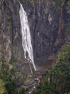
The Wollomombi Falls is a plunge waterfall on the Wollomombi River in the New England region of New South Wales, Australia.

Mundubbera is a town and a locality in the North Burnett Region, Queensland, Australia. In the 2016 census, Mundubbera had a population of 1261 people.

The Burnett River is a river located in the Wide Bay–Burnett and Central Queensland regions of Queensland, Australia.
The Goreng Goreng are an Australian Aboriginal people of Queensland, and also a language group. The Goreng Goreng area is between Baffle Creek to Agnes Water in the north, extending westerly as far as Kroombit Tops.
The Shire of Mundubbera was a local government area in the northern catchment of the Burnett River, Queensland, Australia. The shire covered an area of 4,192.8 square kilometres (1,618.8 sq mi), and existed as a local government area from 1915 until 2008, when it amalgamated with several other shires to form the North Burnett Region.

The Shire of Eidsvold was a local government area in the northern catchment of the Burnett River, Queensland, Australia. The shire covered an area of 4,809.4 square kilometres (1,856.9 sq mi), and existed as a local government area from 1890 until 2008, when it amalgamated with several other shires to form the North Burnett Region.
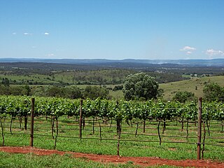
The South Burnett is a peanut growing and wine-producing area on the Great Dividing Range, north of the Darling Downs, in Queensland. It is with the basin of the Burnett River. The area is within two local government areas, South Burnett Region and Gympie Region.
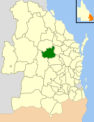
The North Burnett Region is a local government area in Queensland, Australia in the northern catchment of the Burnett River. Established in 2008, it was preceded by several previous local government areas with histories extending back to the early 1900s.
The Amamoor State Forest and Forest Reserve is a riverine rainforest in the Gympie Region in Queensland, Australia. The forest is composed of subtropical vegetation dominated by stands of Melia azedarach, Toona ciliata, Araucaria cunninghamii and A. bidwillii. The Amamoor creek within the reserve is noted as a habitat for the platypus and several species of endangered frogs. The park station is located on Amamoor Creek Road about 180 kilometers north of the state capital of Brisbane and 20 kilometres southwest of the town of Gympie.

Wide Bay–Burnett is a region of the Australian state of Queensland, located between 170–400 km (110–250 mi) north of the state capital, Brisbane. The area's population growth has exceeded the state average over the past 20 years, and it is forecast to grow to more than 430,000 by 2031. It is the subject of the Draft Wide Bay–Burnett Regional Plan, which aims to facilitate this growth while protecting over 90% of the region from urban development.

Hawkwood is a rural locality in the North Burnett Region, Queensland, Australia. In the 2016 census Hawkwood had a population of 27 people.
