Queensland is the second largest state in Australia. It contains 472 separate protected areas with a total land area of 69,388 km2 (26,791 sq mi). 223 of these are National parks, which is the highest number of any Australian state or territory, totaling 65,871 km2 (25,433 sq mi). Seven others are Scientific National Parks, totaling 522 km2 (202 sq mi).

Protected areas of South Australia consists of protected areas located within South Australia and its immediate onshore waters and which are managed by South Australian Government agencies. As of March 2018, South Australia contains 359 separate protected areas declared under the National Parks and Wildlife Act 1972, the Crown Land Management Act 2009 and the Wilderness Protection Act 1992 which have a total land area of 211,387.48 km2 (81,617.16 sq mi) or 21.5% of the state's area.

Black Mountain (Kalkajaka) National Park is a 781-hectare (1,930-acre) protected area in Shire of Cook, Queensland, Australia.

Bowling Green Bay is a national park in the City of Townsville and Shire of Burdekin, Queensland, Australia, 1,103 km northwest of Brisbane, and 28 km south of Townsville and 59 km north of Ayr. It is a Ramsar Convention listed site. The park protects diverse range of habitats including the rugged, forested landscape surrounding Mount Elliot and Saddle Mountain as well as coastal estuaries between Cape Cleveland and Cape Bowling Green.

Cape Palmerston is a national park in the Mackay Region, Queensland, Australia.
Cliff Island is a national park at Yarraden on Cape York Peninsula in Far North Queensland, Australia, 1,757 km northwest of Brisbane. It is part of the Great Barrier Reef Marine Park west of Cape Melville in Princess Charlotte Bay. The park is a restricted access area in order to protect cultural resource of the islands traditional owners, the Lama Lama people.

Currawinya is a national park near Hungerford in South West Queensland, Australia, 828 km west of Brisbane. Part of the mulga lands bioregion this is an area of dry sandy plain with small trees and shrubs. The Paroo River passes through the park.
The Mooloolah River National Park is a nationally protected area located on the Sunshine Coast, Queensland. It covers an area of 830.9 hectares and is bordered by the Mooloolah River to the east, Claymore and Dixon Roads to the west, and the Lower Mooloolah River Environmental Reserve to the south. It is bisected by the Sunshine Motorway with the northern, 161.93 hectare component of the Park being a later addition. The Park was initially vacant crown land prior to national park designation in 1960. Surrounding land uses include livestock grazing, urban development and the campus of the University of the Sunshine Coast. It is the second largest mainland park on the coastal lowlands in South East Queensland after Noosa National Park and represents an example of low-lying coastal floodplain distinctive of the region.
Mount Pinbarren is a national park in Queensland, Australia, 129 km north of Brisbane. It is located in Pinbarren, a locality in the Shire of Noosa. Mount Pinbarren lies within the South East Queensland bioregion and the Mary River catchment area.

Oyala Thumotang, formerly Mungkan Kandju National Park, is a national park in Queensland, Australia, 1,914 kilometres (1,189 mi) northwest of Brisbane.
Sarabah is a small national park in South East Queensland, Australia, 65 km south of Brisbane. The park lies within the catchment area of the Albert River.
The Moreton Bay Marine Park was established in 1992 to protect ecologically significant habitats in Moreton Bay. The marine park extends from Caloundra south to the southern tip of South Stradbroke Island. The marine park's border extends up to the highest tidal mark and covers a total of 3,400 km2.

The Annan River is a river located in the Wet Tropics of Far North Queensland, Australia.
Alwal National Park is a national park in the Shire of Cook on the Cape York Peninsula in Far North Queensland, Australia.
Beeron National Park is a national park at Beeron in the Wide Bay–Burnett region of Queensland, Australia. The 7050-hectare park preserves plant species of high conservation value. It was formerly known as Beeron Holding or 'Rocky' paddock.

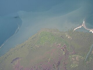
Lama Lama National Park is a national park on Cape York Peninsula in Far North Queensland, Australia. The name comes from the Lama Lama people who are the traditional owners of the land. The park protects coastal plains, beach ridges and sandy hills of the Annie River water catchment. The river marks the southern border of the park.
Mount Binga National Park is a national park at Mount Binga in the Toowoomba Region of the Darling Downs region in southern Queensland, Australia. The park lies within the catchment area of Emu Creek, a tributary of the Brisbane River and belongs to the South East Queensland bioregion.

Mount Lewis National Park is national park in both the Shire of Mareeba and Douglas Shire of Far North Queensland, Australia. It is adjacent to both Daintree National Park and Mount Spurgeon National Park. It is part of the Wet Tropics of Queensland and Einasleigh Uplands bioregions. The park lies within the catchment areas of the Mitchell River, Mossman River and Daintree Rivers. Mount Lewis National Park preserves part of the Mount Carbine Tableland.

The Mossman River is a river located in the Cape York Peninsula of Far North Queensland, Australia.
The Esk River is a river located in the Wet Tropics of Far North Queensland, Australia.
