The Border Ranges National Park is a protected national park that is located in the Northern Rivers region of New South Wales, Australia. A small portion of the national park is also located in South East Queensland. The 31,729-hectare (78,400-acre) park is situated approximately 150 kilometres (93 mi) south of Brisbane, north of Kyogle.

The Nightcap National Park is a national park situated within the Nightcap Range in the Northern Rivers region of New South Wales, Australia. The 8,080-hectare (20,000-acre) park was created in April 1983 and is situated 35 kilometres (22 mi) north of Lismore. The national park is classed by the IUCN World Commission on Protected Areas as Category II and is part of the Shield Volcano Group of the World Heritage Site Gondwana Rainforests of Australia inscribed in 1986 and added to the Australian National Heritage List in 2007. The park was severely burned during the 2019-2020 Australian brushfire season, and its biodiversity has likely been decimated.

Conondale National Park is 130 km north of Brisbane in the Sunshine Coast Hinterland near the town of Conondale in the south east Queensland bioregion. The park covers an area of 35,648 hectares protecting large areas of subtropical rainforest, woodlands, wet and dry sclerophyll forest including Queensland's tallest tree. The park contains areas of regenerating forest which have been previously logged; areas of forest plantations also border the park. The park is currently managed by the Queensland Government under the Nature Conservation Act 1992.

Erringibba is a national park at Glenmorgan in the far west of the Darling Downs region of southern Queensland, Australia, 329 km west of Brisbane. The park was established in 1999 and covers 8.77 km2 (3.39 sq mi). The park lies within the catchment area of the Condamine River and the Brigalow Belt South bioregion.

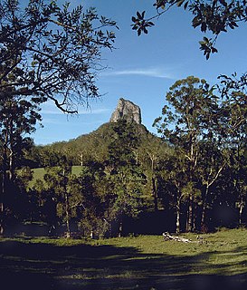
Glass House Mountains National Park is a heritage-listed national park at Glass House Mountains, Sunshine Coast Region, Queensland, Australia. It is also known as Beerburrum Forest Reserve 1. It is 70 km (43 mi) north of Brisbane and consists of a flat plain punctuated by rhyolite and trachyte volcanic plugs, the cores of extinct volcanoes that formed 27 million to 26 million years ago. The mountains would once have had pyroclastic exteriors, but these have eroded away.

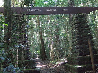
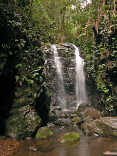
The Lamington National Park is a national park, lying on the Lamington Plateau of the McPherson Range on the Queensland/New South Wales border in Australia. From Southport on the Gold Coast the park is 85 kilometres (53 mi) to the southwest and Brisbane is 110 kilometres (68 mi) north. The 20,600 hectares Lamington National Park is known for its natural environment, rainforests, birdlife, ancient trees, waterfalls, walking tracks and mountain views.

The Main Range is a mountain range and national park in Queensland, Australia, located predominantly in Tregony, Southern Downs Region, 85 kilometres (53 mi) southwest of Brisbane. It is part of the World Heritage Site Gondwana Rainforests of Australia. It protects the western part of a semicircle of mountains in South East Queensland known as the Scenic Rim. This includes the largest area of rainforest in South East Queensland. The park is part of the Scenic Rim Important Bird Area, identified as such by BirdLife International because of its importance in the conservation of several species of threatened birds.

Mount Archer National Park is a national park in Central Queensland, Australia, 522 kilometres (324 mi) northwest of Brisbane. It makes up the backdrop to the city of Rockhampton which marks the start of Tropical Queensland.

Mount Walsh is a national park in Queensland, Australia, 230 km northwest of Brisbane.

The Gondwana Rainforests of Australia, formerly known as the Central Eastern Rainforest Reserves, are the most extensive area of subtropical rainforest in the world. Collectively, the rainforests are a World Heritage Site with fifty separate reserves totalling 366,500 hectares from Newcastle to Brisbane.

The Wet Tropics of Queensland World Heritage Site consists of approximately 8,940 km2 of Australian wet tropical forests growing along the north-east Queensland portion of the Great Dividing Range. The Wet Tropics of Queensland meets all four of the criteria for natural heritage for selection as a World Heritage Site. World Heritage status was declared in 1988, and on 21 May 2007 the Wet Tropics were added to the Australian National Heritage List.

Central Queensland is an ambiguous geographical division of Queensland that centres on the eastern coast, around the Tropic of Capricorn. Its major regional centre is Rockhampton. The region extends from the Capricorn Coast west to the Central Highlands at Emerald, north to the Mackay Regional Council southern boundary, and south to Gladstone. The region is also known as Capricornia. It is one of Australia's main coal exporting regions.

The Daintree Rainforest is a region on the northeast coast of Queensland, Australia, north of Mossman and Cairns. At around 1,200 square kilometres (460 sq mi), the Daintree is a part of the largest continuous area of tropical rainforest on the Australian continent. The Daintree Rainforest is a part of the Wet Tropics of Queensland Rainforest, that spans across the Cairns Region. The Wet Tropics Rainforest is the oldest continually surviving tropical rainforest in the world. Along the coastline north of the Daintree River, tropical forest grows right down to the edge of the sea.

Marcoola is a coastal town and locality in the Sunshine Coast Region, Queensland, Australia. It includes part of the pristine Mount Coolum national park, borders with the Maroochy River and is part of the Maroochy River Catchment Area and includes urban developments of Town of Seaside and Mount Coolum Shores. The name Marcoola was a coined name and reflects its location between MARoochydore and COOLum.

The Conondale Range is a mountain range in Queensland, located between Maleny, Kenilworth, Kilcoy and Jimna. The range is the most westerly part of the Sunshine Coast hinterland and part of the Great Dividing Range. The highest point on the range is Mount Langley reaching 868 m above sea level. This is also the highest point in the Brisbane River catchment.

Kuranda National Park is a national park in Far North Queensland, Australia. Like many national parks in the area it belongs to the Wet Tropics World Heritage Area. The park protects an important wildlife corridor in which rainforest and open eucalypt forest predominate. Walking, mountain biking and four-wheel driving are popular recreational activities.

Malaan National Park is a national park in the Tablelands Region of Far North Queensland, Australia. There are two sections to the park. The largest section occupies the western third of Beatrice and the eastern fringe of Ravenshoe on the Atherton Tableland. The smaller section is in the north of Maalan. It belongs to the Wet Tropics of Queensland bioregion. The park was established to protect significant animal and plant communities. The areas were previously known as Dirran State Forest. It is adjacent to Tully Gorge National Park and Mount Fisher Forest Reserve.

Mount Lewis National Park is national park in both the Shire of Mareeba and Douglas Shire of Far North Queensland, Australia. It is adjacent to both Daintree National Park and Mount Spurgeon National Park. It is part of the Wet Tropics of Queensland and Einasleigh Uplands bioregions. The park lies within the catchment areas of the Mitchell River, Mossman River and Daintree Rivers. Mount Lewis National Park preserves part of the Mount Carbine Tableland.

The Tewantin National Park is a 13 square kilometer national park in Queensland, Australia. It consists of five individual areas west of Noosa Heads in the Wide Bay-Burnett region about 115 kilometers north of Brisbane and 125 km south of Hervey Bay. The park is divided into disconnected sections within Lake Macdonald, Tinbeerwah, Tewantin and Noosaville.

The Windsor Tablelands are a series of plateaus located in Far North Queensland, Australia. The Windsor Tableland and surrounding rainforest area are contained as part of the Wet Tropics of Queensland, sitting between the Daintree Rainforest and Mount Lewis National Park. Additionally, the region is contained in the state electorate of Cook and situated in the greater Tablelands Region of North Queensland. The Tablelands hug the mountain ranges of the Great Dividing Range with the nearest town being Wujal Wujal. The Tableland area is a larger part of the Mount Windsor Forest Reserve which represents 44,000 hectares of land in the Wet Tropic region and is a conserved nature area, as proclaimed by the Government of Queensland in 2005. Predominately the majority of the Mount Windsor Tableland is closed off for any form of public use and access to the area is often only given on request. There is currently no residential population in the Mount Windsor Tableland region as a majority of the area is national park.


