Quinalow

Last updated

Quinalow
Queensland
Quinalow Hotel 001.JPG
Quinalow Hotel, 2017
Australia Queensland location map.svg
Red pog.svg
Quinalow
Coordinates 27°06′29″S151°37′21″E / 27.1080°S 151.6224°E / -27.1080; 151.6224 (Quinalow (town centre))
Population173 (2016 census locality) [1]
 • Density2.016/km2 (5.222/sq mi)
Postcode(s) 4403
Area85.8 km2 (33.1 sq mi)
Time zone AEST (UTC+10:00)
Location
LGA(s) Toowoomba Region
State electorate(s) Condamine
Federal division(s) Groom
Localities around Quinalow:
Moola Malling Maclagan
Irvingdale Quinalow Peranga
Brymaroo Brymaroo Kulpi

Quinalow is a rural town and locality in the Toowoomba Region, Queensland, Australia. [2] [3] In the 2016 census the locality of Quinalow had a population of 173 people. [1]

Contents

Geography

The town is located on Darling Downs in the north of the locality and on the bank of Myall Creek. [4]

Road infrastructure

The Dalby–Cooyar Road runs along the northern boundary. The Pechey-Maclagan Road runs through from south to north. [5]

History

The Daly brothers established the first butter-and-cheese factory on the Darling Downs in 1889 at Quinalow. [6] [7] The district was named Quinalow by the Daly brothers who named it after Catholic Bishop James Quinn who encouraged Irish Catholics suffering due to the Great Famine to immigrate and settle in the area. The -alow comes from the Irish word lough meaning a brook or stream. [8]

Quinalow Provisional School opened on 6 May 1901, with the original school building being completed on 26 February 1901 at a cost of 122 pound 17 shillings. [9] On 1 January 1909, it became Quinalow State School. In 1965 the school offered secondary schooling. In 1985 a pre-school was added. [10]

In August 1979 the original school building (built in 1901) was relocated to Daly Street ( 27°06′40″S151°37′25″E / 27.1111°S 151.6236°E / -27.1111; 151.6236 (Quinalow Library) ), where it was used as a preschool until the new preschool building was built at the school. The original school building was then opened in March 1984 as Quinalow Library. It underwent a major refurbishment in 2014. [11]

Quinalow was affected by the 2010–2011 Queensland floods. Rising floodwaters isolated the town, surrounding the Quinalow pub. Myall Creek was not thought to have risen as high as it did in the 1981 flood. [12]

In the 2011 census, Quinalow had a population of 411. [13]

In the 2016 census the locality of Quinalow had a population of 173 people. [1]

Education

Quinalow State School, 2017 Quinalow State School.JPG
Quinalow State School, 2017

Quinalow State School is a government primary and secondary (Prep-10) school for boys and girls at 7 Progress Street ( 27°06′27″S151°37′20″E / 27.1076°S 151.6222°E / -27.1076; 151.6222 (Quinalow Prep-10 State School) ). [14] [15] In 2018, the school had an enrolment of 78 students with 14 teachers (12 full-time equivalent) and 10 non-teaching staff (6 full-time equivalent). [16]

For secondary education to Year 12, the nearest government secondary schools are Dalby State High School in Dalby to the west and Oakey State High School in Oakey to the south. [4]

Amenities

Quinalow Library, 2017 Quinalow Library 001.JPG
Quinalow Library, 2017

The Toowoomba Regional Council operates a public library in Daly Street. [17]

Quinalow Public Hall is on the corner of Daly Street and Pechey Maclagan Road ( 27°06′40″S151°37′23″E / 27.1110°S 151.6230°E / -27.1110; 151.6230 (Quinalow Public Hall) ). [18]

Related Research Articles

<span class="mw-page-title-main">Dalby, Queensland</span> Town in Queensland, Australia

Dalby is a rural town and locality in the Western Downs Region, Queensland, Australia. In the 2016 census, the locality of Dalby had a population of 12,719 people.

<span class="mw-page-title-main">Highfields, Queensland</span> Town in Queensland, Australia

Highfields is a town and locality in the Toowoomba Region, Queensland, Australia. In 2017, it was the fastest growing area in Toowoomba. At 30 June 2019, the estimated resident population for the Highfields was 14,298.

<span class="mw-page-title-main">Kaimkillenbun</span> Town in Queensland, Australia

Kaimkillenbun is a rural town and locality in the Western Downs Region, Queensland, Australia. In the 2016 census, the locality of Kaimkillenbun had a population of 293 people.

Peranga is a rural town and locality in the Toowoomba Region, Queensland, Australia. In the 2016 census the locality of Peranga had a population of 85 people.

<span class="mw-page-title-main">Cecil Plains, Queensland</span> Town in Queensland, Australia

Cecil Plains is a rural town and locality in the Toowoomba Region, Queensland, Australia. In the 2016 census, the locality of Cecil Plains had a population of 429 people.

<span class="mw-page-title-main">Bowenville, Queensland</span> Town in Queensland, Australia

Bowenville is a rural town and locality in the Toowoomba Region, Queensland, Australia. The town's economy rested on the rail industry and with the winding down of the railways the population declined. In the 2016 census, the locality of Bowenville had a population of 250 people.

<span class="mw-page-title-main">Goombungee, Queensland</span> Town in Queensland, Australia

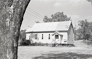
Goombungee is a rural town and locality in the Toowoomba Region, Queensland, Australia. In the 2016 census the locality of Goombungee had a population of 1,026 people.

<span class="mw-page-title-main">Wellcamp, Queensland</span> Suburb of Toowoomba Region, Queensland, Australia

Wellcamp is a rural locality in the Toowoomba Region, Queensland, Australia. In the 2016 census, Wellcamp had a population of 295 people.

Haden is a rural town and locality in the Toowoomba Region, Queensland, Australia. In the 2016 census, the locality of Haden had a population of 195 people.

<span class="mw-page-title-main">Jondaryan, Queensland</span> Town in Queensland, Australia

Jondaryan is a rural town and locality in the Toowoomba Region, Queensland, Australia. In the 2016 census, the locality of Jondaryan had a population of 385 people.

<span class="mw-page-title-main">Pechey, Queensland</span> Town in Queensland, Australia

Pechey is a rural locality in the Toowoomba Region, Queensland, Australia. In the 2016 census Pechey had a population of 105 people.

<span class="mw-page-title-main">Maclagan, Queensland</span> Town in Queensland, Australia

Maclagan is a rural town and locality in the Toowoomba Region, Queensland, Australia. In the 2016 census the locality of Maclagan had a population of 195 people.

<span class="mw-page-title-main">Southbrook, Queensland</span> Town in Queensland, Australia

Southbrook is a rural town and locality in the Toowoomba Region, Queensland, Australia. In the 2021 census, the locality of Southbrook had a population of 626 people.

Kulpi is a rural town and locality in the Toowoomba Region, Queensland, Australia. In the 2016 census, the locality of Kulpi had a population of 77 people.

<span class="mw-page-title-main">Whichello, Queensland</span> Suburb of Toowoomba Region, Queensland, Australia

Whichello is a rural locality in the Toowoomba Region, Queensland, Australia. In the 2016 census, Whichello had a population of 31 people.

<span class="mw-page-title-main">Brookstead, Queensland</span> Town in Queensland, Australia

Brookstead is a rural town and locality in the Toowoomba Region, Queensland, Australia. In the 2016 census, Brookstead had a population of 217 people.

Nutgrove is a rural locality in the Toowoomba Region, Queensland, Australia. In the 2016 census Nutgrove had a population of 32 people.

Highland Plains is a rural locality in the Toowoomba Region, Queensland, Australia. In the 2016 census, Highland Plains had a population of 41 people.

The roads that join the towns of Dalby, Oakey and Cooyar form a triangle that encloses some of the most fertile land on the Darling Downs in Queensland, Australia. These roads are the Warrego Highway, Oakey–Cooyar Road and Dalby–Cooyar Road. Several of the more significant internal roads intersect with Dalby–Cooyar Road, and these are briefly described in this article, along with some significant external roads.

The roads that join the towns of Dalby, Toowoomba and Cooyar form a triangle that encloses some of the most fertile land on the Darling Downs in Queensland, Australia. These roads are the Warrego Highway, New England Highway and Dalby–Cooyar Road. Pechey–Maclagan Road forms a large part of a group of roads that bisect the triangle from east to west, and is also part of one of the groups of roads that bisect from south to north.

References

  1. 1 2 3 Australian Bureau of Statistics (27 June 2017). "Quinalow (SSC)". 2016 Census QuickStats. Retrieved 20 October 2018. OOjs UI icon edit-ltr-progressive.svg
  2. "Quinalow – town in Toowoomba Region (entry 27830)". Queensland Place Names. Queensland Government . Retrieved 29 December 2020.
  3. "Quinalow – locality in Toowoomba Region (entry 49221)". Queensland Place Names. Queensland Government . Retrieved 29 December 2020.
  4. 1 2 "Queensland Globe". State of Queensland . Retrieved 7 March 2021.
  5. Quinalow, Queensland (Map). OpenStreetMap. Retrieved 23 March 2022.
  6. Kerr, John (January 1988). "Geographical Overview of Sawmilling: West to Ipswich and Toowoomba" (PDF). p. 78. Archived (PDF) from the original on 13 April 2020. Retrieved 7 March 2021.
  7. "NEWS OF THE DAY". Toowoomba Chronicle and Darling Downs General Advertiser . No. 4405. Queensland, Australia. 19 August 1890. p. 3. Retrieved 7 March 2021 via National Library of Australia.
  8. "Our school". Quinalow Prep-10 State School. 23 October 2019. Archived from the original on 26 February 2021. Retrieved 7 March 2021.
  9. Quinalow State School History Book. Quinalow State School. 2001. pp. 4–6.
  10. Queensland Family History Society (2010), Queensland schools past and present (Version 1.01 ed.), Queensland Family History Society, ISBN   978-1-921171-26-0
  11. "Public Libraries Statistical Bulletin 2016-17" (PDF). Public Libraries Connect. State Library of Queensland. November 2017. p. 16. Archived from the original on 30 January 2018. Retrieved 30 January 2018.{{cite web}}: CS1 maint: unfit URL (link)
  12. Noller, Miles (11 January 2011). "Quinalow Bar Stays Dry As Myall Creek Floods To The Floor Boards". Toowoomba News. Archived from the original on 6 July 2011. Retrieved 18 January 2011.
  13. "2011 Census QuickStats: Quinalow". Archived from the original on 5 March 2014. Retrieved 22 April 2013.
  14. "State and non-state school details". Queensland Government. 9 July 2018. Archived from the original on 21 November 2018. Retrieved 21 November 2018.
  15. "Quinalow Prep-10 State School". Archived from the original on 26 March 2020. Retrieved 21 November 2018.
  16. "ACARA School Profile 2018". Australian Curriculum, Assessment and Reporting Authority. Archived from the original on 27 August 2020. Retrieved 28 January 2020.
  17. "Quinalow Library". Public Libraries Connect. State Library of Queensland. 2 February 2017. Archived from the original on 29 January 2018. Retrieved 29 January 2018.
  18. "Event Revisioning Workshop - Quinalow Public Hall". user.tr.qld.gov.au. Archived from the original on 25 February 2021. Retrieved 7 March 2021.

Further reading