Felton, Queensland

Last updated

Felton
Queensland
Fields at Felton 2.jpg
Farms along Southbrook Road, 2014
Australia Queensland location map.svg
Red pog.svg
Felton
Coordinates 27°44′57″S151°44′14″E / 27.7491°S 151.7372°E / -27.7491; 151.7372 (Felton (centre of locality))
Population267 (2021 census) [1]
 • Density1.544/km2 (4.000/sq mi)
Postcode(s) 4358
Area172.9 km2 (66.8 sq mi)
Time zone AEST (UTC+10:00)
Location
LGA(s) Toowoomba Region
State electorate(s) Condamine
Federal division(s)
Suburbs around Felton:
Broxburn Southbrook
Cambooya
Greenmount
Scrubby Mountain Felton Nobby
North Branch Felton South Back Plains

Felton is a rural locality in the Toowoomba Region, Queensland, Australia. [2] In the 2021 census, Felton had a population of 267 people. [1]

Contents

Geography

Hodgson Creek flows across the area and forms part of the southwest boundary. [3]

Felton East is a neighbourhood ( 27°48′00″S151°46′00″E / 27.8°S 151.7666°E / -27.8; 151.7666 (Felton East (neighbourhood)) ). [4]

Felton has the following mountains:

History

The name Felton is taken from a pastoral run, which was named by pastoralist Charles Mallard, after his birthplace in England. [2]

In 1877, 7,800 acres (3,200 ha) were resumed from the Felton pastoral run and offered for selection on 17 April 1877. [8]

Mount Kent State School opened on 14 May 1883 and closed on 1959. [9] It was on Ted Mengel Road ( 27°50′41″S151°49′45″E / 27.8446°S 151.8292°E / -27.8446; 151.8292 (Mount Kent State School (former)) ). [10] [11]

Nunkulla State School opened in 1912 and closed in 1959. [9] It was at 34 Nunkulla Road ( 27°46′45″S151°47′16″E / 27.77930°S 151.78772°E / -27.77930; 151.78772 (Nunkulla State School (former)) ). [10] [11]

East Felton State School opened in October 1921 and closed in 1967. [9] It was at 2981 Toowoomba Karara Road ( 27°49′00″S151°45′28″E / 27.81674°S 151.75785°E / -27.81674; 151.75785 (East Felton State School (former)) ). [10] [11]

Felton Hall was built in 1931. In 2015 a new hall was built by relocating a building from St Anthony's Catholic School in Harristown, Toowoomba. [12]

Demographics

In the 2016 census, Felton had a population of 276 people. [13]

In the 2021 census, Felton had a population of 267 people. [1]

Education

There are no schools in Felton. The nearest government primary schools are:

The nearest government secondary schools are:

Amenities

Felton Hall is at 2775 Toowoomba Karara Road ( 27°48′06″S151°46′17″E / 27.8018°S 151.7713°E / -27.8018; 151.7713 (Felton Hall) ). [12] [14]

Related Research Articles

<span class="mw-page-title-main">Christopher Rolleston</span>

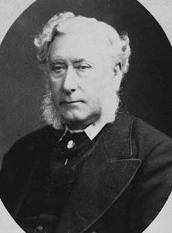
Christopher Rolleston was an English-born colonial public servant in Australia.

<span class="mw-page-title-main">Shire of Cambooya</span> Local government area in Queensland, Australia

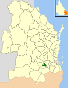
The Shire of Cambooya was a local government area in the Darling Downs region of Queensland, Australia, immediately south of the regional city of Toowoomba. The shire, administered from the town of Greenmount, covered an area of 638.5 square kilometres (246.5 sq mi), and existed as a local government entity from 1914 until 2008, when it amalgamated with several other councils in the Toowoomba area to form the Toowoomba Region.

<span class="mw-page-title-main">Cambooya, Queensland</span> Town in Queensland, Australia

Cambooya is a rural town and locality in the Toowoomba Region, Queensland, Australia. In the 2016 census the locality of Cambooya had a population of 1,584 people.

<span class="mw-page-title-main">Leyburn, Queensland</span> Town in Queensland, Australia

Leyburn is a rural town in the Southern Downs Region and a locality split between the South Downs Region and the Toowoomba Region in Queensland, Australia. In the 2016 census, Leyburn had a population of 476 people.

Wyreema is a rural town and locality in the Toowoomba Region, Queensland, Australia. In the 2016 census, the locality of Wyreema had a population of 1,834 people.

<span class="mw-page-title-main">Pampas, Queensland</span> Suburb of Toowoomba Region, Queensland, Australia

Pampas is a rural locality in the Toowoomba Region, Queensland, Australia. In the 2016 census, Pampas had a population of 62 people.

<span class="mw-page-title-main">East Greenmount, Queensland</span> Suburb of Toowoomba Region, Queensland, Australia

East Greenmount is a rural town and locality in the Toowoomba Region, Queensland, Australia. In the 2021 census, the locality of East Greenmount had a population of 351 people.

<span class="mw-page-title-main">Southbrook, Queensland</span> Town in Queensland, Australia

Southbrook is a rural town and locality in the Toowoomba Region, Queensland, Australia. In the 2021 census, the locality of Southbrook had a population of 626 people.

<span class="mw-page-title-main">Broxburn, Queensland</span> Suburb of Toowoomba Region, Queensland, Australia

Broxburn is a rural locality in the Toowoomba Region, Queensland, Australia. In the 2021 census, Broxburn had a population of 115 people.

<span class="mw-page-title-main">Linthorpe, Queensland</span> Suburb of Toowoomba Region, Queensland, Australia

Linthorpe is a rural locality in the Toowoomba Region, Queensland, Australia. In the 2021 census, Linthorpe had a population of 416 people.

Ellangowan is a rural locality in the Toowoomba Region, Queensland, Australia. In the 2021 census, Ellangowan had a population of 95 people.

Branchview is a rural locality in the Toowoomba Region, Queensland, Australia. In the 2021 census, Branchview had a population of 37 people.

<span class="mw-page-title-main">Bongeen, Queensland</span> Suburb of Toowoomba Region, Queensland, Australia

Bongeen is a rural locality in the Toowoomba Region, Queensland, Australia. In the 2021 census, Bongeen had a population of 71 people.

Irongate is a rural locality in the Toowoomba Region, Queensland, Australia. In the 2021 census, Irongate had a population of 135 people.

<span class="mw-page-title-main">North Branch, Queensland (Toowoomba Region)</span> Suburb of Toowoomba Region, Queensland, Australia

North Branch is a locality in the Toowoomba Region, Queensland, Australia. In the 2021 census, North Branch had a population of 48 people.

Norwin is a rural locality in the Toowoomba Region, Queensland, Australia. In the 2016 census, Norwin had a population of 94 people.

<span class="mw-page-title-main">Umbiram, Queensland</span> Suburb of Toowoomba Region, Queensland, Australia

Umbiram is a rural locality in the Toowoomba Region, Queensland, Australia. In the 2021 census, Umbiram had a population of 146 people.

<span class="mw-page-title-main">Yarranlea, Queensland</span> Suburb of Toowoomba Region, Queensland, Australia

Yarranlea is a rural locality in the Toowoomba Region, Queensland, Australia. In the 2021 census, Yarranlea had a population of 82 people.

Felton South is a rural locality in the Toowoomba Region, Queensland, Australia. In the 2021 census, Felton South had a population of 78 people.

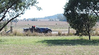
Toowoomba–Karara Road is a continuous 82.5 kilometres (51.3 mi) road route in the Toowoomba and Southern Downs regions of Queensland, Australia. Most of the route is signed as State Route 48. Toowoomba–Karara Road is a state-controlled district road. As part of State Route 48 it provides an alternate route between Toowoomba and Inglewood. It is also part of the shortest route from Toowoomba to Texas.

References

  1. 1 2 3 Australian Bureau of Statistics (28 June 2022). "Felton (SAL)". 2021 Census QuickStats. Retrieved 28 February 2023. OOjs UI icon edit-ltr-progressive.svg
  2. 1 2 "Felton – locality in Toowoomba Region (entry 49261)". Queensland Place Names. Queensland Government . Retrieved 21 July 2021.
  3. "Queensland Globe". State of Queensland . Retrieved 30 November 2022.
  4. "Felton East – locality unbounded in Toowoomba Regional (entry 12266)". Queensland Place Names. Queensland Government . Retrieved 21 July 2021.
  5. 1 2 "Mountain peaks and capes - Queensland". Queensland Open Data. Queensland Government. 12 November 2020. Archived from the original on 25 November 2020. Retrieved 25 November 2020.
  6. "Mount Perkins – mountain in Toowoomba Region (entry 26461)". Queensland Place Names. Queensland Government . Retrieved 25 November 2020.
  7. "Mount Rolleston – mountain in Toowoomba Region (entry 28953)". Queensland Place Names. Queensland Government . Retrieved 25 November 2020.
  8. "Proclamations under the New Land Acts". The Brisbane Courier . Queensland, Australia. 2 March 1877. p. 3. Archived from the original on 27 August 2020. Retrieved 19 February 2020 via Trove.
  9. 1 2 3 Queensland Family History Society (2010), Queensland schools past and present (Version 1.01 ed.), Queensland Family History Society, ISBN   978-1-921171-26-0
  10. 1 2 3 "Parish of Hodgson County of Aubigny" (Map). Queensland Government. 1930. Archived from the original on 30 November 2022. Retrieved 6 September 2023.
  11. 1 2 3 "Queensland Globe". State of Queensland . Retrieved 6 September 2023.
  12. 1 2 "Felton Hall - Community Halls - Toowoomba Region". Community Directory. Archived from the original on 14 December 2021. Retrieved 14 December 2021.
  13. Australian Bureau of Statistics (27 June 2017). "Felton (SSC)". 2016 Census QuickStats. Retrieved 20 October 2018. OOjs UI icon edit-ltr-progressive.svg
  14. "Felton Hall". Festival of Small Halls. Archived from the original on 14 December 2021. Retrieved 14 December 2021.

Commons-logo.svg Media related to Felton, Queensland at Wikimedia Commons