Acland, Queensland

Last updated

Acland
Queensland
Acland No. 2 Colliery (former) (2006).jpg
Acland No. 2 Colliery, 2006
Australia Queensland location map.svg
Red pog.svg
Acland
Coordinates 27°18′17″S151°41′25″E / 27.3047°S 151.6902°E / -27.3047; 151.6902 (Acland (town centre))
Population32 (2016 census) [1]
 • Density0.836/km2 (2.16/sq mi)
Established1912
Postcode(s) 4401
Area38.3 km2 (14.8 sq mi)
Time zone AEST (UTC+10:00)
Location
LGA(s) Toowoomba Region
State electorate(s) Condamine
Federal division(s) Groom
Localities around Acland:
Jondaryan Muldu Highland Plains
Jondaryan Acland Silverleigh
Greenwood
Jondaryan Devon Park Sabine

Acland is a rural town and locality in the Toowoomba Region, Queensland, Australia. [2] [3] In the 2016 census the locality of Acland had a population of 32 people. [1]

Contents

Originally built to support what would become Queensland's oldest continuously worked coal mine, the town had a population of between 200 and 400 prior to the mine being shut down in 1984. In 2008 almost all properties comprising the town were purchased by the new mine operators with the intention that they be demolished as the open cut mine expands into the town site. By 2009 there was only one remaining resident, Glenn Beutel, who had refused the company's offer to purchase his property.

Geography

Acland is north of Oakey, on the Darling Downs, 160 kilometres (100 mi) west of Queensland's state capital, Brisbane.

It lies in pasture country where there has been some dairy farming, horse breeding and coal mining. [4] [5] Rainfall was measured at the post office between 1912 and 1993, recording an average annual rainfall of 690 millimetres (27 in). [6]

History

The town of Acland is believed to be named by then Commission of Railways, Charles Barnard Evans, whose mother's maiden was Acland. [7] [8] It was originally known as Lagoon Creek. [9]

Lagoon Creek Provisional School opened on 22 July 1885. On 1 January 1909 it became Lagoon Creek State School. From 1915 to 1920 it was called Acland State School. It closed on 31 August 1930. [10]

Acland town developed following the mining of coal in the area by the Acland Coal Company. [11] The town had a police officer by 1913, at which time there was also a primary school nearby, known as Lagoon Creek. [12] Acland Railway Station Post Office opened on 1 May 1913. It was replaced by Acland Post Office in 1969, which closed October 1998. [13] [14]

Acland State School opened on 28 February 1921. A declining population meant the primary school had just 12 students by 2004 and it was mothballed in December 2004. [15] It was permanently closed on 24 August 2005. [10] [16] The school faced Allen Street and was bounded by Allen Street, William Street, Bellevue Street and South Streets ( 27°18′19″S151°41′30″E / 27.3054°S 151.6918°E / -27.3054; 151.6918 (Acland State School (former)) ). [17] [18] [19]

The Acland number two colliery opened in 1929, [20] and in the 1940s and 1950s it employed 52 people. [11]

Church of England in Acland after the tornado of 6 December 1952. Church of England in Acland after the tornado of 6 December 1952.jpg
Church of England in Acland after the tornado of 6 December 1952.

On Saturday 8 December 1952, most of the buildings in the town were damaged by a tornado. [21] The Anglican Church, the Presbyterian Church, the public hall and butcher's shop were all destroyed beyond repair. [22] [23]

St Jude's Anglican Church was dedicated on 21 June 1953 by Reverend Rupert Warner Shand. The church had been rebuilt after the previous church was destroyed by the tornado in December 1952. [24] Its closure on 5 December 2006 was approved by Venerable G. F. Harch, Archdeacon of The Downs. [25] In June 2015, it was relocated to the Jondaryan Woolshed to be used as a wedding chapel there. [26] [27] [28]

By 1971, with demand for coal for transport in decline, Acland was home to the only remaining coalmine on the Darling Downs. [20] The mine was Queensland's "oldest and smallest continuously worked coal mine" at the time of its closure in 1984. [29] The old colliery is state heritage-listed, being "the most intact mine site of its age and type in Queensland". [20] [30] From the mine's closure in 1984, to the sale of the site to the Shire of Rosalie in 2000, the workings were operated as a mining museum by Kath and John Greenhalgh, the owners of the farm on which the mine was located. [20] In September 2006 Kath & John Greenhalgh sold the land to New Acland Pastoral Company. [31]

In the 1980s Acland was a six-time winner of the Queensland Tidy Town Award for towns with a population between 200 and 400, [21] and the inaugural overall Tidy Town prize in 1989. [29]

In 1999, New Hope Coal moved into the area and established the New Acland Mine, an open cut coal mine that since 2005 has been New Hope's main coal producing operation. [32] Anticipating major expansion, the company began to purchase houses in Acland in advance of the area becoming an open cut mine pit, expected to produce 10 million tonnes of coal each year. Ahead of the mine's development, several Queensland bottle trees were prepared for transplantation to the new National Arboretum in Canberra. [33]

Acland reported a population of just 53 in the 2006 census. [34]

In December 2008 Glenn Beutel was the only remaining homeowner, having rejected the company's offer to purchase his house. [11] In mid-2010 Beutel continued to resist the company's offers, and was reported to still be maintaining the local park established by his parents. [35] [36] On Monday 4 June 2012, during a live broadcast of ABC TV show Q&A from Toowoomba's Empire Theatre, a question was asked by an audience member which made reference to Glenn Beutel being the last resident of Acland. [37]

In the 2016 census the locality of Acland had a population of 32 people. [1]

Heritage listings

Acland has a number of heritage-listed sites, including:

Education

There are no schools in Acland. The nearest government primary schools are Jondaryan State School in neighbouring Jondaryan to the south-east, Oakey State School in Oakey to the south, Goombungee State School in Goombungee to the east, and Kulpi State School in Kulpi to the north-west. The nearest government secondary school is Oakey State High School in Oakey to the south. [19]

Notable people

Australian radio broadcaster, Alan Jones attended Acland State School from 1946. [15] [39]

See also

Related Research Articles

<span class="mw-page-title-main">Oakey, Queensland</span> Town in Queensland, Australia

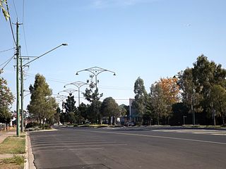
Oakey is a rural town and locality in the Toowoomba Region, Queensland, Australia. The Museum of Army Aviation is located at Oakey Airport.

<span class="mw-page-title-main">Darling Downs</span> Region in Queensland, Australia

The Darling Downs is a farming region on the western slopes of the Great Dividing Range in southern Queensland, Australia. The Downs are to the west of South East Queensland and are one of the major regions of Queensland. The name was generally applied to an area approximating to that of the Condamine River catchment upstream of Condamine township but is now applied to a wider region comprising the Southern Downs, Western Downs, Toowoomba and Goondiwindi local authority areas. The name Darling Downs was given in 1827 by Allan Cunningham, the first European explorer to reach the area and recognises the then Governor of New South Wales, Ralph Darling.

<span class="mw-page-title-main">Warrego Highway</span> Highway in Queensland

The Warrego Highway is located in southern Queensland, Australia. It connects coastal centres to the south western areas of the state, and is approximately 715 km in length. It takes its name from the Warrego River, which is the endpoint of the highway. The entire highway is part of the National Highway system linking Darwin and Brisbane: formerly National Highway 54, Queensland began to convert to the alphanumeric system much of Australia had adopted in the early-2000s and this road is now designated as National Highway A2.

<span class="mw-page-title-main">Shire of Jondaryan</span> Local government area in Queensland, Australia

The Shire of Jondaryan was a local government area located in the Darling Downs region of Queensland, Australia, immediately west of the regional city of Toowoomba. The shire, administered from the town of Oakey, covered an area of 1,910.0 square kilometres (737.5 sq mi), and existed as a local government entity from 1890 until 2008, when it amalgamated with several other councils in the Toowoomba area to form the Toowoomba Region. Its growth in later years has been fuelled by the expansion of Toowoomba and suburbs such as Glenvale and Westbrook.

<span class="mw-page-title-main">Shire of Rosalie</span> Local government area in Queensland, Australia

The Shire of Rosalie was a local government area in the Darling Downs region of Queensland, Australia, immediately northwest of the regional city of Toowoomba. The shire, administered from the town of Goombungee, covered an area of 2,200.7 square kilometres (849.7 sq mi), and existed as a local government entity from 1879 until 2008. In 2008, it amalgamated with several other councils in the Toowoomba area to form the Toowoomba Region.

Gowrie Junction is a rural locality in the Toowoomba Region, Queensland, Australia. It is north-west of Toowoomba. In the 2021 census, Gowrie Junction had a population of 2,030 people. The town of Gowrie is in the eastern part of the locality.

The New Acland Mine is located adjacent to Acland township, about 10 km north of Oakey on the Darling Downs in Queensland, Australia. Geologically it is part of the Wallon Coal Measures and contains more than 500 million tonnes of coal that is removed by the open cut method. The mine is owned and operated by New Hope Coal. As of Monday, September 2, 2019, the mine has become mothballed due to extension applications being denied. A stockpile will require trains to run for a little while longer, roughly twelve months.

The Cooyar railway line was a branch line in the Darling Downs region of Queensland, Australia. The small town of Cooyar is about halfway to Kingaroy in the South Burnett Region. A plan to connect Kingaroy to the south via Cooyar did not eventuate and left Cooyar at the terminus of a branch line running from Oakey west of Toowoomba. It was opened on 28 April 1913 after previous stages to Kulpi and Peranga opened on 29 April 1912 and 4 November 1912 respectively. The line was partially closed beyond Acland on 1 May 1964, with the last segment closed on 8 December 1969.

<span class="mw-page-title-main">Kingsthorpe, Queensland</span> Town in Queensland, Australia

Kingsthorpe is a rural town and locality in the Toowoomba Region, Queensland, Australia. In the 2021 census, the locality of Kingsthorpe had a population of 2,159 people.

<span class="mw-page-title-main">Bowenville, Queensland</span> Town in Queensland, Australia

Bowenville is a rural town and locality in the Toowoomba Region, Queensland, Australia. The town's economy rested on the rail industry and with the winding down of the railways the population declined. In the 2016 census, the locality of Bowenville had a population of 250 people.

<span class="mw-page-title-main">Jondaryan, Queensland</span> Town in Queensland, Australia

Jondaryan is a rural town and locality in the Toowoomba Region, Queensland, Australia. In the 2016 census, the locality of Jondaryan had a population of 385 people.

<span class="mw-page-title-main">Western railway line, Queensland</span> Railway line in Queensland, Australia

The Western railway line is a narrow gauge railway, connecting the south-east and south-west regions of Queensland, Australia. It commences at Toowoomba, at the end of the Main Line railway from Brisbane, and extends west 810 km to Cunnamulla, passing through the major towns of Dalby, Roma and Charleville, although services on the 184 km section from Westgate to Cunnamulla have been suspended since 2011. The Queensland Government was the first railway operator in the world to adopt narrow gauge for a main line, and this remains the system-wide gauge.

<span class="mw-page-title-main">Acland No. 2 Colliery</span> Historic site in Queensland, Australia

Acland No. 2 Colliery is a heritage-listed former mine at 2 Francis Street, Acland, Toowoomba Region, Queensland, Australia. It was added to the Queensland Heritage Register on 29 June 2007.

<span class="mw-page-title-main">Boodua, Queensland</span> Suburb of Toowoomba Region, Queensland, Australia

Boodua is a rural locality in the Toowoomba Region, Queensland, Australia. In the 2016 census Boodua had a population of 93 people.

<span class="mw-page-title-main">David Janetzki</span> Australian politician

David Carl Janetzki is an Australian politician. He was elected to the Queensland Legislative Assembly representing the seat of Toowoomba South for the Liberal National Party at a Toowoomba South state by-election in July 2016.

Silverleigh is a rural locality in the Toowoomba Region, Queensland, Australia. In the 2016 census, Silverleigh had a population of 71 people.

Kings Siding is a rural locality in the Toowoomba Region, Queensland, Australia. In the 2021 census, Kings Siding had a population of 15 people.

Oakey–Cooyar Road is a continuous 58.8 kilometres (36.5 mi) road route in the Darling Downs and Toowoomba regions of Queensland, Australia. The entire route is signed as State Route 68. It is a state-controlled part regional and part district road . It provides an alternate route between the Warrego Highway and the New England Highway, bypassing Toowoomba.

The roads that join the towns of Dalby, Oakey and Cooyar form a triangle that encloses some of the most fertile land on the Darling Downs in Queensland, Australia. These roads are the Warrego Highway, Oakey–Cooyar Road and Dalby–Cooyar Road. Several of the more significant internal roads intersect with Dalby–Cooyar Road, and these are briefly described in this article, along with some significant external roads.

The roads that join the towns of Dalby, Toowoomba and Cooyar form a triangle that encloses some of the most fertile land on the Darling Downs in Queensland, Australia. These roads are the Warrego Highway, New England Highway and Dalby–Cooyar Road. Pechey–Maclagan Road forms a large part of a group of roads that bisect the triangle from east to west, and is also part of one of the groups of roads that bisect from south to north.

References

  1. 1 2 3 Australian Bureau of Statistics (27 June 2017). "Acland (SSC)". 2016 Census QuickStats. Retrieved 20 October 2018. OOjs UI icon edit-ltr-progressive.svg
  2. "Acland – town in Toowoomba Region (entry 42711)". Queensland Place Names. Queensland Government . Retrieved 29 December 2020.
  3. "Acland – locality in Toowoomba Region (entry 47882)". Queensland Place Names. Queensland Government . Retrieved 29 December 2020.
  4. "Downs Breeders – Great Record". The Brisbane Courier. 4 June 1930. Retrieved 19 July 2010.
  5. Masters, pp. 3–12.
  6. Masters, p. 14
  7. "SKETCHER". The Queenslander . 28 March 1914. p. 8. Archived from the original on 2 December 2020. Retrieved 16 April 2014 via National Library of Australia.
  8. "Bernard Charles Acland". 1921/B33745. Queensland Registrar-General of Births, Deaths and Marriages. Archived from the original on 21 July 2015. Retrieved 16 April 2014.
  9. "Mr D. Connell (obituary)". The Brisbane Courier. 31 January 1931. Retrieved 19 July 2010.
  10. 1 2 Queensland Family History Society (2010), Queensland schools past and present (Version 1.01 ed.), Queensland Family History Society, ISBN   978-1-921171-26-0
  11. 1 2 3 Logan, Madeleine. "Acland is a lonely place". Toowoomba Chronicle. Archived from the original on 15 November 2009. Retrieved 30 September 2009.
  12. Masters, pp 5, 6, 14.
  13. Phoenix Auctions History. "Post Office List". Phoenix Auctions. Retrieved 21 March 2021.
  14. Greenhalgh, Kath (2011). Acland from Coal Town to Tidy Town. Oakey Qld.: Bernborough Press. ISBN   9780646562193.
  15. 1 2 "Closing of school shows neglect of bush: Jones". Toowoomba Chronicle. 3 December 2004. Archived from the original on 6 July 2011. Retrieved 30 September 2009.
  16. "Queensland state school – centre closures" (PDF). Queensland Government . 20 August 2013. Archived (PDF) from the original on 20 March 2022. Retrieved 6 April 2022.
  17. "Parish of Watts" (Map). Queensland Government. 1943. Archived from the original on 26 March 2021. Retrieved 26 March 2021.
  18. Google (22 April 2022). "Acland State School (former)" (Map). Google Maps . Google. Retrieved 22 April 2022.
  19. 1 2 "Queensland Globe". State of Queensland . Retrieved 26 March 2021.
  20. 1 2 3 4 "Acland No. 2 Colliery (former) (entry 602599)". Queensland Heritage Register . Queensland Heritage Council. Retrieved 30 September 2009.
  21. 1 2 Watson, Judy (13 August 1989). "Gritty gran carves out an oasis". The Sunday Mail (Brisbane) .
  22. "FOUR TOWNS REPAIR HAVOC". The Courier-mail . No. 5001. Queensland, Australia. 8 December 1952. p. 1. Retrieved 28 July 2020 via National Library of Australia.
  23. "CHURCH STOOD HERE: DOWNS TORNADO WRECKAGE". The Courier-mail . No. 5001. Queensland, Australia. 8 December 1952. p. 5. Retrieved 28 July 2020 via National Library of Australia.
  24. "Tornado-Demolished Church Replaced". Warwick Daily News . No. 10, 566. Queensland, Australia. 22 June 1953. p. 1. Retrieved 27 July 2020 via National Library of Australia.
  25. Anglican Church of Southern Queensland. "Closed Churches". Archived from the original on 3 April 2019. Retrieved 3 July 2020.
  26. "Acland Anglican Church – Former". Churches Australia. Archived from the original on 13 December 2021. Retrieved 13 December 2021.
  27. "Acland Anglican Church – Former". Churches Australia. Archived from the original on 13 December 2021. Retrieved 13 December 2021.
  28. "Highway sight to see as last church removed from Acland". Australian Broadcasting Corporation. 18 June 2015. Archived from the original on 13 December 2021. Retrieved 13 December 2021.
  29. 1 2 Nason, James (6 November 2008). "The coal truth of life next to a mine". Country Life.
  30. Morley, Peter (18 October 2008). "Lone stand as coalminers poised to bulldoze Acland". Courier Mail (Brisbane). Retrieved 30 September 2009.
  31. "Opponents wary as plans instill new hope in coal mine". Archived from the original on 7 November 2014. Retrieved 7 November 2014.
  32. New Hope Corporation (2005). Directors' Annual Report and Financial Statements 2005 (PDF). Brisbane: New Hope Corporation. pp. 2–4. Archived (PDF) from the original on 4 October 2009. Retrieved 30 September 2009.
  33. Stewart, Frances (9 May 2010). "Orphaned trees find a home at National Arboretum". Sunday Canberra Times. p. 20.
  34. Australian Bureau of Statistics (25 October 2007). "Acland (Rosalie Shire) (State Suburb)". 2006 Census QuickStats. Retrieved 20 September 2011.
  35. Houghton, Des (3 April 2010). "Glen Beutel yet to sell home as Acland coal mine closes in". The Courier Mail. Archived from the original on 1 February 2011. Retrieved 19 July 2010.
  36. Taylor, John (3 May 2010). "Fighting to keep Acland alive". 7:30 Report. Australian Broadcasting Corporation. Archived from the original on 13 May 2010. Retrieved 19 July 2010.
  37. "ABC Q&A Episode broadcast live from Toowoomba's Empire Theatre on 4 June 2012 – click on link and go to 30:33". Australian Broadcasting Corporation . Archived from the original on 6 June 2012. Retrieved 7 June 2012.
  38. "Acland No. 2 Colliery (former) (entry 602599)". Queensland Heritage Register . Queensland Heritage Council. Retrieved 15 July 2013.
  39. Masters, p. 36.

Sources

Further reading