Pilton is a rural town and locality in the Toowoomba Region, Queensland, Australia. It is south of the city of Toowoomba. In the 2021 census, the locality of Pilton had a population of 71 people.

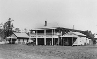
Cooyar is a rural town and locality in the Toowoomba Region, Queensland, Australia. In the 2021 census, the locality of Cooyar had a population of 231 people.
Mount Rascal is a rural locality in the Toowoomba Region, Queensland, Australia. In the 2021 census, Mount Rascal had a population of 393 people.
Top Camp is a locality in the Toowoomba Region, Queensland, Australia. In the 2021 census, Top Camp had a population of 902 people.
Prince Henry Heights is a residential locality on the outskirts of Toowoomba in the Toowoomba Region, Queensland, Australia. In the 2021 census, Prince Henry Heights had a population of 600 people.

Mount Irving is a rural locality in the Toowoomba Region, Queensland, Australia. In the 2021 census, Mount Irving had a population of 34 people.
Clontarf is a rural locality in the Toowoomba Region, Queensland, Australia. In the 2021 census, Clontarf had a population of 28 people.
Sandy Camp is a locality in the Toowoomba Region, Queensland, Australia. In the 2021 census, Sandy Camp had a population of 104 people.
Turallin is a rural town and locality in the Toowoomba Region, Queensland, Australia. In the 2021 census, the locality of Turallin had a population of 64 people.
Millmerran Woods is a rural locality in the Toowoomba Region, Queensland, Australia. In the 2021 census, Millmerran Woods had a population of 152 people.
Millmerran Downs is a rural locality in the Toowoomba Region, Queensland, Australia. In the 2021 census, Millmerran Downs had a population of 103 people.
Cypress Gardens is a rural residential locality in the Toowoomba Region, Queensland, Australia. In the 2021 census, Cypress Gardens had a population of 94 people.
Forest Ridge is a rural locality in the Toowoomba Region, Queensland, Australia. In the 2021 census, Forest Ridge had a population of 30 people.
Condamine Farms is a rural locality in the Toowoomba Region, Queensland, Australia. In the 2021 census, Condamine Farms had a population of 28 people.
Condamine Plains is a rural locality in the Toowoomba Region, Queensland, Australia. In the 2021 census, Condamine Plains had a population of 101 people.
Dunmore is a rural locality in the Toowoomba Region, Queensland, Australia. In the 2021 census, Dunmore had a population of 39 people.
East Cooyar is a rural locality in the Toowoomba Region, Queensland, Australia. In the 2021 census, East Cooyar had a population of 27 people.
Upper Pinelands is a rural locality in the Toowoomba Region, Queensland, Australia. In the 2021 census, Upper Pinelands had a population of 49 people.
Grassdale is a rural locality in the Toowoomba Region, Queensland, Australia. In the 2021 census, Grassdale had "no people or a very low population".
Grays Gate is a rural locality in the Toowoomba Region, Queensland, Australia. In the 2021 census, Grays Gate had a population of 28 people.


