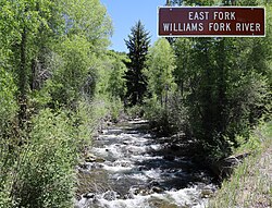
Roaring Fork River is a tributary of the Colorado River, approximately 70 miles (110 km) long, in west central Colorado in the United States. The river drains a populated and economically vital area of the Colorado Western Slope called the Roaring Fork Valley or Roaring Fork Watershed, which includes the resort city of Aspen and the resorts of Aspen/Snowmass.

The Fryingpan River is a tributary of the Roaring Fork River, approximately 42 miles (68 km) long, in west central Colorado in the United States.
The Williams Fork is a 27.4-mile-long (44.1 km) tributary of the Yampa River, in north central Colorado in the United States.
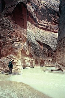
The Paria River is a tributary of the Colorado River, approximately 95 miles (153 km) long, in southern Utah and northern Arizona in the United States. It drains a rugged and arid region northwest of the Colorado, flowing through roadless slot canyons along part of its course.
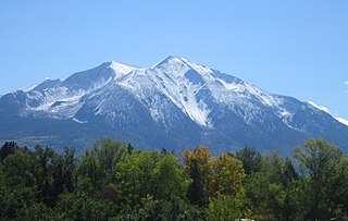
Mount Sopris is a twin-summit mountain in the northwestern Elk Mountains range of the Rocky Mountains of North America. The prominent 12,965-foot (3,952 m) mountain is located in the Maroon Bells-Snowmass Wilderness of White River National Forest, 6.6 miles (10.7 km) north by northeast of the community of Redstone in Pitkin County, Colorado, United States.

The South Fork South Platte River is a tributary of the South Platte River, approximately 45 miles (72 km) long, in central Colorado in the United States. It is located near the headwaters of the South Platte in Park County, Colorado and drains part of the intermontane grassland basin of South Park. It forms the South Platte by its confluence with the Middle Fork South Platte River in southern South Park.
The North Fork Cache la Poudre River is a tributary of the Cache la Poudre River, approximately 59.2 miles (95.3 km) long, in north central Colorado in the United States. It drains a mountainous area of north central Larimer County northwest of Fort Collins on the western side of the Laramie Foothills.

The Williams River is a tributary of the Gauley River, 33 miles (53 km) long, in east-central West Virginia, USA. Via the Gauley, Kanawha and Ohio Rivers, it is part of the watershed of the Mississippi River, draining an area of 132 square miles (342 km²) in a sparsely populated region of the southern Allegheny Mountains and the unglaciated portion of the Allegheny Plateau.

The Arikaree River is a 156-mile-long (251 km) river in the central Great Plains of North America. It lies mostly in the American state of Colorado, draining land between the North and South Forks of the Republican River, and it flows into the North Fork in Nebraska after flowing a short distance through Kansas. It is a designated area within the Colorado Natural Areas Program to protect native and uncommon species that may be endangered or threatened.

Black Mountain is a mountain located in Catron County, New Mexico, on the northern boundary of the Gila Wilderness and in the Gila National Forest.

Boulder Creek is a 31.4-mile-long (50.5 km) creek draining the Rocky Mountains to the west of Boulder, Colorado, as well as the city itself and surrounding plains.

The Puerco River or Rio Puerco is a tributary of the Little Colorado River in northwestern New Mexico and northeastern Arizona. It flows through arid terrain, including the Painted Desert.

The Williams Fork is a tributary of the Colorado River, approximately 33.8 miles (54.4 km) long, in north central Colorado in the United States. It flows through Grand County between the valleys of the Fraser River and the Blue River. It rises at the juncture of McQueary and Bobtail creeks just west of the Continental Divide 8 miles (13 km) west of Berthoud Pass and 7 miles (11 km) north of the Eisenhower Tunnel in the Arapaho National Forest. It flows north-northwest to the Williams Fork Reservoir, then turns northeast and joins the Colorado at Parshall.
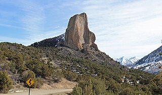
Needle Rock Natural Area is located at the western edge of the West Elk Mountains of Colorado. The surrounding terrain is characterized by laccolithic mountains flanked by precipitous cliffs, extensive talus aprons, forested mesas, canyons, and spacious, well-watered intermontane basins. Needle Rock is an intrusive plug of monzonite porphyry cropping out 3.5 miles (5.6 km) east-northeast of the Town of Crawford in Delta County, Colorado, United States. At an elevation of 7,797 feet (2,377 m), the towering rock spire stands 800 feet (240 m) tall above the floor of the Smith Fork of the Gunnison River valley. The massive rock feature originated in the Oligocene geological epoch when magma intruded between existing sedimentary rocks as the crown of a buried laccolith or possibly the underlying conduit of a laccolith. Subsequent erosion has exposed the prominent rock formation seen in the natural area today.
South Fork Crystal River is a tributary of the Crystal River in Gunnison County, Colorado, United States. The stream's source is the confluence of Rock Creek and the East Fork in the White River National Forest. It flows through Crystal Canyon to a confluence with the North Fork Crystal River that forms the Crystal River.
East Fork South Fork Crystal River is a tributary of the South Fork Crystal River in Gunnison County, Colorado. The stream's source is on the west side of West Maroon Peak in the Maroon Bells-Snowmass Wilderness. It flows west to a confluence with Rock Creek in the White River National Forest that forms the South Fork Crystal River.
North Fork West Mancos River is a tributary of the West Mancos River in Montezuma County, Colorado. The river flows from a source east of Hesperus Mountain in the San Juan National Forest to a confluence with the South Fork that forms the West Mancos River.

Ptarmigan Peak is the highest summit of the South Williams Fork Mountains range in the Rocky Mountains of North America. The peak is north of Dillon, CO in the White River National Forest.
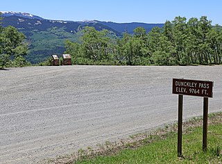
Dunckley Pass is a high mountain pass in The Flat Tops mountains of western Colorado. Rio Blanco County Road 8, a gravel road, traverses the pass, which divides the watersheds of East Fork Williams Fork and Fish Creek.
