East India Docks

Last updated
East India Docks
East India dock 1806.jpg
East India dock looking south towards the River Thames, 1806. The original Brunswick dock and mast house (latterly known as the Export Dock) can be seen alongside the river. The Import Dock is in the foreground.
Location London
Coordinates 51°30′29″N0°00′04″E / 51.5081°N 0.001°E / 51.5081; 0.001
Built1803
Built for East India Company
Demolished1967
Architect Ralph Walker
Tower Hamlets London UK location map.svg
Red pog.svg
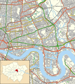
Location of East India Docks in London Borough of Tower Hamlets

The East India Docks were a group of docks in Blackwall, east London, north-east of the Isle of Dogs. Today only the entrance basin and listed perimeter wall remain visible.

Contents

History

Early history

Brunswick Dock, which became the Export Dock Brunswick dock London 1800s.jpg
Brunswick Dock, which became the Export Dock
East India Export Dock, 1843 East India Export Dock (1843).jpg
East India Export Dock, 1843
Union-Castle liners in East India Docks in 1902 Union-Castle liners in the East India Docks.jpg
Union-Castle liners in East India Docks in 1902

Following the successful creation of the West India Docks which opened in 1802, an Act of Parliament in 1803 set up the East India Dock Company, promoted by the Honourable East India Company. Joseph Cotton was chairman of the Dock Company from 1803. [1] The foundation stone was laid on 11 March 1805 [2] and the sluices of its floating gate opened on 26 July 1806, being ready to receive ships five days later. [3]

The docks, designed by engineer Ralph Walker, [4] were located to the north-east of the West India Docks. They were based on the existing Brunswick Dock, which had been used for fitting out and repairing ships as part of Blackwall Yard. The Brunswick Dock, which had originally been connected directly to the Thames to the south, became the Export Dock. To the north the company built a larger 18-acre (7.3 ha) Import Dock. Both were connected to the Thames via an eastern entrance basin. [5]

The company rapidly became profitable through its trade in commodities such as tea, spices, indigo, silk and Persian carpets. The tea trade alone was worth £30 million a year. The docks spawned further local industry, with spice merchants and pepper grinders setting up around the dock to process goods. [6]

In 1838 the two companies merged to form the East and West India Docks Company. In 1886, in the last act of a ruinous game of leapfrog with the London & St Katharine Dock Company, they built the Tilbury Docks. The East and West India Docks Company operated in cooperation with the London & St Katharine Dock Company from 1888, and the two companies merged as the London and India Docks Company on 1 January 1901. On 31 March 1909 the docks were taken over by the Port of London Authority, along with the other enclosed docks. [7]

While much smaller than the West India Docks or the later Royal Docks, the East India Docks could still handle East Indiamen of 1,000 tons and up to 250 ships at one time. However the advent of steam power and larger ships reduced the importance of this dock. [6] The docks played a key role in the Second World War as a location for constructing the floating Mulberry harbours used by the Allies to support the D-Day landings in France. [8]

After the war, during which all the docks were badly damaged, the East India Docks were confined to occasional Channel Islands traffic and to the maintenance of equipment including dredgers. [6]

Brunswick Wharf Power Station, a monumental brick structure with fluted concrete chimneys, was built on the site of the Export Dock in stages between 1946 and 1956; it has since been decommissioned and demolished. [9]

From the 1960s onwards, the East India Docks experienced a steady decline – as did all of London's other docks – as the shipping industry adopted containerisation, which effectively moved traffic downstream to Tilbury. [10] In 1967 the East India Docks were the first of the London docks to close. [5]

Layout

The original docks consisted of an Import Dock of 18 acres (73,000 m2) of water, to the north of the site, and an Export Dock of 15 acres (61,000 m2), to the south of the site. [5] There was also an Entrance Dock of 2.75 acres (11,100 m2) of water on the east of the site. [5]

Redevelopment

The boundary wall, on the west side of the Republic office campus London Borough of Tower Hamlets - East India Dock Boundary Wall - 20220904171108.jpg
The boundary wall, on the west side of the Republic office campus

In the late 20th century the docks were mostly filled in and only the entrance basin remains, as a wildlife refuge and an attractive local amenity. Since 1994 the area has been served by its own Docklands Light Railway East India station. [11]

Developments on the site of the Import Dock include the Mulberry Place in 1992 [12] and the Republic campus with offices, retail and public space which was largely completed in 2019. [13] Two buildings on the campus have been renamed as Import and Export to provide a nod to the site's past. [14] The names of the streets on the site of the Import Dock reflect the names of some of the goods traded here: Clove Crescent, Nutmeg Lane, Coriander Avenue, Oregano Drive, Rosemary Drive and Saffron Avenue. [15]

Meanwhile the site of the Export Dock was converted for residential use with an amenity with mature trees known as Virginia Quay Park. [16]

Related Research Articles

<span class="mw-page-title-main">Isle of Dogs</span> Area in the East End of London, England

The Isle of Dogs is a large peninsula bounded on three sides by a large meander in the River Thames in East London, England, which includes the Cubitt Town, Millwall and Canary Wharf districts. The area was historically part of the Manor, Hamlet, Parish and, for a time, the wider borough of Poplar. The name had no official status until the 1987 creation of the Isle of Dogs Neighbourhood by Tower Hamlets London Borough Council. It has been known locally as simply "the Island" since the 19th century.

<span class="mw-page-title-main">Poplar, London</span> Area of East London, England

Poplar is a district in East London, England, now part of the London Borough of Tower Hamlets. Five miles (8 km) east of Charing Cross, it is part of the East End.

The Port of London is that part of the River Thames in England lying between Teddington Lock and the defined boundary with the North Sea and including any associated docks. Once the largest port in the world, it was the United Kingdom's largest port as of 2020. Usage is largely governed by the Port of London Authority ("PLA"), a public trust established in 1908; while mainly responsible for coordination and enforcement of activities it also has some minor operations of its own.

<span class="mw-page-title-main">West India Docks</span> Historic dock site, now part of Canary Wharf area.

The West India Docks are a series of three docks, quaysides and warehouses built to import goods from and export goods and occasionally passengers to the British West Indies on the Isle of Dogs in London the first of which opened in 1802. Following their commercial closure in 1980, the Canary Wharf development was built around the wet docks by narrowing some of their broadest tracts.

<span class="mw-page-title-main">Blackwall, London</span> Area of the East End of London, England

Blackwall is an area of Poplar, in the London Borough of Tower Hamlets, East London. The neighbourhood includes Leamouth and the Coldharbour conservation area.

<span class="mw-page-title-main">Leamouth</span> Human settlement in England

Leamouth is a locality in the Blackwall area of the London Borough of Tower Hamlets. The area takes its name from the former Leamouth Wharf and lies on the west side of the confluence of the Bow Creek stretch of the Lea, at its confluence with the River Thames.

<span class="mw-page-title-main">Millwall Dock</span> Historic site in London

Millwall Dock is a dock at Millwall, London, England, located south of Canary Wharf on the Isle of Dogs.

<span class="mw-page-title-main">City Canal</span> Former canal excavated across the Isle of Dogs in east London

The City Canal was a short, and short-lived, canal excavated across the Isle of Dogs in east London, linking two reaches of the River Thames. Today, it has been almost completely reconstructed to form the South Dock of the West India Docks.

<span class="mw-page-title-main">Blackwall Yard</span> Former shipyard in Blackwall, London

Blackwall Yard is a small body of water that used to be a shipyard on the River Thames in Blackwall, engaged in ship building and later ship repairs for over 350 years. The yard closed in 1987.

<span class="mw-page-title-main">Brunswick Wharf Power Station</span> Former coal and oil-fired power station

Brunswick Wharf Power Station was a coal- and oil-fired power station on the River Thames at Blackwall in London. The station was planned from 1939 by Poplar Borough Council but construction only started in 1947 after the Second World War. It was decommissioned in 1984, and the site was redeveloped.

John Aird & Co. was once a leading British civil engineering business based in London.

<span class="mw-page-title-main">A1206 road (Great Britain)</span> Road around the Isle of Dogs, in the east of London, England

The A1206, also known as the Isle of Dogs Distributor Road, is a crescent-shaped ring road around the Isle of Dogs, in the East End of London. It is made up of Westferry Road, Manchester Road and Prestons Road and is the main road through the area, connecting parts of the London Docklands.

<span class="mw-page-title-main">Frederick Palmer (engineer)</span> British civil engineer (1862–1934)

Sir Frederick Palmer was a British civil engineer.

London Yard was a shipyard in London, in use between around 1856 and 1908 by various shipbuilding companies, including Westwood, Baillie and Yarrow Shipbuilders.

<span class="mw-page-title-main">John Perry (shipbuilder)</span>

John Perry was the founder of the Blackwall Yard, where he built ships largely for the East India Company.

<span class="mw-page-title-main">East India Dock Road</span> Major arterial route in London

East India Dock Road is a major arterial route from Limehouse to Canning Town in London. The road takes its name from the former East India Docks in the Port of London, and partly serves as the high street of Poplar. To the west it becomes Commercial Road and to the east Newham Way. It forms part of the A13, a major road connecting the historic City of London to Tilbury and Southend.

Sir Henry Johnson was an English shipbuilder and politician who sat in the House of Commons in 1679. He was one of the leading commercial shipbuilders on the River Thames during the period of enormous mercantile expansion and the Dutch wars after the Restoration..

<span class="mw-page-title-main">Mulberry Place</span> Municipal building in London, England

Mulberry Place, formerly Tower Hamlets Town Hall, is a building in Nutmeg Lane, Poplar, London. It was the headquarters of Tower Hamlets London Borough Council from 1992 to 2023, before their relocation to the new Tower Hamlets Town Hall in Whitechapel Road.

<span class="mw-page-title-main">Virginia Quay Settlers Monument</span> Memorial in London

The Virginia Quay Settlers Monument is a public monument in Tower Hamlets, London, to the first settlers of the Colony of Virginia who departed from here in 1606. The monument has its origins in a plaque erected on the Brunswick Dock master's house in 1928. The house was badly damaged by bombing during the Second World War and in 1951 the plaque was incorporated into a monument erected during development of the site into the Brunswick Wharf Power Station. The monument was designed by Harold Brown and consisted of rough-hewn granite blocks from the walls of the West India Docks surmounted by a bronze sculpture of a mermaid. The mermaid was later stolen. The monument was refurbished by Barratt Homes during redevelopment in 1999. A polished granite plinth was added and the mermaid replaced by a mariner's astrolabe sculpted by Wendy Taylor. The monument is currently located on the riverside facing the Millennium Dome.

References

  1. Bowen, H. V. "Cotton, Joseph". Oxford Dictionary of National Biography (online ed.). Oxford University Press. doi:10.1093/ref:odnb/6421.(Subscription or UK public library membership required.)
  2. Salisbury and Winchester Journal, 11 March 1805, page 1
  3. Morning Chronicle, 31 July 1806, page 2
  4. Skempton, A.W. (2002) A Biographical Dictionary of Civil Engineers in Great Britain and Ireland, pp. 757-758
  5. 1 2 3 4 Hobhouse, Hermione (1994). "'The East India Docks: Historical development', in Survey of London: Volumes 43 and 44, Poplar, Blackwall and Isle of Dogs". London: British History Online. pp. 575–582. Retrieved 30 November 2019.
  6. 1 2 3 "East India Docks (1806-1967)". Port Cities. Retrieved 30 November 2019.
  7. "The Port of London". The Times . No. 38921. 31 March 1909. p. 10. Retrieved 3 August 2019.
  8. "Damaged buildings at the East India Docks, Blackwall". Port Cities. Retrieved 30 November 2019.
  9. Hobhouse, Hermione (1994). "XXI Brunswick Wharf". volumes 43 and 44: Poplar, Blackwall and Isle of Dogs, the Parish of All Saints. Survey of London. London: Continuum International Publishing Group. pp. 593–600. ISBN   0-485-48244-4 . Retrieved 31 October 2011.
  10. "History". London's Royal Docks. Retrieved 30 November 2019.
  11. "East India DLR station". Transport for London. Retrieved 30 November 2019.
  12. "Council 'powerless' to stop town hall being turned into flats". BD. 5 October 2018. Retrieved 30 November 2019.
  13. "Will East India Dock be the next Shoreditch?". Homes and Property. 6 December 2016. Retrieved 13 March 2019.
  14. "Export Building @ Republic, 2 Clove Crescent, East India Dock, London E14". Allsop. Retrieved 30 November 2019.
  15. "Saffron Avenue". Street List. Retrieved 30 November 2019.
  16. Hatts, Leigh (2015). The Lea Valley Walk: Leagrave to the heart of London. Cicerone Press. ISBN   978-1852847746.

Further reading


Coordinates: 51°30′29.2″N0°0′3.5″E / 51.508111°N 0.000972°E / 51.508111; 0.000972