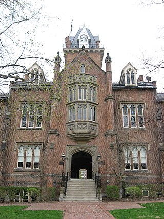
Brooke County is a county in the Northern Panhandle of the U.S. state of West Virginia. As of the 2020 census, the population was 22,559. Its county seat is Wellsburg. The county was created in 1797 from part of Ohio County and named in honor of Robert Brooke, Governor of Virginia from 1794 to 1796. Brooke County is part of the Weirton-Steubenville, WV-OH Metropolitan Statistical Area, which is also included in the Pittsburgh-New Castle-Weirton, PA-WV-OH Combined Statistical Area.
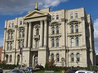
Jefferson County is a county located in the U.S. state of Ohio. As of the 2020 census, the population was 65,249. Its county seat is Steubenville. The county is named for Thomas Jefferson, who was vice president at the time of its creation.

The northern panhandle is one of the two panhandles in the U.S. state of West Virginia. It is a culturally and geographically distinct region of the state. It is the state's northernmost extension, bounded by Ohio and the Ohio River on the north and west and the state of Pennsylvania on the east. Its unusual configuration is the result of the Revolutionary-era claims of Virginia's former Yohogania County boundary lying along the Ohio River, conflicting with interpretations of the Colony of Pennsylvania's royal charter. The conflict was settled by compromise in the 1780s.

The eastern panhandle is one of the two panhandles in the U.S. state of West Virginia; the other is the northern panhandle. It is a small stretch of territory in the northeast of the state, bordering Maryland and Virginia. Some sources and regional associations only identify the eastern panhandle as being composed of Morgan, Berkeley, and Jefferson counties. Berkeley and Jefferson counties are geographically located in the Shenandoah Valley. West Virginia is the only U.S. state with two panhandles.

The Pittsburgh, Cincinnati, Chicago and St. Louis Railroad, commonly called the Pan Handle Route, was a railroad that was part of the Pennsylvania Railroad system. Its common name came from its main line, which began at Pittsburgh, Pennsylvania, crossed the Northern Panhandle of West Virginia, and continued west to Bradford, Ohio, where it split into a northern line to Chicago and a southern one through Indianapolis, Indiana, to East St. Louis, Illinois.

West Virginia Route 2 is a state highway in the US state of West Virginia. It generally parallels the Ohio River along the western border of the state, from U.S. Route 60 in Huntington northeasterly to U.S. Route 30 in Chester.
Transport in the U.S. state of West Virginia is handled by the West Virginia Department of Transportation (WVDOT) which employs more than 6,000 in West Virginia.
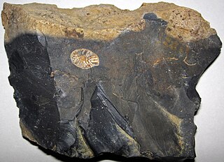
The Maple Creek phase is an archaeological phase, remains of which have been found on the Ohio and Kentucky sides of the Ohio River, primarily around the area of modern Cincinnati. The material culture of the Maple Creek phase is characterized by McWhinney Heavy Stemmed points, Meron-Trimble points, a chipped-stone micro-tool industry, diagnostic features such as earth ovens, and large riverine base camps. This suite of cultural characteristics appear to be shared by a number of sites in this area in the period of approximately 5000-3000 B.P., ending with the Early Woodland period.

The Panhandle Bridge carries the three lines of the Port Authority Light Rail Network across the Monongahela River in Pittsburgh, Pennsylvania. The name comes from Pennsylvania Railroad subsidiary Pittsburgh, Cincinnati, Chicago and St. Louis Railroad, also known as the Panhandle Route, which operated over the bridge.
Steubenville Township is one of the fourteen townships of Jefferson County, Ohio, United States. The 2020 census found 4,117 people in the township.

Wells Township is one of the fourteen townships of Jefferson County, Ohio, United States. The 2020 census found 2,491 people in the township.

Henry Swearingen was an American politician who served two terms as a U.S. Representative from Ohio from 1838 to 1841.

The Weirton–Steubenville, WV–OH Metropolitan Statistical Area, also known as the Upper Ohio Valley, is a metropolitan statistical area consisting of two counties in the Northern Panhandle of West Virginia and one in Ohio, anchored by the cities of Weirton and Steubenville. As of the 2020 census, the MSA had a population of 116,903. This puts it at 334th largest in the United States. It is also included in the larger Pittsburgh–New Castle–Weirton, PA–OH–WV Combined Statistical Area.

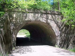
Interstate 70 (I-70) is a portion of the Interstate Highway System that runs from near Cove Fort, Utah, at a junction with I-15 to Baltimore, Maryland. It crosses the Northern Panhandle of West Virginia through Ohio County and the city of Wheeling. This segment is the shortest of all states through which I-70 passes, crossing West Virginia for only 14.45 miles (23.26 km). The Fort Henry Bridge carries I-70 from Wheeling Island across the Ohio River and into downtown Wheeling before the freeway enters the Wheeling Tunnel. I-470, a southerly bypass of Wheeling and the lone auxiliary Interstate Highway in West Virginia, is intersected near Elm Grove. Before crossing into Pennsylvania, I-70 passes The Highlands, a major shopping center in the panhandle, and the Bear Rocks Lake Wildlife Management Area. On average, between 27,000 and 53,000 vehicles use the freeway every day.
The Prehistory of West Virginia spans ancient times until the arrival of Europeans in the early 17th century. Hunters ventured into West Virginia's mountain valleys and made temporary camp villages since the Archaic period in the Americas. Many ancient human-made earthen mounds from various mound builder cultures survive, especially in the areas of Moundsville, South Charleston, and Romney. The artifacts uncovered in these areas give evidence of a village society with a tribal trade system culture that included limited cold worked copper. As of 2009, over 12,500 archaeological sites have been documented in West Virginia.
Robert Parissi is an American singer, songwriter, and musician, best known as frontman for the American funk group Wild Cherry. He also wrote the group's only hit, the 1976 chart-topping "Play That Funky Music". He was raised in the steel mill town of Mingo Junction, Ohio. He graduated from Mingo High School in 1968. Rob formed the band Wild Cherry in 1970 in Steubenville, Ohio, one mile north of Mingo Junction along the Ohio River. The band played the Ohio Valley region, Wheeling, West Virginia and the rest of the Northern West Virginia panhandle, and Pittsburgh, Pennsylvania.
The Trinchera Cave Archeological District (5LA9555) is an archaeological site in Las Animas County, Colorado with artifacts primarily dating from 1000 BC to AD 1749, although there were some Archaic period artifacts found. The site was added to the National Register of Historic Places in 2001 and is located on State Trust Lands.

The Market Street Bridge is a suspension bridge connecting Market Street in Steubenville, Ohio and West Virginia Route 2 in Follansbee, West Virginia over the Ohio River. As a project of the Steubenville Bridge Company, it was constructed in 1905 by the Ohio Steel Erection Company, the framework was created by the Penn Bridge Company, and the original steel was done by Jones and Laughlin Steel Company and Bethlehem Steel. The bridge spans a length of 1,794 feet (547 m) with a width of 20.7 feet (6.3 m). As of 2002, the average daily traffic was estimated around 15,000 vehicles. It was listed on the National Register of Historic Places in 2019.
Upper Mercer flint or Upper Mercer chert is a type of flint, or a pure form of chert, found in Coshocton, Hocking, and Perry counties of Ohio. Made of forms of silica and quartz, the hard and brittle stone was used by prehistoric people to make tools and weapons. To create stone tools, flint was heated to make chipping away at the stone easier, and then the flint was chipped to form razor-sharp edges. Resulting tools included spearheads, scrapers, knives, and arrows.


