East Stour, Dorset

Last updated

East Stour
The former White Horse Pub at East Stour - geograph.org.uk - 420630.jpg
East Stour
Dorset UK location map.svg
Red pog.svg
East Stour
Location within Dorset
Population573  [1]
OS grid reference ST 7993 2292
Unitary authority
Shire county
Region
Country England
Sovereign state United Kingdom
Post town GILLINGHAM
Postcode district SP8
Dialling code 01747
Police Dorset
Fire Dorset and Wiltshire
Ambulance South Western
UK Parliament
List of places
UK
England
Dorset
51°00′19″N2°17′15″W / 51.0053°N 2.2874°W / 51.0053; -2.2874 Coordinates: 51°00′19″N2°17′15″W / 51.0053°N 2.2874°W / 51.0053; -2.2874
East Stour parish church Christ Church, East Stour, Dorset - geograph.org.uk - 1225339.jpg
East Stour parish church

East Stour is a village and civil parish in the ceremonial county of Dorset in southern England. It lies within the Dorset administrative district, about two miles (three kilometres) south of the town of Gillingham. The village is 12 mile (800 metres) from the east bank of the River Stour in the Blackmore Vale and two miles (three kilometres) west of the broadly conical local landmark Duncliffe Hill (with a summit elevation of 210 metres or 690 feet). Above the west bank of the river, about one mile (1.5 kilometres) away, is the village of West Stour. The A30 London to Penzance road passes through the village. In the 2011 census the civil parish had a population of 573. [1]

Contents

History

Part of the shaft of a cross, probably dating from the late 10th or early 11th century, was found in 1939 when a house in the village was demolished. The stone fragment has a cross-section a little under 30 centimetres (12 inches) square and is about 70 cm (27+12 in) high; its faces are embellished with vine-scroll, interlace and palmette ornament. It was transferred to the British Museum. [2]

In the Domesday Book of 1086 East Stour and West Stour together were recorded as Stur or Sture, [3] which had 73 households and administratively was in Gillingham Hundred. [4] A 1695 map shows the village name as Stower Estover.[ citation needed ]

East Stour village was the original settlement in the parish, with study of field boundaries suggesting that encroachment on the "waste" or common land subsequently occurred eastwards, initially immediately east of the village, then further east in post-medieval times. The farms at New House and Cole Street in the northeast of the parish date from settlement in the late 18th century, and in the southeast the waste was enclosed in 1804. [2]

The parish church was rebuilt in 1841–42 near the site of its predecessor, from which the Norman stone font was retrieved. [5]

Governance

East Stour is in the electoral ward called The Stours, which extends southeast as far as East Orchard and in the 2011 census had a population of 1,786. [6] The ward is part of the constituency of North Dorset, and is currently represented in the UK parliament by the Conservative Simon Hoare. [7]

In local government East Stour is governed by Dorset County Council at the county level and North Dorset District Council at the district level. [8] At the parish level East Stour is one of four parishes—the others being Todber, Stour Provost and West Stour—under the governance of The Stours Parish Council, which is a grouped parish council. [9]

Geography

The underlying geology of the parish is Corallian Limestone in the west and Kimmeridge clay in the east, with gault clay around the greensand of Duncliffe Hill. [2] The village is on the limestone. [10]

Demography

In the 2011 census East Stour civil parish had 267 dwellings, [11] 251 households and a population of 573. [1] 26.2% of residents were age 65 or over, compared to 16.4% for England as a whole. [12]

Amenities

East Stour has a village hall [13] and two public houses: The Crown Inn on the B3092 towards Gillingham and The Kings Arms at East Stour Common. [14] [15]

Notable residents

The writer and magistrate Henry Fielding (1707—1754), who also founded the Bow Street Runners, lived in the manor house for three years, after inheriting it. During this time he spent his fortune and consequently became a professional writer. The house, sited west of the church, was demolished in 1835, though its mullioned windows were probably incorporated into its replacement, which previously was called Fielding's Farm but in 1919 became Church Farm. [16] [17]

Related Research Articles

Kington Magna Human settlement in England

Kington Magna is a village and civil parish in the Blackmore Vale area of Dorset, England, about 3+12 miles southwest of Gillingham.

<span class="mw-page-title-main">Shaftesbury</span> Town and civil parish in Dorset, England

Shaftesbury is a town and civil parish in Dorset, England. It is situated on the A30 road, 20 miles west of Salisbury, near the border with Wiltshire. It is the only significant hilltop settlement in Dorset, being built about 215 metres above sea level on a greensand hill on the edge of Cranborne Chase.

<span class="mw-page-title-main">Iwerne Minster</span> Human settlement in England

Iwerne Minster is a village and civil parish in Dorset, England. It lies on the edge of the Blackmore Vale, approximately midway between the towns of Shaftesbury and Blandford Forum. The A350 main road between those towns passes through the edge of the village, just to the west. In the 2011 Census the civil parish had a population of 978.

Marnhull Human settlement in England

Marnhull is a village and civil parish in the county of Dorset in southern England. It lies in the Blackmore Vale, three miles north of Sturminster Newton. The resort towns of Bournemouth and Weymouth are approximately 30 miles south. Marnhull is sited on a low ridge of Corallian limestone above the valley of the River Stour, which forms the northern and western boundaries of the parish. In the 2011 census the parish had 962 dwellings, 905 households and a population of 1,998.

Stour Provost Human settlement in England

Stour Provost is a village and civil parish in the Blackmore Vale area of north Dorset, England, situated on the River Stour between Sturminster Newton and Gillingham. In old writings it is usually spelled Stower Provost.

Alton Pancras Human settlement in England

Alton Pancras is a small village and civil parish in Dorset, England. In the 2011 census the civil parish had a population of 175.

Buckhorn Weston Human settlement in England

Buckhorn Weston is a village and civil parish in the English county of Dorset, situated in the Blackmore Vale about 3 miles west of the town of Gillingham. It lies on the western edge of the former royal hunting ground of Gillingham Forest. The underlying geology is Oxford clay and Corallian limestone. In the 2011 census the civil parish had a population of 356.

Charlton Marshall Human settlement in England

Charlton Marshall is a village and civil parish in the English county of Dorset. It lies within the North Dorset administrative district, on the A350 road 2 miles south of the market town of Blandford Forum. It is sited on a river terrace above the floodplain of the River Stour, with most of the land in the parish stretching south-west over chalk hills. In the 2011 census the number of dwellings recorded within the parish was 513 and the population was 1,156.

Child Okeford Human settlement in England

Child Okeford is a village and civil parish in the county of Dorset in southern England, 3 miles east of the small town of Sturminster Newton in the North Dorset administrative district. Child Okeford lies downstream from Sturminster, along the River Stour, which passes half a mile west of the village. In the 2011 census the civil parish had a population of 1,114.

Milborne St Andrew Village in Dorset, England

Milborne St Andrew is a village and civil parish in the county of Dorset in southern England. It is situated on the A354 road, 9 miles northeast of the county town Dorchester, in a winterbourne valley on the dip slope of the Dorset Downs. In the 2011 census the parish had 472 dwellings, 453 households and a population of 1,062.

Motcombe Human settlement in England

Motcombe is a village and civil parish in north Dorset, England. It lies about two miles north of Shaftesbury. It is sited on Kimmeridge clay soil beneath hills at the edge of the Blackmore Vale. The parish is one of the largest in Dorset. In the 2011 census the parish had 611 dwellings, 564 households and a population of 1,474.

Okeford Fitzpaine Human settlement in England

Okeford Fitzpaine is a village and civil parish in the English county of Dorset, situated in the Blackmore Vale three miles south of the town of Sturminster Newton. It is sited on a thin strip of greensand under the scarp face of the Dorset Downs. In the 2011 census the civil parish—which includes the village of Belchalwell to the west and most of the hamlet of Fiddleford to the north—had 404 dwellings, 380 households and a population of 913.

Pulham Human settlement in England

Pulham is a village and civil parish in the county of Dorset in south-west England. It is situated in the Blackmore Vale, 7 miles southeast of Sherborne. In the 2011 Census the civil parish had 105 dwellings, 103 households and a population of 269.

Silton Human settlement in England

Silton is a small village and civil parish in north Dorset, England, situated in the Blackmore Vale four miles northwest of Gillingham. In the 2011 census, the civil parish had 57 households and a population of 123.

<span class="mw-page-title-main">Stourpaine</span> Human settlement in England

Stourpaine is a village and civil parish in the ceremonial county of Dorset in southern England. It is situated in the valley of the River Stour in the Dorset administrative district, three miles northwest of Blandford Forum. The A350 road, which connects Blandford to Shaftesbury to the north, passes through the village. The chalk hills of Cranborne Chase and the Dorset Downs lie immediately northeast and southwest respectively. In the 2011 census the civil parish had 277 dwellings, 265 households and a population of 617.

Sutton Waldron Human settlement in England

Sutton Waldron is a village and civil parish in north Dorset, England, situated on the A350 road between Iwerne Minster and Fontmell Magna, in the Blackmore Vale under the scarp of Cranborne Chase, 8 miles north of Blandford Forum and 5 miles south of Shaftesbury. In the 2011 census the parish had 93 dwellings, 87 households and a population of 200.

Tarrant Monkton Human settlement in England

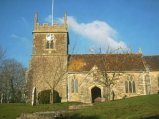
Tarrant Monkton is a village and civil parish in north Dorset, England, situated in the Tarrant Valley about four miles east-northeast of Blandford Forum. Within the parish boundary, 1+12 miles over hills to the west, lies the major part of Blandford Camp army base. In the 2011 census the parish—including the army base—had a population of 1,986. The village is centred on the All Saints Parish Church, opposite which is the Langton Arms, a public house and restaurant.

Todber Human settlement in England

Todber is a village and civil parish in the county of Dorset in southern England. It lies in the Blackmore Vale, about five miles southwest of Shaftesbury. The underlying geology is Corallian limestone. In the 2011 census the parish had 55 households and a population of 140.

Hazelbury Bryan Village in Dorset, England

Hazelbury Bryan is a village and civil parish in the county of Dorset in southern England. It is situated in the Blackmore Vale, approximately five miles southwest of the small town of Sturminster Newton. The parish includes the hamlets of Droop, Kingston, Parkgate, Pidney, Pleck, Wonston and Woodrow. In the 2011 census the parish had 480 dwellings, 454 households and a population of 1,059.

Askerswell Human settlement in England

Askerswell is a small village and civil parish in the county of Dorset in southwest England. It is sited on the small River Asker. It lies 11 miles (18 km) west of the county town Dorchester. The parish has an area of 1,724 acres and in the northeast includes the western slopes of Eggardon Hill, including part of the Iron Age hill fort close to its summit. In the 2011 census the civil parish had a population of 154.

References

  1. 1 2 3 "Area: East Stour (Parish). Key Figures for 2011 Census: Key Statistics". Neighbourhood Statistics. Office for National Statistics. Retrieved 6 July 2014.
  2. 1 2 3 "'East Stour', An Inventory of the Historical Monuments in Dorset, Volume 4: North (1972), pp. 16–17". British History Online. University of London & History of Parliament Trust. November 2013. Retrieved 6 July 2014.
  3. "Dorset S–Z". The Domesday Book Online. domesdaybook.co.uk. Retrieved 7 July 2014.
  4. "Place: [East and West] Stour". Open Domesday. domesdaymap.co.uk. Archived from the original on 14 July 2014. Retrieved 8 July 2014.
  5. North Dorset District Council, North Dorset District Official Guide, Home Publishing Co. Ltd., c.1983, p33
  6. "The Stours". ukcensusdata.com. Retrieved 1 March 2015.
  7. "Dorset North Parliamentary constituency". Election 2015. BBC. Retrieved 10 May 2015.
  8. "Parish and town councils in North Dorset". dorsetforyou.com. Dorset County Council. 5 March 2015. Retrieved 15 March 2015.
  9. "Welcome to The Stours Parish Council Website". The Stours Group Parish Council. Retrieved 15 March 2015.
  10. Ralph Wightman (1983). Portrait of Dorset (4 ed.). Robert Hale Ltd. p. 17. ISBN   0-7090-0844-9.
  11. "Area: East Stour (Parish). Dwellings, Household Spaces and Accommodation Type, 2011 (KS401EW)". Neighbourhood Statistics. Office for National Statistics. Retrieved 15 March 2015.
  12. "Area: East Stour (Parish). Age Structure, 2011 (KS102EW)". Neighbourhood Statistics. Office for National Statistics. Retrieved 15 March 2015.
  13. "East Stour Village Hall". Dorset Halls Network. Dorset Village Halls Association. 2012. Retrieved 15 March 2015.
  14. "The Crown Inn". pub-explorer.com. Retrieved 15 March 2015.
  15. "The Kings Arms". kingsarmseaststour.com. Retrieved 15 March 2015.
  16. Hyams, John (1970). Dorset. B T Batsford Ltd. p. 201. ISBN   0-7134-0066-8.
  17. White, Steve; Hannay, Clive (November 2011). "From Shaftesbury towards Stalbridge". Dorset Life Magazine. Retrieved 22 September 2015.