Eastern Avenue (Toronto)

Last updated

Eastern Avenue

Eastern Ave map.png
VIA Train Crosses Eastern Avenue.jpg
A Via Rail train crosses over Eastern Avenue near its intersection with Broadview Avenue
Route information
Maintained by City of Toronto
Length4.5 km[ citation needed ] (2.8 mi)
Major junctions
West end Front Street at Erin Street
East end Queen Street East
continues as Kingston Road
Location
Country Canada
Province Ontario
Major cities Toronto
Highway system
  • Roads in Toronto

Eastern Avenue is an east-west street in Toronto, Ontario, Canada. It runs from just east of Parliament Street in the downtown to just west of Coxwell Avenue, near the Beaches neighbourhood. Originally Eastern crossed the Don River at the Old Eastern Avenue Bridge, but that bridge was disconnected in 1964. [1] Today, Eastern's east and west halves cross the Don River north of the old alignment via a large bridge with ramps connecting to the Don Valley Parkway, and this viaduct (known as the Eastern Avenue Bypass in some maps) forks out and becomes the eastern terminus of both Richmond and Adelaide streets.

Contents

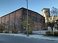
Eastern runs through what was once the heart of Toronto's most industrial area, the region just north of Toronto Harbour and the Port Lands area. Today most of the factories have departed. [2] Some do remain, notably the large Weston bakery. Several film studios have moved into the former industrial areas near Eastern and Carlaw, and this area is today billed as the Studio District. Eastern was also home to the headquarters of the Toronto chapter of the Hells Angels, until it was raided and confiscated by police in April 2007. [3]

At its eastern terminus it now meets up at Kingston Road, once the main cross colonial route linking York to the other major Upper Canada settlement of Kingston.

Prior to 2000, however, Eastern Avenue did not meet up directly with Kingston Road, but at a point a few hundred feet west of the intersection of Kingston Road and Queen Street. Only with the demolition of Greenwood Racetrack was Eastern Avenue extended to flow directly into Kingston Road. The former terminus of Eastern Avenue still exists—it is the small unmarked (and unnamed) street that runs south off Queen Street between Coxwell and Orchard Park Avenues. A small isolated section of Eastern Avenue runs from Sumach Street to Lawren Harris Square.

Almost all the street scenes in the film Hairspray were filmed on Eastern Avenue. [4]

Public transit

The TTC proposed a 150 Eastern bus in 2022, which would operate along the length of the road. [5]

A number of north-south buses use Eastern as the street they loop along before returning northwards. They include the 22 Coxwell, 31 Greenwood, and 72 Pape. [6]

In 2008 bike lanes were added to Eastern, sparking controversy regarding practicality of bike lanes on arterial roads. [7]

Landmarks

Landmarks and notable sites along Eastern from west to east

LandmarkCross streetNotesImage
Inglenook Community High School Cherry StHistoric school building Inglebrook School.jpg
Dominion Wheel & Foundries Limited Rolling Mills RoadAbandoned site of a former rail parts manufacturer; includes four buildings of heritage significance [8] Foundry-southwest-corner.jpg
Old Eastern Avenue Bridge Don RiverAbandoned bridge King Street Bridge.JPG
Sunlight ParkDon RiverFirst baseball park in Toronto, demolished 1896
Broadview Lofts BroadviewFormer warehouse converted into lofts Broadview Lofts.JPG
Toronto Film StudiosCarlaw
Weston BakeryCarlawOne of the remaining, operable factories
Russell Carhouse GreenwoodTTC streetcar yard Russell TTC on Eastern.jpg
South Central sorting plantGreenwoodMain Canada Post facility for central Toronto
Greenwood Raceway GreenwoodRacetrack demolished in the 1990s

Related Research Articles

<span class="mw-page-title-main">The Beaches, Toronto</span> Neighbourhood in Toronto, Ontario, Canada

The Beaches is a neighbourhood in Toronto, Ontario, Canada. It is so named because of its four beaches situated on Lake Ontario. It is located east of downtown within the "Old" City of Toronto. The approximate boundaries of the neighbourhood are from Victoria Park Avenue on the east to Kingston Road on the north, along Dundas Street to Coxwell Avenue on the west, south to Lake Ontario. The Beaches is part of the east-central district of Toronto.

<span class="mw-page-title-main">Queen Street, Toronto</span> Thoroughfare in Toronto, Ontario

Queen Street is a major east–west thoroughfare in Toronto, Ontario, Canada. It extends from Roncesvalles Avenue and King Street in the west to Victoria Park Avenue in the east. Queen Street was the cartographic baseline for the original east–west avenues of Toronto's and York County's grid pattern of major roads. The western section of Queen is a centre for Canadian broadcasting, music, fashion, performance, and the visual arts. Over the past twenty-five years, Queen West has become an international arts centre and a tourist attraction in Toronto.

<span class="mw-page-title-main">Gerrard Street (Toronto)</span> Thoroughfare in Toronto, Ontario

Gerrard Street is a street in Toronto, Ontario, Canada. It consists of two separate parts, historically referred to as Lower Gerrard and Upper Gerrard. The former stretches between University Avenue and Coxwell Avenue for 6 km, across Old Toronto. The latter portion starts 300 m north of Lower Gerrard's eastern terminus and runs between Coxwell Avenue and Clonmore Drive, between Victoria Park Avenue and Warden Avenue, in Scarborough for another 4 km.

<span class="mw-page-title-main">West Hill, Toronto</span> Neighbourhood in Toronto, Ontario, Canada

West Hill is a neighbourhood in Toronto, Ontario, Canada. It is located in the eastern end of the city, in the former suburb of Scarborough. It is roughly bounded by Scarborough Golf Club Road and a branch of Highland Creek on the west, the CNR railway tracks and Lake Ontario on the south, and Highland Creek on the north-east. The name comes from its elevated position on the west side of Highland Creek, a deep glacial ravine.

<span class="mw-page-title-main">Bloor Street</span> Major thoroughfare in Toronto

Bloor Street is a major east–west residential and commercial thoroughfare in Toronto, Ontario, Canada. Bloor Street runs from the Prince Edward Viaduct, which spans the Don River Valley, westward into Mississauga where it ends at Central Parkway. East of the viaduct, Danforth Avenue continues along the same right-of-way. The street, approximately 25 kilometres (16 mi) long, contains a significant cross-sample of Toronto's ethnic communities. It is also home to Toronto's famous shopping street, the Mink Mile.

<span class="mw-page-title-main">Lawrence Avenue</span> Thoroughfare in Toronto, Ontario

Lawrence Avenue is a major east–west thoroughfare in Toronto, Ontario, Canada. It is divided into east and west portions by Yonge Street, the dividing line of east–west streets in Toronto.

<span class="mw-page-title-main">Eglinton Avenue</span> Road in Toronto and Mississauga, Canada

Eglinton Avenue is a major east–west arterial thoroughfare in Toronto and Mississauga in the Canadian province of Ontario. The street begins at Highway 407 at the western limits of Mississauga, as a continuation of Lower Baseline in Milton. It traverses the midsection of both cities and ends at Kingston Road. Eglinton Avenue is the only street to cross all six former boroughs of Metropolitan Toronto.

<span class="mw-page-title-main">Kingston Road (Toronto)</span> Road in Toronto and Durham, Ontario, Canada

Kingston Road is a major arterial road in Toronto and Durham Region, Ontario. It the southernmost major (mainly) east-west road in the eastern portion of Toronto, specifically in the district of Scarborough, and runs east to Ajax in Durham. Until 1998, it formed a portion of Highway 2. The name of the street is derived from Kingston, Ontario as the road was the primary route used to travel from Toronto to the settlements east of it situated along the shores of Lake Ontario; in the west end of Kingston, the road was referred to as the York Road until at least 1908, and is today named Princess Street.

<span class="mw-page-title-main">Lake Shore Boulevard</span> Street in Toronto

Lake Shore Boulevard is a major arterial road running along more than half of the Lake Ontario waterfront in the city of Toronto, Ontario, Canada. Prior to 1998, two segments of Lake Shore Boulevard were designated as part of Highway 2, with the highway following the Gardiner Expressway between these two sections.

<span class="mw-page-title-main">Bayview Avenue</span> Major north-south route in the Greater Toronto Area of Ontario

Bayview Avenue is a major north–south route in the Greater Toronto Area of Ontario. North of Toronto, in York Region, Bayview is designated as York Regional Road 34.

<i>Hairspray</i> (2007 film) 2007 film directed by Adam Shankman

Hairspray is a 2007 musical romantic comedy film based on the 2002 Broadway musical of the same name, which in turn was based on John Waters's 1988 comedy film of the same name. Produced by Ingenious Media and Zadan/Meron Productions, and adapted from both Waters's 1988 script and Thomas Meehan and Mark O'Donnell's book for the stage musical by screenwriter Leslie Dixon, the film was directed and choreographed by Adam Shankman and has an ensemble cast including John Travolta, Michelle Pfeiffer, Christopher Walken, Amanda Bynes, James Marsden, Queen Latifah, Brittany Snow, Zac Efron, Elijah Kelley, Allison Janney, and Nikki Blonsky in her feature film debut. Set in 1962 Baltimore, Maryland, the film follows the "pleasantly plump" teenager Tracy Turnblad (Blonsky) as she pursues stardom as a dancer on a local television dance show and rallies against racial segregation.

<span class="mw-page-title-main">506 Carlton</span> Streetcar route in Toronto, Canada

506 Carlton is a Toronto streetcar route run by the Toronto Transit Commission in Ontario, Canada. It runs from Main Street station on subway Line 2 Bloor–Danforth along Gerrard, Carlton and College Streets to High Park. Despite the route's name, less than 10 percent of its length actually uses Carlton Street.

<span class="mw-page-title-main">502 Downtowner</span> Streetcar route in Toronto, Canada

The 502 Downtowner was a streetcar route operated by the Toronto Transit Commission in Toronto, Ontario, Canada. It ran from the Bingham Loop at Victoria Park Avenue and Kingston Road in the Beaches neighbourhood to McCaul Loop in downtown Toronto. Starting in September 2019, all streetcar services along Kingston Road were consolidated into the 503 Kingston Rd route.

<span class="mw-page-title-main">Upper Beaches</span> Neighbourhood in Toronto, Ontario, Canada

The Upper Beaches is a neighbourhood in Toronto, Ontario, Canada. It is directly north of the Beaches area. It stretches from Coxwell Avenue in the west to Victoria Park in the east. The southern border is Kingston Road, while the northern boundary is generally considered to be the Canadian National Railway tracks between Gerrard Street and Danforth Avenue. The western part of the area was originally called Norway, and the larger area was once part of the Town of East Toronto. The name "Upper Beaches" was first used by developers and real estate agents around the period of 2001 to 2003 for the selling of houses on redeveloped land in the area, and was used as a marketing tag to attract buyers. The area was never considered part of the Beaches neighbourhood but was close to it. The city's current name for this area is East End Danforth, though that is rarely used. The city also includes the buildings along and just north of Danforth Avenue in the neighbourhood. The western portion between Woodbine Avenue and Coxwell is referred to by the city as Woodbine Corridor.

<span class="mw-page-title-main">Woodbine Avenue</span> Road in Ontario, Canada

Woodbine Avenue is a north–south arterial road consisting of two sections in Toronto and York Region in Ontario, Canada.

<span class="mw-page-title-main">Toronto streetcar system loops</span>

Turning loops of the Toronto streetcar system serve as termini and turnback points for streetcar routes in Toronto, Ontario, Canada. The single-ended streetcars require track loops in order to reverse direction. Besides short off-street track loops these can also be larger interchange points, having shelters and driver facilities, or be part of a subway station structure for convenient passenger interchange.

<span class="mw-page-title-main">Bingham Loop</span>

Bingham Loop is a station and turning loop at the eastern terminus of the 503 Kingston Rd streetcar lines of the Toronto Transit Commission (TTC). It lies between Victoria Park Avenue and Bingham Avenue, just north of Kingston Road in Toronto.

References

  1. "Dead little bridges, like the steel truss-strengthened span on Eastern Avenue, can put an urban explorer in a melancholy mood." John Bentley Mays. The Globe and Mail. Feb 15, 1995. pg. C.3
  2. "Hoping for gold: Can the Olympics turn around a forgotten neighbourhood?" Malcolm Kelly. National Post. Dec 9, 2000. pg. G.1.FRO
  3. CTV Toronto - Hells Angels clubhouses raided in three provinces - CTV News, Shows and Sports - Canadian Television
  4. Shankman, Adam (Director) (2007-11-20). Hairspray: Commentary with Director Adam Shankman and Nikki Blonsky (DVD). New York, NY: New Line Cinema. Event occurs at 1:17:08-1:17:19. Retrieved 2017-11-24. ...this is back on that street that [Nikki Blonsky] rode the garbage truck down... Eastern Avenue. We shot everything on Eastern Avenue.
  5. Murno (2022-02-07). "TTC 2022 Service Plan Update". Steve Munro. Retrieved 2022-11-16.
  6. "TTC Route Map Archived 2011-02-16 at the Wayback Machine " Toronto Transit Commission
  7. "New bike lanes spark some four-wheel fury." Jack Lakey. Toronto Star. Jul 19, 2008. pg. A.13
  8. "City of Toronto's Heritage Property Search".