The Prince Edward Viaduct System, commonly referred to as the Bloor Viaduct, is the name of a truss arch bridge system in Toronto, Ontario, Canada, connecting Bloor Street East, on the west side of the system, with Danforth Avenue on the east. The system includes the Rosedale Valley phase and the Sherbourne Phase, an embankment built to extend Bloor Street East to the Rosedale Ravine from Sherbourne Street. The Don Valley phase of the system, the most recognizable, spans the Don River Valley, crossing over the Bayview Avenue Extension, the Don River, and the Don Valley Parkway.

Roncesvalles is a neighbourhood in the city of Toronto, Ontario, Canada, centred on Roncesvalles Avenue, a north–south street leading from the intersection of King and Queen Streets to the south, north to Dundas Street West, a distance of roughly 1.5 kilometres. It is located east of High Park, north of Lake Ontario, in the Parkdale–High Park provincial and federal ridings and the municipal Ward 14. Its informal boundaries are High Park to the west, Bloor Street West to the north, Lake Ontario/Queen Street West to the south and Lansdowne Avenue/rail corridor to the east. Originally known as "Howard Park", most of this area was formerly within the boundaries of Parkdale and Brockton villages and was annexed into Toronto in the 1880s.

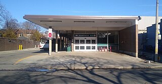
Castle Frank is a station on Line 2 Bloor–Danforth of the Toronto subway. It is located at the northwest corner of Bloor Street East and Castle Frank Road. Wi-Fi service is available at this station.

Roncesvalles Avenue is a north-south minor arterial street in Toronto, Ontario, Canada. It begins at the intersection of Queen Street West, King Street West and the Queensway running north to Dundas Street West. At its southern starting point, King Street West traffic continues northward onto Roncesvalles Avenue unless the traffic turns east or west onto Queen Street West or the Queensway. At its northern end point, traffic continues onto Dundas Street, which is essentially a straight-line northern extension of Roncesvalles.

The Toronto Street Railway (TSR) was the operator of a horse-drawn streetcar system from 1861 to 1891 in Toronto, Ontario, Canada. Its successor, the Toronto Railway Company, inherited the horsecar system and electrified it between 1892 and 1894.

Bloor Street is a major east–west residential and commercial thoroughfare in Toronto, Ontario, Canada. Bloor Street runs from the Prince Edward Viaduct, which spans the Don River Valley, westward into Mississauga where it ends at Central Parkway. East of the viaduct, Danforth Avenue continues along the same right-of-way. The street, approximately 25 kilometres (16 mi) long, contains a significant cross-sample of Toronto's ethnic communities. It is also home to Toronto's famous shopping street, the Mink Mile.

Bathurst Street is a main north–south thoroughfare in Toronto, Ontario, Canada. It begins at an intersection of the Queens Quay roadway, just north of the Lake Ontario shoreline. It continues north through Toronto to the Toronto boundary at Steeles Avenue. It is a four-lane thoroughfare throughout Toronto. The roadway continues north into York Region where it is known as York Regional Road 38.

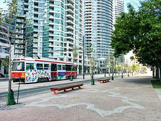
Queens Quay is a prominent street in the Harbourfront neighbourhood of Toronto, Ontario, Canada. The street was originally commercial in nature due to the many working piers along the waterfront; parts of it have been extensively rebuilt in since the 1970s with parks, condominiums, retail, as well as institutional and cultural development.

504 King is an east–west Toronto streetcar route in Ontario, Canada. It serves King Street in Downtown Toronto as well as Broadview Avenue on the east end and Roncesvalles Avenue on the west end of the line. The route consists of two overlapping branches: 504A between Line 2 Bloor–Danforth's Dundas West station and Distillery Loop, and 504B between Broadview station – also on Line 2 – and Dufferin Gate Loop. The two branches overlap on King Street between Dufferin and Sumach streets, both passing St. Andrew station and King station on subway Line 1 Yonge–University.

Samuel Peters Jarvis was a Canadian government official in the nineteenth century. He was the Chief Superintendent for the Indian Department in Upper Canada (1837–1845), and he was a member of the Family Compact.

Jarvis Street is a north-south thoroughfare in downtown Toronto, Ontario, Canada, passing through some of the oldest developed areas in the city. Its alignment extends from Queens Quay East in the south to Bloor Street in the north. The segment south of Front Street is known as "Lower Jarvis Street" while the segment from Bloor Street to Mount Pleasant Road is known as "Ted Rogers Way".

Runnymede Road is a 3km street in the west end of Toronto, Canada. It runs from Morningside Avenue at its south end and ends at Henrietta Street, north of St. Clair Ave. At its southern end, it begins as a narrow 2 lane road. It heads north to Bloor Street, where it widens to accommodate bikes lanes. At St. Clair however, the bikes lanes stop and it's just a 2-way street north until Henrietta.

Toronto, Ontario, like many North American cities, has slowly been improving its cycling infrastructure. The number of cyclists in Toronto has been increasing progressively, particularly in the city's downtown core. As cycling conditions improve, a cycling culture has grown and alternatives such as automobiles are seen as less attractive. The politics of providing resources for cyclists, particularly dedicated bike lanes, has been contentious, particularly since the 2010s.

East Bayfront, or the East Bayfront Precinct, is an emerging neighbourhood in Toronto, Ontario, Canada. It is currently undergoing a transformation from industrial use to mixed-use as part of Waterfront Toronto's plans to create a residential and commercial district urban core near the lake.

Following the Upper Canada Rebellion of 1837 Lieutenant Governor of Upper Canada Sir George Arthur directed the construction of a Sherbourne Blockhouse, and a ring of six other blockhouses -- to guard the approaches to Toronto in case there was another rebellion. The Sherbourne Blockhouse was located at the northern end of Sherbourne Street, at the current intersection with Bloor, just south of the Rosedale Ravine.

The Toronto Transit Commission operated a separate Spadina streetcar line on Spadina Avenue, from 1923 to 1948. Spadina Avenue is a major north–south road in downtown Toronto.

The Toronto Railway Company Belt Line was a streetcar route that operated in Toronto, Ontario, Canada. The route was created by the Toronto Railway Company in 1891 and taken over by the Toronto Transportation Commission in 1921, which cancelled the route in 1923 as part of its reorganization of streetcar routes.
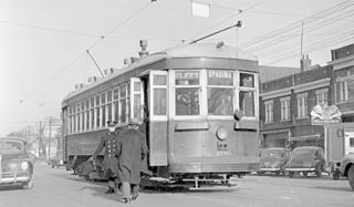
The Toronto Transit Commission operated the Bloor streetcar line along Bloor Street and Danforth Avenue, extending at its longest from Jane Street in the west end of the city to Luttrell Avenue in the east. Both Luttrell and Jane loops at the termini were transfer points between streetcars and suburban bus routes. The line was abandoned in 1966 with the opening of the Bloor-Danforth subway line, except for two stubs of the line abandoned in 1968.


