Eastover, South Carolina

Last updated

Eastover, South Carolina
Eastover09.JPG
Main Street
Richland County South Carolina incorporated and unincorporated areas Eastover highlighted.svg
Location in Richland County and the state of South Carolina.
Coordinates: 33°52′39″N80°41′41″W / 33.87750°N 80.69472°W / 33.87750; -80.69472
Country United States
State South Carolina
County Richland
Area
[1]
  Total1.21 sq mi (3.15 km2)
  Land1.21 sq mi (3.15 km2)
  Water0.00 sq mi (0.00 km2)
Elevation
[2]
190 ft (60 m)
Population
 (2020) [3]
  Total614
  Density505.77/sq mi (195.23/km2)
Time zone UTC-5 (EST)
  Summer (DST) UTC-4 (EDT)
ZIP code
29044
Area code(s) 803, 839
FIPS code 45-22390 [4]
GNIS feature ID1222202 [2]
Website http://www.eastoversc.com

Eastover is a town in Richland County, South Carolina, United States. The population was 813 at the 2010 census, [5] down from 830 in 2000. It is part of the Columbia, South Carolina, Metropolitan Statistical Area.

Contents

History

The J.A. Byrd Mercantile Store, Farmers and Merchants Bank Building, Good Hope Baptist Church, Goodwill Plantation, Kensington Plantation House, St. Phillip School, Saint Thomas' Protestant Episcopal Church, Claudius Scott Cottage, and Siloam School are listed on the National Register of Historic Places. [6]

Geography

Eastover is located at 33°52′39″N80°41′41″W / 33.87750°N 80.69472°W / 33.87750; -80.69472 (33.877553, -80.694592). [7]

According to the United States Census Bureau, the town has a total area of 1.2 square miles (3.1 km2), all land. [5]

Demographics

Historical population
CensusPop.Note
1910 237
1920 32637.6%
1930 39320.6%
1940 47320.4%
1950 56419.2%
1960 71326.4%
1970 81714.6%
1980 89910.0%
1990 1,04416.1%
2000 830−20.5%
2010 813−2.0%
2020 614−24.5%
U.S. Decennial Census [8] [3]

2020 census

Eastover racial composition [9]
RaceNum.Perc.
White (non-Hispanic)182.93%
Black or African American (non-Hispanic)56391.69%
Asian 40.65%
Other/Mixed 193.09%
Hispanic or Latino 101.63%

As of the 2020 United States census, there were 614 people, 271 households, and 153 families residing in the town.

2000 census

At the 2000 census, [4] there were 830 people, 307 households and 228 families residing in the town. The population density was 670.8 inhabitants per square mile (259.0/km2). There were 357 housing units at an average density of 288.5 per square mile (111.4/km2). The racial makeup of the town was 92.26% African American, 6.87% White, 0.41% Asian, 0.12% from other races, and 0.48% from two or more races. Hispanic or Latino of any race were 0.24% of the population.

There were 307 households, of which 39.4% had children under the age of 18 living with them, 26.4% were married couples living together, 43.0% had a female householder with no husband present, and 25.7% were non-families. 23.5% of all households were made up of individuals, and 9.4% had someone living alone who was 65 years of age or older. The average household size was 2.64 and the average family size was 3.07.

32.4% of the population were under the age of 18, 10.6% from 18 to 24, 24.7% from 25 to 44, 21.7% from 45 to 64, and 10.6% who were 65 years of age or older. The median age was 32 years. For every 100 females, there were 81.2 males. For every 100 females age 18 and over, there were 67.0 males.

The median household income was $20,114 and the median family income was $19,844. Males had a median income of $23,250 versus $17,875 for females. The per capita income for the town was $9,304. About 36.9% of families and 37.3% of the population were below the poverty line, including 53.1% of those under age 18 and 30.0% of those age 65 or over.

Education

Richland County School District One operates area public schools.

Webber Elementary School is in Eastover. [10] Eastover is zoned to Webber Elementary, Southeast Middle School, and Lower Richland High School. [11]

Points of interest

Eastover is the site of McEntire Joint National Guard Base and the headquarters for the South Carolina Air National Guard.

South Carolina Electric & Gas Company's Wateree Station 700 megawatt coal power plant is located here.

South Carolina's only national park, the Congaree National Park, is twelve miles southwest of Eastover. Eastover is the closest municipality to the park.

Notable people

Politics

Eastover is in South Carolina's 6th congressional district.

Related Research Articles

<span class="mw-page-title-main">Richland County, South Carolina</span> County in South Carolina, United States

Richland County is located in the U.S. state of South Carolina. As of the 2020 census, its population was 416,147, making it the second-most populous county in South Carolina, behind only Greenville County. The county seat and largest community is Columbia, the state capital. The county was established on March 12, 1785. Richland County is part of the Columbia, SC Metropolitan Statistical Area. In 2020, the center of population of South Carolina was located in Richland County, in the city of Columbia. The county is also the location of the geographic center of South Carolina, southeast of Columbia.

<span class="mw-page-title-main">Kershaw County, South Carolina</span> County in South Carolina, United States

Kershaw County is a county located in the U.S. state of South Carolina. As of the 2020 census, its population was 65,403. The county seat and largest community is Camden. The county was created in 1791 from parts of Claremont, Lancaster, Fairfield, and Richland counties. It is named for Col. Joseph Kershaw (1727–1791), an early settler and American Revolutionary War patriot.

<span class="mw-page-title-main">Aurora, North Carolina</span> Town in North Carolina, United States

Aurora is a town in Beaufort County, North Carolina, United States. The population was 520 at the 2010 Census.

<span class="mw-page-title-main">Eastover, North Carolina</span> Town in North Carolina, United States

Eastover is a town in Cumberland County, North Carolina, United States. The population was 3,656 at the 2020 census. It was incorporated on July 25, 2007.

<span class="mw-page-title-main">Richlands, North Carolina</span> Town in North Carolina, United States

Richlands is a town in Onslow County, North Carolina, United States. In the 2020 U.S. census, the population was 2,287. It is included in the Jacksonville, North Carolina Metropolitan Statistical Area. Incorporated on March 29, 1880, it was the first town in Onslow County to have its own library and museum. Richlands was also the first town in Onslow County to have a female mayor, Annette Hargett.

<span class="mw-page-title-main">Winterville, North Carolina</span> Town in North Carolina, United States

Winterville is a town in Pitt County, North Carolina, United States. The population was 10,591 as of the 2020 census. The town is a part of the Greenville Metropolitan Area.

<span class="mw-page-title-main">Williamston, South Carolina</span> Town in South Carolina, United States

Williamston is a town in Anderson County, South Carolina. The population was 4,043 at the 2020 census.

<span class="mw-page-title-main">Blackville, South Carolina</span> Town in South Carolina, United States

Blackville is a small town in Barnwell County, South Carolina, United States. The population was 2,406 at the 2010 census.

<span class="mw-page-title-main">Williston, South Carolina</span> Town in South Carolina, United States

Williston is a town in Barnwell County, South Carolina, United States. The population was 3,139 at the 2010 census.

<span class="mw-page-title-main">Pageland, South Carolina</span> Town in South Carolina, United States

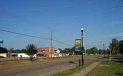
Pageland is a town in Chesterfield County, South Carolina, United States. It is the second largest town in Chesterfield County. The population was 2,760 at the 2010 census.

<span class="mw-page-title-main">Kershaw, South Carolina</span> Town in South Carolina, United States

Kershaw is a town in Lancaster County, South Carolina, United States. It was incorporated in 1888. As of the 2010 census, the population was 1,803, and as of 2019 the estimated population was 2,321. The Haile Gold Mine, where gold was discovered in 1825, is 3 miles (5 km) from town and was at one time the largest single producer of gold in the Appalachian region.

<span class="mw-page-title-main">Lancaster, South Carolina</span> City in South Carolina, United States

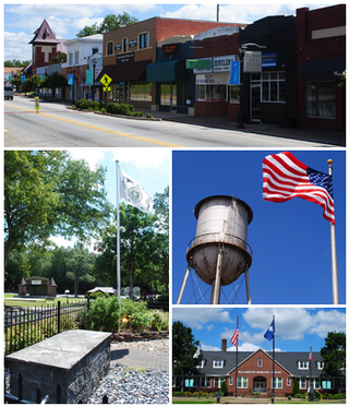
The city of Lancaster is the county seat of Lancaster County, South Carolina, United States, located in the Charlotte Metropolitan Area. As of the United States Census of 2010, the city population was 8,526. The city was named after the famous House of Lancaster.

<span class="mw-page-title-main">Gilbert, South Carolina</span> Town in South Carolina, United States

Gilbert is a town in Lexington County, South Carolina, United States. The population was 569 at the 2010 census. It is part of the Columbia, South Carolina Metropolitan Statistical Area.

<span class="mw-page-title-main">North, South Carolina</span> Town in South Carolina, United States

North is a town in Orangeburg County, South Carolina, United States. The population was 696 at the 2020 census.

<span class="mw-page-title-main">Forest Acres, South Carolina</span> City in South Carolina, United States

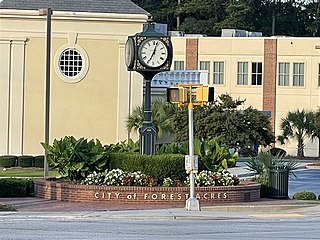
Forest Acres is a city in Richland County, South Carolina, United States. The population was 10,606 at the 2020 census. It is part of the Columbia, South Carolina, Metropolitan Statistical Area and is an enclave of the city of Columbia.

<span class="mw-page-title-main">St. Andrews, South Carolina</span> Census-designated place in South Carolina, United States

St. Andrews is a census-designated place (CDP) in Richland County, South Carolina, United States. The population was 20,493 at the 2010 census. It is part of the Columbia, South Carolina Metropolitan Statistical Area.

<span class="mw-page-title-main">Yemassee, South Carolina</span> Town in South Carolina, United States

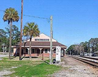
Yemassee is a small Lowcountry town in Beaufort and Hampton counties in the U.S. state of South Carolina. The population was 1,027 at the 2010 census. Yemassee is near the borders of Colleton and Jasper counties. The town is divided by the county line between Beaufort and Hampton counties, which follows the roadbed of the CSX railroad. Most of the town's population presently lies within Hampton County. As defined by the U.S. Census Bureau, the Beaufort County portion of Yemassee is included within the Hilton Head Island-Bluffton-Beaufort, SC Metropolitan Statistical Area. Yemassee hosts one of the few commercial breeding facilities of non-human primates in the entire United States, Alpha Genesis, Inc., which serves as a major employer for the town. Also, the Frank Lloyd Wright-designed Auldbrass Plantation house and outbuildings lie just outside the town limits of Yemassee.

<span class="mw-page-title-main">Blythewood, South Carolina</span> Town in South Carolina, United States

Blythewood is a town in Richland and Fairfield counties, South Carolina, United States. It is a suburb of Columbia, South Carolina. The 2020 United States census puts the population at 4,772. It is part of the Columbia, South Carolina, Metropolitan Statistical Area. It is located around 15 miles from downtown Columbia.

<span class="mw-page-title-main">Irmo, South Carolina</span> Town in South Carolina, United States

Irmo is a town in Lexington and Richland counties, South Carolina, United States and a suburb of Columbia. It is part of the Columbia Metropolitan Statistical Area and is located 12 miles (19 km) northwest of the city center. The population of Irmo was 11,097 at the 2010 census.

<span class="mw-page-title-main">Eagle, Wisconsin</span> Village in Wisconsin, United States

Eagle is a village in Waukesha County, Wisconsin, United States. At the 2020 census, the population was 2,071. The village is located within the Town of Eagle.

References

  1. "ArcGIS REST Services Directory". United States Census Bureau. Retrieved October 15, 2022.
  2. 1 2 U.S. Geological Survey Geographic Names Information System: Eastover, South Carolina
  3. 1 2 "Census Population API". United States Census Bureau. Retrieved October 15, 2022.
  4. 1 2 "U.S. Census website". United States Census Bureau . Retrieved January 31, 2008.
  5. 1 2 "Geographic Identifiers: 2010 Demographic Profile Data (G001): Eastover town, South Carolina". U.S. Census Bureau, American Factfinder. Archived from the original on February 12, 2020. Retrieved January 14, 2013.
  6. "National Register Information System". National Register of Historic Places . National Park Service. July 9, 2010.
  7. "US Gazetteer files: 2010, 2000, and 1990". United States Census Bureau. February 12, 2011. Retrieved April 23, 2011.
  8. "Census of Population and Housing". Census.gov. Retrieved June 4, 2015.
  9. "Explore Census Data". data.census.gov. Retrieved December 13, 2021.
  10. "Home." Webber Elementary School. Retrieved on December 10, 2016. "Address 140 Webber School Road, Eastover, SC 29044"
  11. "RichlandOneSCPlotMaps150323.pdf." Richland County School District One. Retrieved on December 10, 2016.