Dentsville, South Carolina

Last updated
Dentsville, South Carolina
Richland County South Carolina incorporated and unincorporated areas Dentsville highlighted.svg
Location in Richland County and the state of South Carolina.
Coordinates: 34°4′31″N80°57′19″W / 34.07528°N 80.95528°W / 34.07528; -80.95528 Coordinates: 34°4′31″N80°57′19″W / 34.07528°N 80.95528°W / 34.07528; -80.95528
CountryUnited States
State South Carolina
County Richland
Area
[1]
  Total6.82 sq mi (17.67 km2)
  Land6.69 sq mi (17.33 km2)
  Water0.13 sq mi (0.35 km2)
Elevation
[2]
230 ft (70 m)
Population
 (2020) [3]
  Total14,431
  Density2,156.78/sq mi (832.77/km2)
Time zone UTC−5 (Eastern (EST))
  Summer (DST) UTC−4 (EDT)
FIPS code 45-19285 [4]
GNIS feature ID1249475 [2]

Dentsville is a census-designated place (CDP) in Richland County, South Carolina, United States. The population was 14,062 at the 2010 census. [5] It is part of the Columbia, South Carolina, Metropolitan Statistical Area.

Contents

Geography

Dentsville is located at 34°4′31″N80°57′19″W / 34.07528°N 80.95528°W / 34.07528; -80.95528 (34.075403, -80.955207). [6]

According to the United States Census Bureau, the CDP has a total area of 6.9 square miles (17.9 km2), of which 6.8 square miles (17.5 km2) is land and 0.12 square miles (0.3 km2), or 1.93%, is water. [5]

Demographics

Historical population
CensusPop.
2020 14,431
U.S. Decennial Census [7]

2020 census

Dentsville racial composition [8]
RaceNum.Perc.
White (non-Hispanic)2,33216.16%
Black or African American (non-Hispanic)9,86068.33%
Native American 440.3%
Asian 5593.87%
Pacific Islander 110.08%
Other/Mixed 4953.43%
Hispanic or Latino 1,1307.83%

As of the 2020 United States census, there were 14,431 people, 6,403 households, and 3,599 families residing in the CDP.

2000 census

As of the census [4] of 2000, there were 13,009 people, 5,376 households, and 3,290 families residing in the CDP. The population density was 1,844.8 people per square mile (712.5/km2). There were 5,797 housing units at an average density of 822.1 per square mile (317.5/km2). The racial makeup of the CDP was 36.05% White, 58.28% African American, 0.21% Native American, 2.54% Asian, 0.05% Pacific Islander, 1.30% from other races, and 1.58% from two or more races. Hispanic or Latino of any race were 2.90% of the population.

There were 5,376 households, out of which 26.9% had children under the age of 18 living with them, 38.1% were married couples living together, 18.7% had a female householder with no husband present, and 38.8% were non-families. 32.2% of all households were made up of individuals, and 6.4% had someone living alone who was 65 years of age or older. The average household size was 2.30 and the average family size was 2.91.

In the CDP, the population was spread out, with 21.6% under the age of 18, 9.5% from 18 to 24, 34.6% from 25 to 44, 22.2% from 45 to 64, and 12.1% who were 65 years of age or older. The median age was 35 years. For every 100 females, there were 80.7 males. For every 100 females age 18 and over, there were 74.8 males.

The median income for a household in the CDP was $38,721, and the median income for a family was $46,996. Males had a median income of $32,015 versus $23,726 for females. The per capita income for the CDP was $19,916. About 7.1% of families and 8.6% of the population were below the poverty line, including 9.9% of those under age 18 and 5.9% of those age 65 or over.


Related Research Articles

<span class="mw-page-title-main">James City, North Carolina</span> Census-designated place in North Carolina, United States

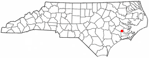
James City is an unincorporated area and census-designated place (CDP) in Craven County, North Carolina, United States. The population was 5,899 at the 2010 census. It is part of the New Bern, North Carolina Micropolitan Statistical Area.

<span class="mw-page-title-main">Westport, North Carolina</span> Census-designated place in North Carolina, United States

Westport is an unincorporated community and census-designated place (CDP) located in Lincoln County, North Carolina, United States. The population of the CDP was 4,026 at the 2010 census, up from 2,006 at the 2000 census. The community's name comes from its location on the west side of Lake Norman.

<span class="mw-page-title-main">Myrtle Grove, North Carolina</span> CDP in North Carolina, United States

Myrtle Grove is a census-designated place (CDP) in New Hanover County, North Carolina, United States. The population was 8,875 at the 2010 census. It is part of the Wilmington Metropolitan Statistical Area.

Raemon is a census-designated place (CDP) in Robeson County, North Carolina, United States. The population was 212 at the 2000 census.

Flat Rock is a census-designated place (CDP) in Surry County, North Carolina, United States. The name "Flat Rock" stems from the community's granite quarry. The granite quarry is the largest open-face granite quarry in the world, and has been mined continuously since 1889 by the North Carolina Granite Corporation.

<span class="mw-page-title-main">Baidland, Pennsylvania</span> Census-designated place in Pennsylvania, United States

Baidland is a census-designated place (CDP) in Washington County, Pennsylvania, United States. The population was 1,563 at the 2010 census.

<span class="mw-page-title-main">Shell Point, South Carolina</span> CDP in South Carolina, United States

Shell Point is a census-designated place (CDP) in Beaufort County, South Carolina, United States. The population was 2,336 at the 2010 census. As defined by the U.S. Census Bureau, Shell Point is included within the Hilton Head Island-Bluffton-Beaufort, SC Metropolitan Statistical Area.

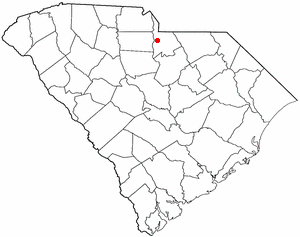
Elgin is an unincorporated community and census-designated place (CDP) in Lancaster County, South Carolina, United States. The population was 2,607 at the 2010 census.

<span class="mw-page-title-main">Irwin, South Carolina</span> Census-designated place in South Carolina, United States

Irwin is an unincorporated community and census-designated place (CDP) in Lancaster County, South Carolina, United States. The population was 1,405 at the 2010 census.

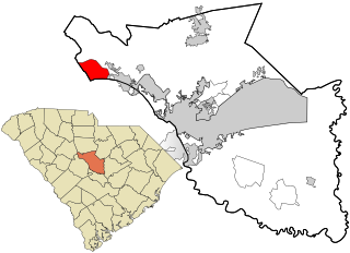
Seven Oaks is a census-designated place (CDP) in Lexington County, South Carolina, United States, 8 miles (13 km) northwest of downtown Columbia, the state capital. The population of the CDP was 15,144 at the 2010 census. It is part of the Columbia Metropolitan Statistical Area.

<span class="mw-page-title-main">Lake Murray of Richland, South Carolina</span> Census-designated place in South Carolina, United States

Lake Murray of Richland is a census-designated place (CDP) in Richland County, South Carolina, United States. The population was 5,484 at the 2010 census. It is part of the Columbia, South Carolina Metropolitan Statistical Area.

<span class="mw-page-title-main">Woodfield, South Carolina</span> Census-designated place in South Carolina, United States

Woodfield is a census-designated place (CDP) in Richland County, South Carolina, United States. The population was 9,303 at the 2010 census. It is part of the Columbia, South Carolina Metropolitan Statistical Area.

Cane Savannah is a census-designated place (CDP) in Sumter County, South Carolina, United States. The population was 1,452 at the 2000 census. It is included in the Sumter, South Carolina Metropolitan Statistical Area.

<span class="mw-page-title-main">Cherryvale, South Carolina</span> CDP in South Carolina, United States

Cherryvale is a census-designated place (CDP) in Sumter County, South Carolina, United States. The population was 2,461 at the 2000 census. It is included in the Sumter, South Carolina Metropolitan Statistical Area.

Dalzell is a census-designated place (CDP) in Sumter County, South Carolina, United States. The population was 2,260 at the 2000 census. It is included in the Sumter, South Carolina Metropolitan Statistical Area.

<span class="mw-page-title-main">Mulberry, South Carolina</span> CDP in South Carolina, United States

Mulberry is a census-designated place (CDP) in Sumter County, South Carolina, United States. The population was 841 at the 2000 census. It is included in the Sumter, South Carolina Metropolitan Statistical Area.

Oswego is a census-designated place (CDP) in Sumter County, South Carolina, United States. The population was 95 at the 2000 census. It is included in the Sumter, South Carolina Metropolitan Statistical Area.

Privateer is a census-designated place (CDP) in Sumter County, South Carolina, United States. The population was 2,118 at the 2000 census. It is included in the Sumter, South Carolina Metropolitan Statistical Area.

<span class="mw-page-title-main">Parkman, Wyoming</span> CDP in Wyoming, United States

Parkman is a census-designated place (CDP) in Sheridan County, Wyoming, United States. The population was 180 at the 2020 census.

<span class="mw-page-title-main">Ladson, South Carolina</span> Census-designated place in South Carolina, United States

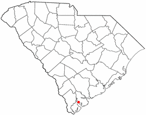
Ladson is a census-designated place (CDP) in Berkeley, Charleston and Dorchester counties in the U.S. state of South Carolina. The population was 13,790 at the 2010 census. It is named in honor of the Ladson family, one of the oldest planter and merchant families in the Charleston area; one of its members was lieutenant governor James Ladson.

References

  1. "ArcGIS REST Services Directory". United States Census Bureau. Retrieved October 15, 2022.
  2. 1 2 U.S. Geological Survey Geographic Names Information System: Dentsville, South Carolina
  3. "Census Population API". United States Census Bureau. Retrieved Oct 15, 2022.
  4. 1 2 "U.S. Census website". United States Census Bureau . Retrieved 2008-01-31.
  5. 1 2 "Geographic Identifiers: 2010 Demographic Profile Data (G001): Dentsville CDP, South Carolina". U.S. Census Bureau, American Factfinder. Archived from the original on February 12, 2020. Retrieved January 14, 2013.
  6. "US Gazetteer files: 2010, 2000, and 1990". United States Census Bureau. 2011-02-12. Retrieved 2011-04-23.
  7. "Census of Population and Housing". Census.gov. Retrieved June 4, 2016.
  8. "Explore Census Data". data.census.gov. Retrieved 2021-12-13.

[1] [ circular reference ]

  1. Bryan Callen