Garden City, South Carolina

Last updated

Garden City, South Carolina
CDP
ThePieratGardenCity.jpg
The Pier at Garden City Beach
Nickname: 
Garden City Beach
SCMap-doton-GardenCity.PNG
Location in South Carolina
Coordinates: 33°35′16″N79°0′19″W / 33.58778°N 79.00528°W / 33.58778; -79.00528
CountryUnited States
State South Carolina
County Horry, Georgetown
Area
[1]
  Total5.45 sq mi (14.12 km2)
  Land5.34 sq mi (13.84 km2)
  Water0.11 sq mi (0.28 km2)
Elevation
20 ft (6 m)
Population
 (2020) [2]
  Total10,235
  Density1,914.87/sq mi (739.33/km2)
Time zone UTC−5 (EST)
  Summer (DST) UTC−4 (EDT)
ZIP code
29576
Area code(s) 843, 854
FIPS code 45-28455 [3]
GNIS feature ID1867521 [4]

Garden City, sometimes known as Garden City Beach, is a census-designated place (CDP) in Horry County, South Carolina, United States. The population was 9,209 at the 2010 census. [5] Garden City Beach is located directly south of Surfside Beach. The developed part of the beach extends south beyond the limits of the Garden City CDP, into Georgetown County, and ends on a peninsula at the mouth of Murrells Inlet. [6]

Contents

Geography

Garden City is located in southern Horry County at 33°35′16″N79°0′19″W / 33.58778°N 79.00528°W / 33.58778; -79.00528 (33.587760, -79.005221). [7] It is bordered to the northeast by the town of Surfside Beach, to the northwest by U.S. Route 17, to the south by the Georgetown County/Horry County line, and to the southeast by the Atlantic Ocean. U.S. Route 17 Business is the main road through the center of the community, leading northeast 10 miles (16 km) to the center of Myrtle Beach. Georgetown is 25 miles (40 km) to the southwest via US 17.

According to the United States Census Bureau, the Garden City CDP has a total area of 5.4 square miles (14.1 km2), of which 5.4 square miles (13.9 km2) are land and 0.1 square miles (0.2 km2), or 1.47%, are water. [5]

Demographics

Historical population
CensusPop.Note
2020 10,235
U.S. Decennial Census [8]

2020 census

Garden City racial composition [9]
RaceNum.Perc.
White (non-Hispanic)9,36691.51%
Black or African American (non-Hispanic)1471.44%
Native American 160.16%
Asian 410.4%
Pacific Islander 130.13%
Other/Mixed 3653.57%
Hispanic or Latino 2872.8%

As of the 2020 United States census, there were 10,235 people, 4,893 households, and 2,765 families residing in the CDP.

2000 census

As of the census [3] of 2000, there were 9,357 people, 4,703 households, and 2,873 families residing in the CDP. The population density was 1,745.1 inhabitants per square mile (673.8/km2). There were 7,995 housing units at an average density of 1,491.1 per square mile (575.7/km2). The racial makeup of the CDP was 97.02% White, 1.00% African American, 0.28% Native American, 0.42% Asian, 0.10% Pacific Islander, 0.30% from other races, and 0.89% from two or more races. Hispanic or Latino of any race were 1.12% of the population.

There were 4,703 households, out of which 12.8% had children under the age of 18 living with them, 52.2% were married couples living together, 6.9% had a female householder with no husband present, and 38.9% were non-families. 31.9% of all households were made up of individuals, and 15.4% had someone living alone who was 65 years of age or older. The average household size was 1.96 and the average family size was 2.40.

In the CDP, the population was spread out, with 11.2% under the age of 18, 5.6% from 18 to 24, 21.5% from 25 to 44, 27.6% from 45 to 64, and 34.2% who were 65 years of age or older. The median age was 54 years. For every 100 females, there were 91.5 males. For every 100 females age 18 and over, there were 89.1 males.

The median income for a household in the CDP was $34,967, and the median income for a family was $40,403. Males had a median income of $27,683 versus $22,904 for females. The per capita income for the CDP was $24,062. About 2.9% of families and 5.5% of the population were below the poverty line, including 7.4% of those under age 18 and 3.5% of those age 65 or over.

Attractions

The Pier at Garden City

Formally known as the Kingfisher Pier that was completely destroyed by Hurricane Hugo and replaced, [10] It is approximately 668 feet (204 m) long, with a rain shelter at the end of the pier which includes a bar and nightly live music during the tourist season. [11]

Garden City Golf Cart Parade

The Garden City Golf Cart Parade is a Fourth of July parade that features red, white and blue-decorated golf carts. It has been a community tradition for almost 30 years. It originally started at Calhoun Drive behind Willards Fireworks. After a brief hiatus, it was held again on July 4, 2009. [12]

Weather

Temperatures tend to be in the 80s (°F) during the summer months in Garden City, SC, and in the 40s during the winter. The warmest month of the year is July with an average maximum temperature of 90.40 °F (32.44 °C), while the coldest month of the year is January with an average minimum temperature of 37.30 °F (2.94 °C). The annual average precipitation at Garden City is 54.57 inches. Rainfall is fairly evenly distributed throughout the year. The wettest month of the year is September with an average rainfall of 6.44 inches. [13]

Hurricane Hazel

The worst disaster in the community's history occurred on 14 October 1954. Hurricane Hazel slammed into the community and left only two houses habitable.

Hurricane Hugo

In September 1989, Hurricane Hugo destroyed 43% of the beachfront structures along the coast in Garden City. [14] In the aftermath of the storm, Horry County administrator M. L. Love said, "Garden City for all practical purposes is gone." [15] The Kingfisher Pier, as it was known at that time, was also destroyed by Hurricane Hugo. Reconstruction of the pier began in February 1992. The Pier at Garden City, as it is known today, was fully operational July 1992, and no significant damage has been reported since then. [16]

Transportation

Roads and highways

Mass transit

Related Research Articles

<span class="mw-page-title-main">Horry County, South Carolina</span> County in South Carolina, United States

Horry County is the easternmost county in the U.S. state of South Carolina. As of the 2020 census, its population was 351,029. It is the fourth-most populous county in South Carolina. The county seat is Conway.

<span class="mw-page-title-main">Georgetown County, South Carolina</span> County in South Carolina, United States

Georgetown County is a county located in the U.S. state of South Carolina. As of the 2020 census, the population was 63,404. Its county seat is Georgetown. The county was founded in 1769. It is named for George III of the United Kingdom.

<span class="mw-page-title-main">Brunswick County, North Carolina</span> County in North Carolina, United States

Brunswick County is the southernmost county in the U.S. state of North Carolina. As of the 2020 census, the population was 136,693. Its population was only 73,143 in 2000, making it one of the fastest-growing counties in the state. With a nominal growth rate of approximately 47% in ten years, much of the growth is centered in the eastern section of the county in the suburbs of Wilmington such as Leland, Belville and Southport. The county seat is Bolivia, which at a population of around 150 people is among the least populous county seats in the state.

<span class="mw-page-title-main">Myrtle Grove, Florida</span> Census-designated place in Florida, United States

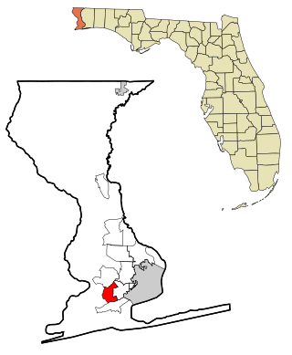
Myrtle Grove is a census-designated place (CDP) in Escambia County, Florida, United States. It is considered to be a community within Pensacola. The population was 15,870 at the 2010 census. It is part of the Pensacola–Ferry Pass–Brent Metropolitan Statistical Area.

<span class="mw-page-title-main">Poipu, Hawaii</span> Census-designated place in Hawaii, United States

Poʻipū is a census-designated place (CDP) in Kauaʻi County on the southern side of the island of Kauaʻi in the U.S. state of Hawaiʻi. The population was 1,299 at the 2020 census. The town features a group of high-end hotels, resorts and two main shopping centers.

<span class="mw-page-title-main">Ocean Isle Beach, North Carolina</span> Town in North Carolina, United States

Ocean Isle Beach is a small seaside town in Brunswick County, North Carolina, United States. It was incorporated as a town in 1959 and is part of the Myrtle Beach metropolitan area. The population was 867 at the 2020 census. Located at the southern end of North Carolina's Atlantic coastline, along the Atlantic Intracoastal Waterway, Ocean Isle Beach has private homes, seasonal rentals, and various tourist attractions.

<span class="mw-page-title-main">Wrightsville Beach, North Carolina</span> Town in North Carolina, United States

Wrightsville Beach is a town in New Hanover County, North Carolina, United States. Wrightsville Beach is just east of Wilmington and is part of the Wilmington Metropolitan Statistical Area. The population was 2,477 at the 2010 census. The town consists of a 4-mile (6 km) long beach island, an interior island called Harbor Island, and pockets of commercial property on the mainland. It served as a filming location of Dawson's Creek.

<span class="mw-page-title-main">Murrells Inlet, South Carolina</span> Census-designated place in South Carolina, United States

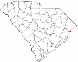
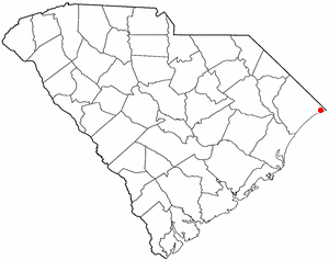
Murrells Inlet is an unincorporated area and census-designated place in Georgetown County, South Carolina, United States. The population was 7,547 at the 2010 census. It is about 13 miles south of Myrtle Beach, South Carolina and 21 miles north of Georgetown, the county seat.

<span class="mw-page-title-main">Pawleys Island, South Carolina</span> Town in South Carolina, United States

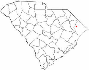
Pawleys Island is a town in Georgetown County, South Carolina, United States, and the Atlantic coast barrier island on which the town is located.

<span class="mw-page-title-main">Aynor, South Carolina</span> Town in South Carolina, United States

Aynor is a small town in Horry County, South Carolina, United States, south of Galivants Ferry. The population was 560 at the 2010 census and estimated in 2018 to be 934. Aynor High School consistently ranks as one of the best schools in Horry County and South Carolina.

<span class="mw-page-title-main">Briarcliffe Acres, South Carolina</span> Town in South Carolina, United States

Briarcliffe Acres is a town in Horry County, South Carolina, United States, located between Myrtle Beach and North Myrtle Beach. The population was 457 at the 2010 census.

<span class="mw-page-title-main">Bucksport, South Carolina</span> Census-designated place in South Carolina, United States

Bucksport is an unincorporated community and census-designated place (CDP) in Horry County, South Carolina, United States. The population was 876 at the 2010 census. It is a rural port on the Atlantic Intracoastal Waterway at the merger point with the Waccamaw River. The port has some services available for boaters and is also home to the Bucksport Restaurant.

<span class="mw-page-title-main">Conway, South Carolina</span> City in South Carolina, United States

Conway is a city in Horry County, South Carolina. The population was 24,849 at the 2020 census, up from 17,103 in 2010 census. It is the county seat of Horry County and is part of the Myrtle Beach metropolitan area. It is the home of Coastal Carolina University.

<span class="mw-page-title-main">Forestbrook, South Carolina</span> Census-designated place in South Carolina, United States

Forestbrook is a census-designated place (CDP) in Horry County, South Carolina, United States. The population was 4,612 at the 2010 census, up from 3,391 at the 2000 census.

<span class="mw-page-title-main">Little River, South Carolina</span> CDP in South Carolina, United States

Little River is a census-designated place (CDP) in Horry County, South Carolina, United States. The population was 11,711 at the 2020 census.

<span class="mw-page-title-main">Loris, South Carolina</span> City in South Carolina, United States

Loris is a city in Horry County, South Carolina, United States. The population was 2,396 at the 2010 census, up from 2,079 in 2000.

<span class="mw-page-title-main">Myrtle Beach, South Carolina</span> City in South Carolina, United States

Myrtle Beach is a resort city on the east coast of the United States in Horry County, South Carolina. It is located in the center of a long and continuous 60-mile (97 km) stretch of beach known as the "Grand Strand in the northeastern part of the state. Its year-round population was 35,682 as of the 2020 census.

<span class="mw-page-title-main">North Myrtle Beach, South Carolina</span> City in South Carolina, United States

North Myrtle Beach is a city in Horry County, South Carolina, United States. It was created in 1968 from four existing municipalities, and is located about 15 miles (24 km) northeast of Myrtle Beach. It serves as one of the primary tourist destinations along the Grand Strand. As of the 2010 census, the population was 13,752, and in 2019 the estimated population was 16,819. It is part of the Myrtle Beach–Conway–North Myrtle Beach Metropolitan Statistical Area, which had a combined population of 449,295 as of 2016.

<span class="mw-page-title-main">Red Hill, South Carolina</span> Census-designated place in South Carolina, United States

Red Hill is a census-designated place (CDP) in Horry County, South Carolina, United States. The population was 13,223 at the 2010 census, up from 10,509 at the 2000 census.

<span class="mw-page-title-main">Surfside Beach, South Carolina</span> Town in South Carolina, United States

Surfside Beach is a town in Horry County, South Carolina, United States. Its nickname is "The Family Beach". The population was 3,837 at the 2010 census, down from 4,425 in 2000. It is considered a part of the Grand Strand.

References

  1. "ArcGIS REST Services Directory". United States Census Bureau. Retrieved October 15, 2022.
  2. "Census Population API". United States Census Bureau. Retrieved October 15, 2022.
  3. 1 2 "U.S. Census website". United States Census Bureau . Retrieved January 31, 2008.
  4. "US Board on Geographic Names". United States Geological Survey. October 25, 2007. Retrieved January 31, 2008.
  5. 1 2 "Geographic Identifiers: 2010 Census Summary File 1 (G001): Garden City CDP, South Carolina". American Factfinder. U.S. Census Bureau. Archived from the original on February 13, 2020. Retrieved January 26, 2018.
  6. "About the Myrtle Beach Area". Myrtle Beach Area Chamber of Commerce. Retrieved November 15, 2010.
  7. "US Gazetteer files: 2010, 2000, and 1990". United States Census Bureau. February 12, 2011. Retrieved April 23, 2011.
  8. "Census of Population and Housing". Census.gov. Retrieved June 4, 2016.
  9. "Explore Census Data". data.census.gov. Retrieved December 15, 2021.
  10. Goldstein, Robert (2000), Coastal fishing in the Carolinas: from surf, pier, and jetty, Winston-Salem, North Carolina: John F. Blair
  11. "Garden City Beach". Archived from the original on November 24, 2010. Retrieved November 14, 2010.
  12. Floyd, Allyson (June 9, 2009). "Golf cart parade comes back to Garden City". Myrtle Beach/Florence South Carolina market: Barrington Broadcasting Group, LLC. Retrieved November 15, 2010.
  13. "Garden City, SC Weather". IDcide. Retrieved November 15, 2010.
  14. National Research Council (U.S.). Committee on Natural Disasters (1994). Hurricane Hugo: Puerto Rico, the U.S. Virgin Islands, and South Carolina, September 17–22, 1989. Washington, DC: National Academies Press. p. 224.
  15. "Hurricance Hugo" . Retrieved September 29, 2022.
  16. "The Pier at Garden City Weather". Archived from the original on November 28, 2010. Retrieved November 15, 2010.